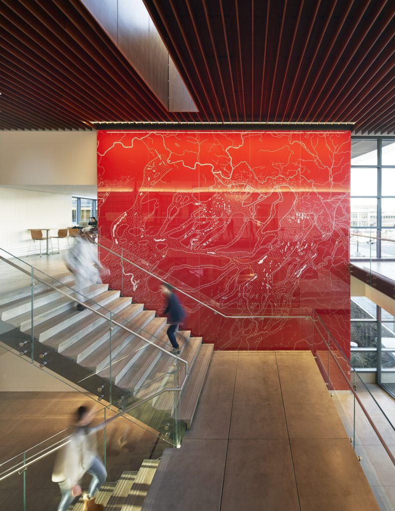
Harlen Bretz (1882-1981) detailed glacial flooding of the Cheney-Palouse track during the Ice Age Floods. The Bretz Feature Wall artistically reimagines a map from his groundbreaking publication in 1923. 14,000 to 18,000 years ago Cheney was repeatedly covered by catastrophic flooding from the Northeast when the ice-dam of Glacial Lake Missoula failed, releasing water into, and over, Glacial Lake Columbia. The high-water mark would have been approximately 200ft over your head.
Subsequent researchers continue to refine the Ice Age Flood story. Their work reveals multiple Ice Age Floods in Eastern Washington that swept across the scablands and down the Columbia, ponding in places to create temporary lakes before finally exiting into the Pacific Ocean.
EWU Geology worked with building designers to imagine this dynamic art piece that pays tribute to the unique geology of our region.


