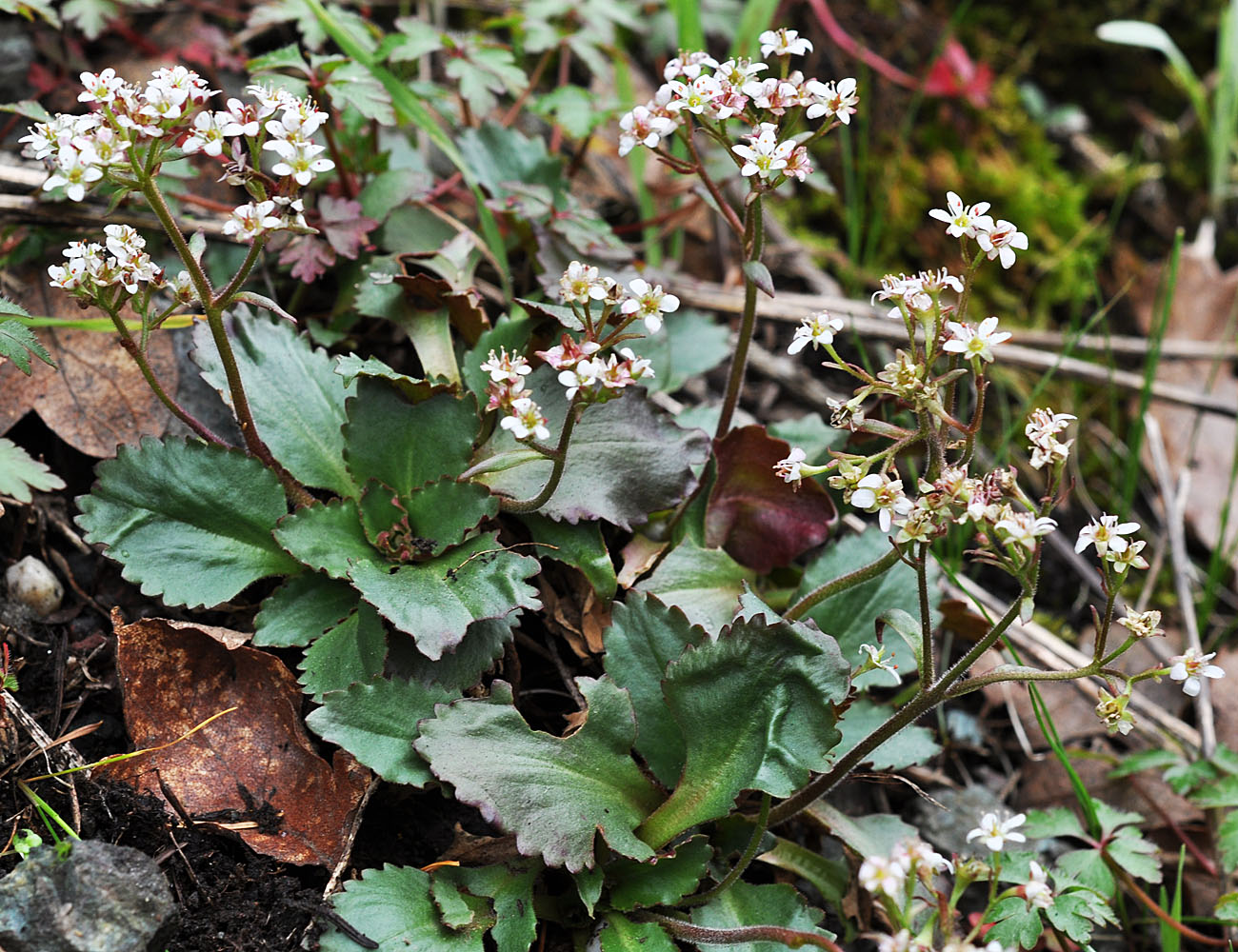
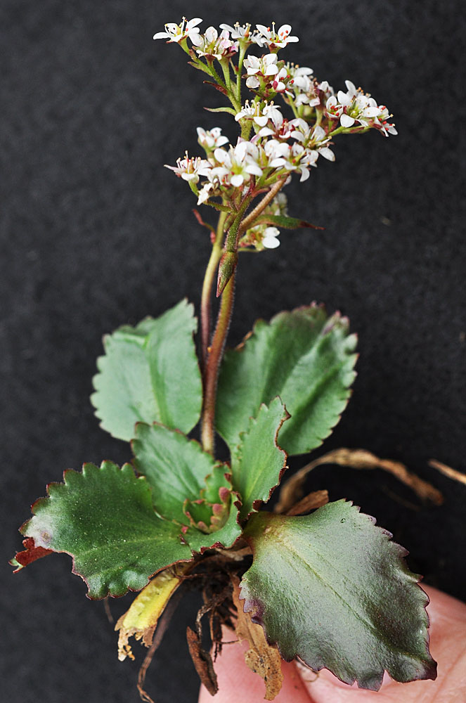
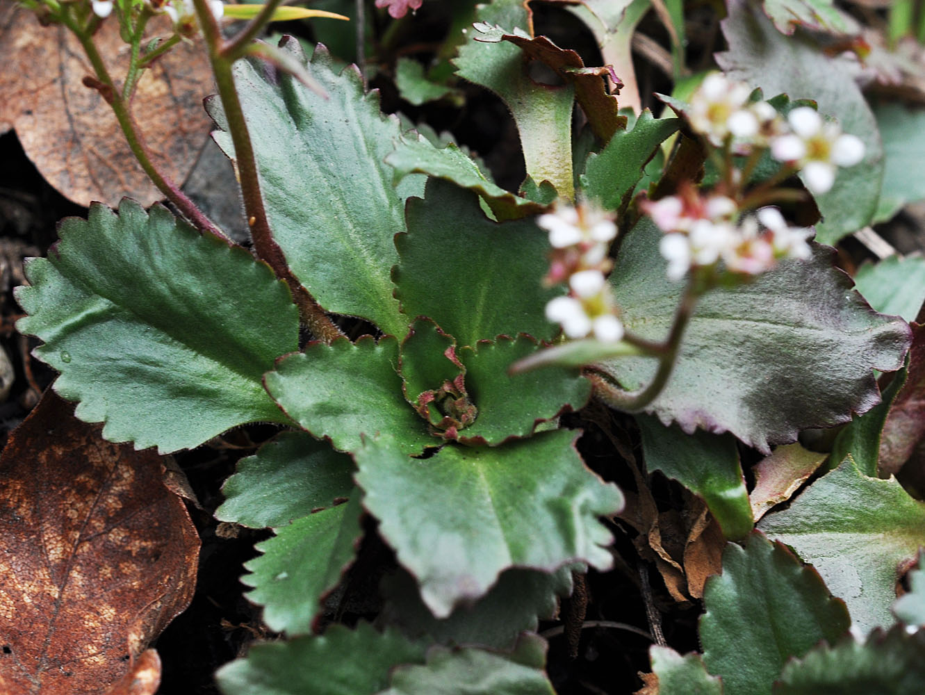
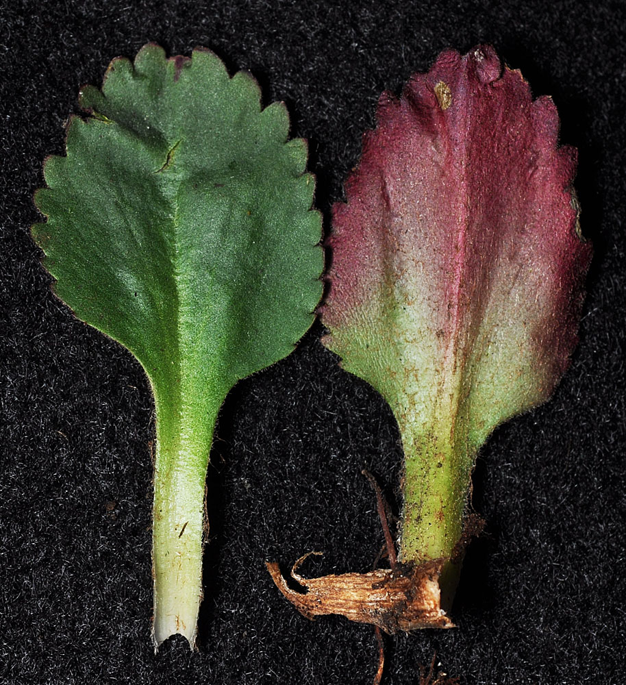
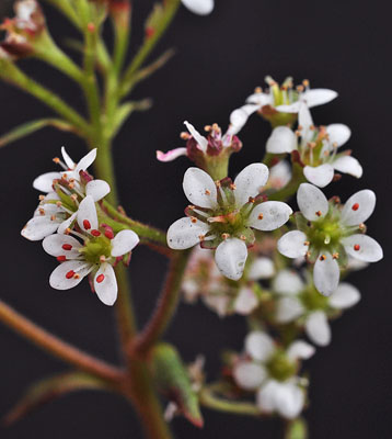
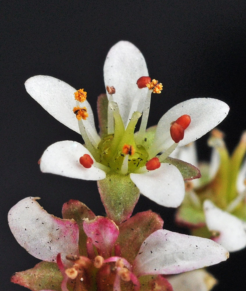
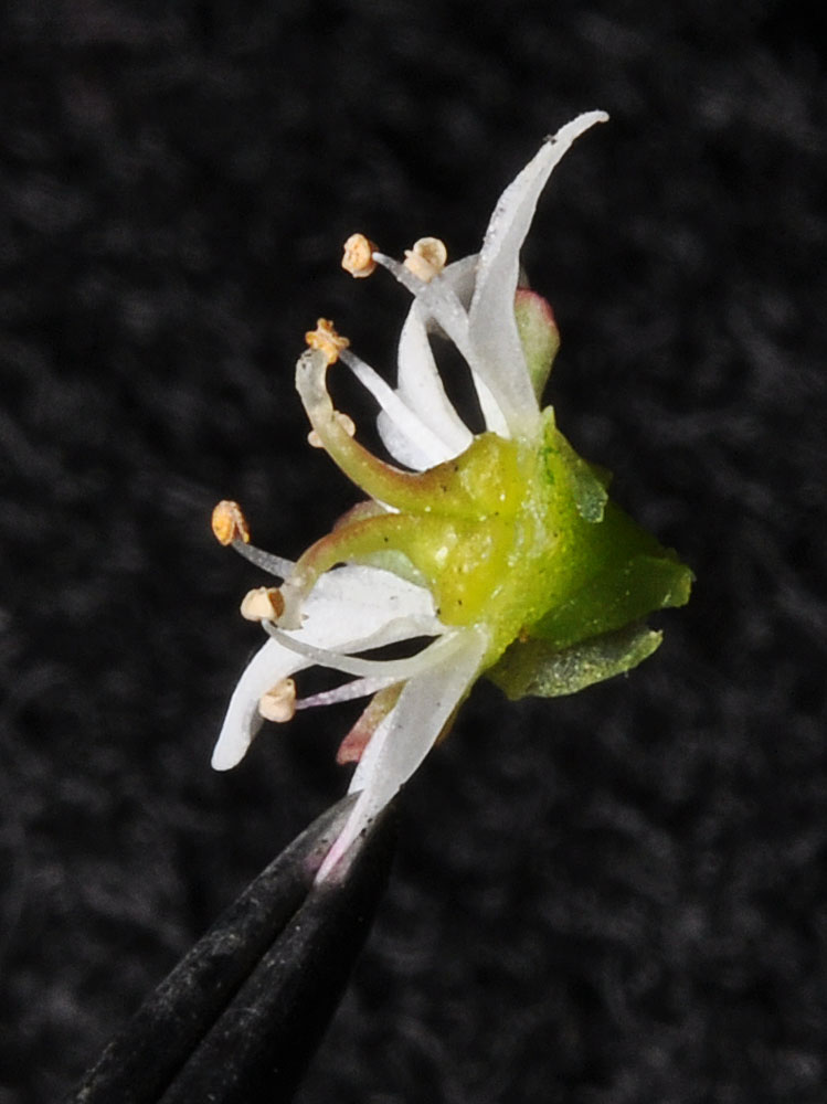
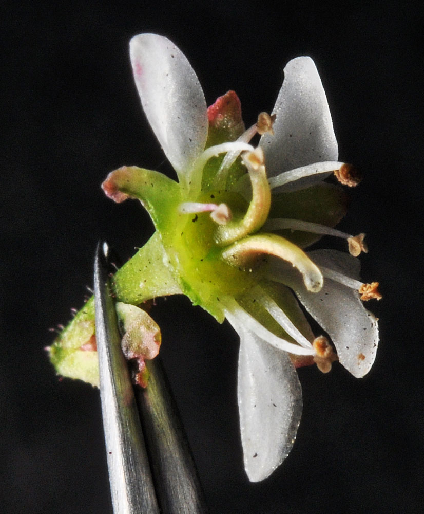
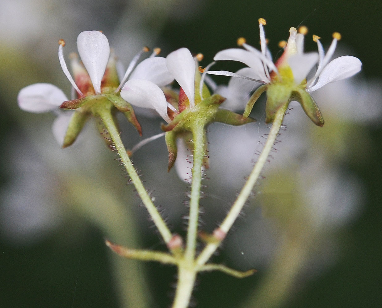
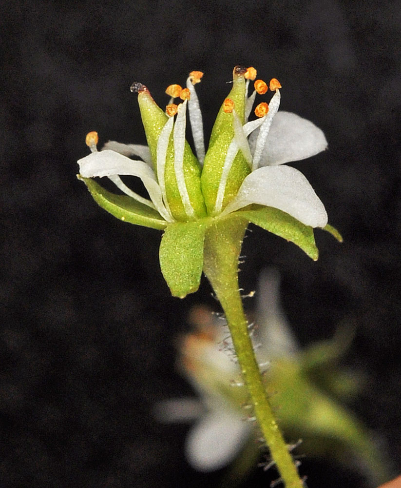
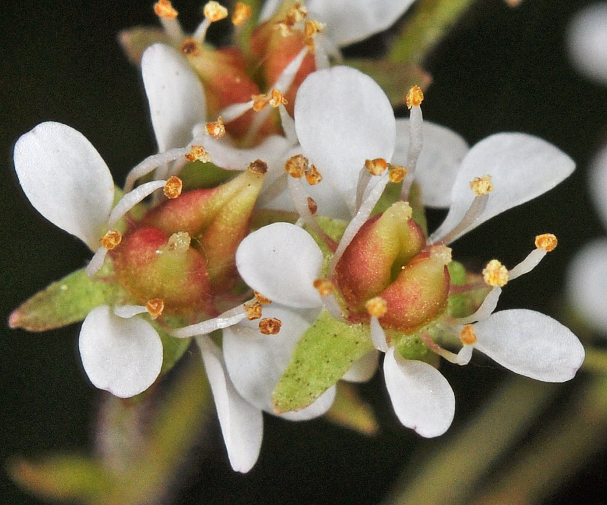
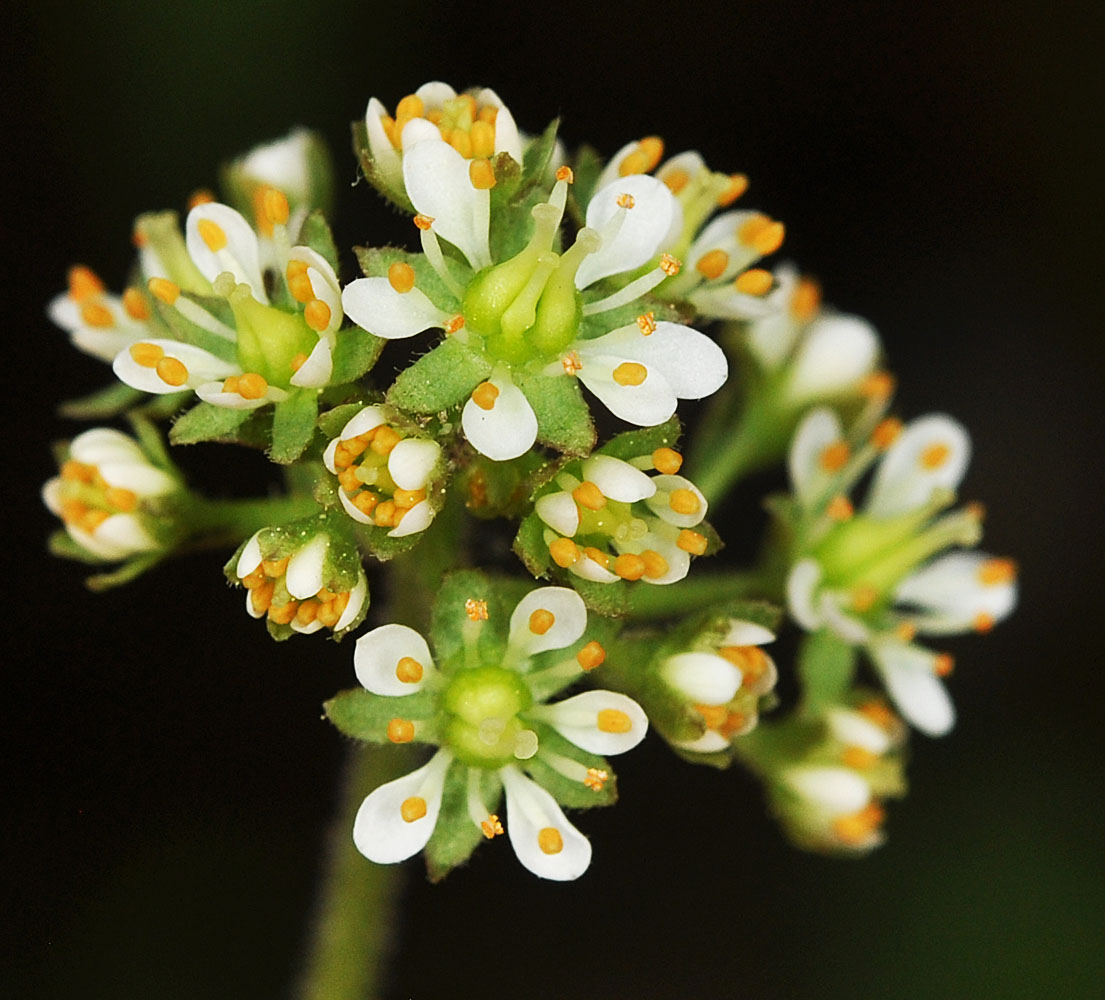
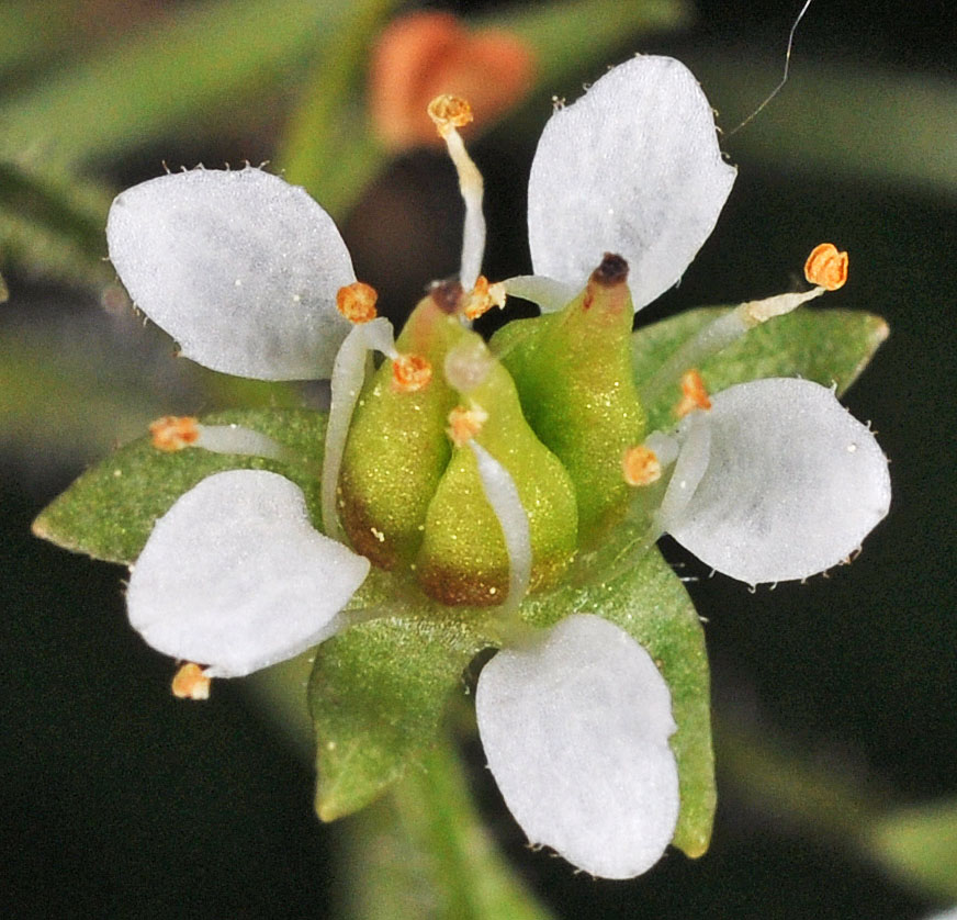
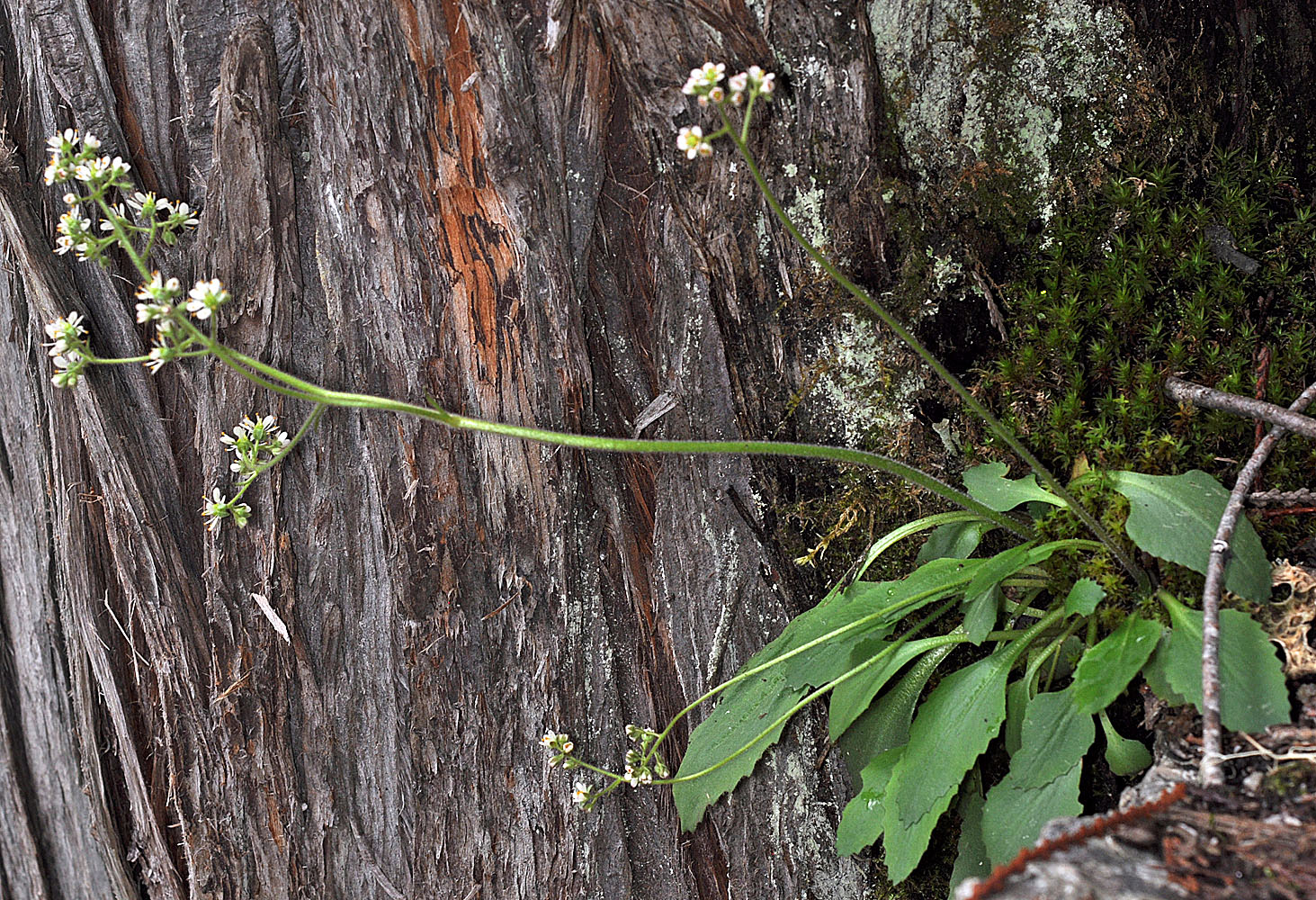
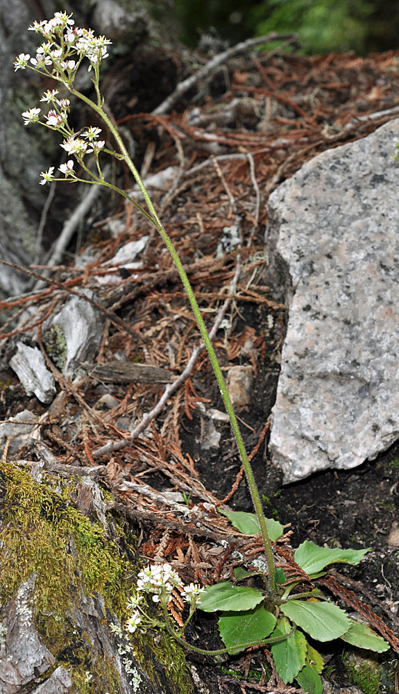
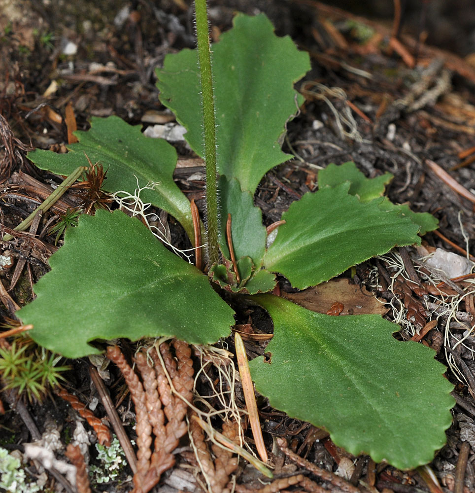
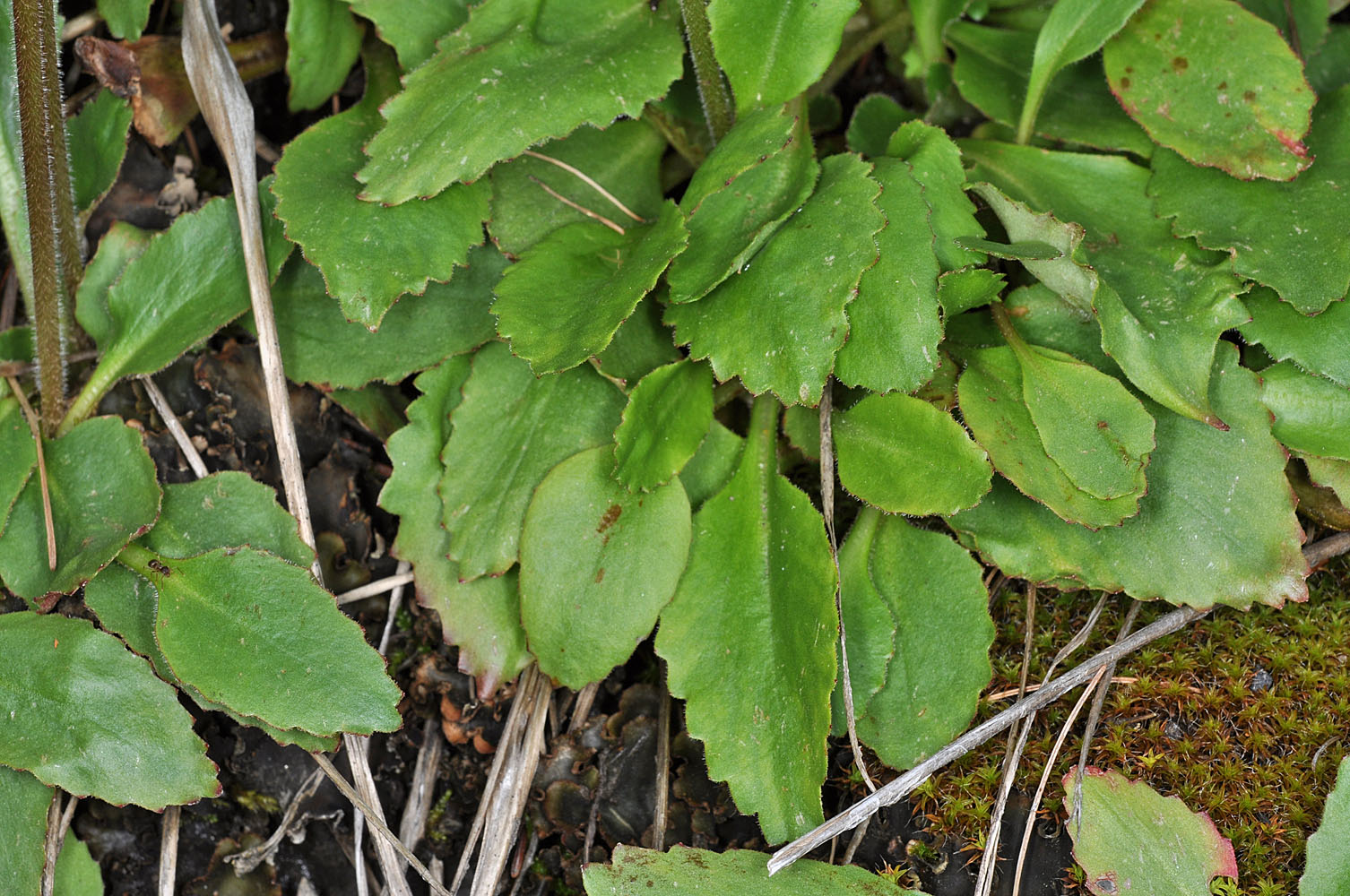
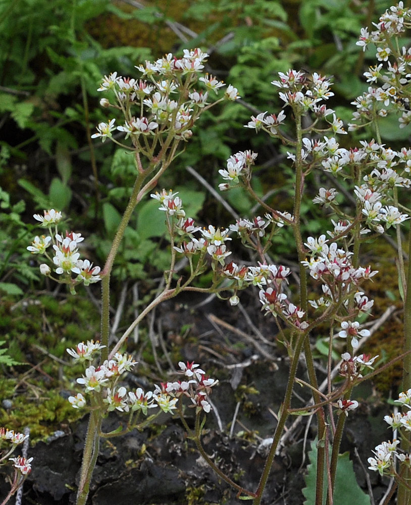
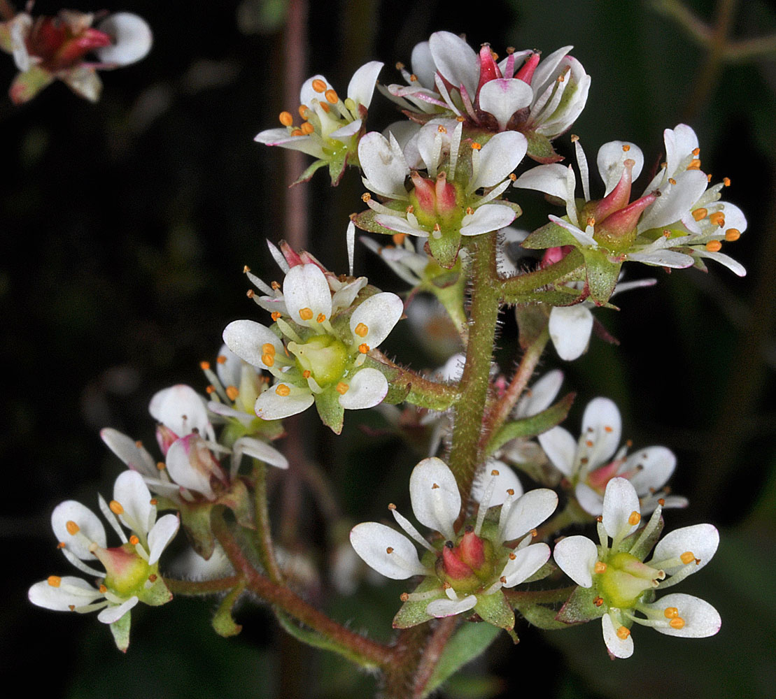
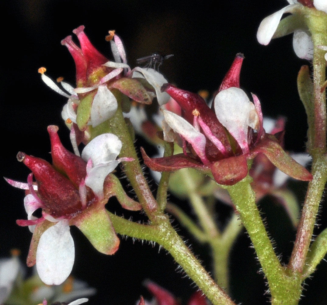
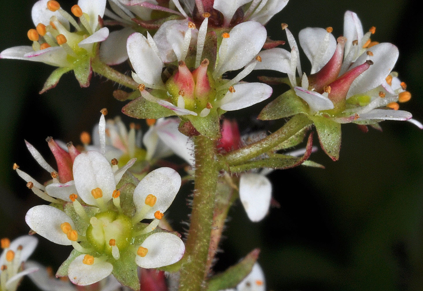
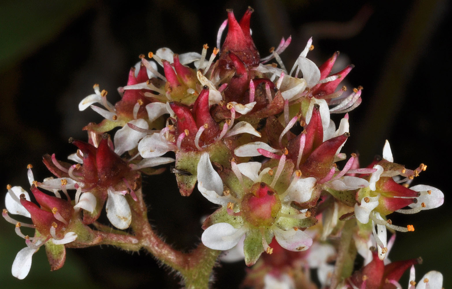
mountain saxifrage, redwool saxifrage, western saxifrage
Eastern Washington
Native
Synonyms
Conservation Status
Notes
Click on any image to enlarge it.
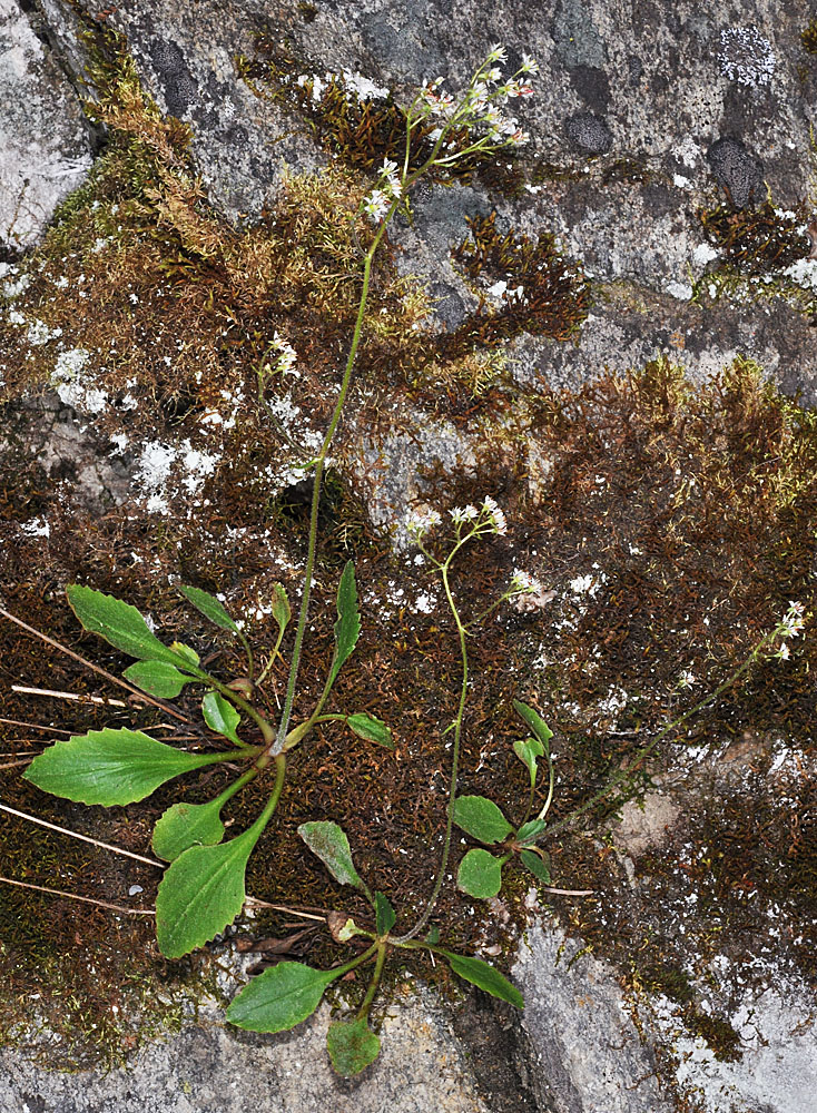
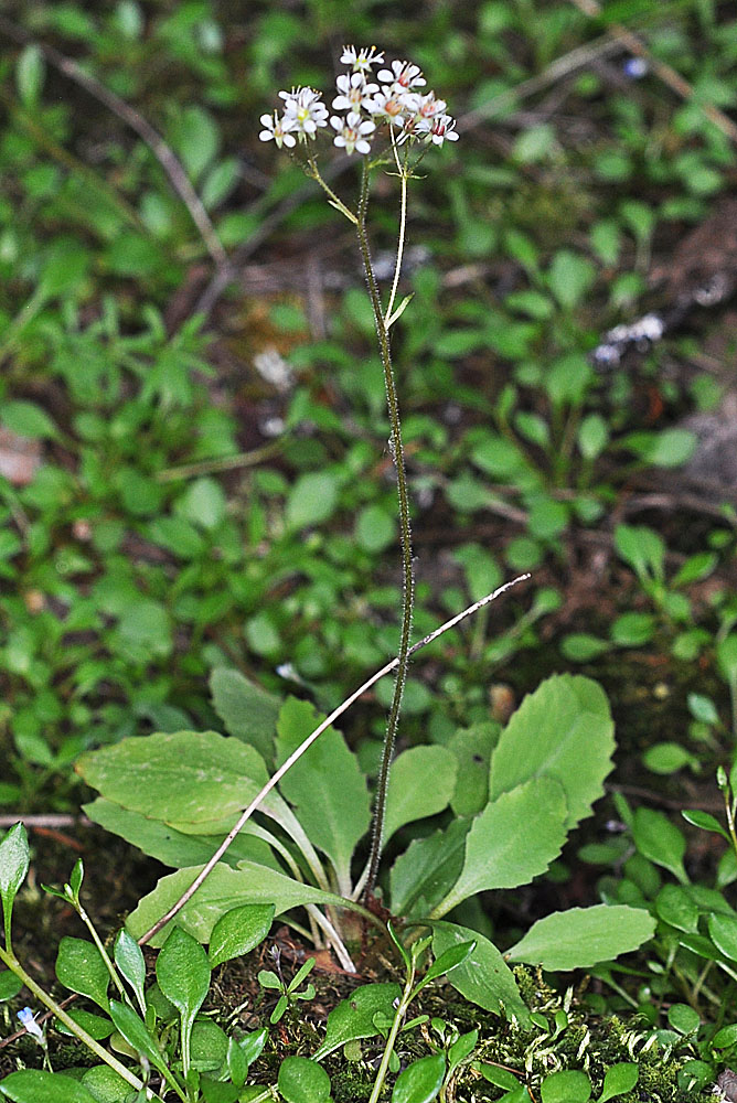
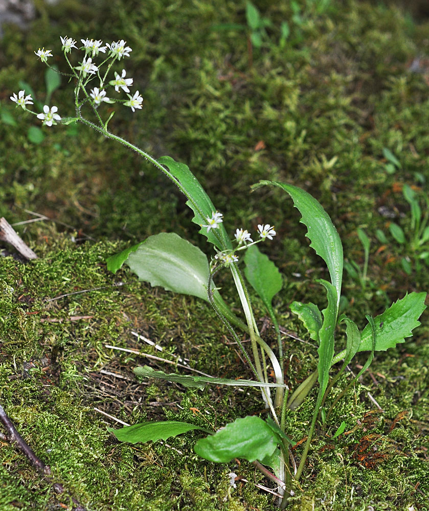
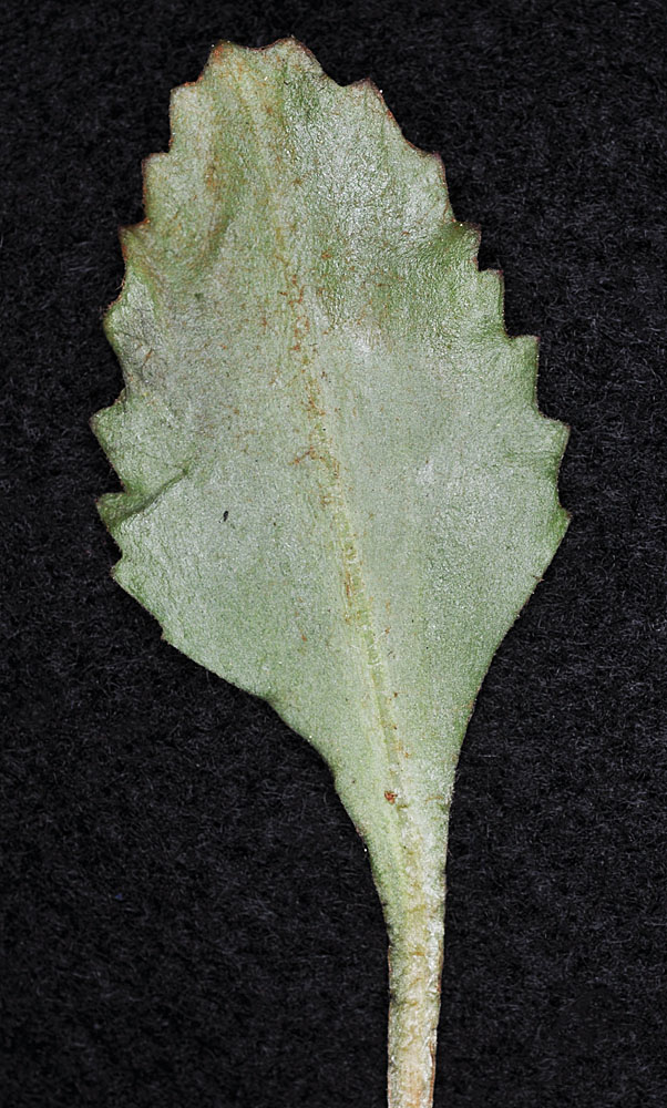
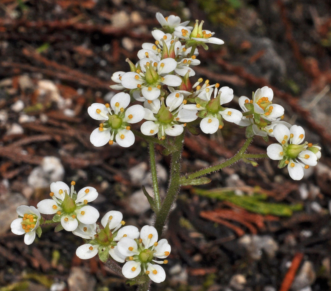
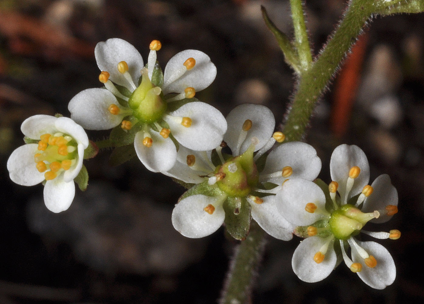
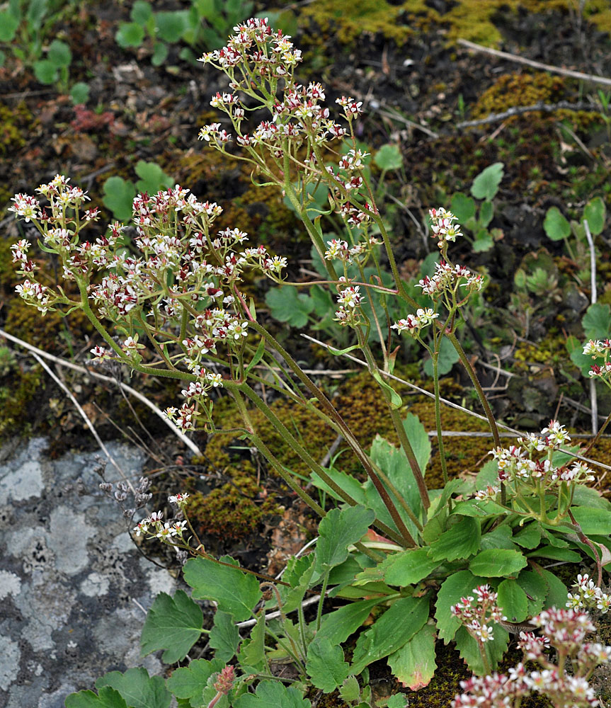
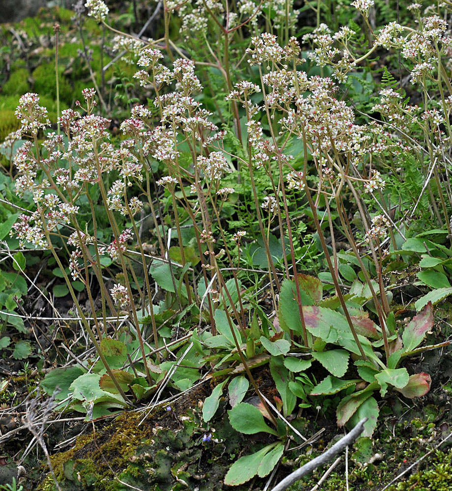
2.2 air mi ENE of Stevenson, WA along Hwy 14.; N 45.70968 W 121.84230; Skamania Co.; 3/20/20152.2 air mi ENE of Stevenson, WA along Hwy 14.; N 45.70968 W 121.84230; Skamania Co.; 3/20/20152.2 air mi ENE of Stevenson, WA along Hwy 14.; N 45.70968 W 121.84230; Skamania Co.; 3/20/20152.2 air mi ENE of Stevenson, WA along Hwy 14.; N 45.70968 W 121.84230; Skamania Co.; 3/20/20152.2 air mi ENE of Stevenson, WA along Hwy 14.; N 45.70968 W 121.84230; Skamania Co.; 3/20/20152.2 air mi ENE of Stevenson, WA along Hwy 14.; N 45.70968 W 121.84230; Skamania Co.; 3/20/20152.2 air mi ENE of Stevenson, WA along Hwy 14.; N 45.70968 W 121.84230; Skamania Co.; 3/20/20152.2 air mi ENE of Stevenson, WA along Hwy 14.; N 45.70968 W 121.84230; Skamania Co.; 3/20/20159.47 air mi WSW of Kettle Falls, Wa., Ca. 0.3 mi from south end of Donaldson Draw along Bangs Mt. Rd.; N 48.54939 W 118.24123; Ferry Co., 5/12/20169.47 air mi WSW of Kettle Falls, Wa., Ca. 0.3 mi from south end of Donaldson Draw along Bangs Mt. Rd.; N 48.54939 W 118.24123; Ferry Co., 5/12/20169.47 air mi WSW of Kettle Falls, Wa., Ca. 0.3 mi from south end of Donaldson Draw along Bangs Mt. Rd.; N 48.54939 W 118.24123; Ferry Co., 5/12/20169.47 air mi WSW of Kettle Falls, Wa., Ca. 0.3 mi from south end of Donaldson Draw along Bangs Mt. Rd.; N 48.54939 W 118.24123; Ferry Co., 5/12/20169.47 air mi WSW of Kettle Falls, Wa., Ca. 0.3 mi from south end of Donaldson Draw along Bangs Mt. Rd.; N 48.54939 W 118.24123; Ferry Co., 5/12/20169.47 air mi WSW of Kettle Falls, Wa., Ca. 0.3 mi from south end of Donaldson Draw along Bangs Mt. Rd.; N 48.54939 W 118.24123; Ferry Co., 5/12/20169.47 air mi WSW of Kettle Falls, Wa., Ca. 0.3 mi from south end of Donaldson Draw along Bangs Mt. Rd.; N 48.54939 W 118.24123; Ferry Co., 5/12/20169.47 air mi WSW of Kettle Falls, Wa., Ca. 0.3 mi from south end of Donaldson Draw along Bangs Mt. Rd.; N 48.54939 W 118.24123; Ferry Co., 5/12/20169.47 air mi WSW of Kettle Falls, Wa., Ca. 0.3 mi from south end of Donaldson Draw along Bangs Mt. Rd.; N 48.54939 W 118.24123; Ferry Co., 5/12/20169.47 air mi WSW of Kettle Falls, Wa., Ca. 0.3 mi from south end of Donaldson Draw along Bangs Mt. Rd.; N 48.54939 W 118.24123; Ferry Co., 5/12/2016Rd from Nordman, ID to Metaline Falls; Stagger Inn Cpg – Granite Falls; 48.76658N 117.06196W – Pend Oreille Co., WA – 6/20/2010Rd from Nordman, ID to Metaline Falls; Stagger Inn Cpg – Granite Falls; 48.76658N 117.06196W – Pend Oreille Co., WA – 6/20/2010Rd from Nordman, ID to Metaline Falls; Stagger Inn Cpg – Granite Falls; 48.76658N 117.06196W – Pend Oreille Co., WA – 6/20/2010Rd from Nordman, ID to Metaline Falls; Stagger Inn Cpg – Granite Falls; 48.76658N 117.06196W – Pend Oreille Co., WA – 6/20/2010Rd from Nordman, ID to Metaline Falls; Stagger Inn Cpg – Granite Falls; 48.76658N 117.06196W – Pend Oreille Co., WA – 6/20/2010Hwy 20 just W of Sherman Pass at 48.60986N 118.54127W – Ferry Co., WA – 6/21/2010Hwy 20 just W of Sherman Pass at 48.60986N 118.54127W – Ferry Co., WA – 6/21/2010Hwy 20 just W of Sherman Pass at 48.60986N 118.54127W – Ferry Co., WA – 6/21/2010Hwy 20 just W of Sherman Pass at 48.60986N 118.54127W – Ferry Co., WA – 6/21/2010Hwy 20 just W of Sherman Pass at 48.60986N 118.54127W – Ferry Co., WA – 6/21/2010Hwy 20 just W of Sherman Pass at 48.60986N 118.54127W – Ferry Co., WA – 6/21/2010Hwy 20 just W of Sherman Pass at 48.60986N 118.54127W – Ferry Co., WA – 6/21/2010Hwy 20 just W of Sherman Pass at 48.60986N 118.54127W – Ferry Co., WA – 6/21/2010