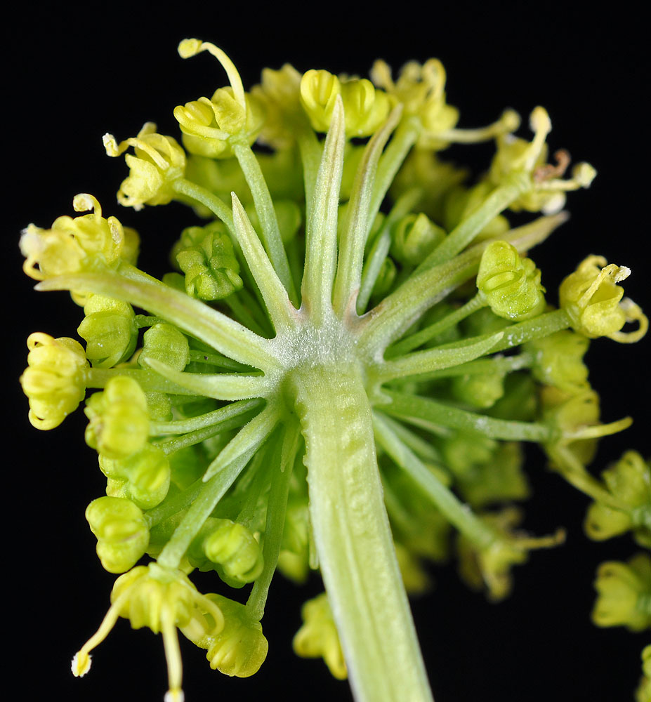
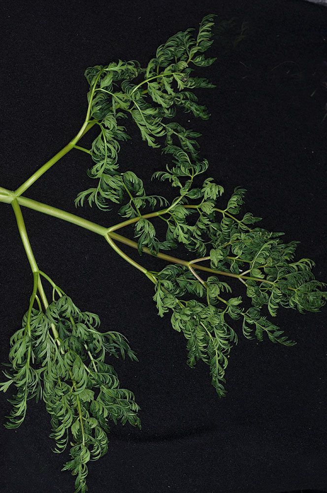
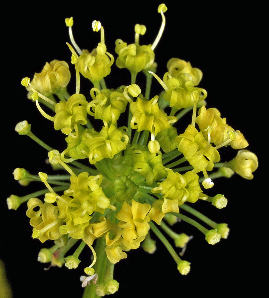
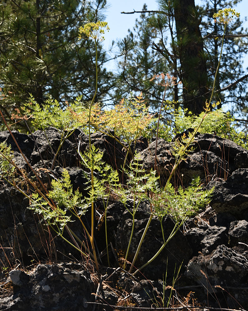
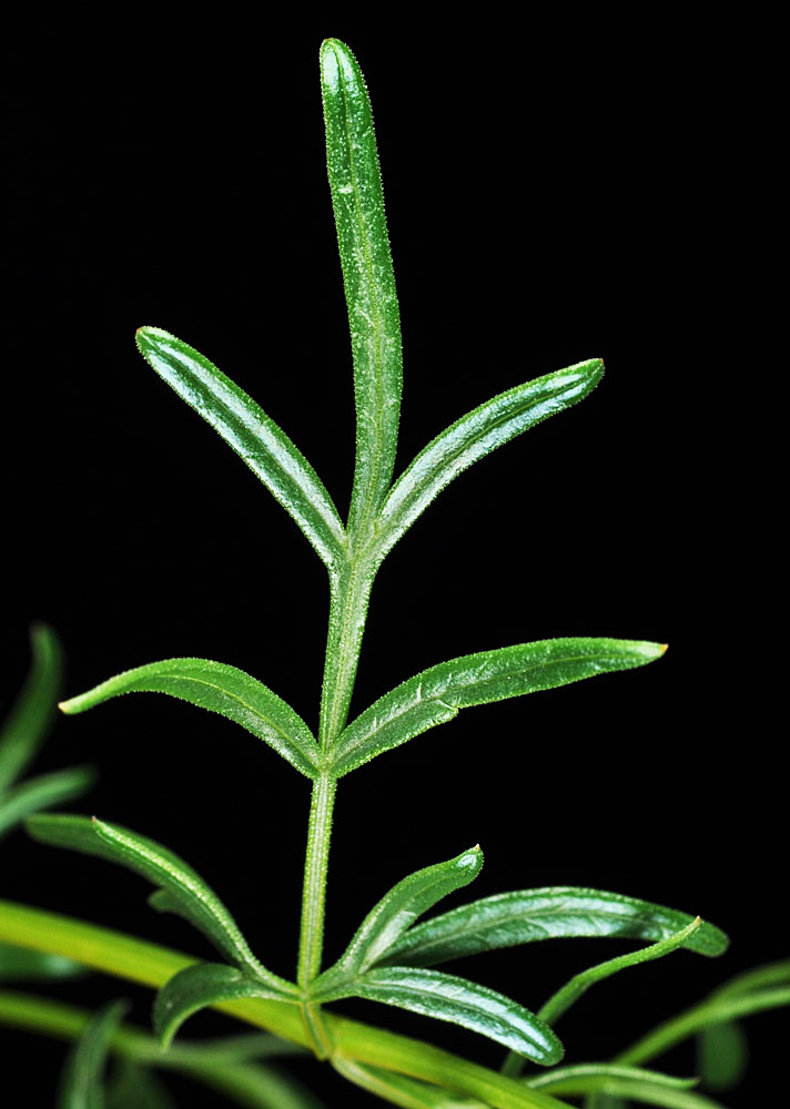
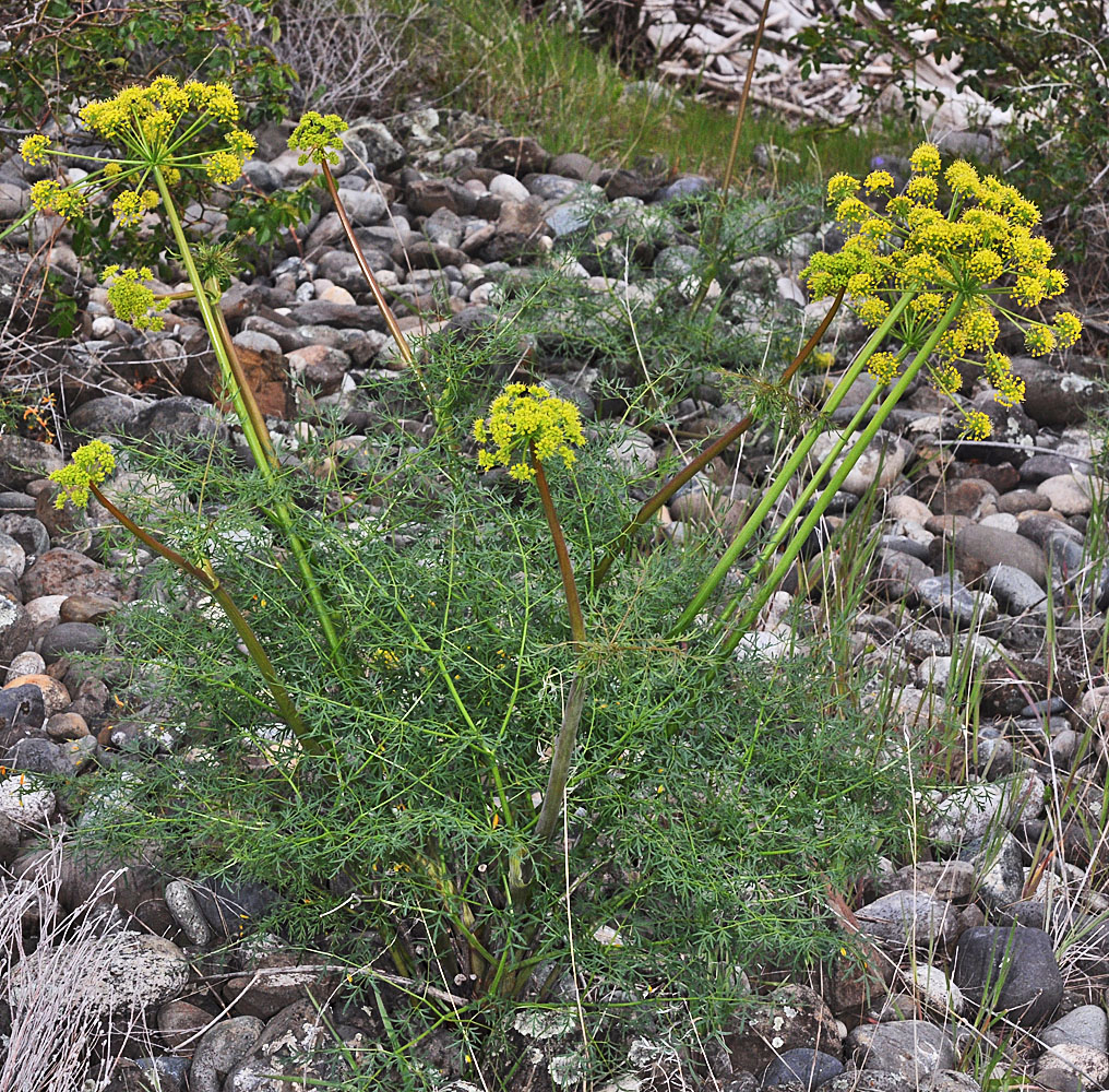
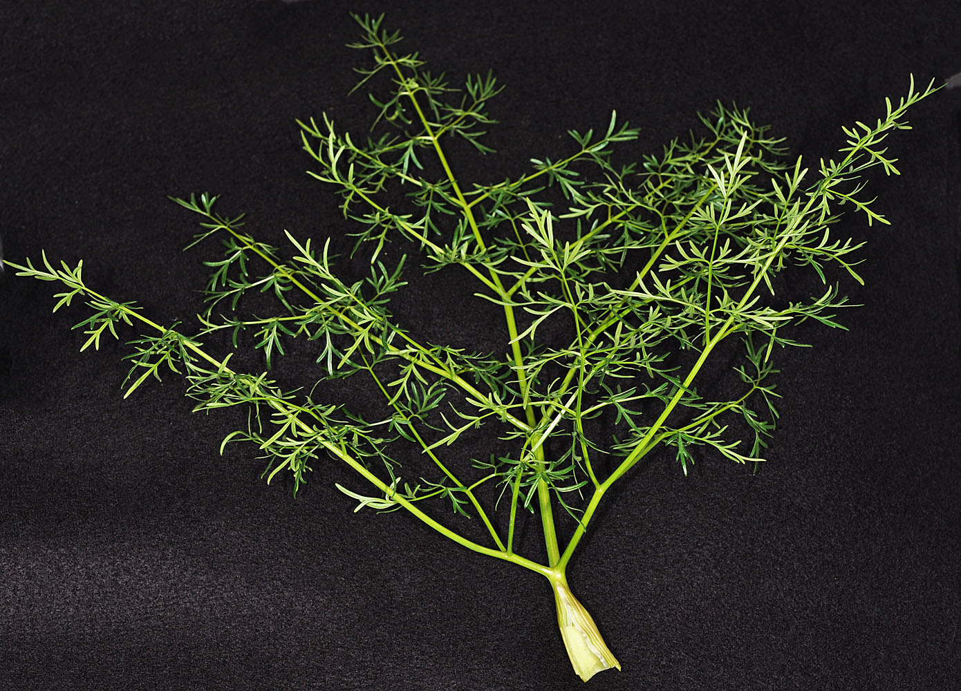
Along Cheney – Spangle Rd ca. 0.5 mi NE of Downy Rd; N 47.41867 W 117.40099- Spokane Co., WA – 4/15/2010Along Cheney – Spangle Rd ca. 0.5 mi NE of Downy Rd; N 47.41867 W 117.40099- Spokane Co., WA – 4/15/2010Along Cheney – Spangle Rd ca. 0.5 mi NE of Downy Rd; N 47.41867 W 117.40099- Spokane Co., WA – 4/15/2010Along Cheney – Spangle Rd ca. 0.5 mi NE of Downy Rd; N 47.41867 W 117.40099- Spokane Co., WA – 4/15/2010Along Cheney – Spangle Rd ca. 0.5 mi NE of Downy Rd; N 47.41867 W 117.40099- Spokane Co., WA – 4/15/2010Directly N of camping area at Boyer Park W of Lower Granite Dam, WA in talus of RR tracks; N 46.682022 W 117.445900 – Whitman Co. – 4/22/2011Directly N of camping area at Boyer Park W of Lower Granite Dam, WA in talus of RR tracks; N 46.682022 W 117.445900 – Whitman Co. – 4/22/2011Directly N of camping area at Boyer Park W of Lower Granite Dam, WA in talus of RR tracks; N 46.682022 W 117.445900 – Whitman Co. – 4/22/2011Directly N of camping area at Boyer Park W of Lower Granite Dam, WA in talus of RR tracks; N 46.682022 W 117.445900 – Whitman Co. – 4/22/2011Along Hwy 904; 2.22 mi NE of Tyler, WA; N 47.44660 W 117.74012; Spokane Co.; 6/9/2019Along Hwy 904; 2.22 mi NE of Tyler, WA; N 47.44660 W 117.74012; Spokane Co.; 6/9/2019Along Hwy 904; 2.22 mi NE of Tyler, WA; N 47.44660 W 117.74012; Spokane Co.; 6/9/2019Along Hwy 904; 2.22 mi NE of Tyler, WA; N 47.44660 W 117.74012; Spokane Co.; 6/9/2019Along Hwy 904; 2.22 mi NE of Tyler, WA; N 47.44660 W 117.74012; Spokane Co.; 6/9/20190.4 mi N of Granite Rock S of Wawawai in the Snake R. Cyn.; N 46.61237 W 117.37331; Whitman Co.; 4/20/20110.4 mi N of Granite Rock S of Wawawai in the Snake R. Cyn.; N 46.61237 W 117.37331; Whitman Co.; 4/20/20110.4 mi N of Granite Rock S of Wawawai in the Snake R. Cyn.; N 46.61237 W 117.37331; Whitman Co.; 4/20/2011