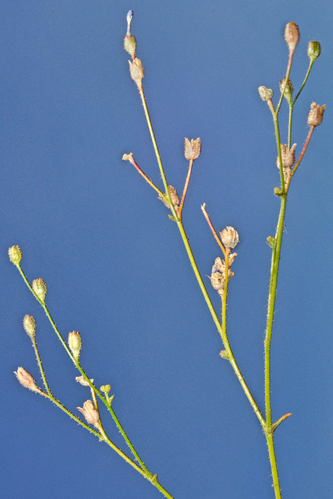
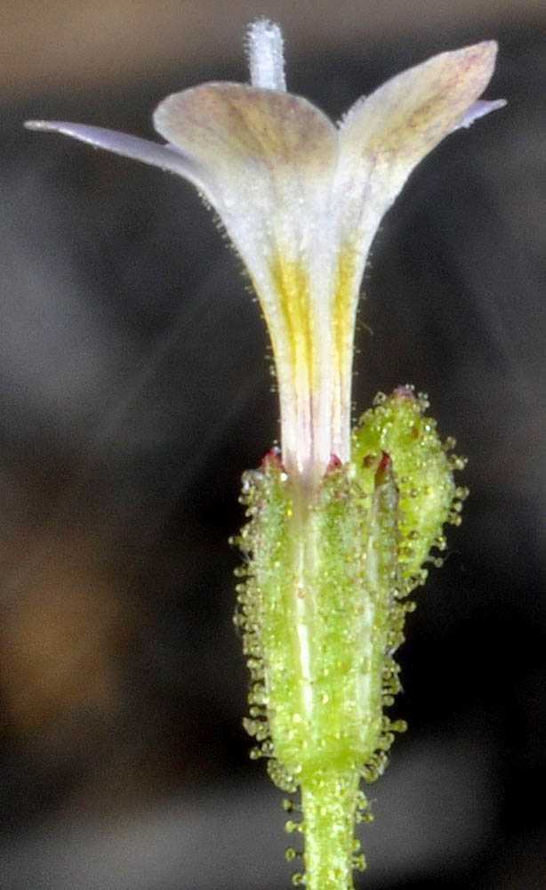
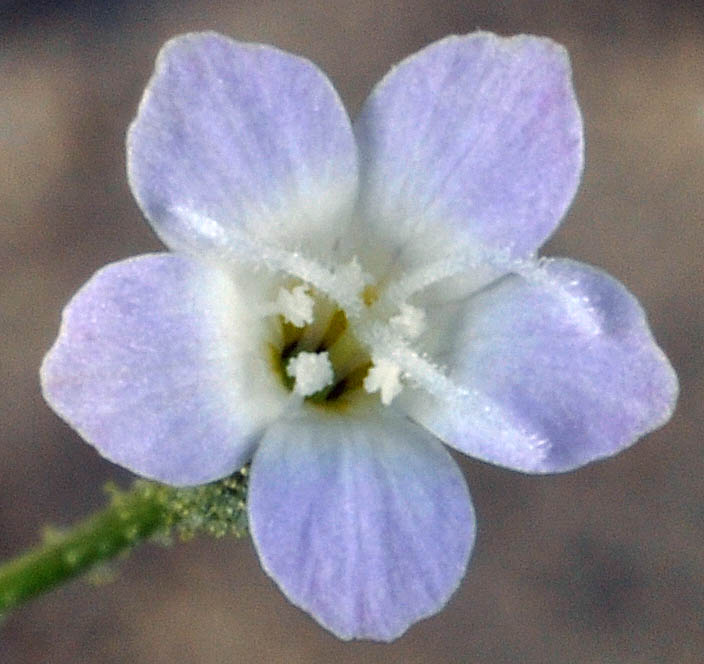
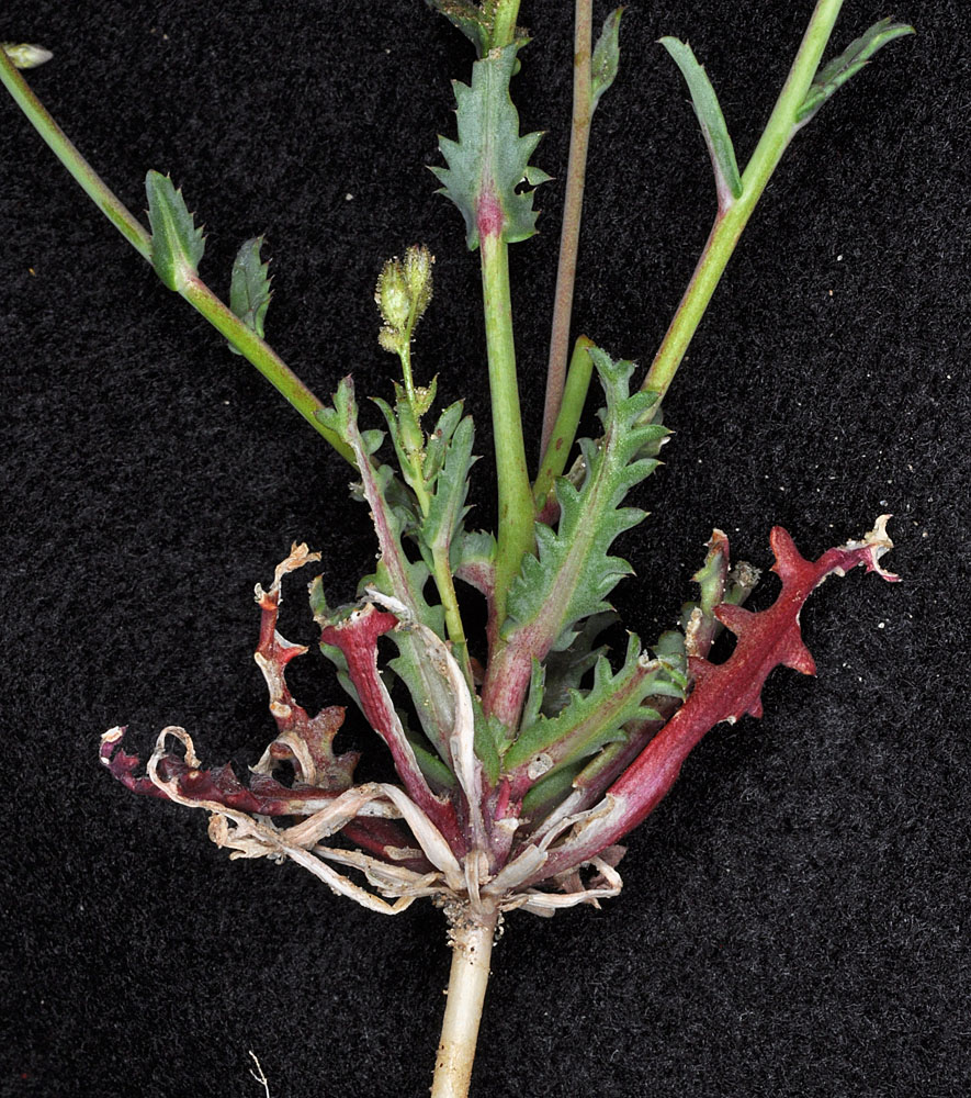
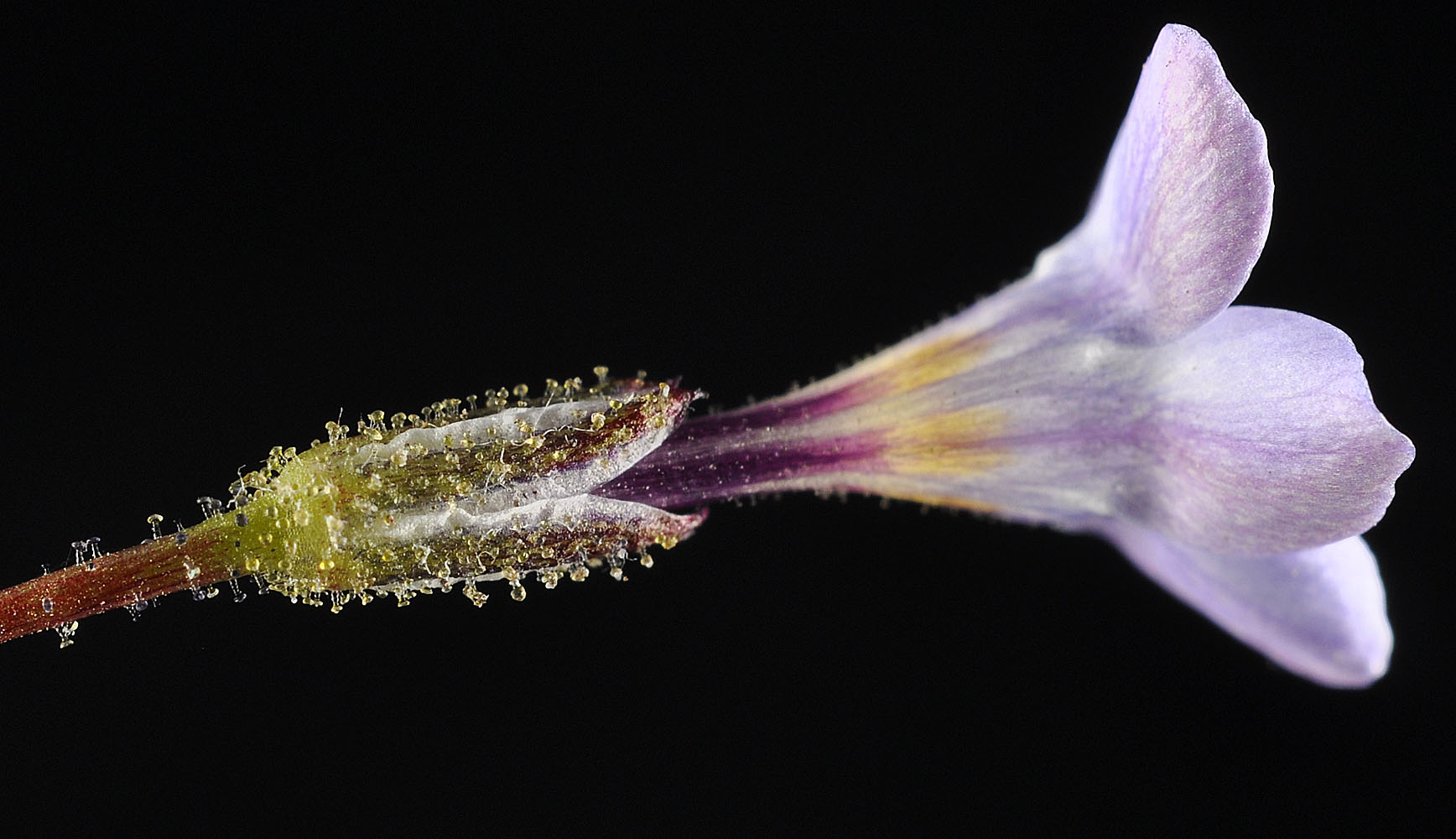
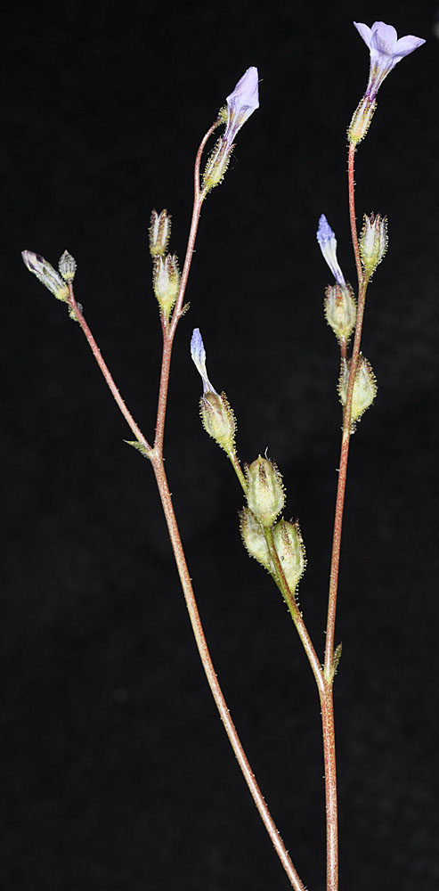
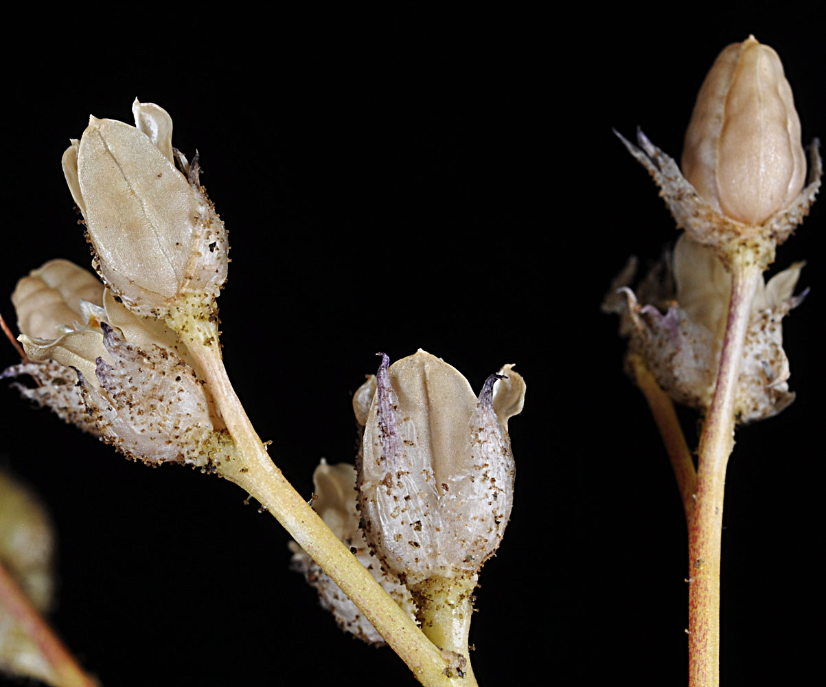
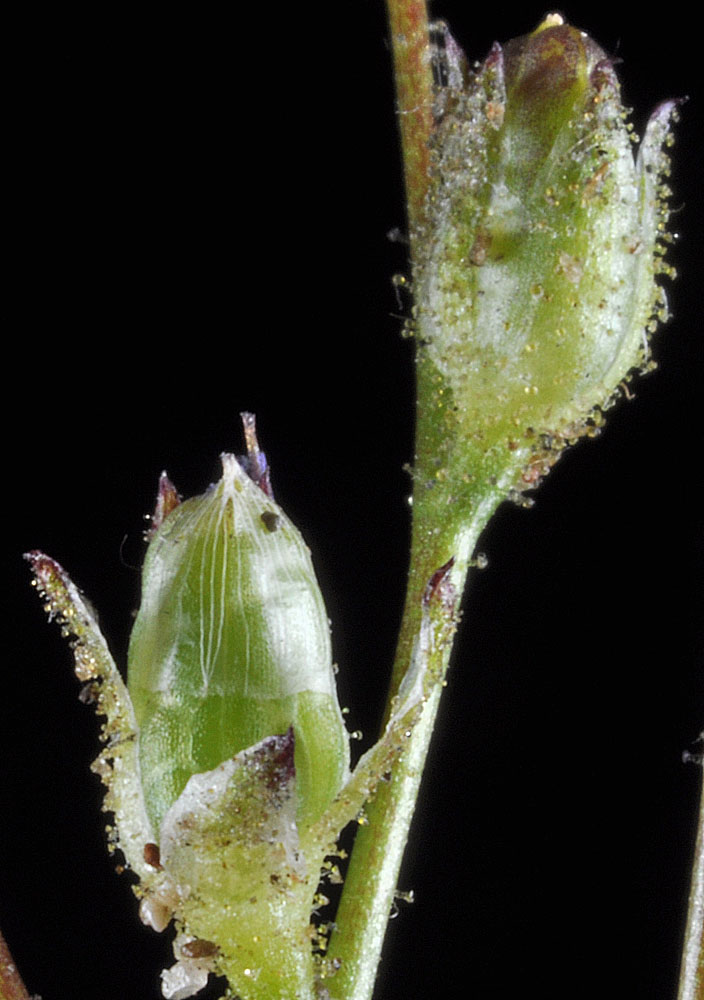
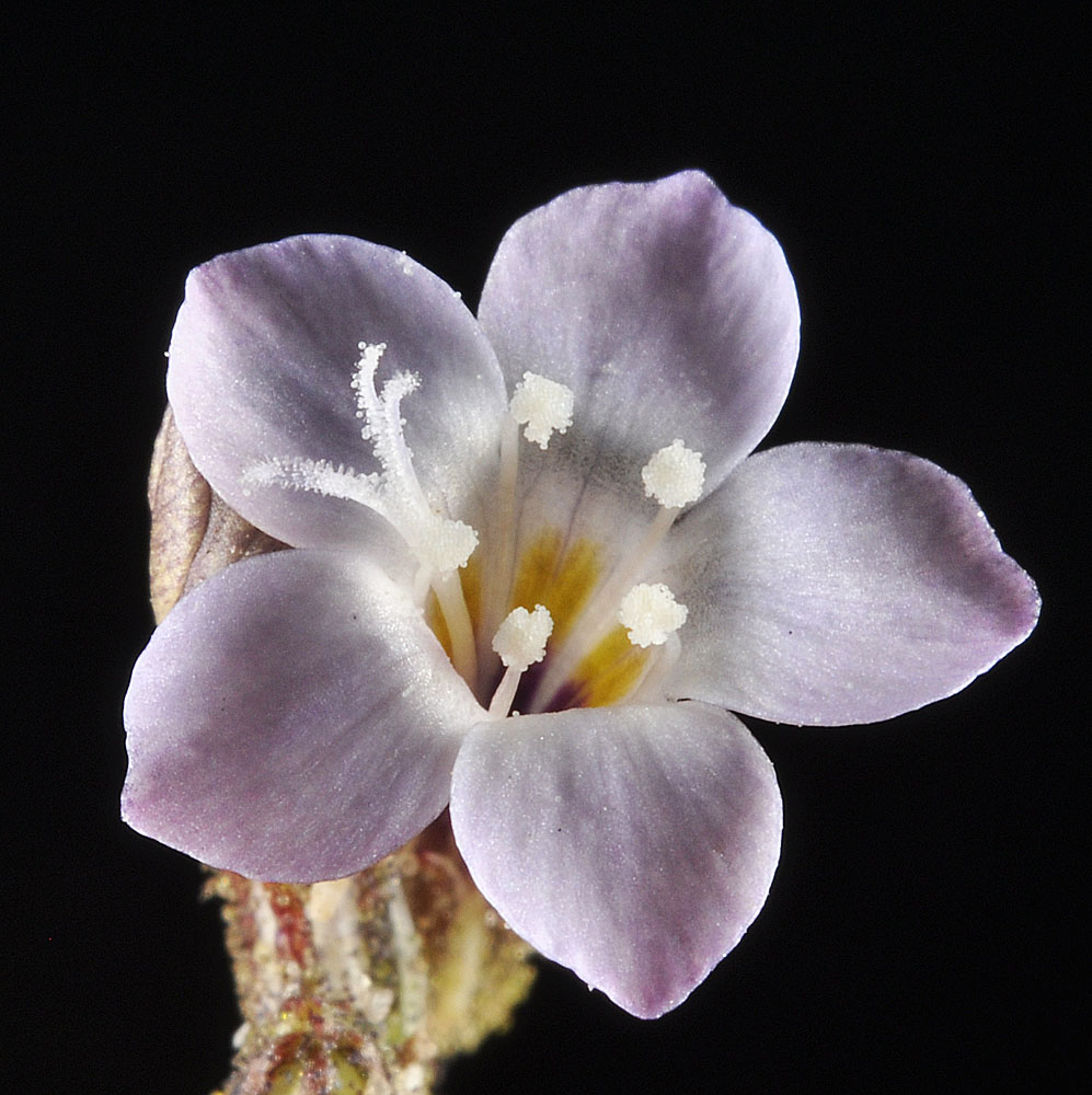
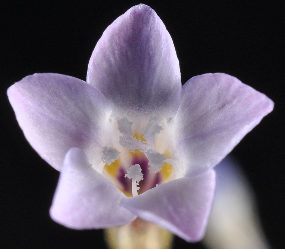
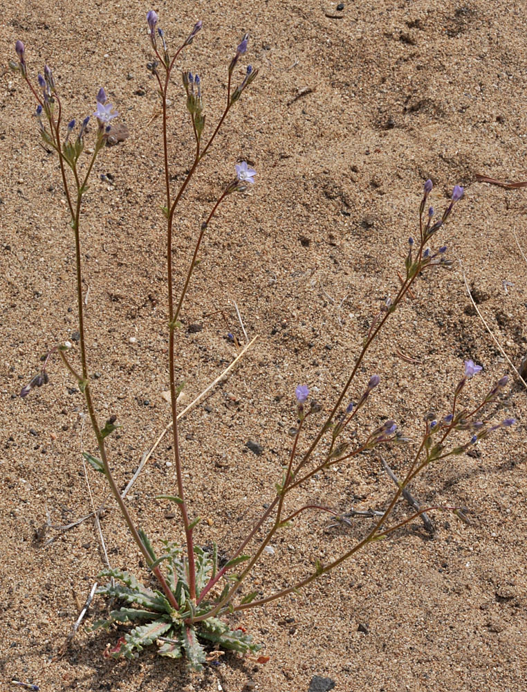
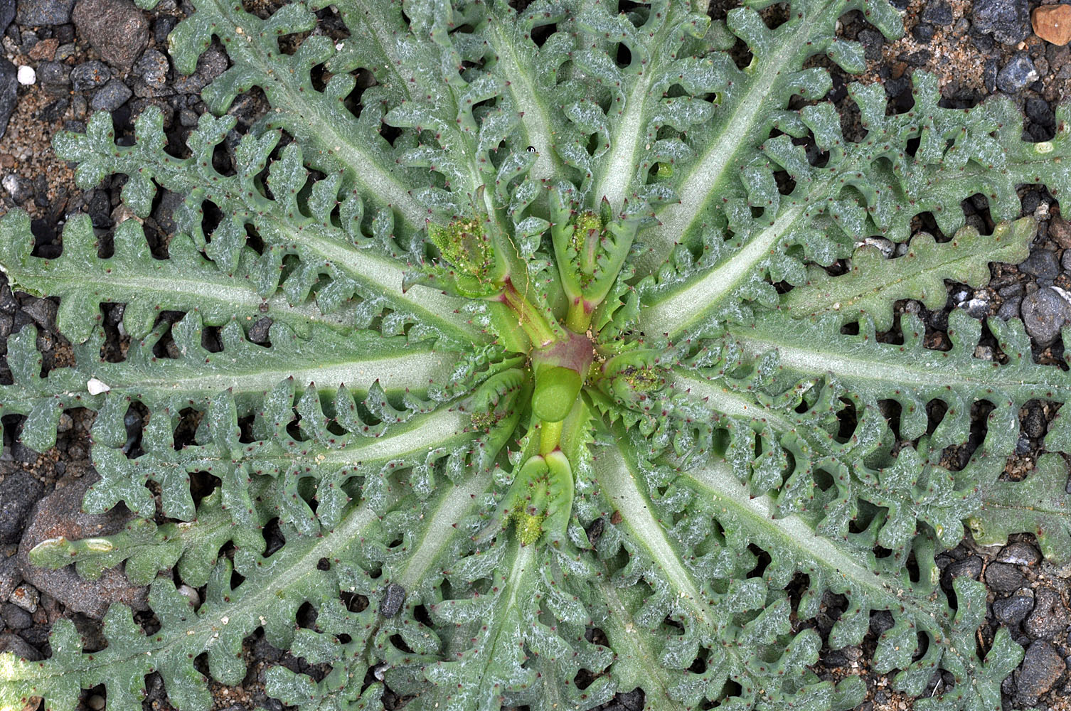
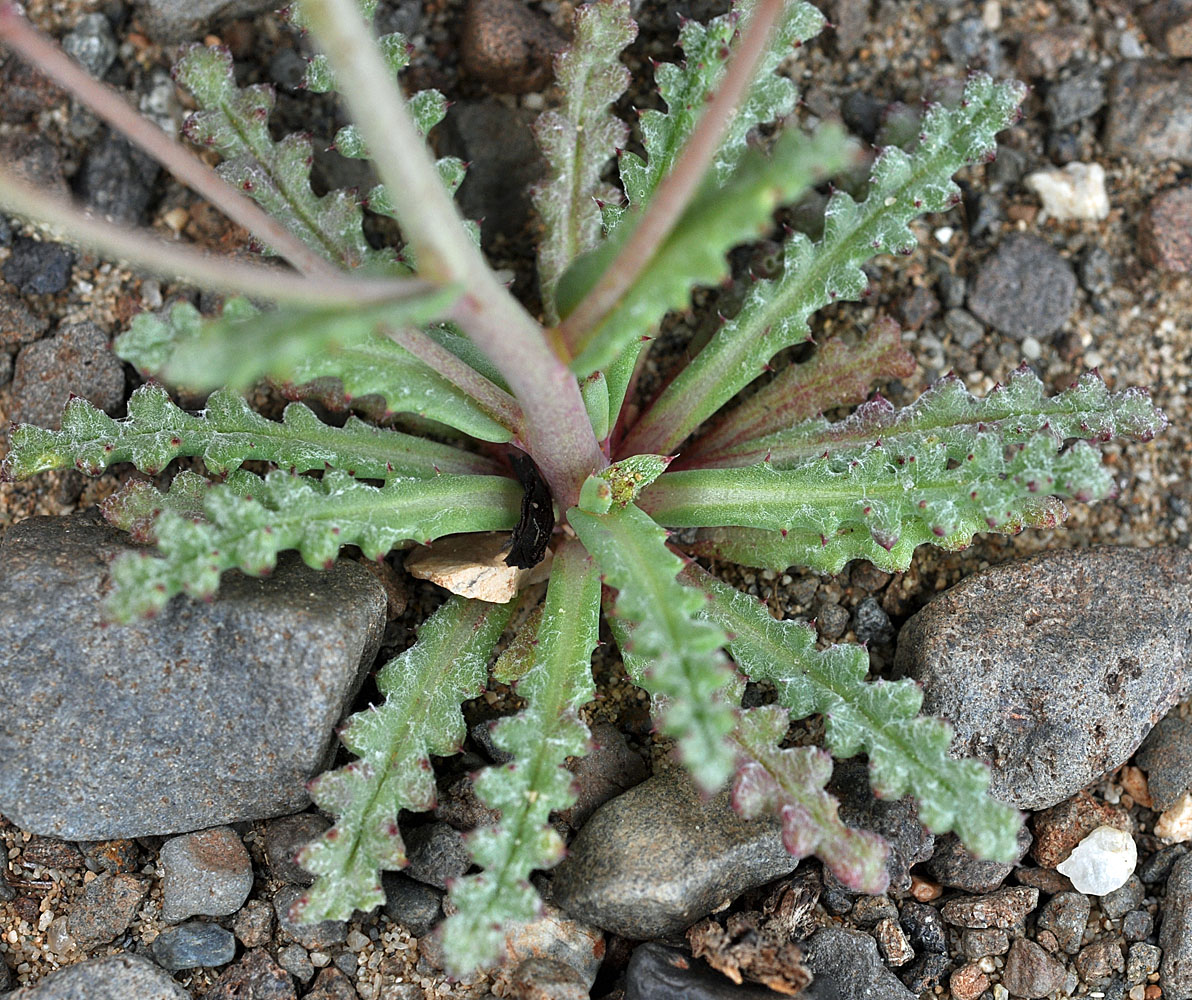
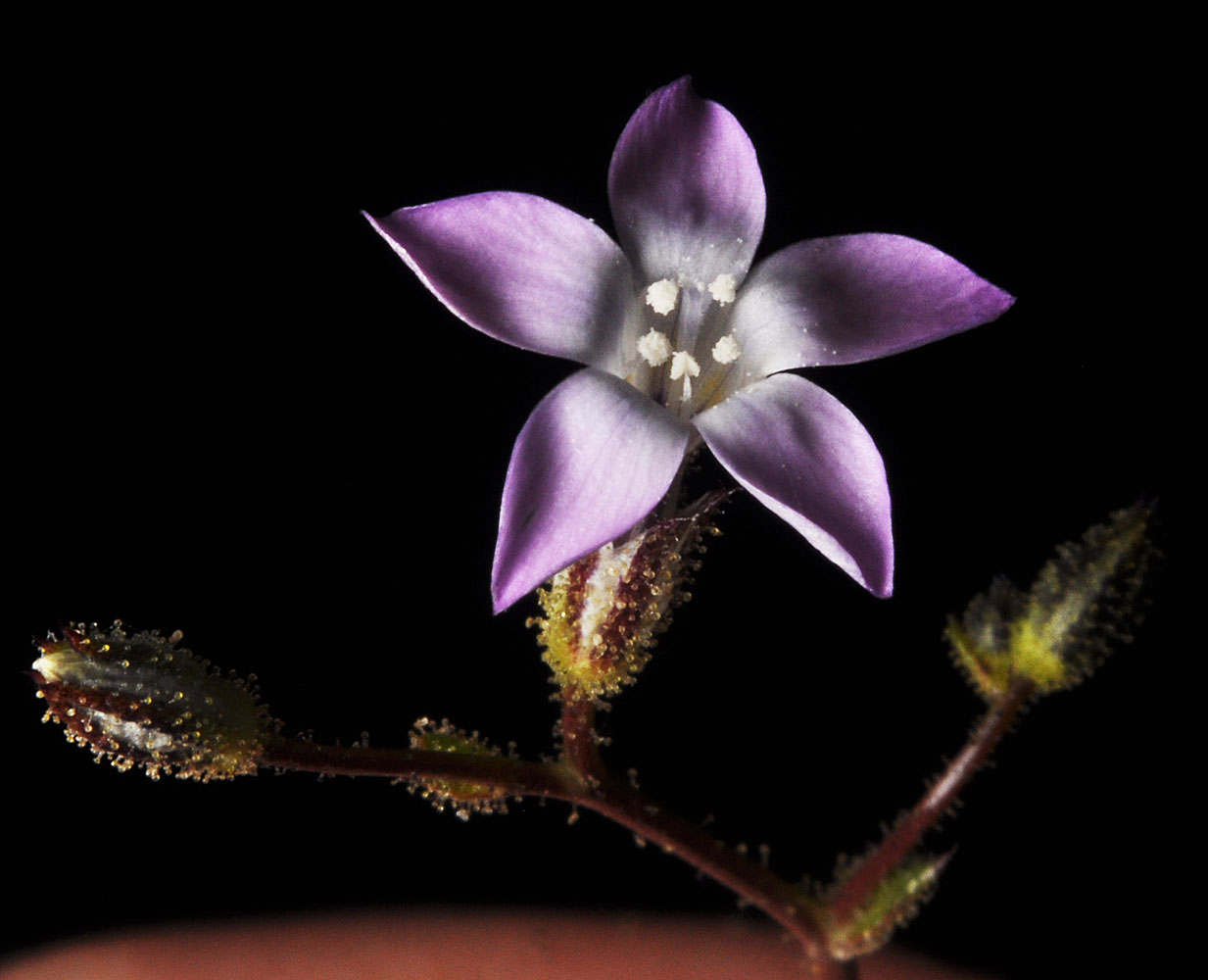
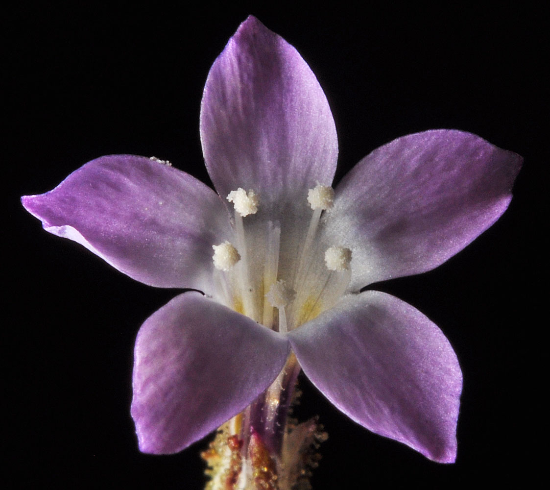
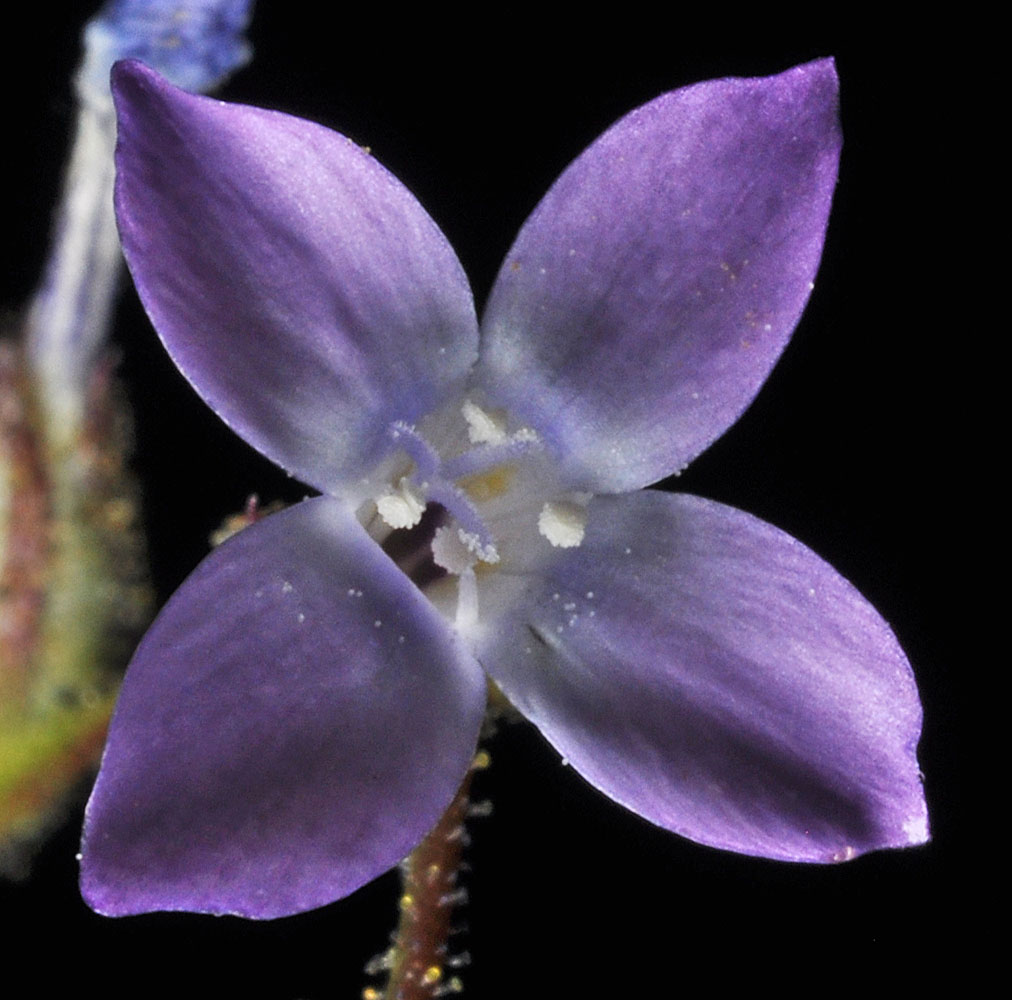
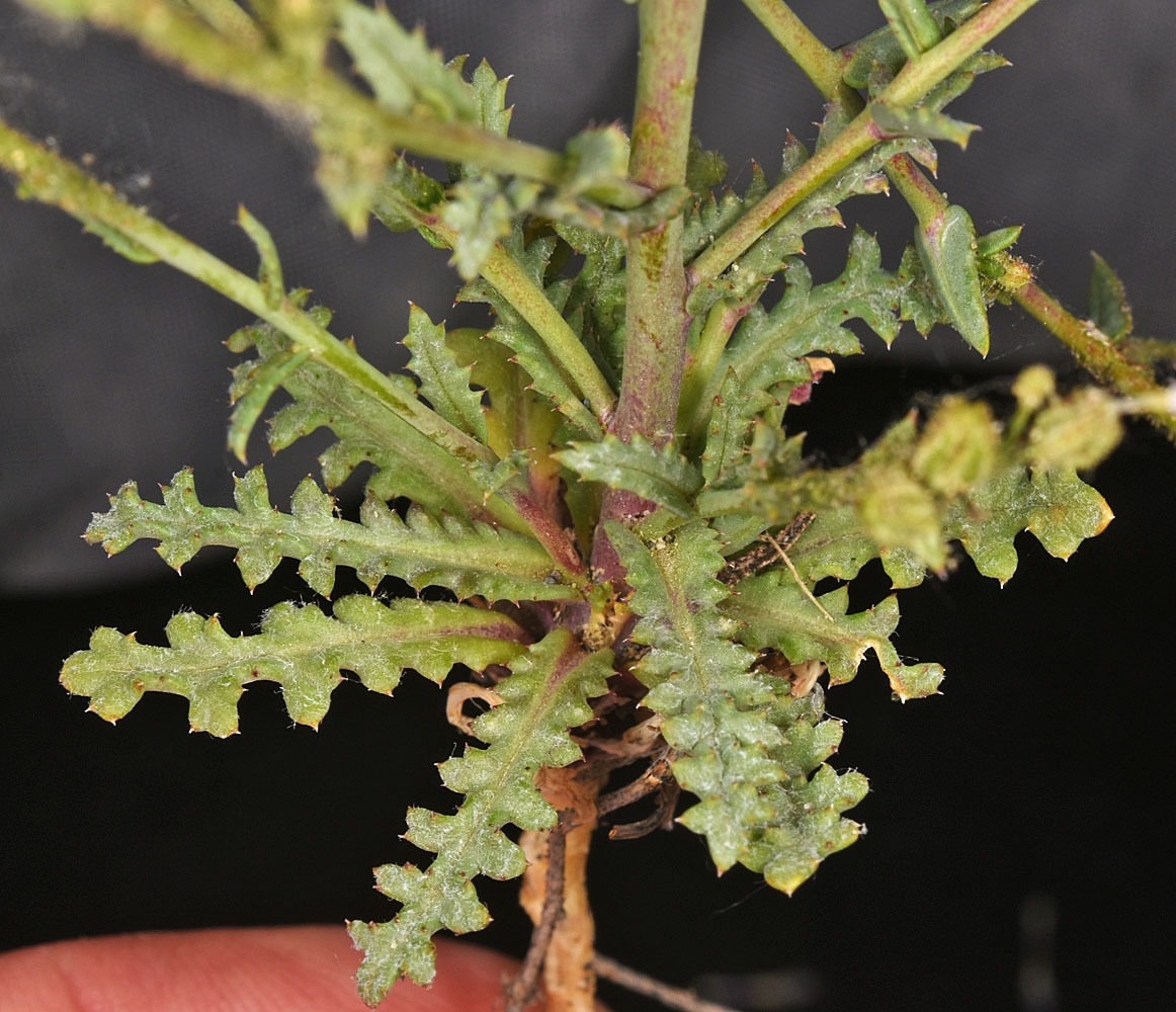
Hwy 24, 0.9 mi. NE of Vernita Bridge (Columbia River) – N46.65017, W119.72352 – Grant Co., WA – 5/28/2009Hwy 24, 0.9 mi. NE of Vernita Bridge (Columbia River) – N46.65017, W119.72352 – Grant Co., WA – 5/28/2009Hwy 24, 0.9 mi. NE of Vernita Bridge (Columbia River) – N46.65017, W119.72352 – Grant Co., WA – 5/28/2009Ca. 1 mi NE of Vernita Bridge along Hwy 24; 46 39.113N 119 43.091W – Grant Co., WA – 4/26/2010Ca. 1 mi NE of Vernita Bridge along Hwy 24; 46 39.113N 119 43.091W – Grant Co., WA – 4/26/2010Ca. 1 mi NE of Vernita Bridge along Hwy 24; 46 39.113N 119 43.091W – Grant Co., WA – 4/26/2010Ca. 1 mi NE of Vernita Bridge along Hwy 24; 46 39.113N 119 43.091W – Grant Co., WA – 4/26/2010Ca. 1 mi NE of Vernita Bridge along Hwy 24; 46 39.113N 119 43.091W – Grant Co., WA – 4/26/2010Ca. 1 mi NE of Vernita Bridge along Hwy 24; 46 39.113N 119 43.091W – Grant Co., WA – 4/26/2010Ca. 1 mi NE of Vernita Bridge along Hwy 24; 46 39.113N 119 43.091W – Grant Co., WA – 4/26/2010Ca. 1 mi NE of Vernita Bridge along Hwy 24; 46 39.113N 119 43.091W – Grant Co., WA – 4/26/2010Ca. 1 mi NE of Vernita Bridge along Hwy 24; 46 39.113N 119 43.091W – Grant Co., WA – 4/26/2010Along Hwy L-SW NW of Vernita Bridge on bluff above river; W of road; N 46.651764 W 119.743717 – Grant Co. – 5/29/2011Along Hwy L-SW NW of Vernita Bridge on bluff above river; W of road; N 46.651764 W 119.743717 – Grant Co. – 5/29/2011Dunes just west of Rock Creek along Hwy 14 west of Roosevelt, WA; N 45.70353 W 120.46666; Klickitat Co.; 4/14/2014Dunes just west of Rock Creek along Hwy 14 west of Roosevelt, WA; N 45.70353 W 120.46666; Klickitat Co.; 4/14/2014Dunes just west of Rock Creek along Hwy 14 west of Roosevelt, WA; N 45.70353 W 120.46666; Klickitat Co.; 4/14/2014Dunes just west of Rock Creek along Hwy 14 west of Roosevelt, WA; N 45.70353 W 120.46666; Klickitat Co.; 4/14/2014S of Sand Dune Rd ca. 3.24 mi S of South Frontage Rd NW in Moses Lake, WA. 1.1 air mi SSW of Gaileys Island. N 47.05975 W 119.32857; Grant Co.; 5/24/2020S of Sand Dune Rd ca. 3.24 mi S of South Frontage Rd NW in Moses Lake, WA. 1.1 air mi SSW of Gaileys Island. N 47.05975 W 119.32857; Grant Co.; 5/24/2020S of Sand Dune Rd ca. 3.24 mi S of South Frontage Rd NW in Moses Lake, WA. 1.1 air mi SSW of Gaileys Island. N 47.05975 W 119.32857; Grant Co.; 5/24/2020S of Sand Dune Rd ca. 3.24 mi S of South Frontage Rd NW in Moses Lake, WA. 1.1 air mi SSW of Gaileys Island. N 47.05975 W 119.32857; Grant Co.; 5/24/2020S of Sand Dune Rd ca. 3.24 mi S of South Frontage Rd NW in Moses Lake, WA. 1.1 air mi SSW of Gaileys Island. N 47.05975 W 119.32857; Grant Co.; 5/24/2020