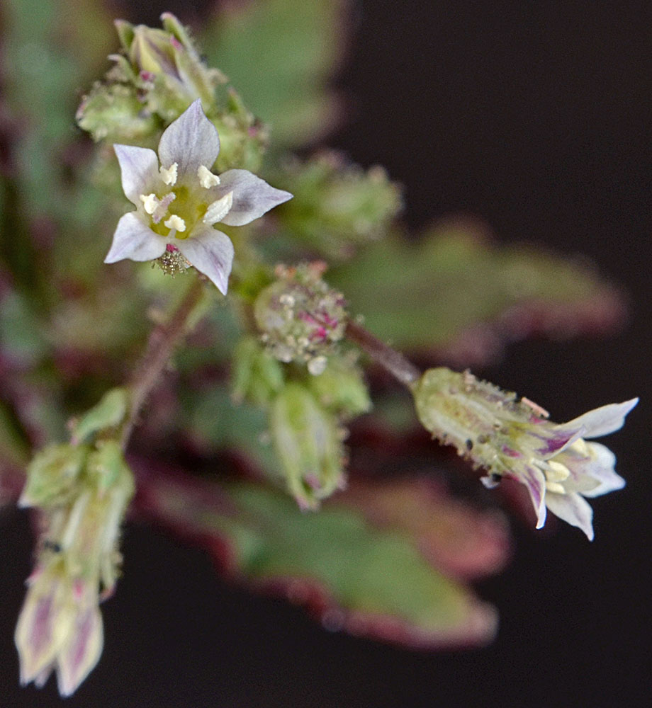
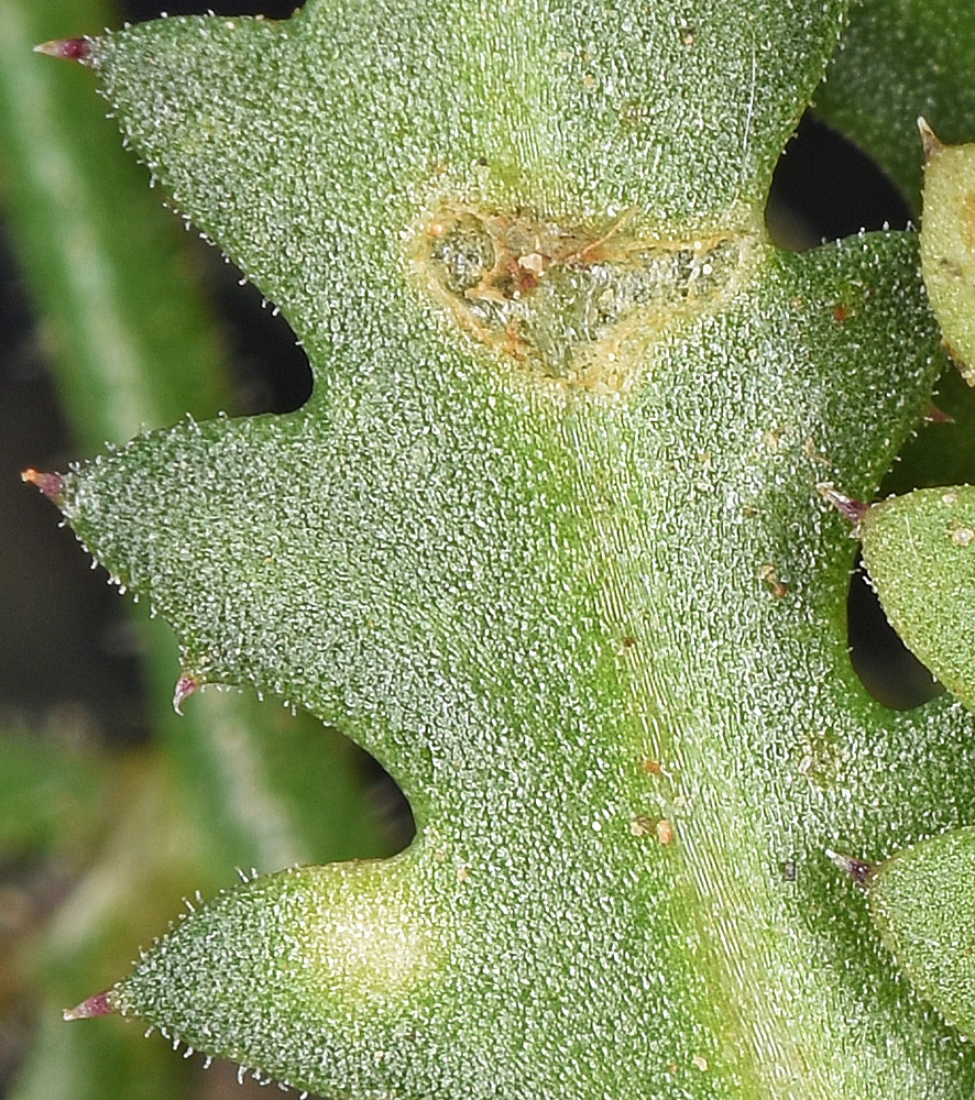
Squaw Creek Rd., 1.8 mi. S of Hwy 20, 7.8 air mi. SW of Harper Junction, Malheur Co., OR, 2825 ft. elev.Squaw Creek Rd., 1.8 mi. S of Hwy 20, 7.8 air mi. SW of Harper Junction, Malheur Co., OR, 2825 ft. elev.Squaw Creek Rd., 1.8 mi. S of Hwy 20, 7.8 air mi. SW of Harper Junction, Malheur Co., OR, 2825 ft. elev.Squaw Creek Rd., 1.8 mi. S of Hwy 20, 7.8 air mi. SW of Harper Junction, Malheur Co., OR, 2825 ft. elev.Squaw Creek Rd., 1.8 mi. S of Hwy 20, 7.8 air mi. SW of Harper Junction, Malheur Co., OR, 2825 ft. elev.Squaw Creek Rd., 1.8 mi. S of Hwy 20, 7.8 air mi. SW of Harper Junction, Malheur Co., OR, 2825 ft. elev.W of Hwy 95, 7.1 mi. S of Burns Jct., S of Crooked Creek, 3857 ft. elev.W of Hwy 95, 7.1 mi. S of Burns Jct., S of Crooked Creek, 3857 ft. elev.W of Hwy 95, 7.1 mi. S of Burns Jct., S of Crooked Creek, 3857 ft. elev.W of Hwy 95, 7.1 mi. S of Burns Jct., S of Crooked Creek, 3857 ft. elev.W of Hwy 95, 7.1 mi. S of Burns Jct., S of Crooked Creek, 3857 ft. elev.W of Hwy 95, 7.1 mi. S of Burns Jct., S of Crooked Creek, 3857 ft. elev.Ridge ca. 250 yds. W of unnamed rd. 0.7 mi. SE of jct. with Hwy 95, W of Rome, 3662 ft. elev.Squaw Creek Rd., 1.8 mi. S of Hwy 20, 7.8 air mi. SW of Harper Junction, Malheur Co., OR, 2825 ft. elev.