| Scientific Name | Lomatium cous (S. Wats.) Coult. & Rose |
| Family | Apiaceae |
| Common Names | cous-root desert-parsley, cous |
| Eastern Washington | Native |
| Synonyms | Lomatium circumdatum (S. Watson) J.M. Coult. & Rose Lomatium montanum J.M. Coult. & Rose |
| Conservation Status | |
| Notes |
Click on any image to enlarge it.
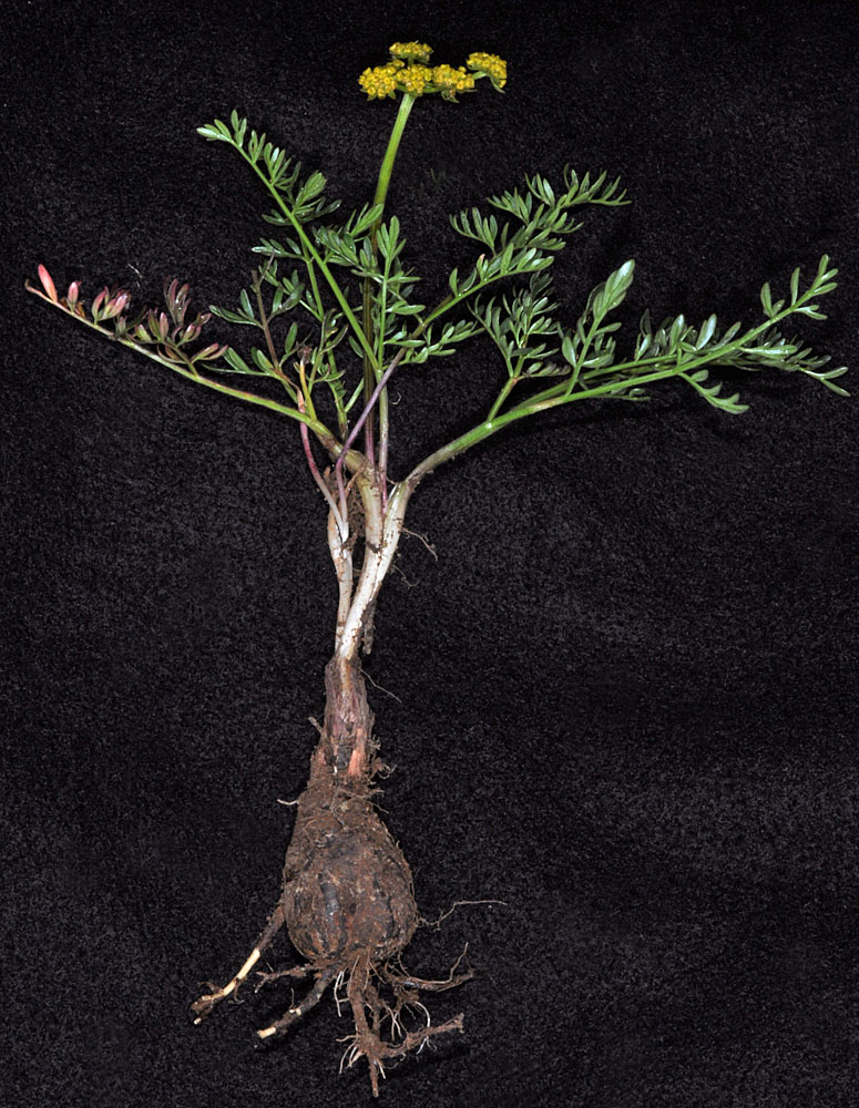
SE of Milton-Freewater, OR near the corner of Spofford and Walla Walla River rds; N 45.90229 W 118.33606 – Umatilla Co. – 4/13/2011 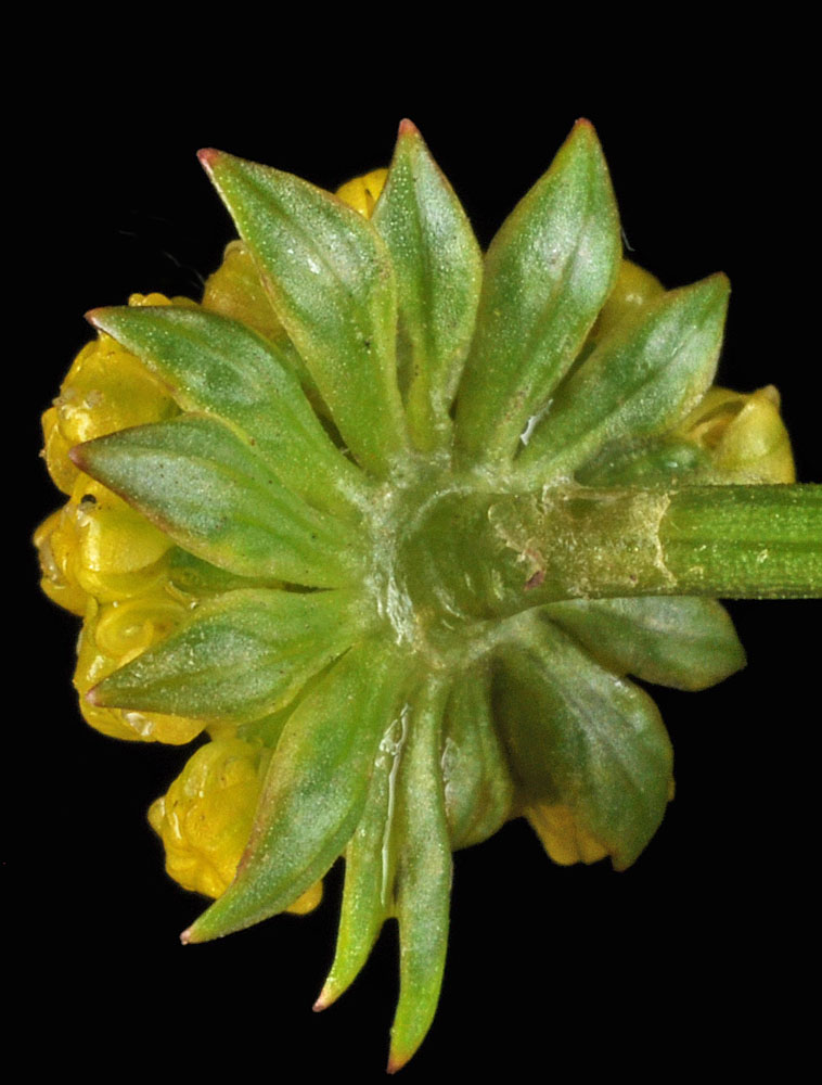
SE of Milton-Freewater, OR near the corner of Spofford and Walla Walla River rds; N 45.90229 W 118.33606 – Umatilla Co. – 4/13/2011 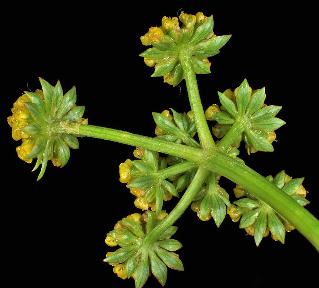
SE of Milton-Freewater, OR near the corner of Spofford and Walla Walla River rds; N 45.90229 W 118.33606 – Umatilla Co. – 4/13/2011 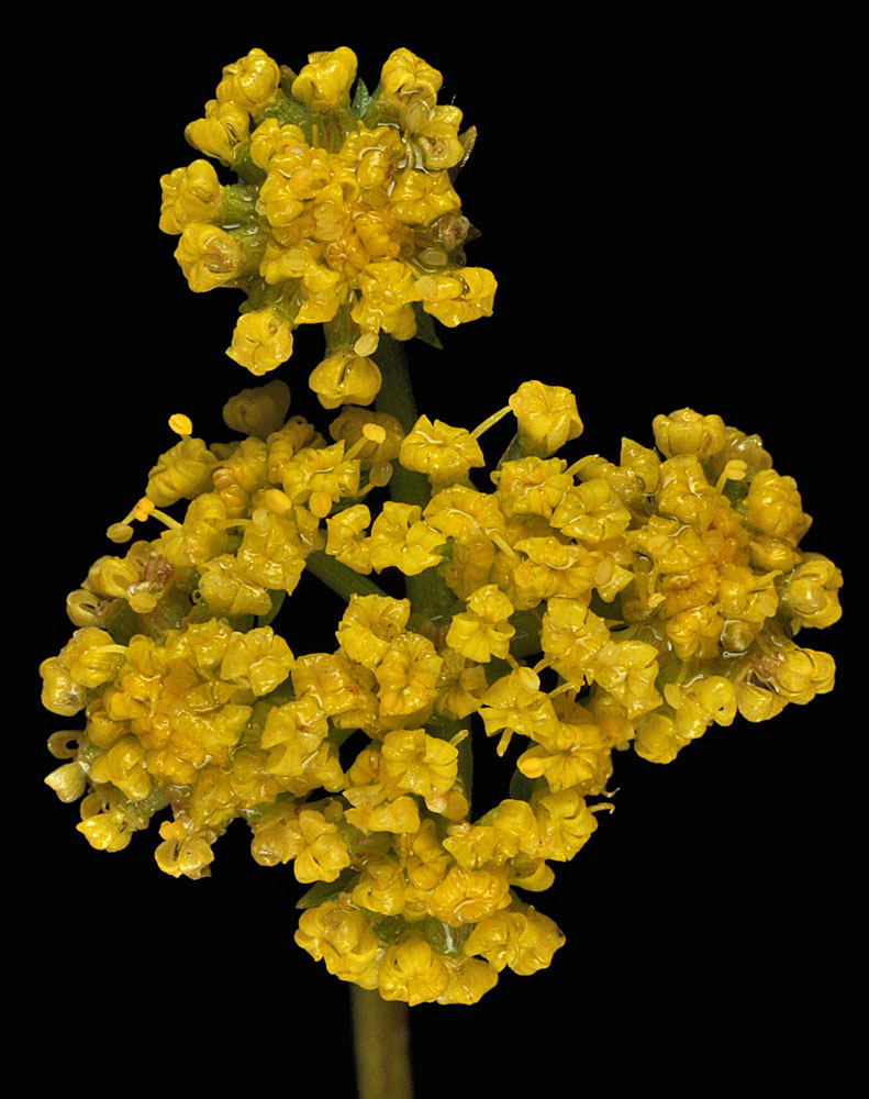
SE of Milton-Freewater, OR near the corner of Spofford and Walla Walla River rds; N 45.90229 W 118.33606 – Umatilla Co. – 4/13/2011 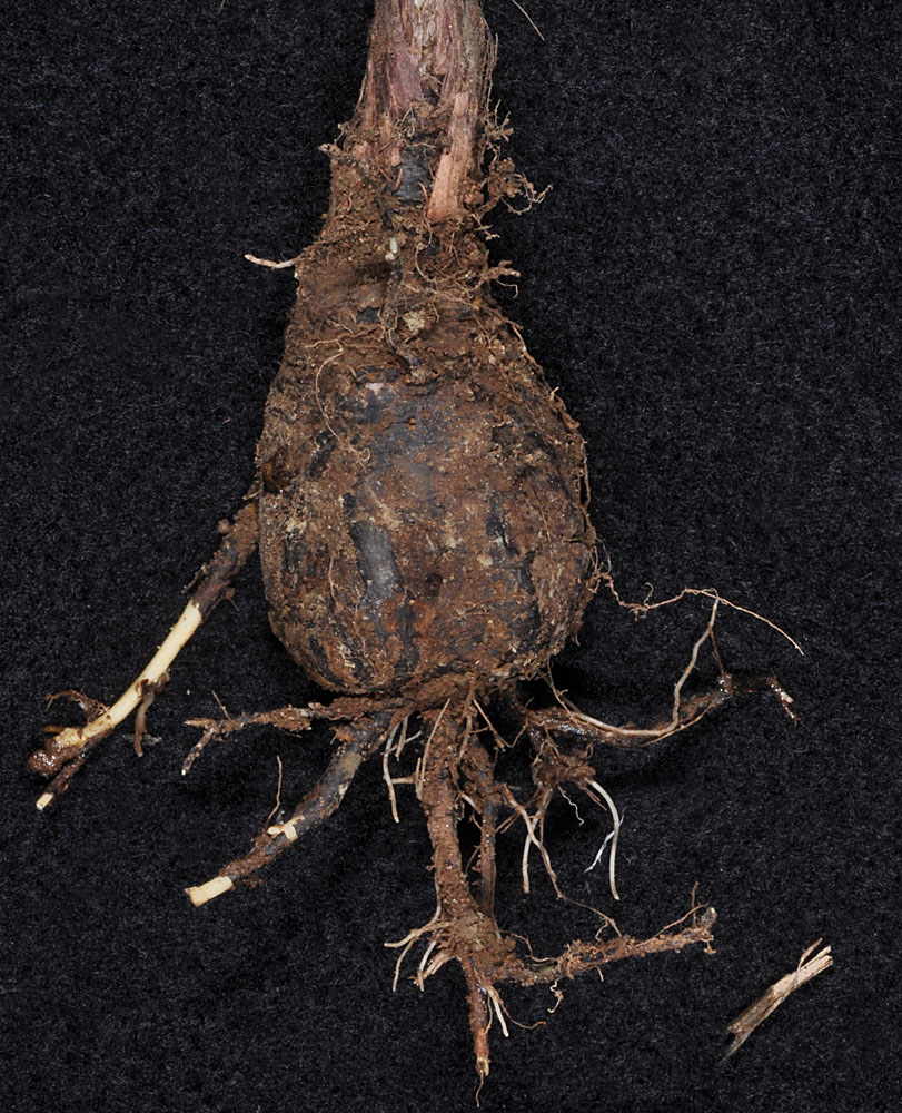
SE of Milton-Freewater, OR near the corner of Spofford and Walla Walla River rds; N 45.90229 W 118.33606 – Umatilla Co. – 4/13/2011 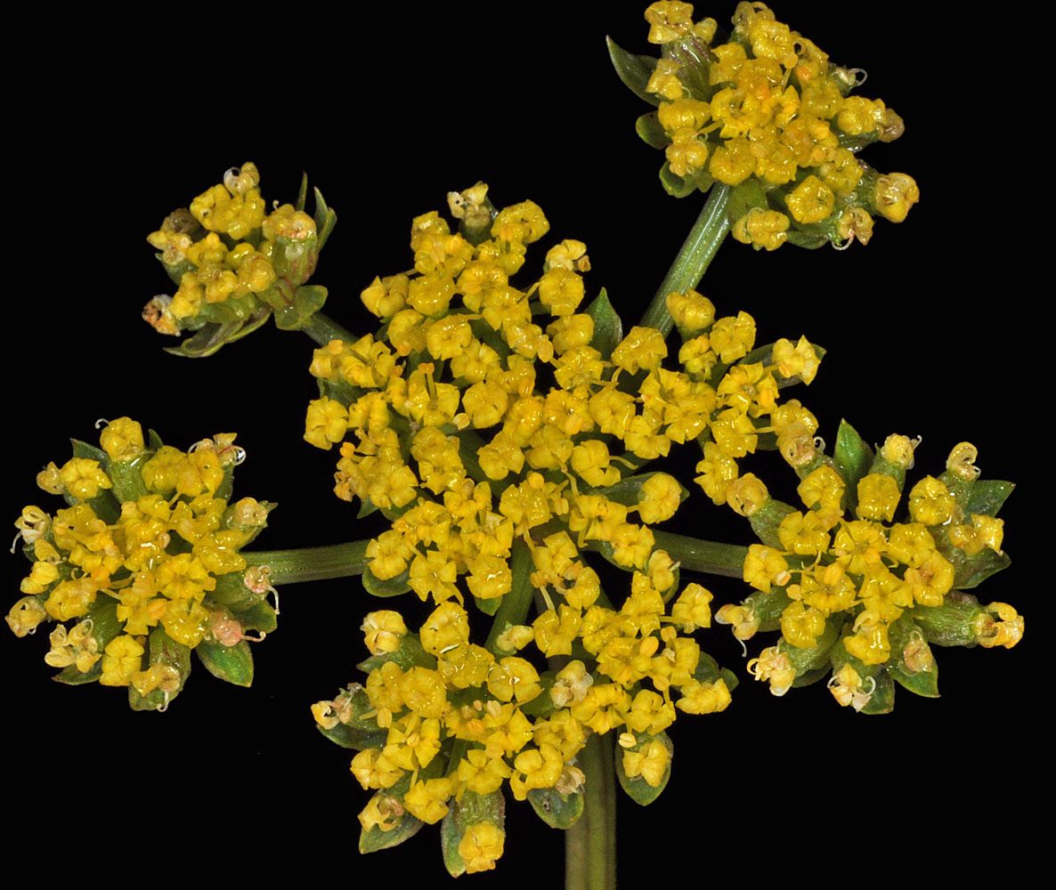
SE of Milton-Freewater, OR near the corner of Spofford and Walla Walla River rds; N 45.90229 W 118.33606 – Umatilla Co. – 4/13/2011 
SE of Milton-Freewater, OR near the corner of Spofford and Walla Walla River rds; N 45.90229 W 118.33606 – Umatilla Co. – 4/13/2011 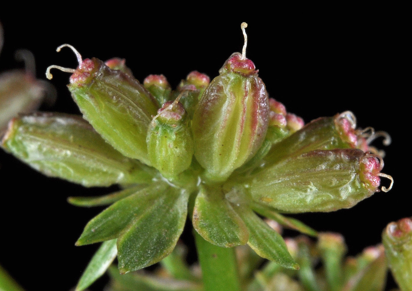
SE of Milton-Freewater, OR near the corner of Spofford and Walla Walla River rds; N 45.90229 W 118.33606 – Umatilla Co. – 4/13/2011 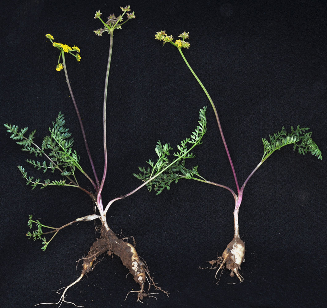
S of Pomeroy, WA along Mountain Rd (Scroggin Ridge-becomes USF Rd 40) 2.1 mi N of Nat. Forest Boundry-Elk Fence; N 46.31847 W 117.57317 – Garfield Co. – 6/22/2011 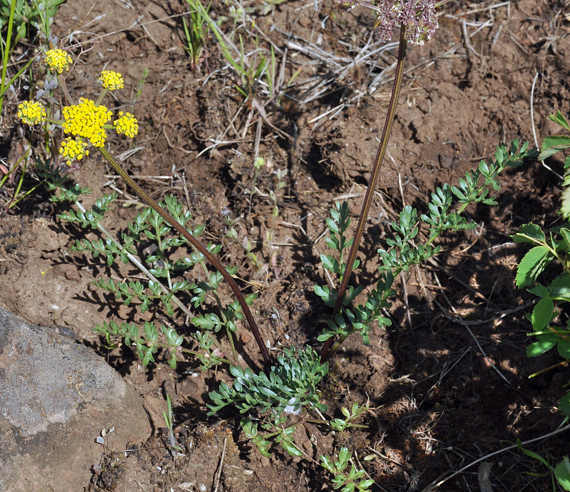
S of Pomeroy, WA along Mountain Rd (Scroggin Ridge-becomes USF Rd 40) 2.1 mi N of Nat. Forest Boundry-Elk Fence; N 46.31847 W 117.57317 – Garfield Co. – 6/22/2011 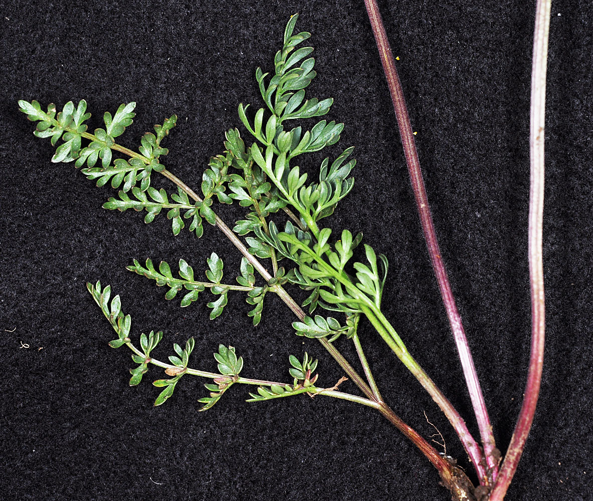
S of Pomeroy, WA along Mountain Rd (Scroggin Ridge-becomes USF Rd 40) 2.1 mi N of Nat. Forest Boundry-Elk Fence; N 46.31847 W 117.57317 – Garfield Co. – 6/22/2011 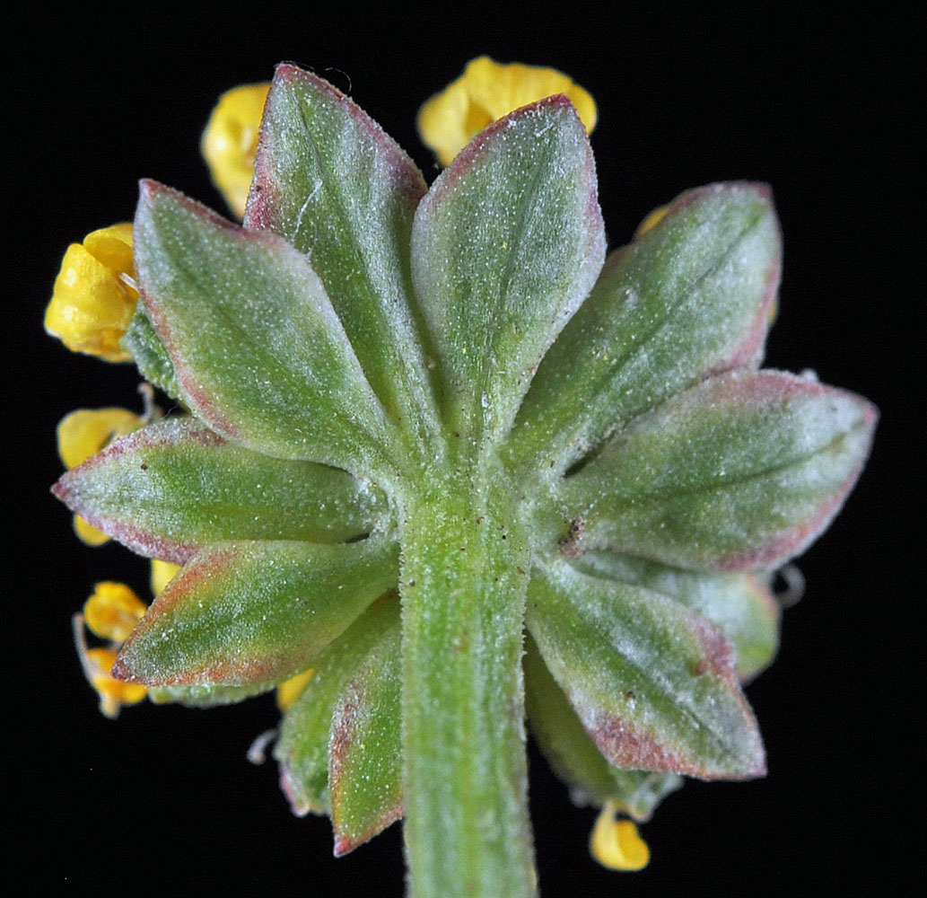
S of Pomeroy, WA along Mountain Rd (Scroggin Ridge-becomes USF Rd 40) 2.1 mi N of Nat. Forest Boundry-Elk Fence; N 46.31847 W 117.57317 – Garfield Co. – 6/22/2011 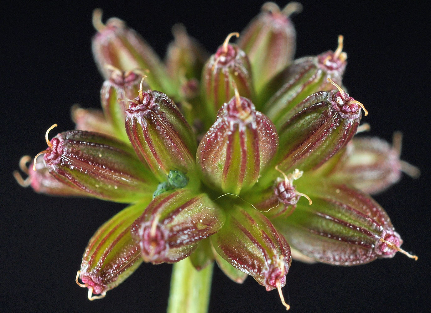
S of Pomeroy, WA along Mountain Rd (Scroggin Ridge-becomes USF Rd 40) 2.1 mi N of Nat. Forest Boundry-Elk Fence; N 46.31847 W 117.57317 – Garfield Co. – 6/22/2011 
Anatone Butte 6.1 air mi WSW of Anatone, WA. 0.2 mi SE of the jct of W. MT. Rd. (NF 4304) with NF 170.; N 46.10894 W 117.25470; Asotin Co.; 6/3/2018 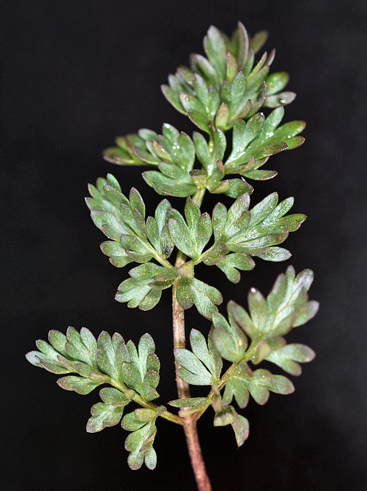
Anatone Butte 6.1 air mi WSW of Anatone, WA. 0.2 mi SE of the jct of W. MT. Rd. (NF 4304) with NF 170.; N 46.10894 W 117.25470; Asotin Co.; 6/3/2018 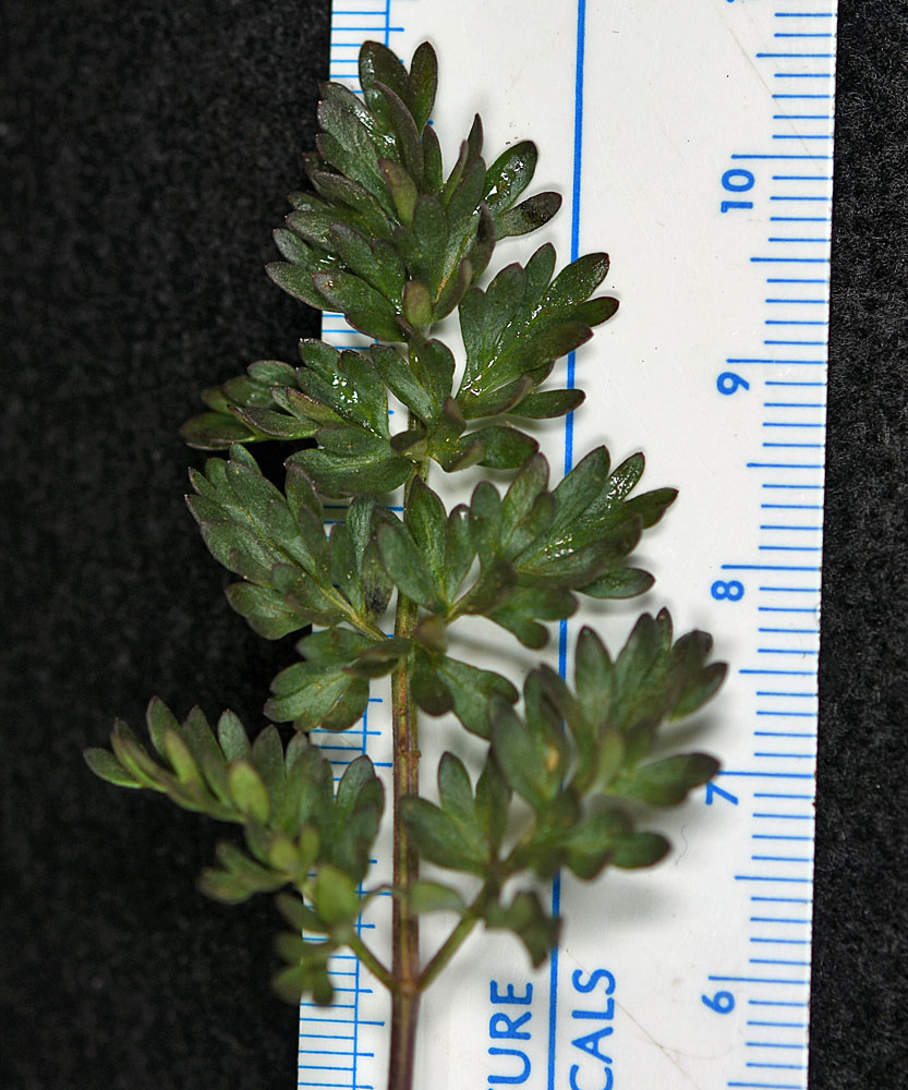
Anatone Butte 6.1 air mi WSW of Anatone, WA. 0.2 mi SE of the jct of W. MT. Rd. (NF 4304) with NF 170.; N 46.10894 W 117.25470; Asotin Co.; 6/3/2018 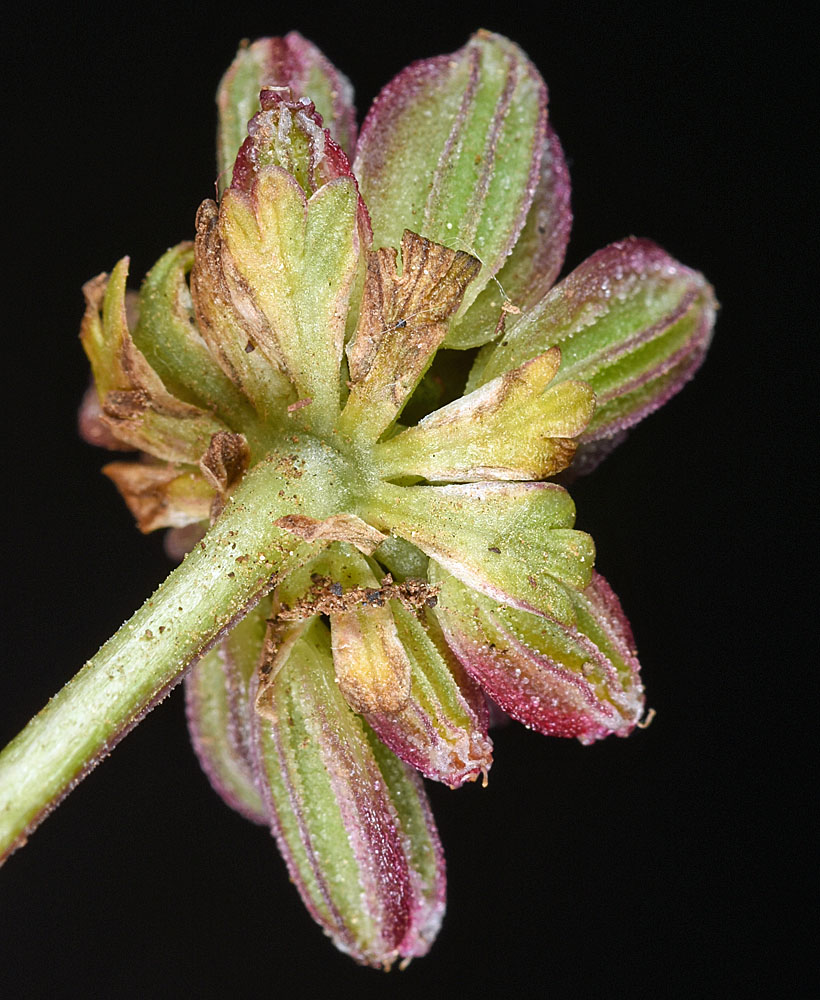
Anatone Butte 6.1 air mi WSW of Anatone, WA. 0.2 mi SE of the jct of W. MT. Rd. (NF 4304) with NF 170.; N 46.10894 W 117.25470; Asotin Co.; 6/3/2018 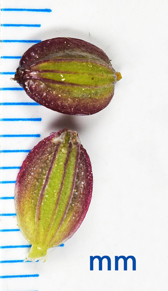
Anatone Butte 6.1 air mi WSW of Anatone, WA. 0.2 mi SE of the jct of W. MT. Rd. (NF 4304) with NF 170.; N 46.10894 W 117.25470; Asotin Co.; 6/3/2018 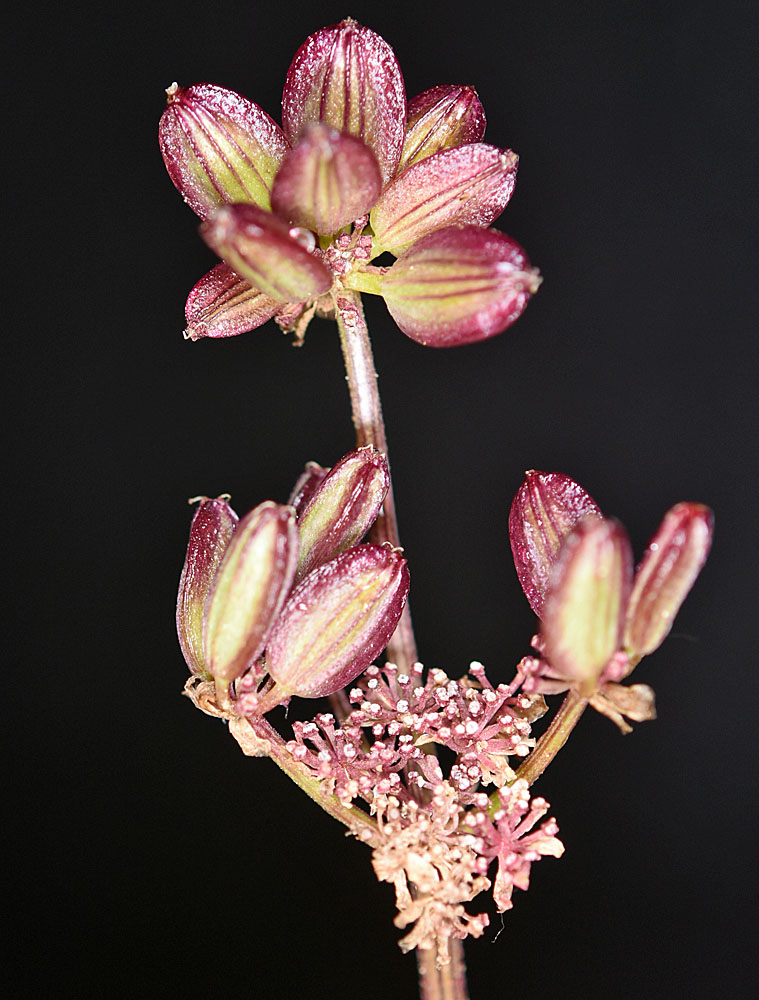
Anatone Butte 6.1 air mi WSW of Anatone, WA. 0.2 mi SE of the jct of W. MT. Rd. (NF 4304) with NF 170.; N 46.10894 W 117.25470; Asotin Co.; 6/3/2018


