| Scientific Name | Penstemon acuminatus Dougl. ex Lindl. var. acuminatus |
| Family | Plantaginaceae |
| Common Names | sand dune penstemon, sharp-leaved penstemon |
| Eastern Washington | Native |
| Synonyms | None |
| Conservation Status | |
| Notes |
Click on any image to enlarge it.
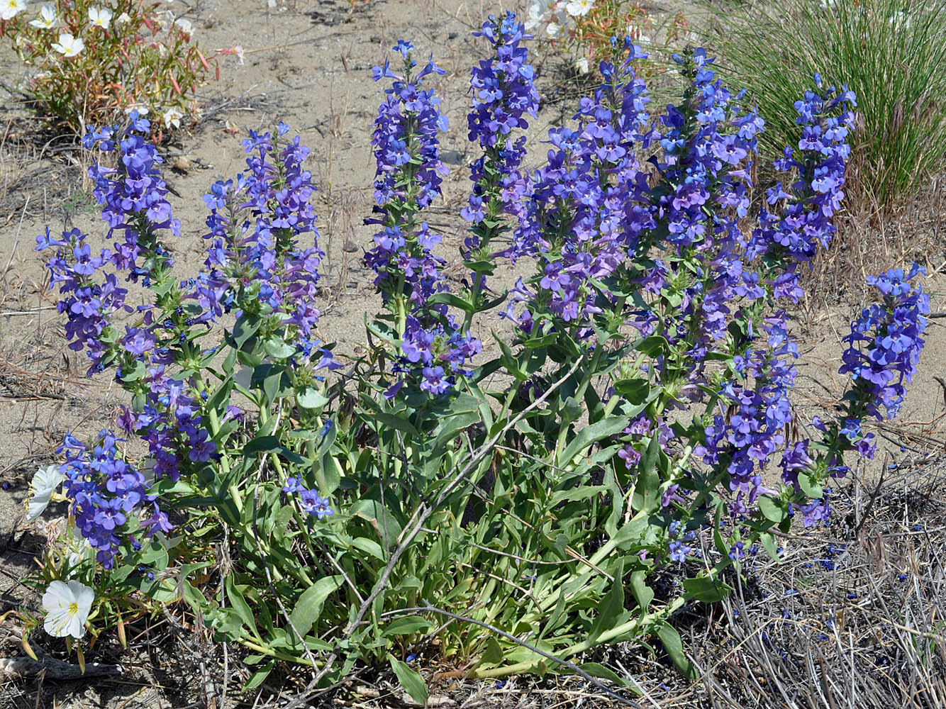
Along Hwy 240 ca 9.2 mi SE of its jct with Hwy 24 at 46 29 539N 119 35 721W – Benton Co., WA – 5/28/2009 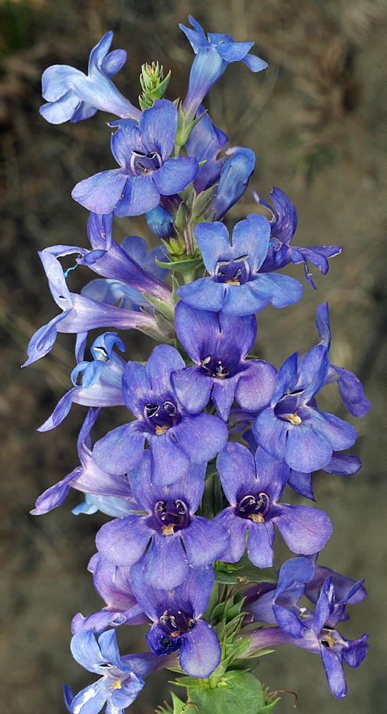
Along Hwy 240 ca 9.2 mi SE of its jct with Hwy 24 at 46 29 539N 119 35 721W – Benton Co., WA – 5/28/2009 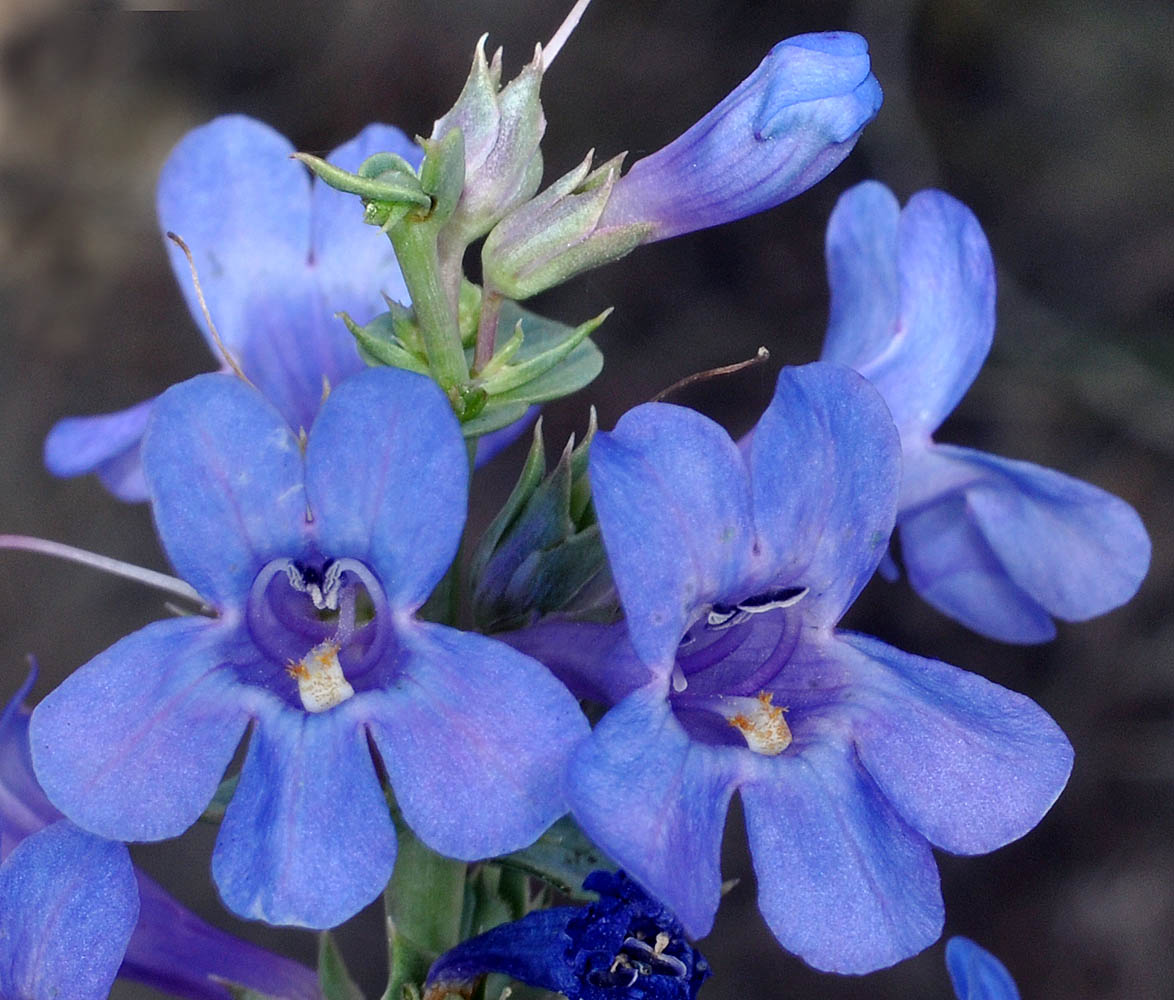
Along Hwy 240 ca 9.2 mi SE of its jct with Hwy 24 at 46 29 539N 119 35 721W – Benton Co., WA – 5/28/2009 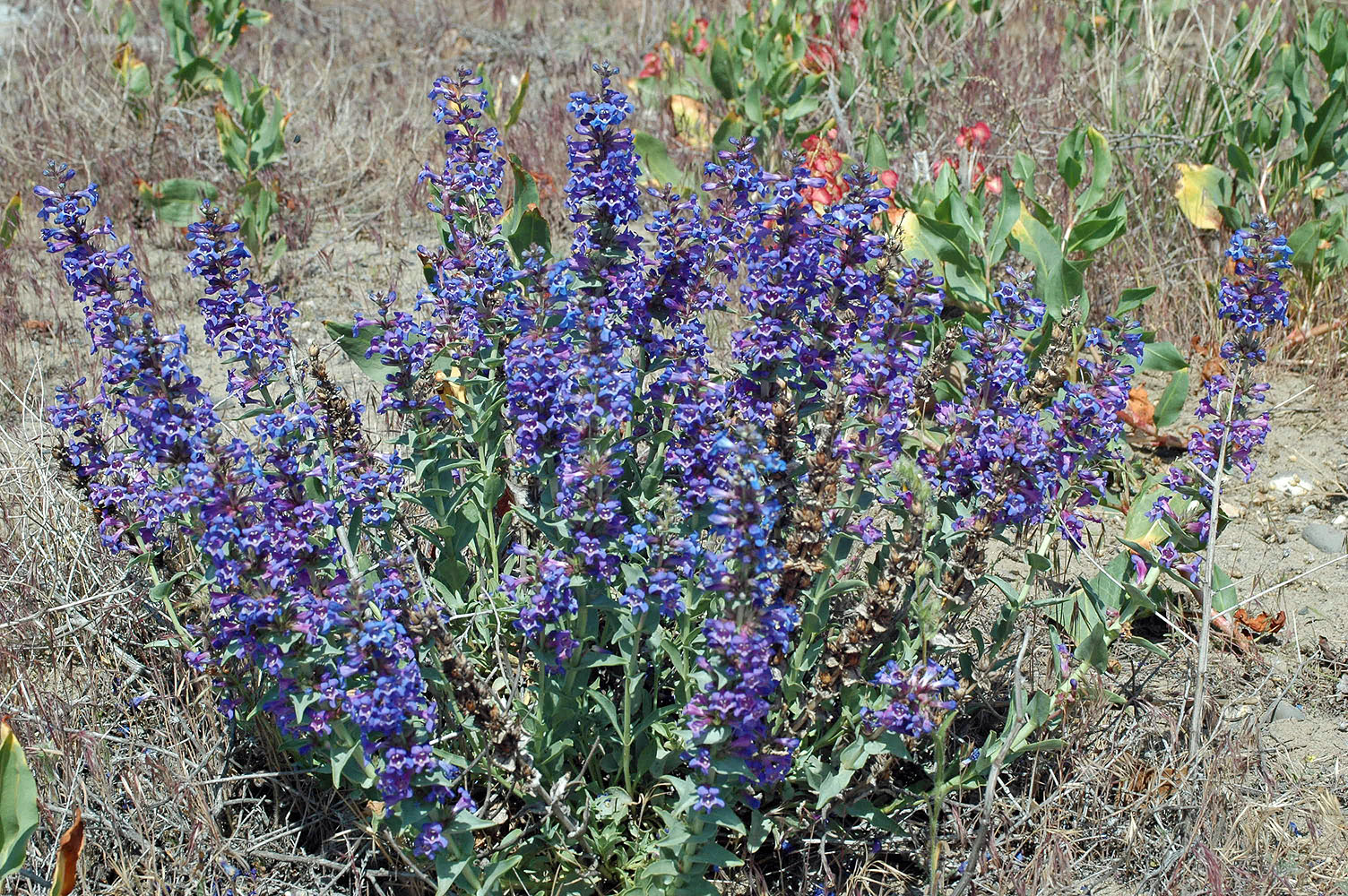
W of Pasco-riverside w of new bridge; 46 16 200N 119 14 824W – Franklin Co., WA – 5/16/2009 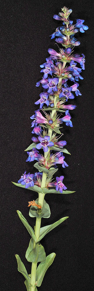
W of Pasco-riverside w of new bridge; 46 16 200N 119 14 824W – Franklin Co., WA – 5/16/2009 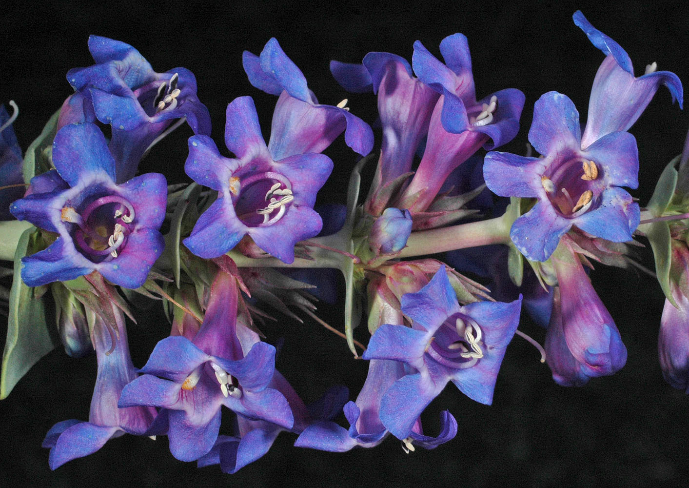
W of Pasco-riverside w of new bridge; 46 16 200N 119 14 824W – Franklin Co., WA – 5/16/2009 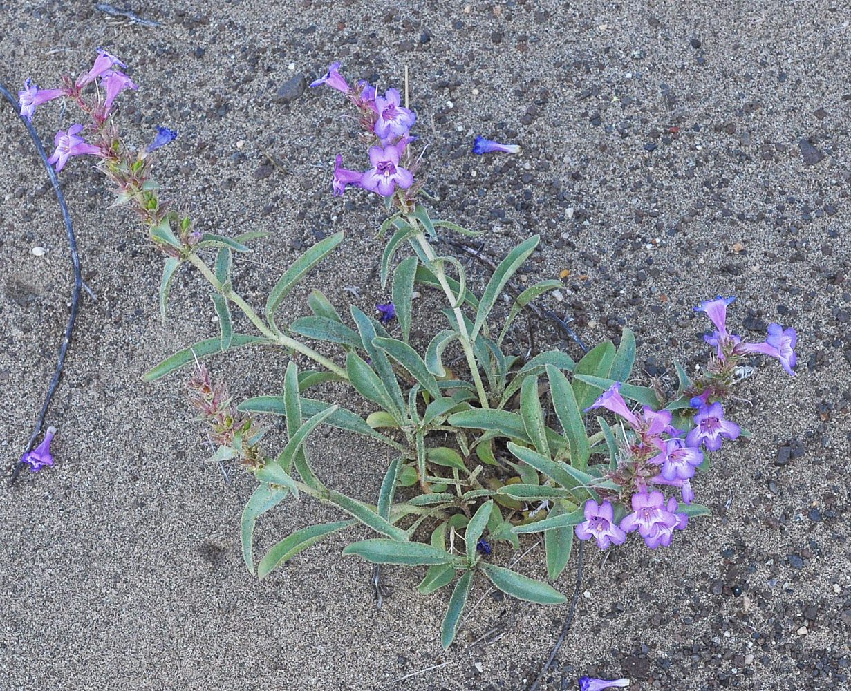
Sandy draw between bluffs 800 Yds N of the N end of the Vernita Bridge; N 46.65040 W 119.73771; Grant Co., WA; 5/2/2014 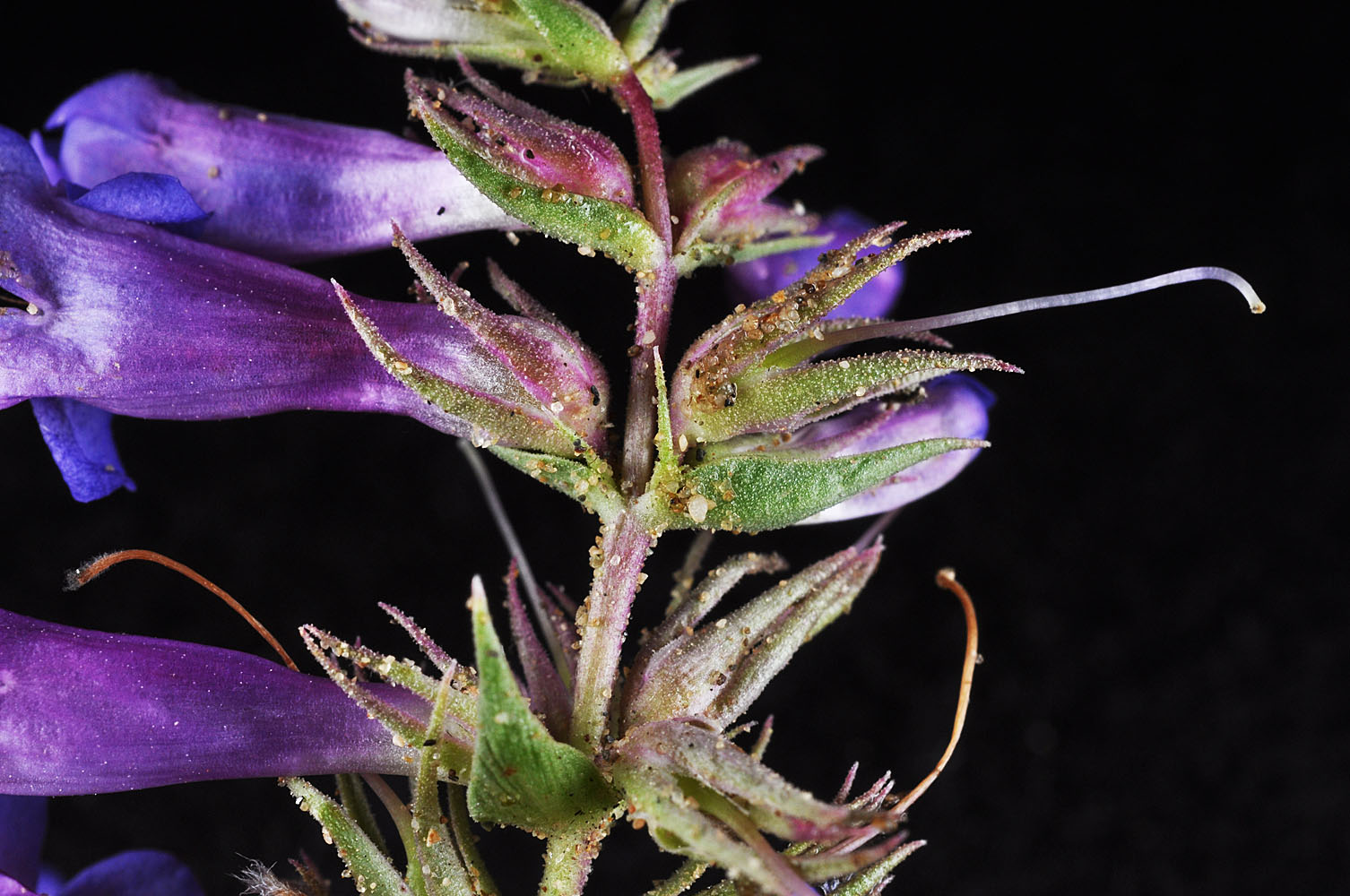
Sandy draw between bluffs 800 Yds N of the N end of the Vernita Bridge; N 46.65040 W 119.73771; Grant Co., WA; 5/2/2014 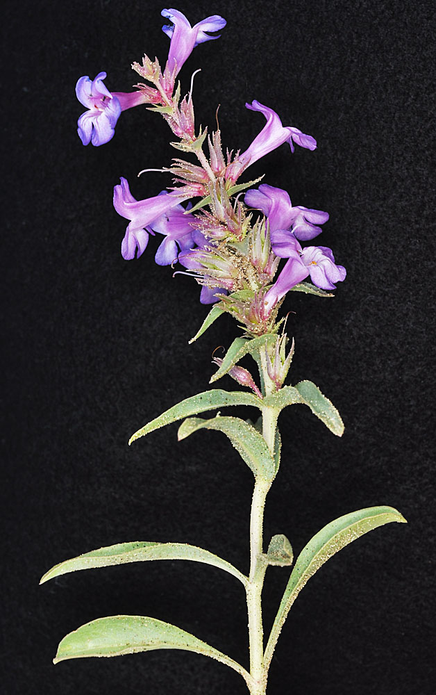
Sandy draw between bluffs 800 Yds N of the N end of the Vernita Bridge; N 46.65040 W 119.73771; Grant Co., WA; 5/2/2014 
Sandy draw between bluffs 800 Yds N of the N end of the Vernita Bridge; N 46.65040 W 119.73771; Grant Co., WA; 5/2/2014 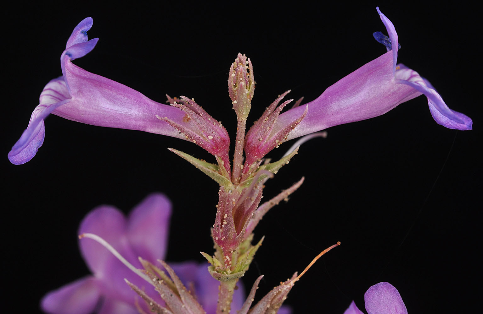
Sandy draw between bluffs 800 Yds N of the N end of the Vernita Bridge; N 46.65040 W 119.73771; Grant Co., WA; 5/2/2014 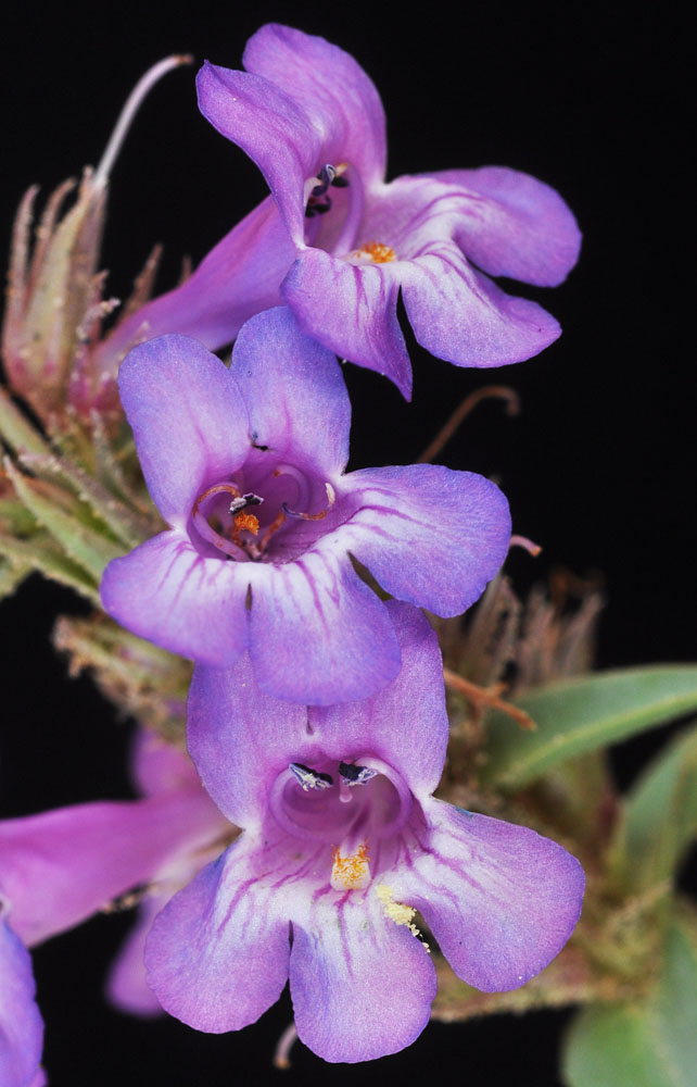
Sandy draw between bluffs 800 Yds N of the N end of the Vernita Bridge; N 46.65040 W 119.73771; Grant Co., WA; 5/2/2014 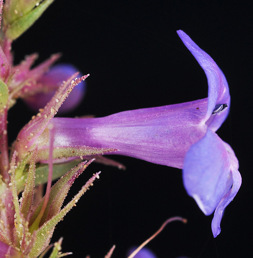
Sandy draw between bluffs 800 Yds N of the N end of the Vernita Bridge; N 46.65040 W 119.73771; Grant Co., WA; 5/2/2014 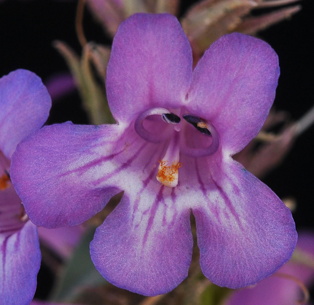
Sandy draw between bluffs 800 Yds N of the N end of the Vernita Bridge; N 46.65040 W 119.73771; Grant Co., WA; 5/2/2014 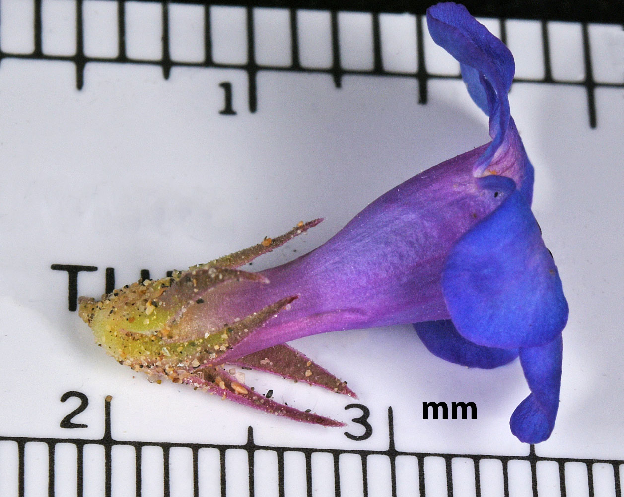
Just E of Hwy 243; 1.65 air mi N of Wanapum Dam in sand; N 46.90111 W 119.94782; Grant Co.; 5/1/2017 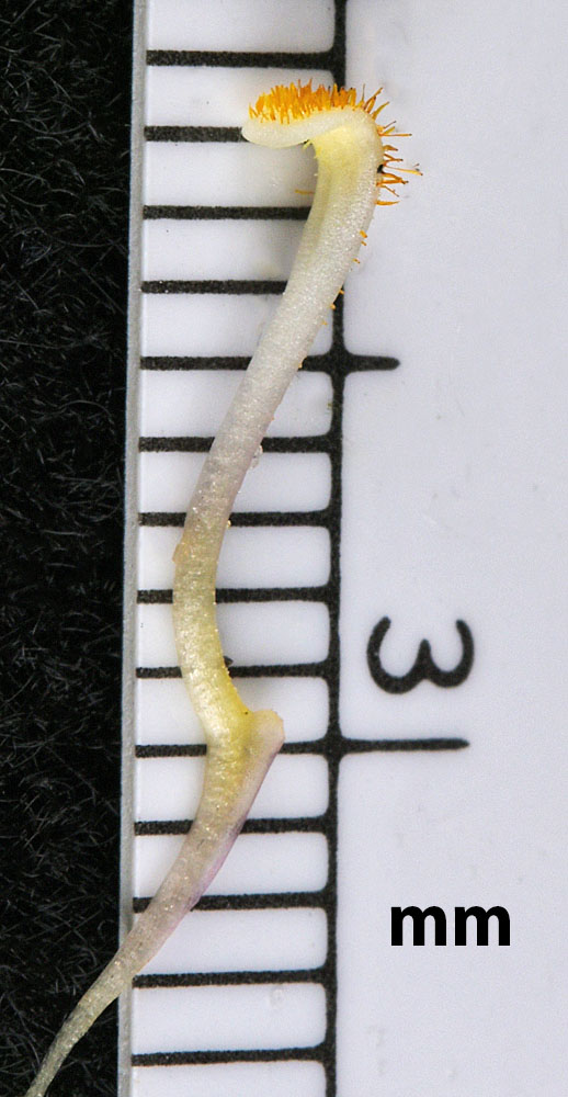
Just E of Hwy 243; 1.65 air mi N of Wanapum Dam in sand; N 46.90111 W 119.94782; Grant Co.; 5/1/2017 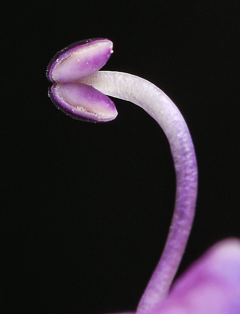
Just E of Hwy 243; 1.65 air mi N of Wanapum Dam in sand; N 46.90111 W 119.94782; Grant Co.; 5/1/2017


