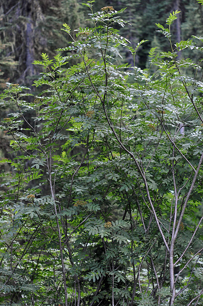
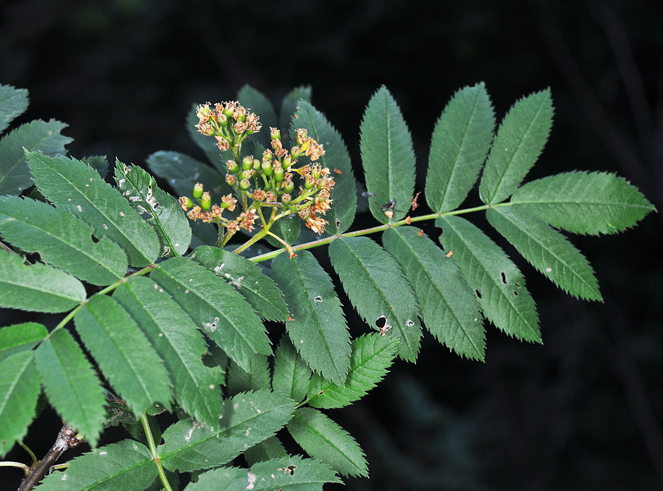
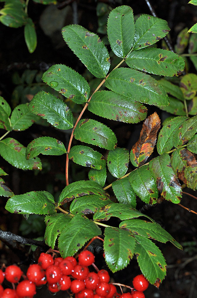
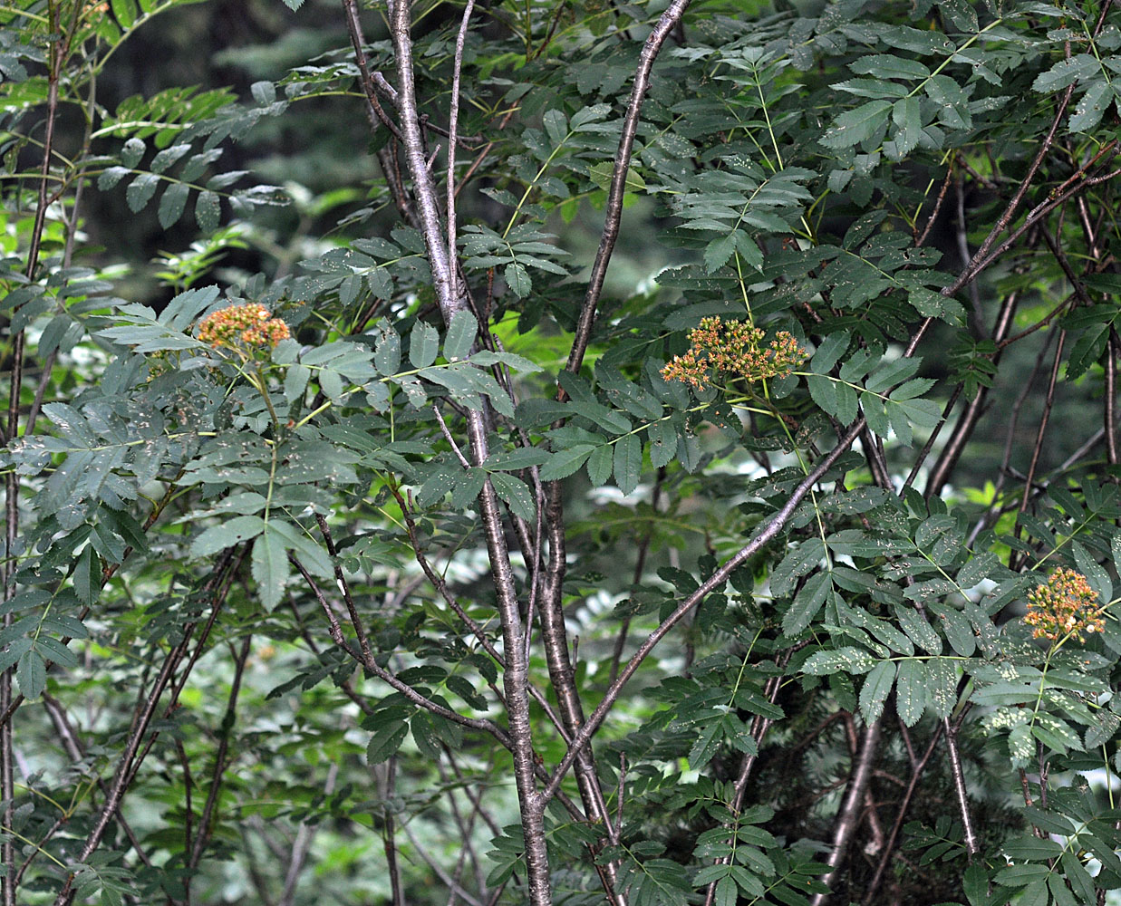
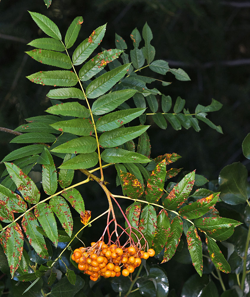
Greene’s mountain ash, Cascade mountain-ash, western mountain-ash
Eastern Washington
Native
Conservation Status
Notes
Click on any image to enlarge it.
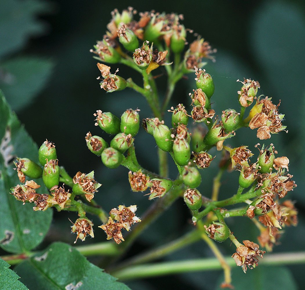
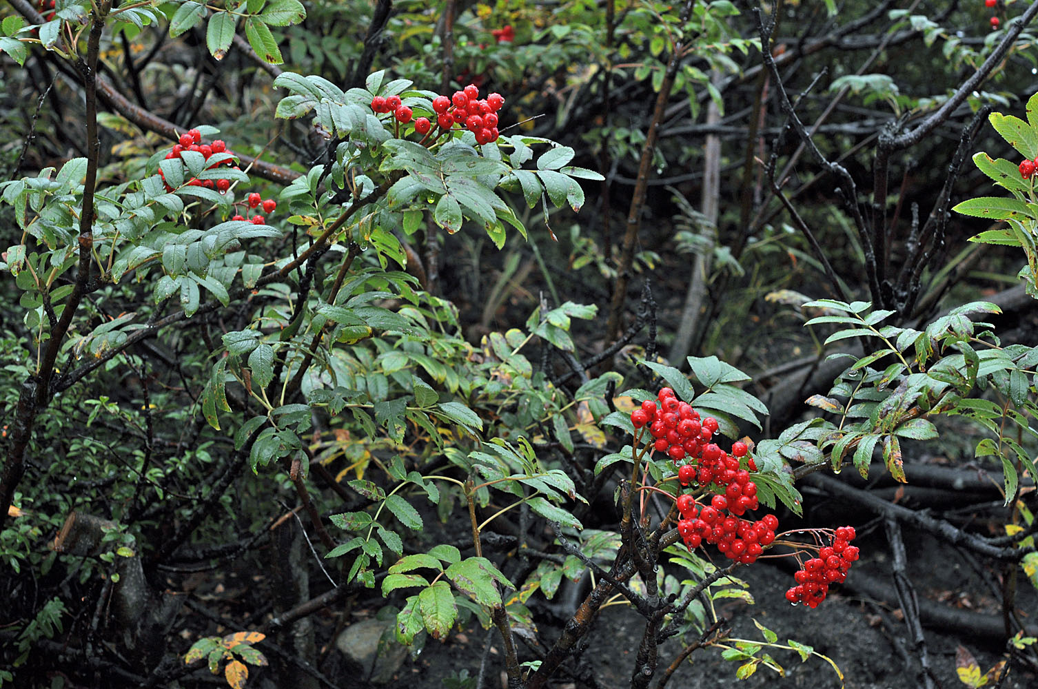
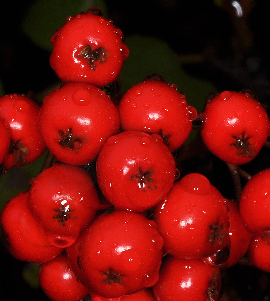
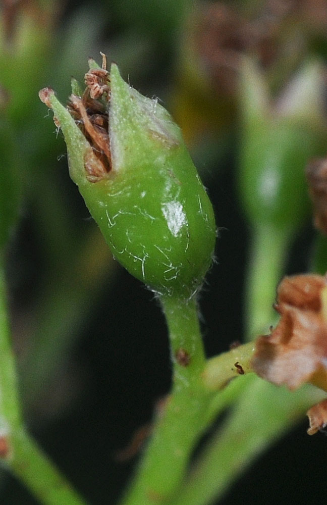
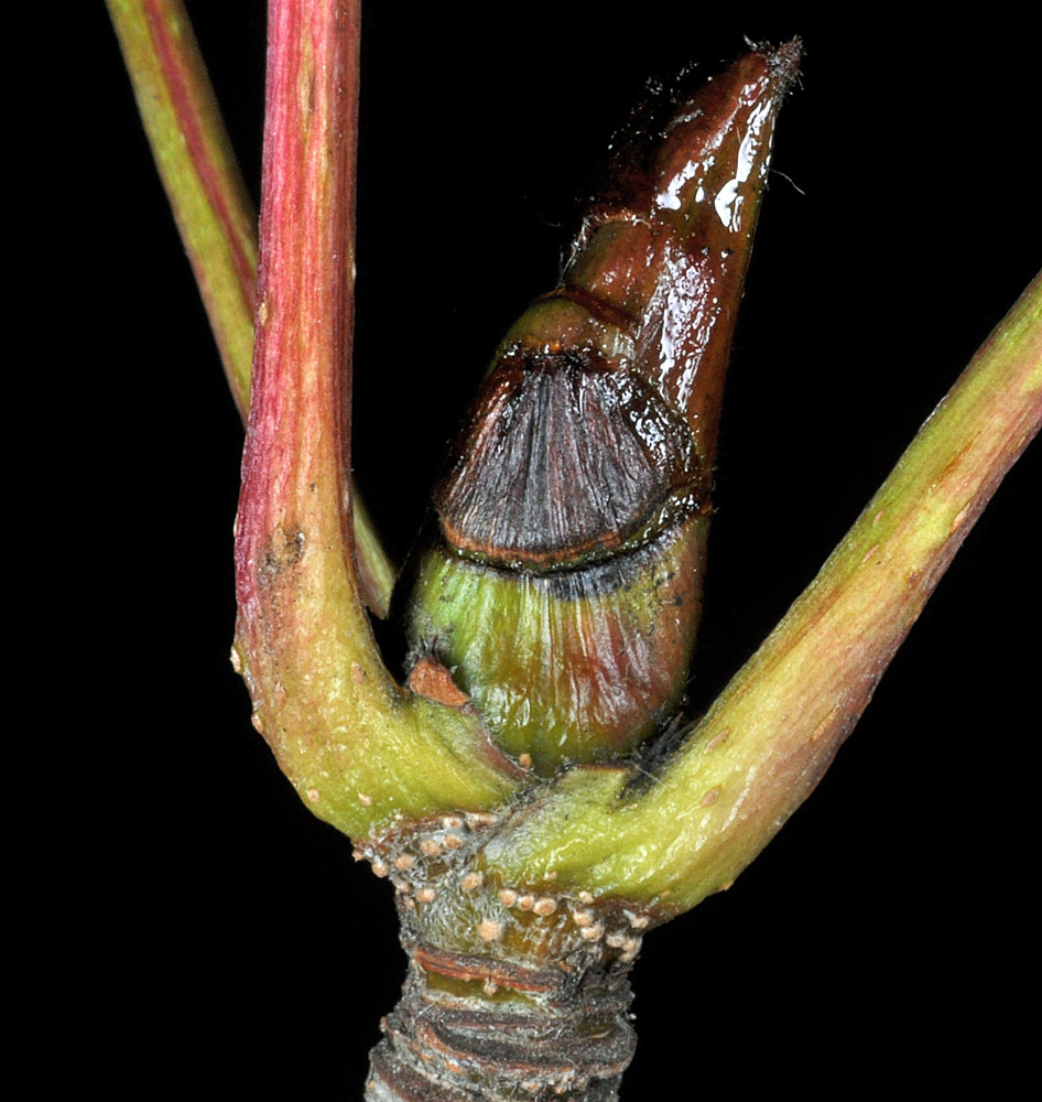
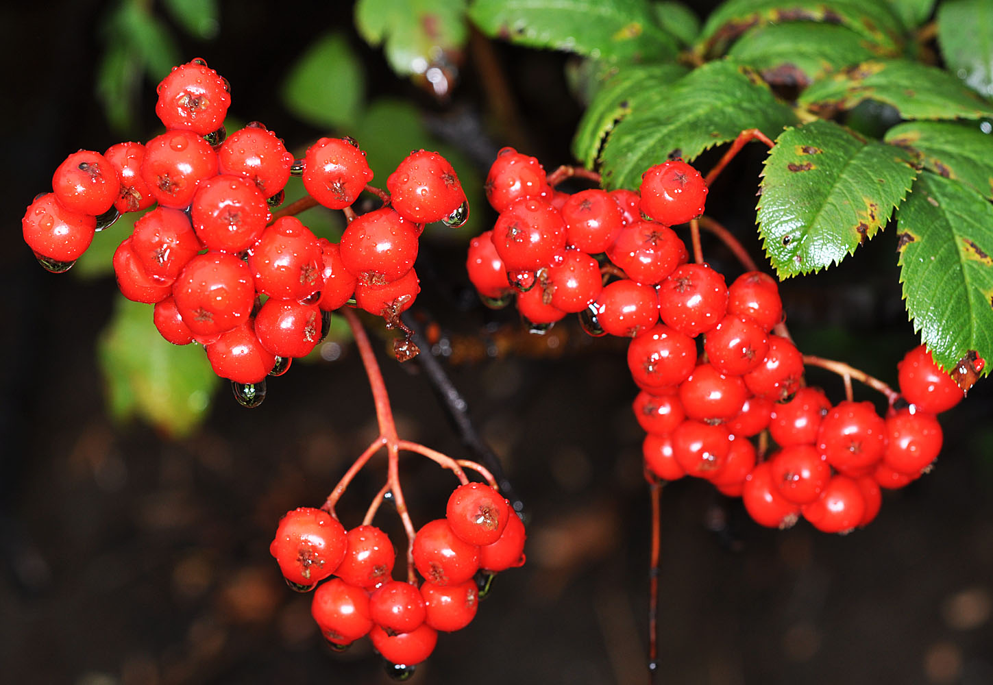
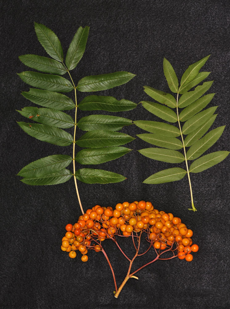
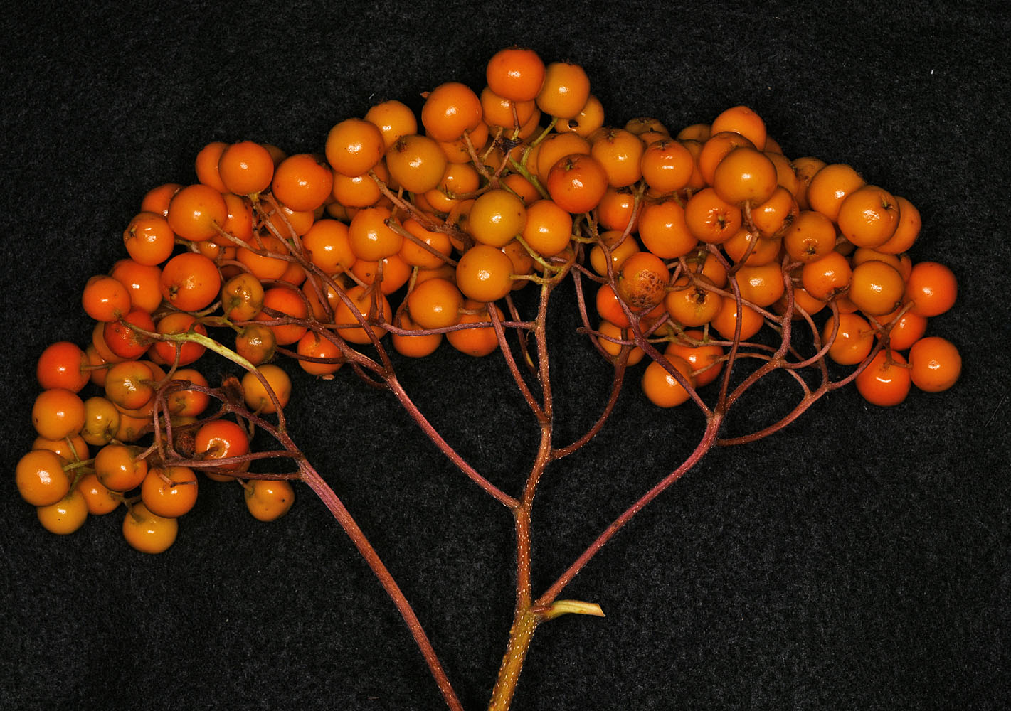
2.5 mi E of Forest Rd 6960 (Upper Mill Creek Rd) along Hwy 2; ca. 8.3 mi E of Stevens Pass, WA; N 47.77473 W 120.96134 – Chelan Co. – 10/7/2011Along Rd just N of Bunchgrass Meadows SW of Sullivan Lake ca. 7/8 mi.; N 48.701641 W 117.175764 – Pend Oreille Co. – 8/10/2011Along Rd just N of Bunchgrass Meadows SW of Sullivan Lake ca. 7/8 mi.; N 48.701641 W 117.175764 – Pend Oreille Co. – 8/10/20112.5 mi E of Forest Rd 6960 (Upper Mill Creek Rd) along Hwy 2; ca. 8.3 mi E of Stevens Pass, WA; N 47.77473 W 120.96134 – Chelan Co. – 10/7/2011Along Rd just N of Bunchgrass Meadows SW of Sullivan Lake ca. 7/8 mi.; N 48.701641 W 117.175764 – Pend Oreille Co. – 8/10/2011Along Rd just N of Bunchgrass Meadows SW of Sullivan Lake ca. 7/8 mi.; N 48.701641 W 117.175764 – Pend Oreille Co. – 8/10/20112.5 mi E of Forest Rd 6960 (Upper Mill Creek Rd) along Hwy 2; ca. 8.3 mi E of Stevens Pass, WA; N 47.77473 W 120.96134 – Chelan Co. – 10/7/20112.5 mi E of Forest Rd 6960 (Upper Mill Creek Rd) along Hwy 2; ca. 8.3 mi E of Stevens Pass, WA; N 47.77473 W 120.96134 – Chelan Co. – 10/7/2011Along Rd just N of Bunchgrass Meadows SW of Sullivan Lake ca. 7/8 mi.; N 48.701641 W 117.175764 – Pend Oreille Co. – 8/10/20112.5 mi E of Forest Rd 6960 (Upper Mill Creek Rd) along Hwy 2; ca. 8.3 mi E of Stevens Pass, WA; N 47.77473 W 120.96134 – Chelan Co. – 10/7/20112.5 mi E of Forest Rd 6960 (Upper Mill Creek Rd) along Hwy 2; ca. 8.3 mi E of Stevens Pass, WA; N 47.77473 W 120.96134 – Chelan Co. – 10/7/20110.18 air mi NW of MT. Horrible; 26.8 air mi SSE of Pomeroy, WA.; N 46.10065 W 117.45073; Garfield Co.; 8/23/20200.18 air mi NW of MT. Horrible; 26.8 air mi SSE of Pomeroy, WA.; N 46.10065 W 117.45073; Garfield Co.; 8/23/20200.18 air mi NW of MT. Horrible; 26.8 air mi SSE of Pomeroy, WA.; N 46.10065 W 117.45073; Garfield Co.; 8/23/20200.18 air mi NW of MT. Horrible; 26.8 air mi SSE of Pomeroy, WA.; N 46.10065 W 117.45073; Garfield Co.; 8/23/2020