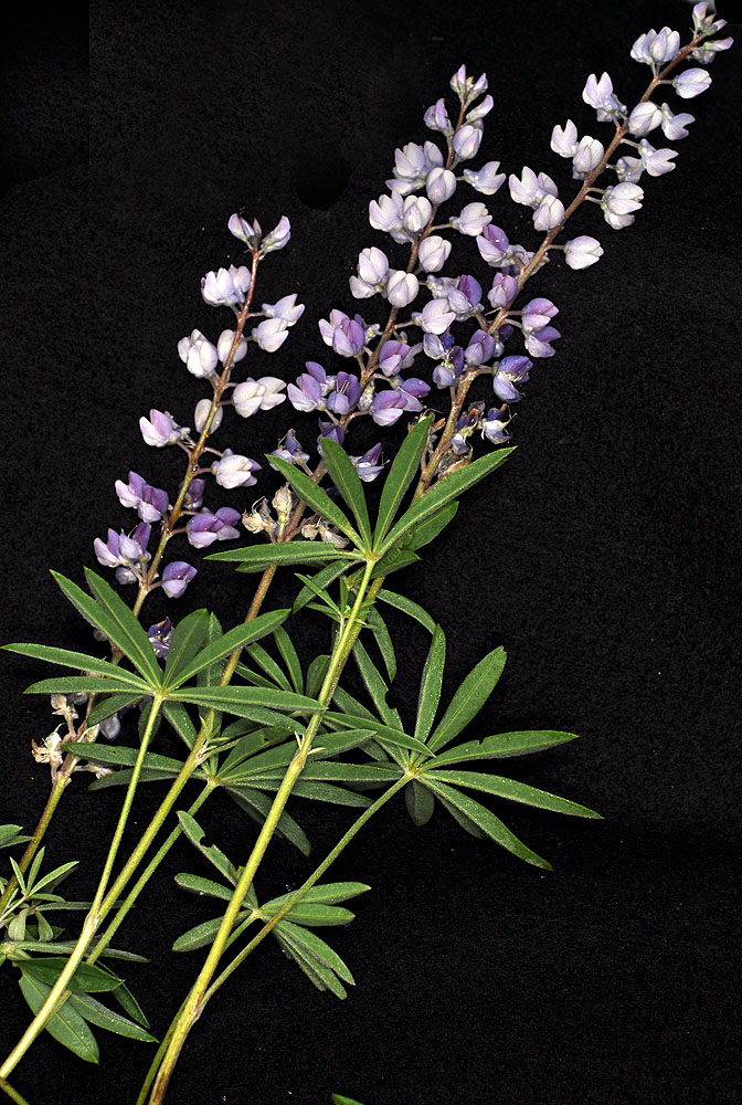
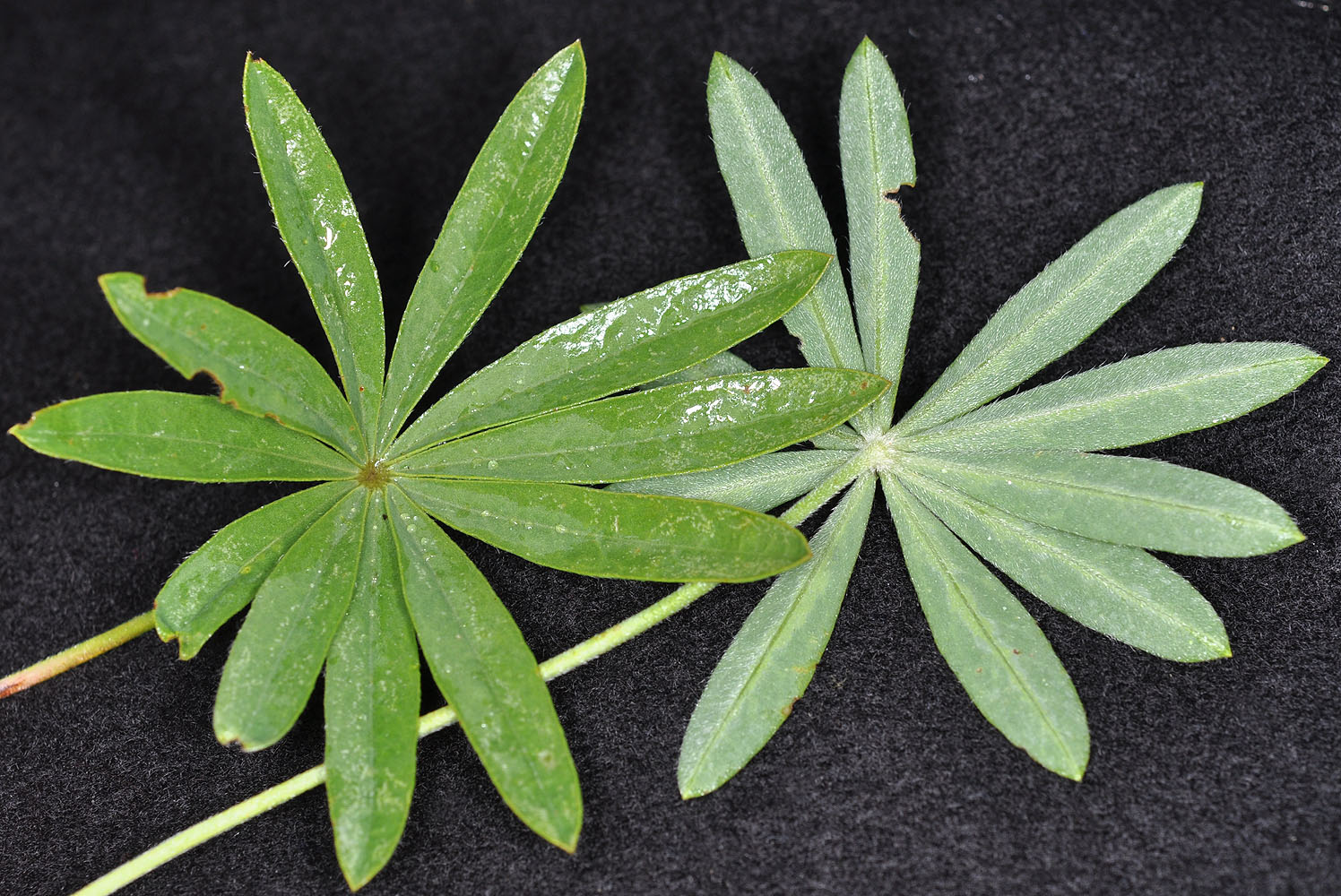
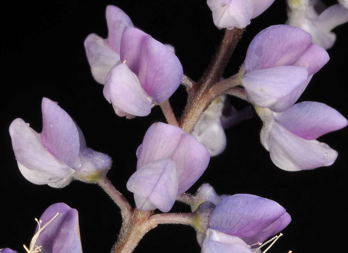
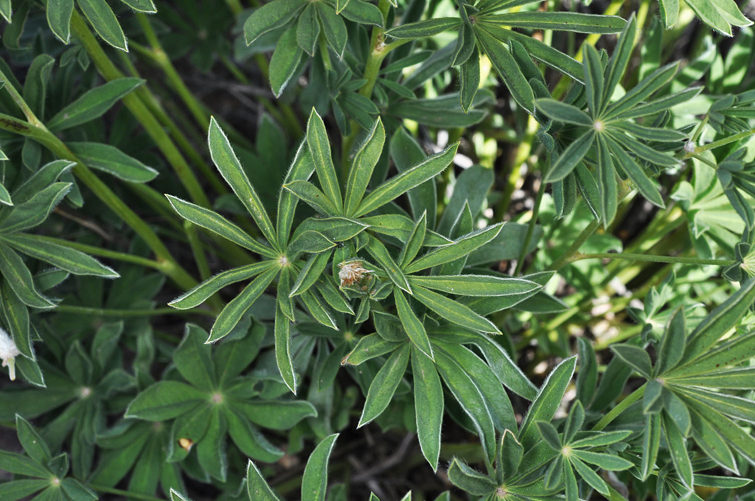
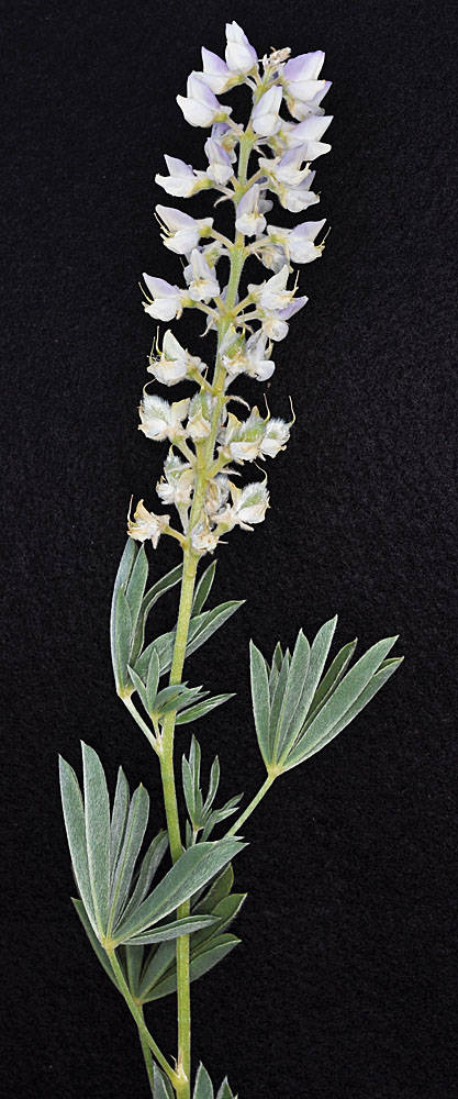
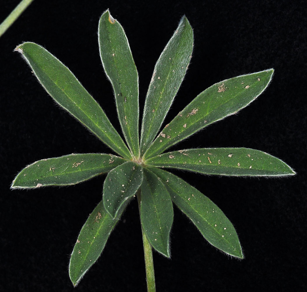
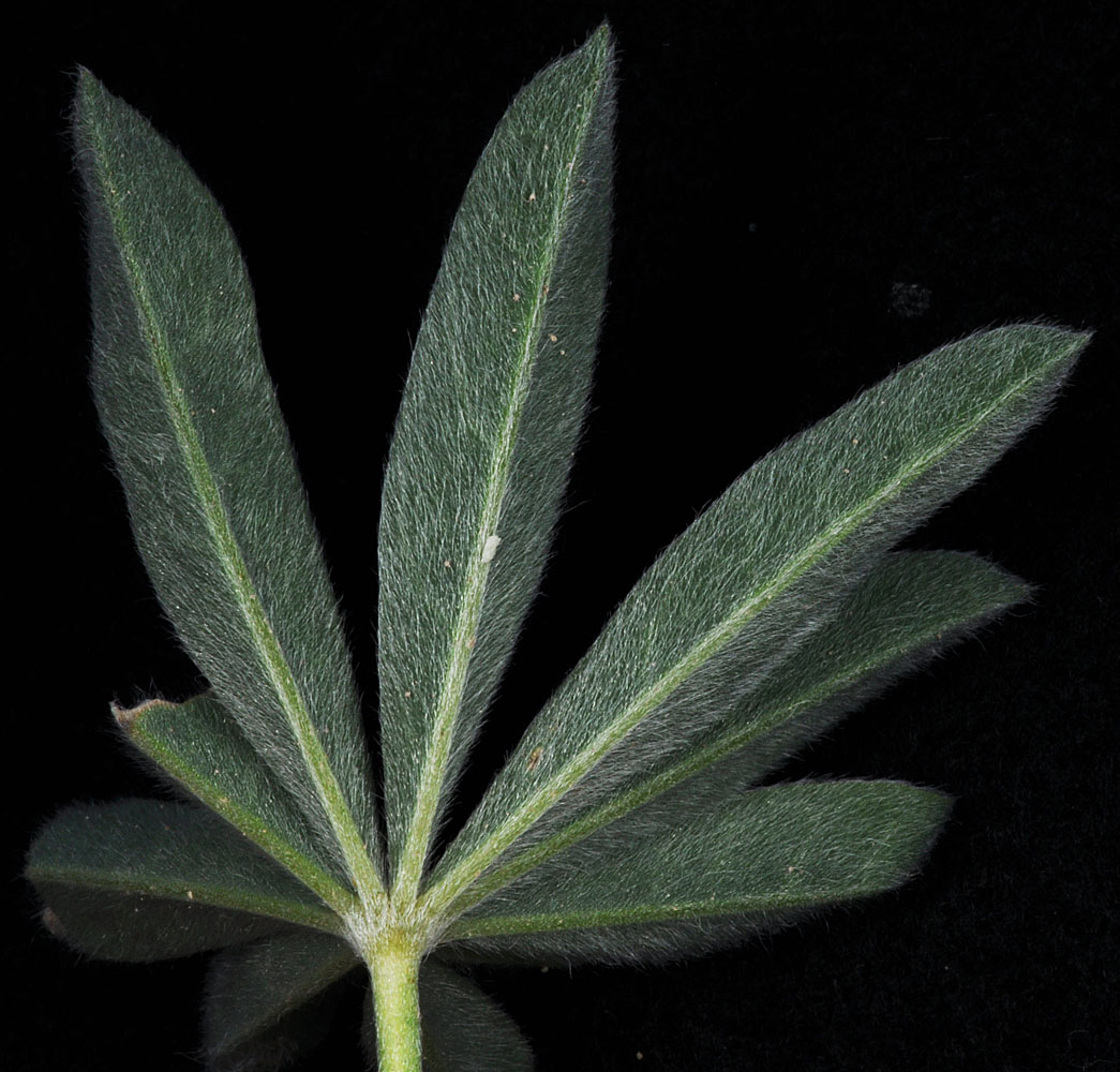
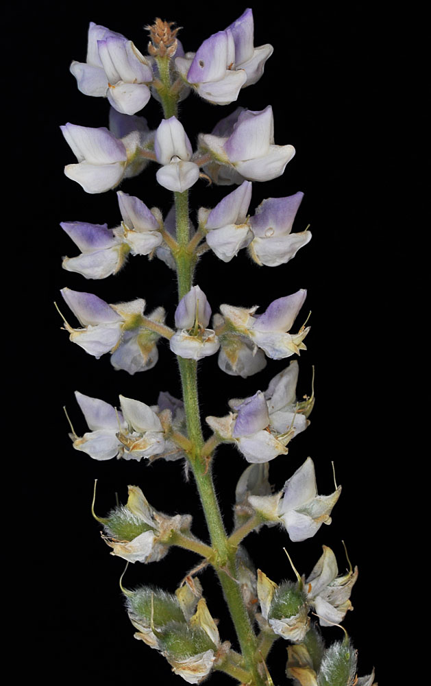
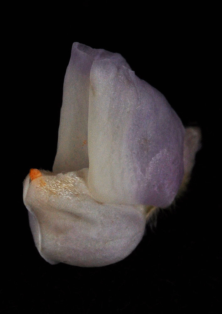
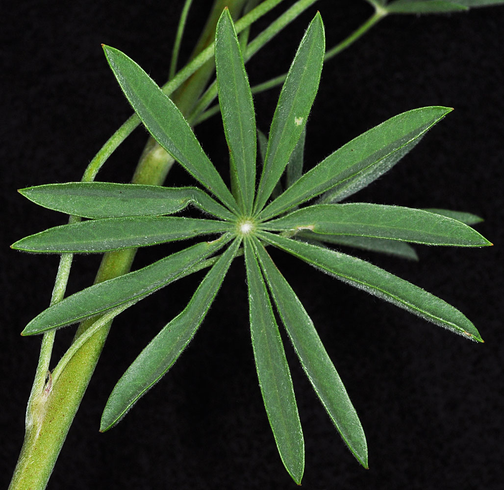
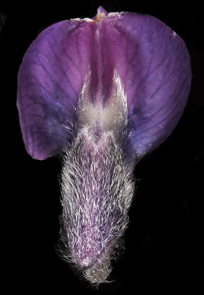
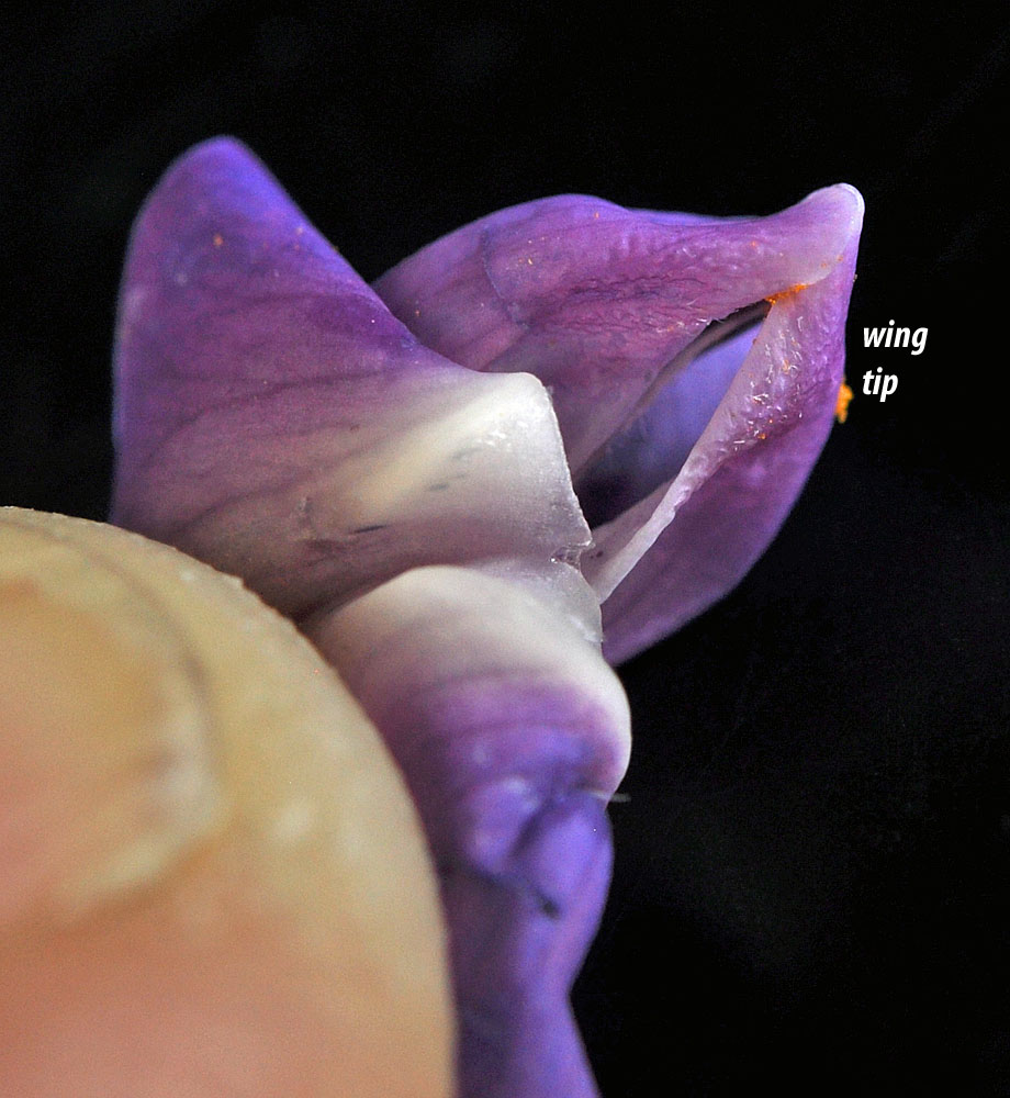
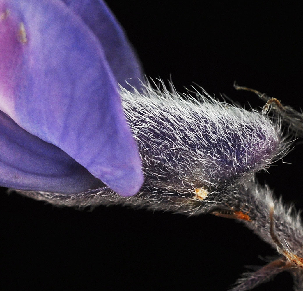
Along Hwy 129 S of Anatone, just S of Smyth Rd; 46.09873N 117.14830W – Asotin Co., WA – 6/10/2010Along Hwy 129 S of Anatone, just S of Smyth Rd; 46.09873N 117.14830W – Asotin Co., WA – 6/10/2010Along Hwy 129 S of Anatone, just S of Smyth Rd; 46.09873N 117.14830W – Asotin Co., WA – 6/10/2010Along Hwy 129 S of Anatone, just S of Smyth Rd; 46.09873N 117.14830W – Asotin Co., WA – 6/10/2010Along Hwy 129 S of Anatone, just S of Smyth Rd; 46.09873N 117.14830W – Asotin Co., WA – 6/10/2010Along Hwy 129 S of Anatone, just S of Smyth Rd; 46.09873N 117.14830W – Asotin Co., WA – 6/10/2010At Brogan Pass W of Brogan, OR; N 44.27735 W 117.64862; Malheur Co.; 6/3/2013At Brogan Pass W of Brogan, OR; N 44.27735 W 117.64862; Malheur Co.; 6/3/2013At Brogan Pass W of Brogan, OR; N 44.27735 W 117.64862; Malheur Co.; 6/3/2013At Brogan Pass W of Brogan, OR; N 44.27735 W 117.64862; Malheur Co.; 6/3/2013At Brogan Pass W of Brogan, OR; N 44.27735 W 117.64862; Malheur Co.; 6/3/2013At Brogan Pass W of Brogan, OR; N 44.27735 W 117.64862; Malheur Co.; 6/3/2013At Brogan Pass W of Brogan, OR; N 44.27735 W 117.64862; Malheur Co.; 6/3/2013At Brogan Pass W of Brogan, OR; N 44.27735 W 117.64862; Malheur Co.; 6/3/2013At Brogan Pass W of Brogan, OR; N 44.27735 W 117.64862; Malheur Co.; 6/3/2013At Brogan Pass W of Brogan, OR; N 44.27735 W 117.64862; Malheur Co.; 6/3/2013At Brogan Pass W of Brogan, OR; N 44.27735 W 117.64862; Malheur Co.; 6/3/2013At Brogan Pass W of Brogan, OR; N 44.27735 W 117.64862; Malheur Co.; 6/3/2013Road between Roosevelt and Bickleton; top of bluff above Roosevelt; 3 mi NE of Roosevelt; N 45.78003 W 120.18465; Klickitat Co., WA; 5/4/2014Road between Roosevelt and Bickleton; top of bluff above Roosevelt; 3 mi NE of Roosevelt; N 45.78003 W 120.18465; Klickitat Co., WA; 5/4/2014Road between Roosevelt and Bickleton; top of bluff above Roosevelt; 3 mi NE of Roosevelt; N 45.78003 W 120.18465; Klickitat Co., WA; 5/4/2014Road between Roosevelt and Bickleton; top of bluff above Roosevelt; 3 mi NE of Roosevelt; N 45.78003 W 120.18465; Klickitat Co., WA; 5/4/2014Road between Roosevelt and Bickleton; top of bluff above Roosevelt; 3 mi NE of Roosevelt; N 45.78003 W 120.18465; Klickitat Co., WA; 5/4/2014Road between Roosevelt and Bickleton; top of bluff above Roosevelt; 3 mi NE of Roosevelt; N 45.78003 W 120.18465; Klickitat Co., WA; 5/4/2014Road between Roosevelt and Bickleton; top of bluff above Roosevelt; 3 mi NE of Roosevelt; N 45.78003 W 120.18465; Klickitat Co., WA; 5/4/2014Road between Roosevelt and Bickleton; top of bluff above Roosevelt; 3 mi NE of Roosevelt; N 45.78003 W 120.18465; Klickitat Co., WA; 5/4/2014Road between Roosevelt and Bickleton; top of bluff above Roosevelt; 3 mi NE of Roosevelt; N 45.78003 W 120.18465; Klickitat Co., WA; 5/4/2014Road between Roosevelt and Bickleton; top of bluff above Roosevelt; 3 mi NE of Roosevelt; N 45.78003 W 120.18465; Klickitat Co., WA; 5/4/2014Road between Roosevelt and Bickleton; top of bluff above Roosevelt; 3 mi NE of Roosevelt; N 45.78003 W 120.18465; Klickitat Co., WA; 5/4/2014Road between Roosevelt and Bickleton; top of bluff above Roosevelt; 3 mi NE of Roosevelt; N 45.78003 W 120.18465; Klickitat Co., WA; 5/4/2014