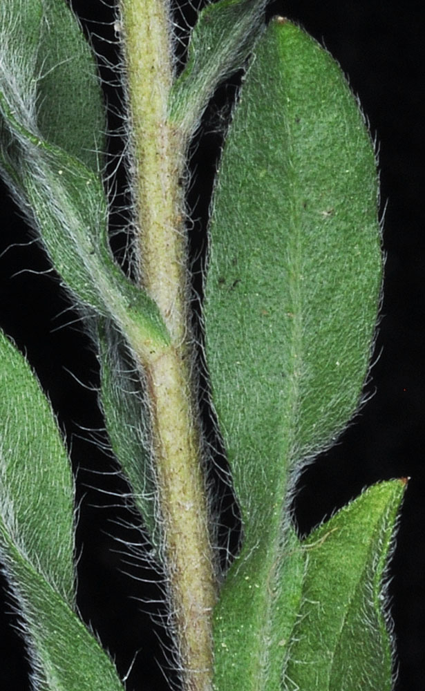
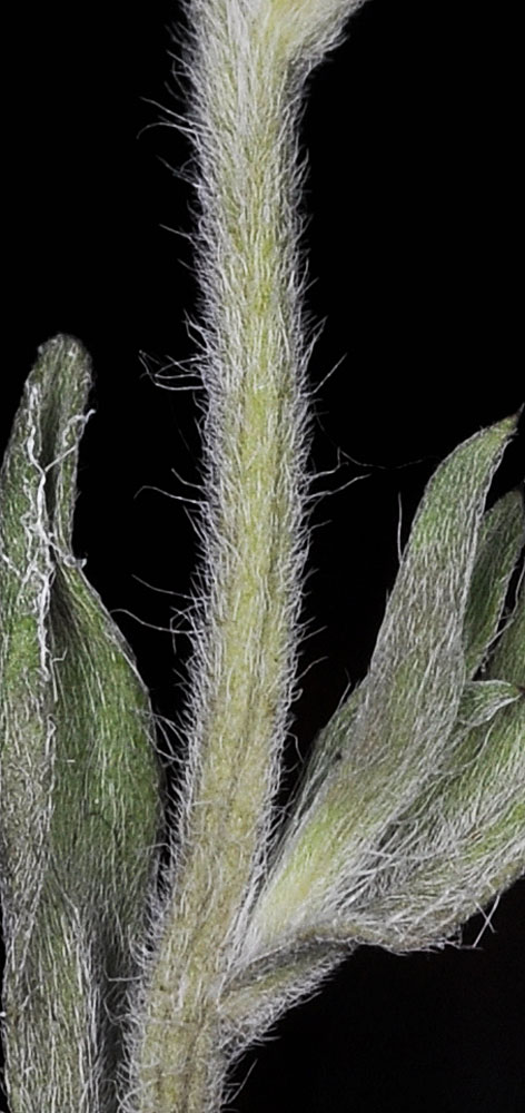
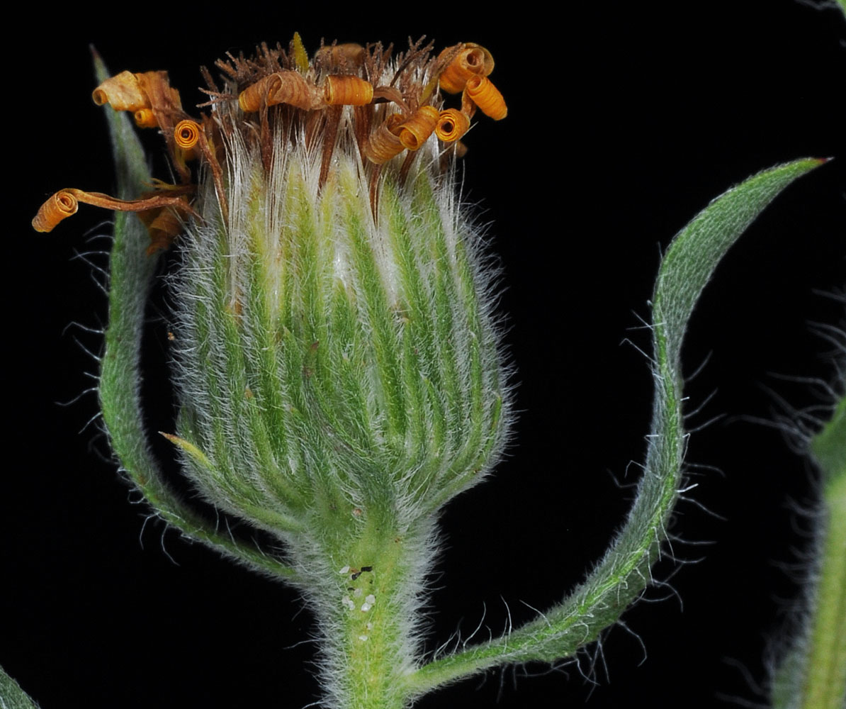
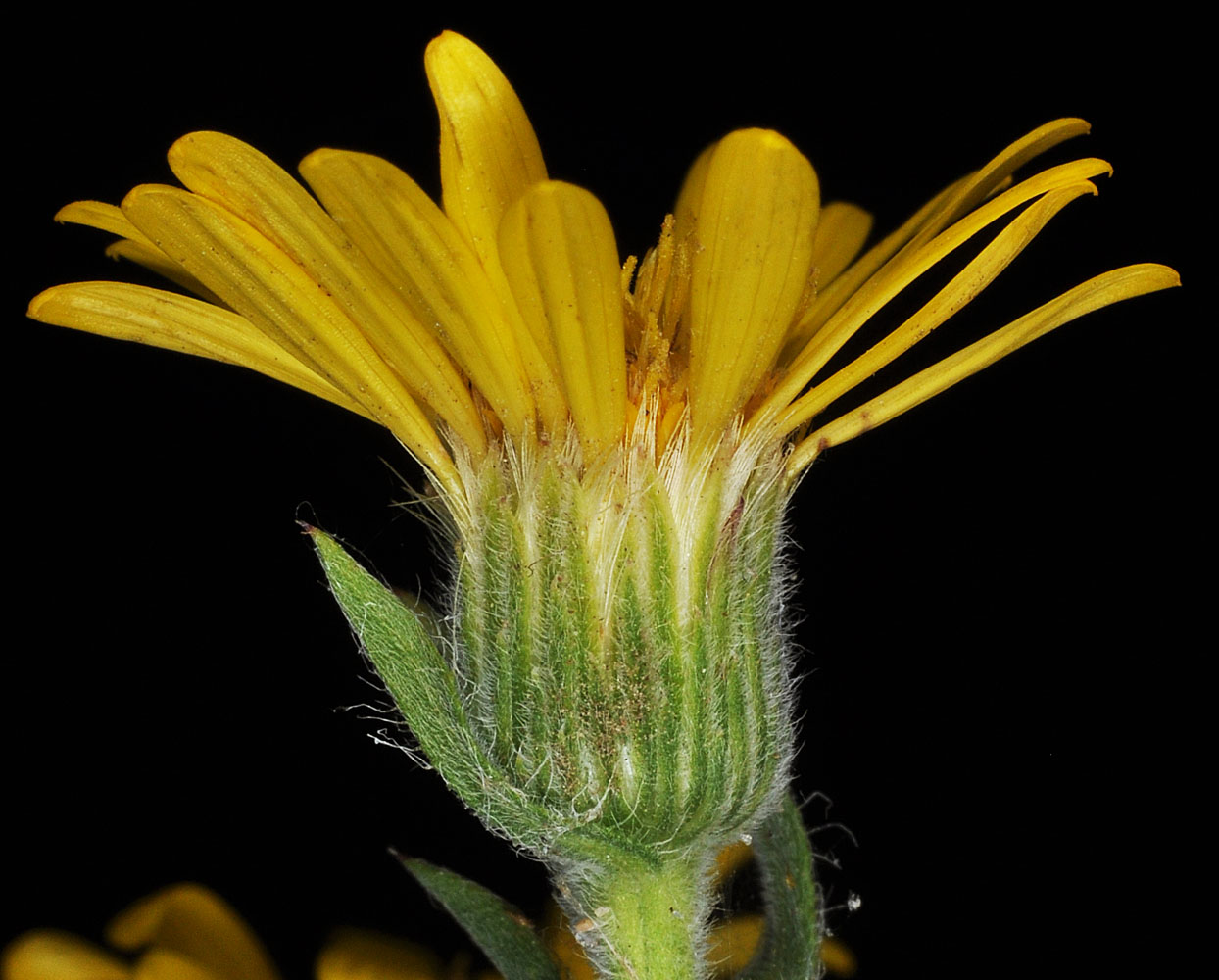
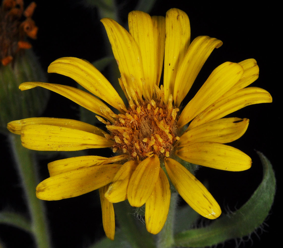
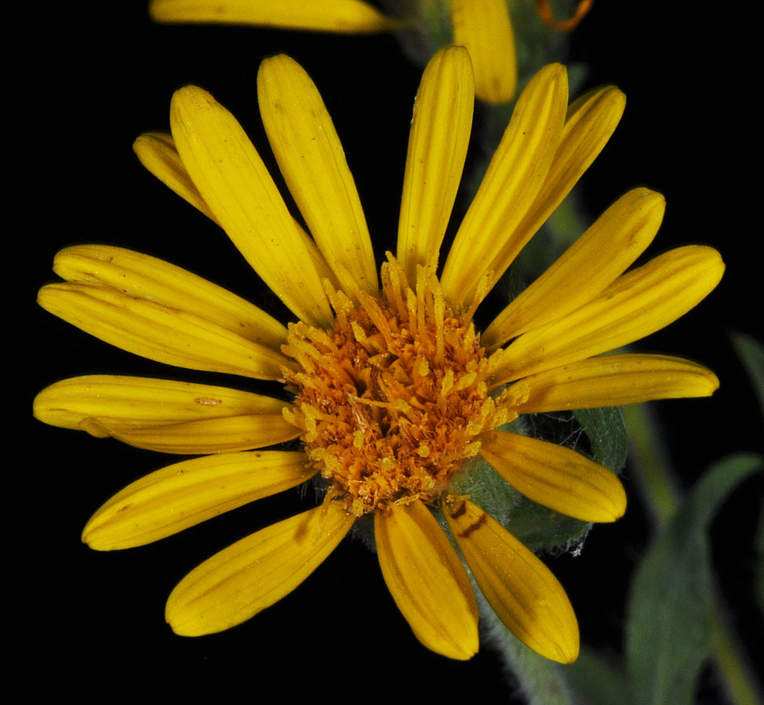
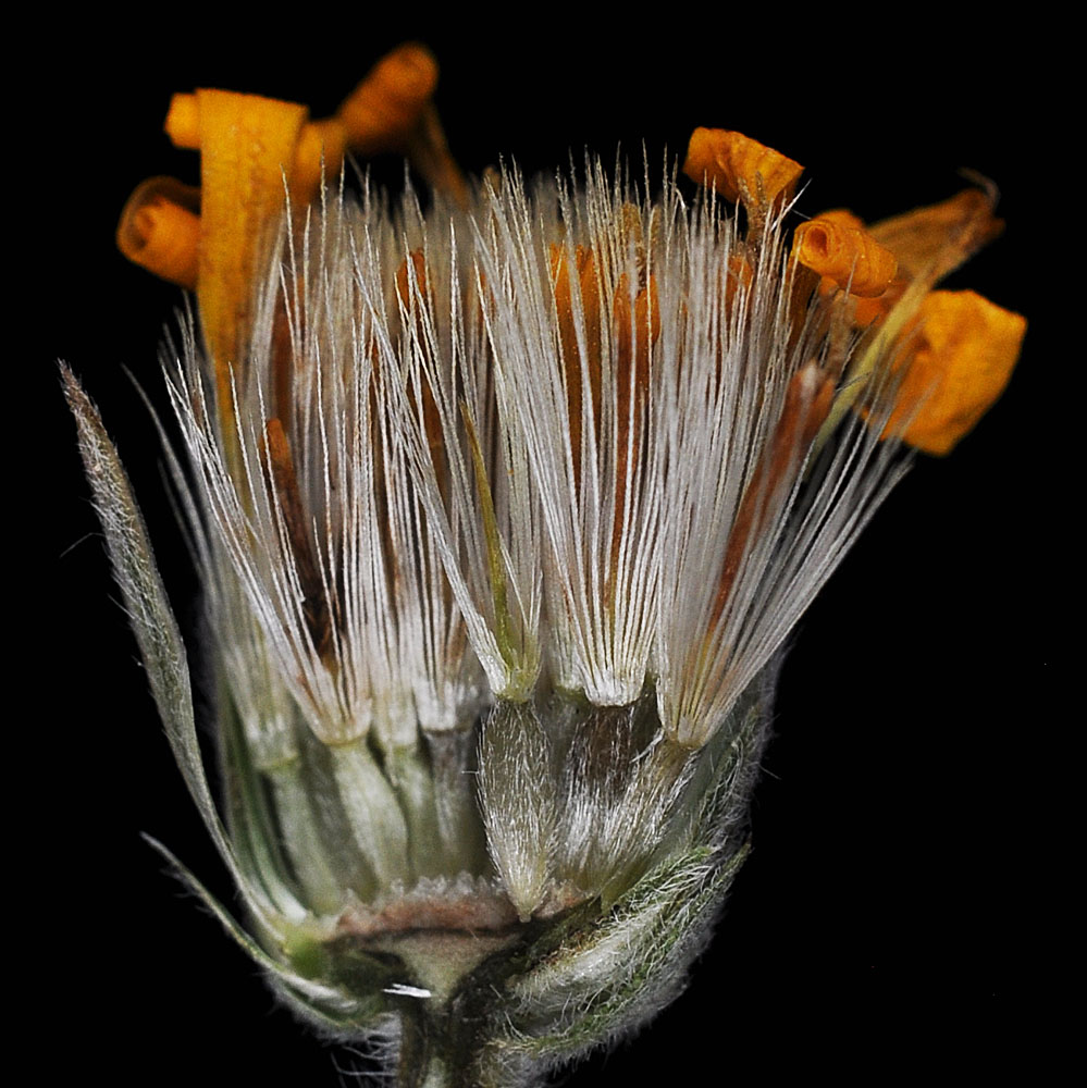
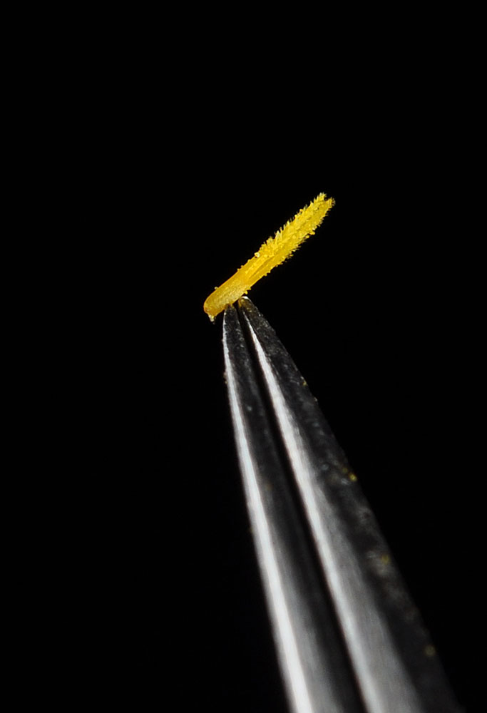
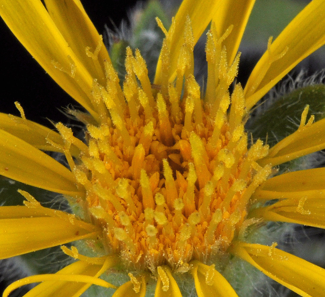
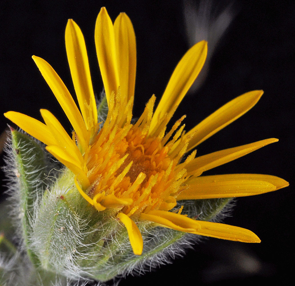
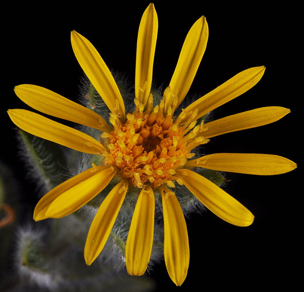
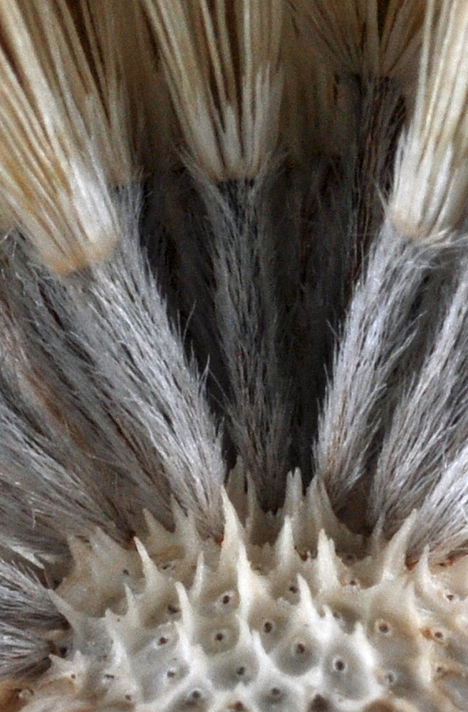
Heterotheca villosa (Pursh) Shinners var. minor (Hook.) Semple
Family
Asteraceae
Common Names
hairy goldenaster, hispid goldenaster
Eastern Washington
Native
Conservation Status
Notes
Click on any image to enlarge it.
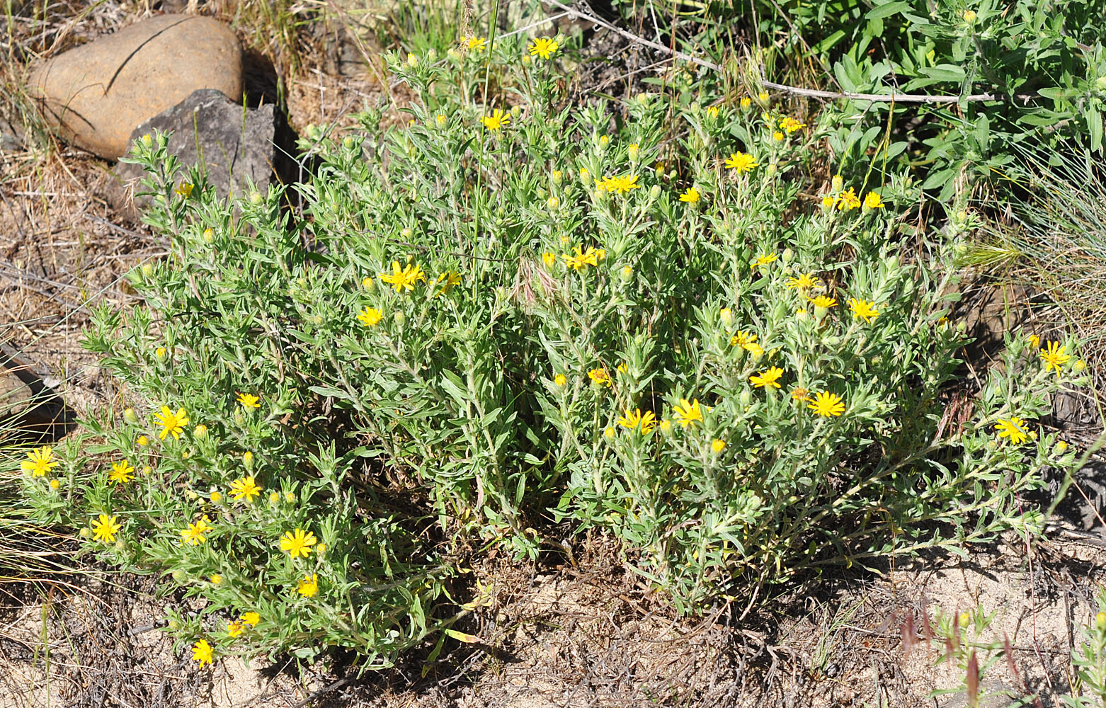
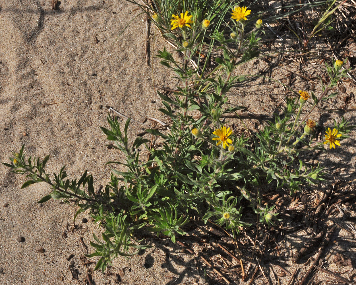
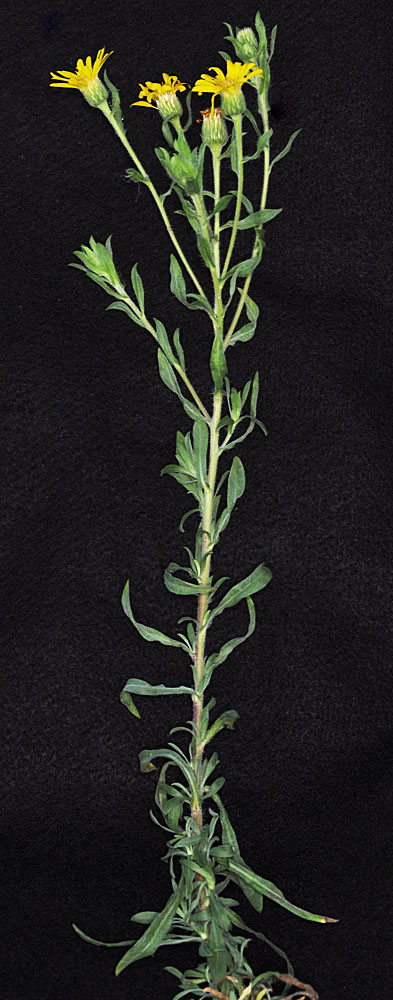
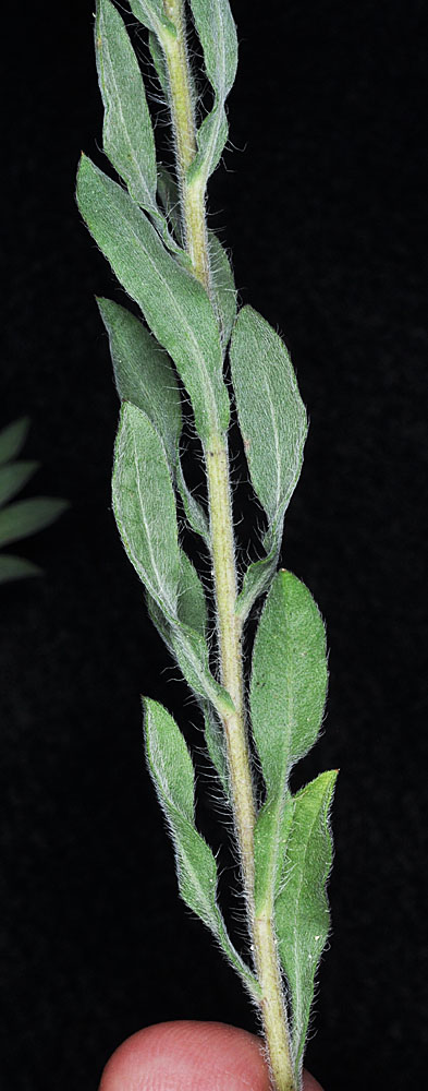
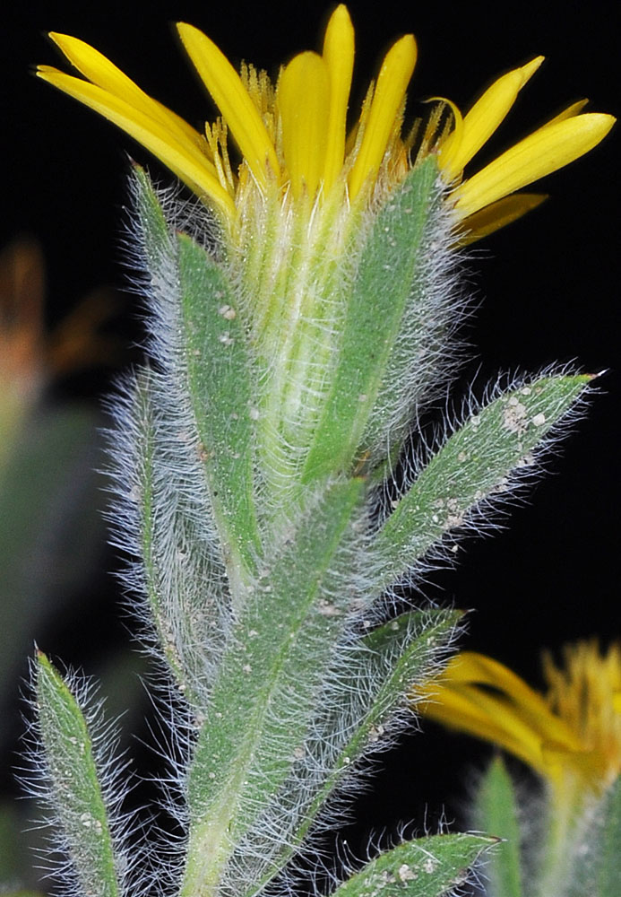
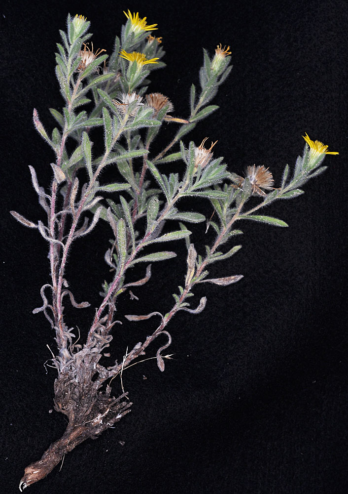
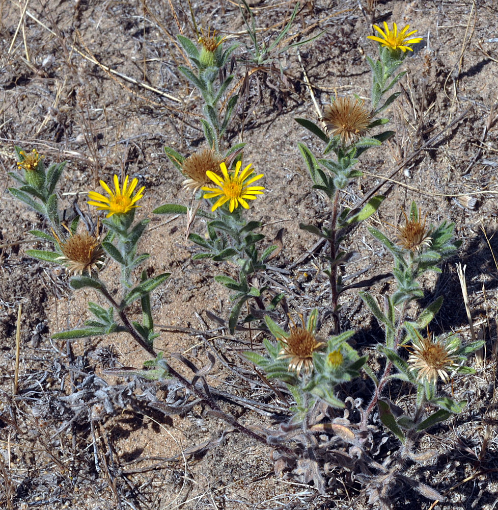
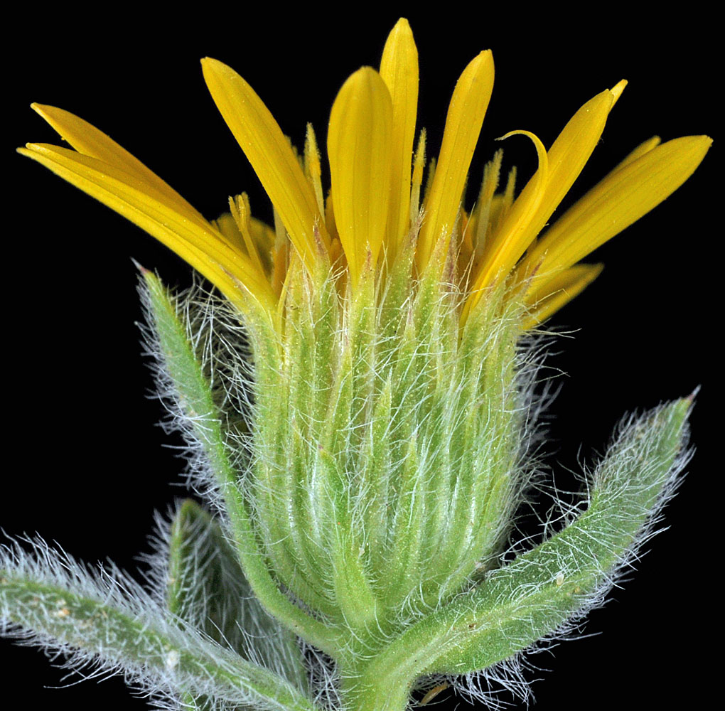
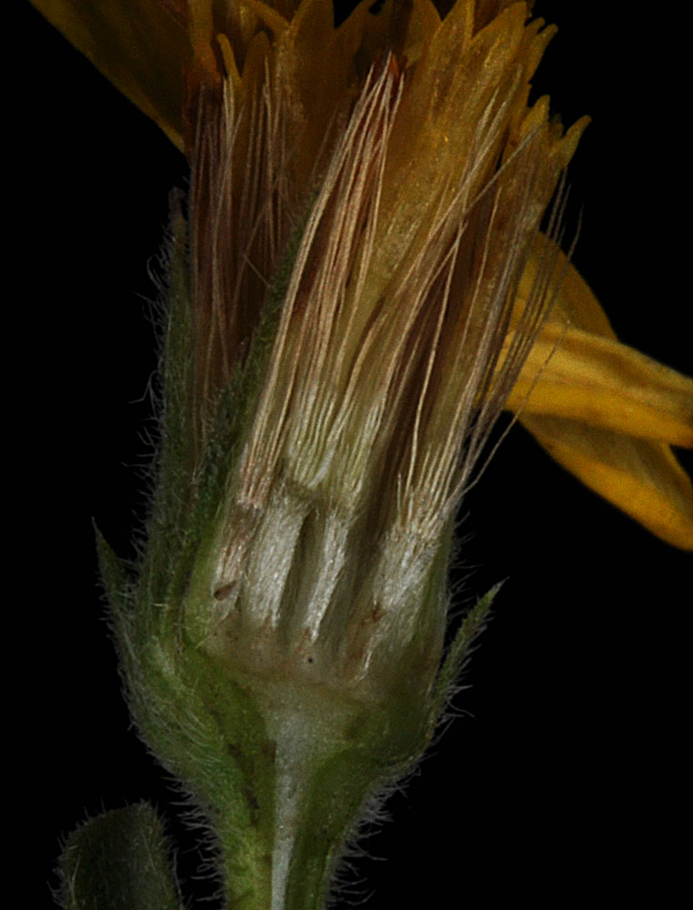
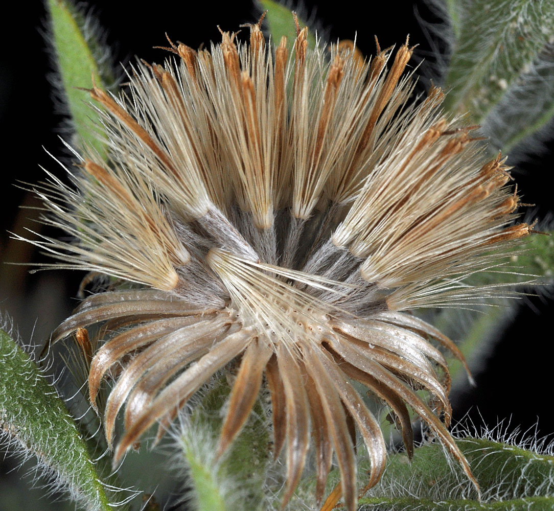
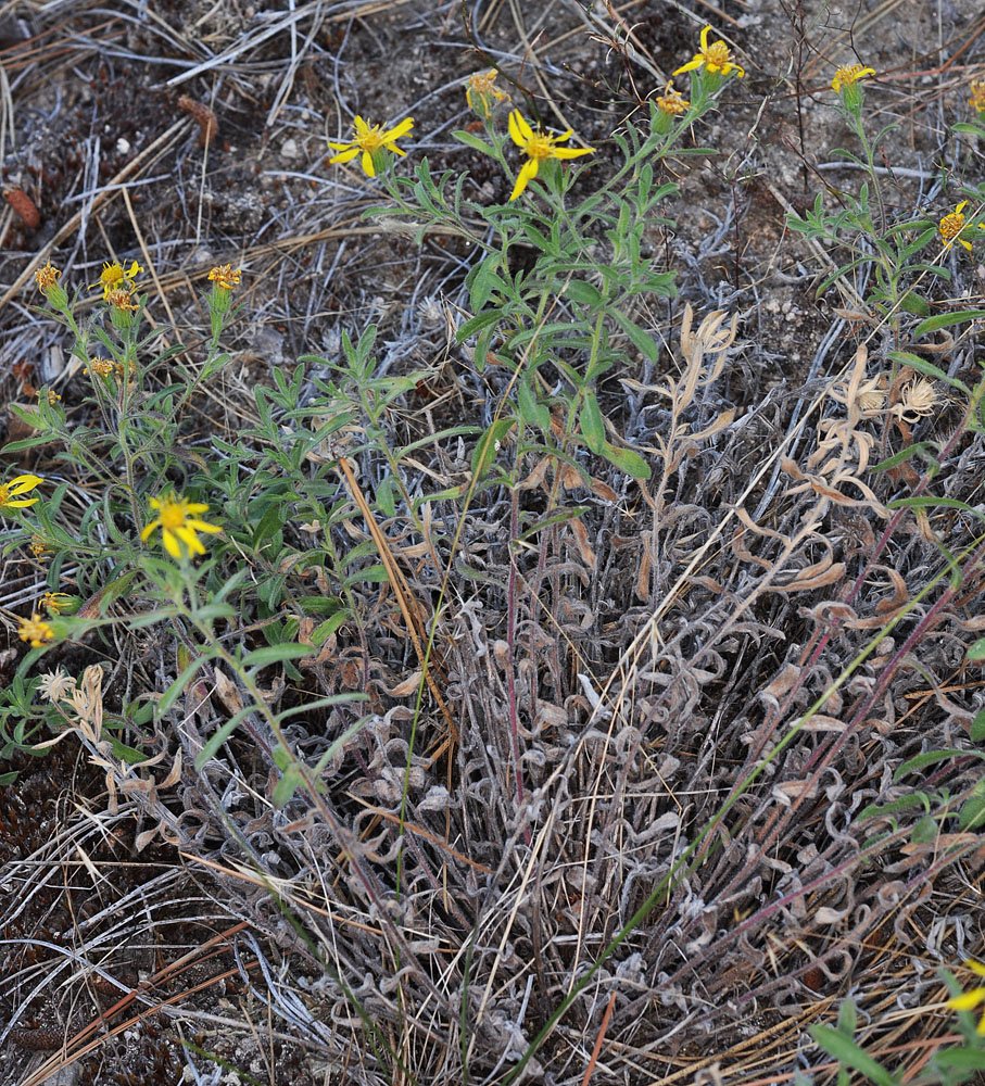
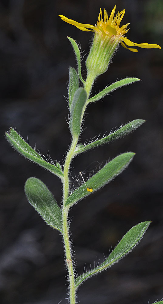
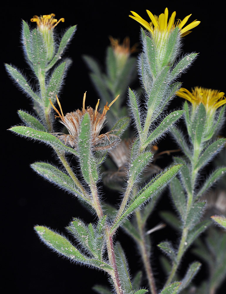
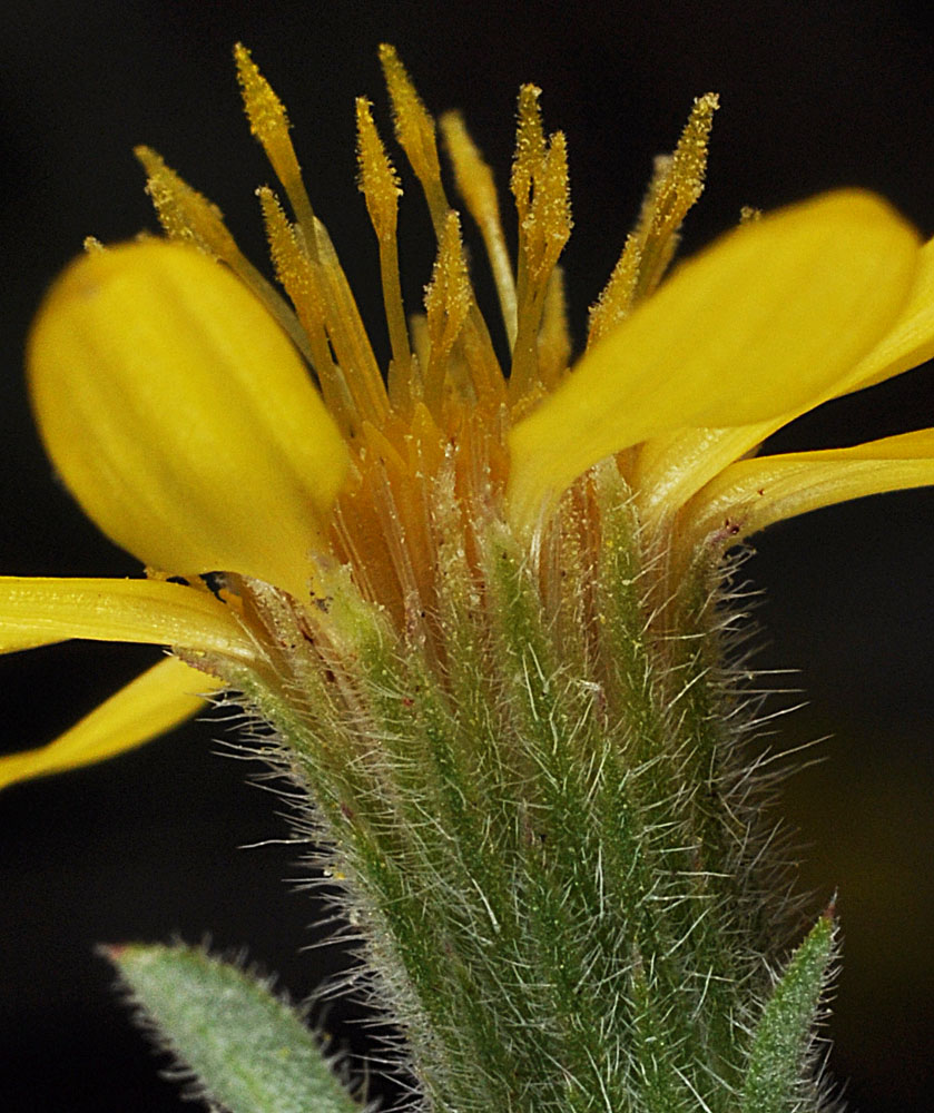
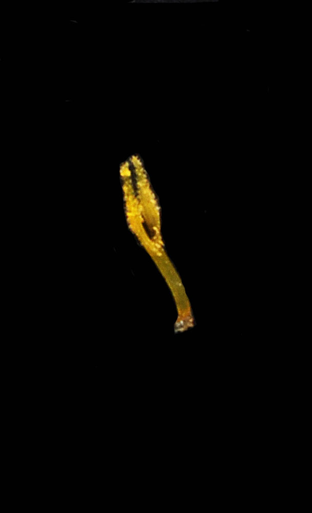
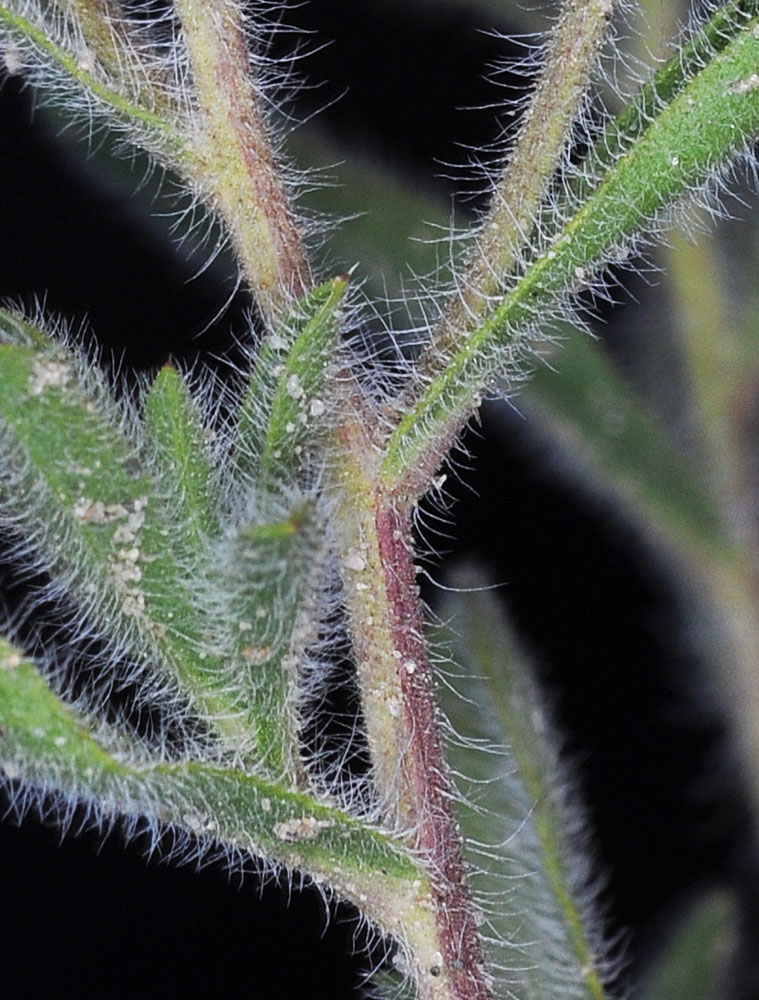
Along Hwy 12, 1.36 mi NE of jct with Hwy 3 along Clearwater River; ca. 9.8 air mi W of Lenore, ID; N 46.48031 W 116.75309; Nez Perce Co.; 6/6/2015Along Hwy 12, 1.36 mi NE of jct with Hwy 3 along Clearwater River; ca. 9.8 air mi W of Lenore, ID; N 46.48031 W 116.75309; Nez Perce Co.; 6/6/2015Along Hwy 12, 1.36 mi NE of jct with Hwy 3 along Clearwater River; ca. 9.8 air mi W of Lenore, ID; N 46.48031 W 116.75309; Nez Perce Co.; 6/6/2015Along Hwy 12, 1.36 mi NE of jct with Hwy 3 along Clearwater River; ca. 9.8 air mi W of Lenore, ID; N 46.48031 W 116.75309; Nez Perce Co.; 6/6/2015Along Hwy 12, 1.36 mi NE of jct with Hwy 3 along Clearwater River; ca. 9.8 air mi W of Lenore, ID; N 46.48031 W 116.75309; Nez Perce Co.; 6/6/2015Along Hwy 12, 1.36 mi NE of jct with Hwy 3 along Clearwater River; ca. 9.8 air mi W of Lenore, ID; N 46.48031 W 116.75309; Nez Perce Co.; 6/6/2015Along Hwy 12, 1.36 mi NE of jct with Hwy 3 along Clearwater River; ca. 9.8 air mi W of Lenore, ID; N 46.48031 W 116.75309; Nez Perce Co.; 6/6/2015Along Hwy 12, 1.36 mi NE of jct with Hwy 3 along Clearwater River; ca. 9.8 air mi W of Lenore, ID; N 46.48031 W 116.75309; Nez Perce Co.; 6/6/2015Along Hwy 12, 1.36 mi NE of jct with Hwy 3 along Clearwater River; ca. 9.8 air mi W of Lenore, ID; N 46.48031 W 116.75309; Nez Perce Co.; 6/6/2015Along Hwy 12, 1.36 mi NE of jct with Hwy 3 along Clearwater River; ca. 9.8 air mi W of Lenore, ID; N 46.48031 W 116.75309; Nez Perce Co.; 6/6/2015Along Hwy 12, 1.36 mi NE of jct with Hwy 3 along Clearwater River; ca. 9.8 air mi W of Lenore, ID; N 46.48031 W 116.75309; Nez Perce Co.; 6/6/2015Along Hwy 12, 1.36 mi NE of jct with Hwy 3 along Clearwater River; ca. 9.8 air mi W of Lenore, ID; N 46.48031 W 116.75309; Nez Perce Co.; 6/6/2015Along Hwy 12, 1.36 mi NE of jct with Hwy 3 along Clearwater River; ca. 9.8 air mi W of Lenore, ID; N 46.48031 W 116.75309; Nez Perce Co.; 6/6/2015W of Washtucna, WA in dunes ca. 1/2 mi E of Hwy 21 S of Hampton Rd.; N 46.78079 W 118.53018 – Adams Co. – 7/31/2011W of Washtucna, WA in dunes ca. 1/2 mi E of Hwy 21 S of Hampton Rd.; N 46.78079 W 118.53018 – Adams Co. – 7/31/2011W of Washtucna, WA in dunes ca. 1/2 mi E of Hwy 21 S of Hampton Rd.; N 46.78079 W 118.53018 – Adams Co. – 7/31/2011W of Washtucna, WA in dunes ca. 1/2 mi E of Hwy 21 S of Hampton Rd.; N 46.78079 W 118.53018 – Adams Co. – 7/31/2011W of Washtucna, WA in dunes ca. 1/2 mi E of Hwy 21 S of Hampton Rd.; N 46.78079 W 118.53018 – Adams Co. – 7/31/2011W of Washtucna, WA in dunes ca. 1/2 mi E of Hwy 21 S of Hampton Rd.; N 46.78079 W 118.53018 – Adams Co. – 7/31/2011W of Washtucna, WA in dunes ca. 1/2 mi E of Hwy 21 S of Hampton Rd.; N 46.78079 W 118.53018 – Adams Co. – 7/31/2011W of Washtucna, WA in dunes ca. 1/2 mi E of Hwy 21 S of Hampton Rd.; N 46.78079 W 118.53018 – Adams Co. – 7/31/2011West center edge of McDowell Lake, SE of Colville, WA; N 48.46766 W 117.68389; Stevens Co.; 8/27/2012W of Washtucna, WA in dunes ca. 1/2 mi E of Hwy 21 S of Hampton Rd.; N 46.78079 W 118.53018 – Adams Co. – 7/31/2011West center edge of McDowell Lake, SE of Colville, WA; N 48.46766 W 117.68389; Stevens Co.; 8/27/2012West center edge of McDowell Lake, SE of Colville, WA; N 48.46766 W 117.68389; Stevens Co.; 8/27/2012W of Washtucna, WA in dunes ca. 1/2 mi E of Hwy 21 S of Hampton Rd.; N 46.78079 W 118.53018 – Adams Co. – 7/31/2011West center edge of McDowell Lake, SE of Colville, WA; N 48.46766 W 117.68389; Stevens Co.; 8/27/2012West center edge of McDowell Lake, SE of Colville, WA; N 48.46766 W 117.68389; Stevens Co.; 8/27/2012W of Washtucna, WA in dunes ca. 1/2 mi E of Hwy 21 S of Hampton Rd.; N 46.78079 W 118.53018 – Adams Co. – 7/31/2011