| Scientific Name | Cryptantha ambigua (A. Gray) Greene |
| Family | Boraginaceae |
| Common Names | wilke’s cryptantha, obscure cryptantha, basin cat’s eye |
| Eastern Washington | Native |
| Synonyms | None |
| Conservation Status | |
| Notes |
Click on any image to enlarge it.
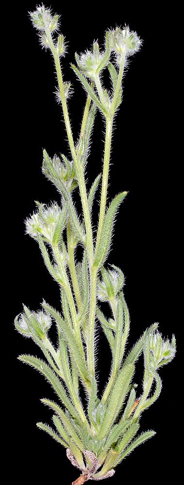
© Gerald D.. Carr N side of Squaw Butte Rd., 6.6 mi. SSE of Hwy 20, 4560 ft. elev., N43.46556, W119.68516, Harney Co., OR, 6/3/2013 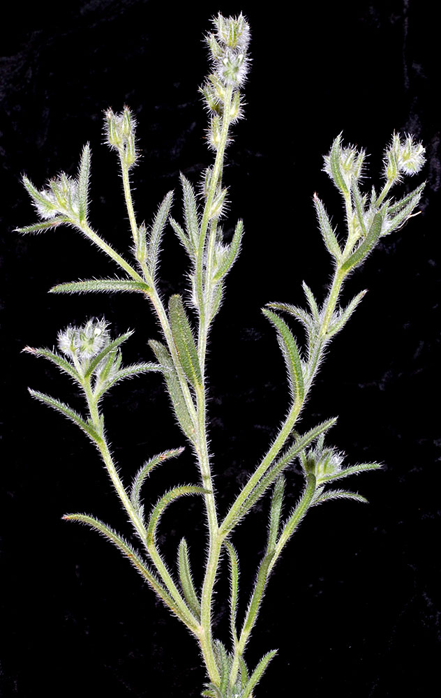
© Gerald D.. Carr N side of Squaw Butte Rd., 6.6 mi. SSE of Hwy 20, 4560 ft. elev., N43.46556, W119.68516, Harney Co., OR, 6/3/2013 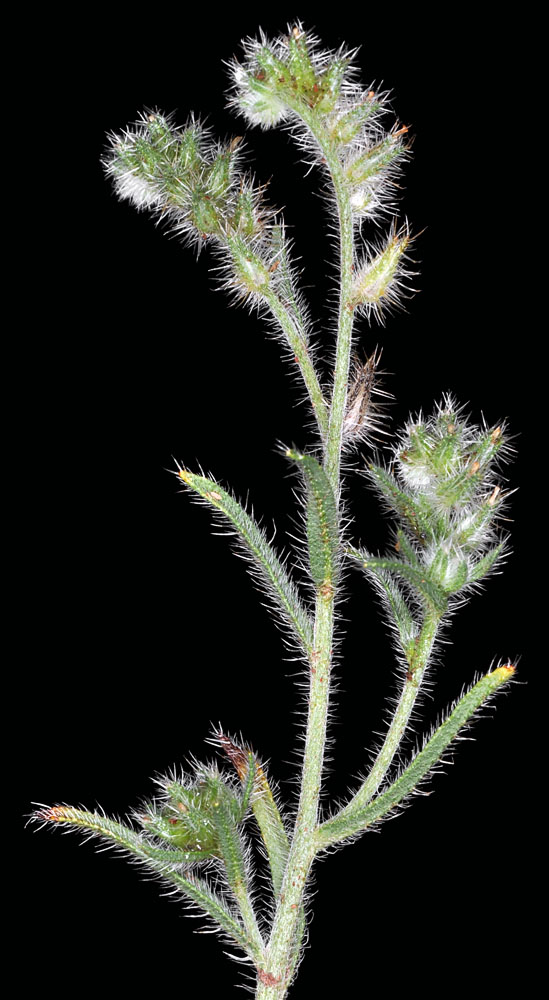
© Gerald D.. Carr Hwy 126, ca. 0.6 mi. W of Olmstead Rd., ca. 10 mi. W of Sisters, 3035 ft. elev., N44.29338, W121.34450, Deschutes Co., OR, 7/18/2011 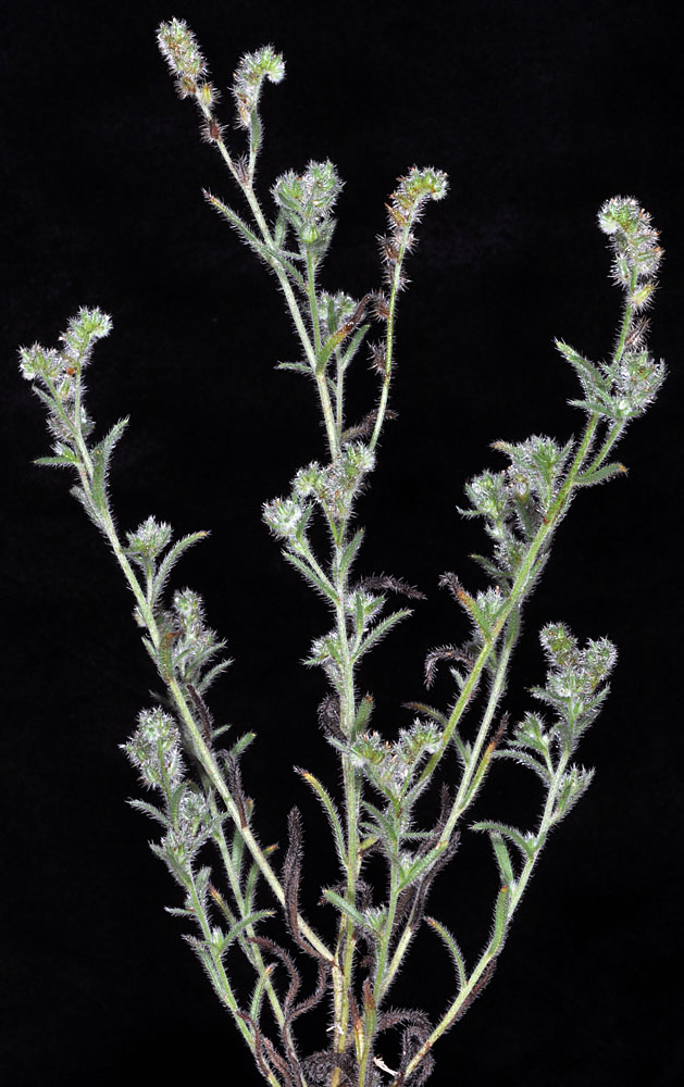
© Gerald D.. Carr Hwy 126, ca. 0.6 mi. W of Olmstead Rd., ca. 10 mi. W of Sisters, 3035 ft. elev., N44.29338, W121.34450, Deschutes Co., OR, 7/18/2011 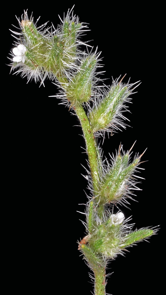
© Gerald D.. Carr Hwy 126, ca. 0.6 mi. W of Olmstead Rd., ca. 10 mi. W of Sisters, 3035 ft. elev., N44.29338, W121.34450, Deschutes Co., OR, 7/18/2011 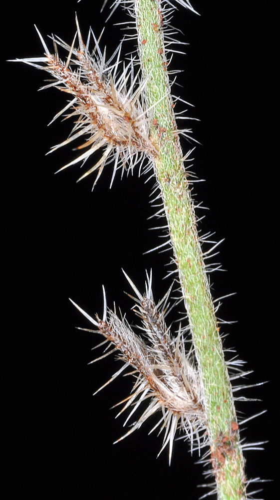
© Gerald D.. Carr Hwy 126, ca. 0.6 mi. W of Olmstead Rd., ca. 10 mi. W of Sisters, 3035 ft. elev., N44.29338, W121.34450, Deschutes Co., OR, 7/18/2011 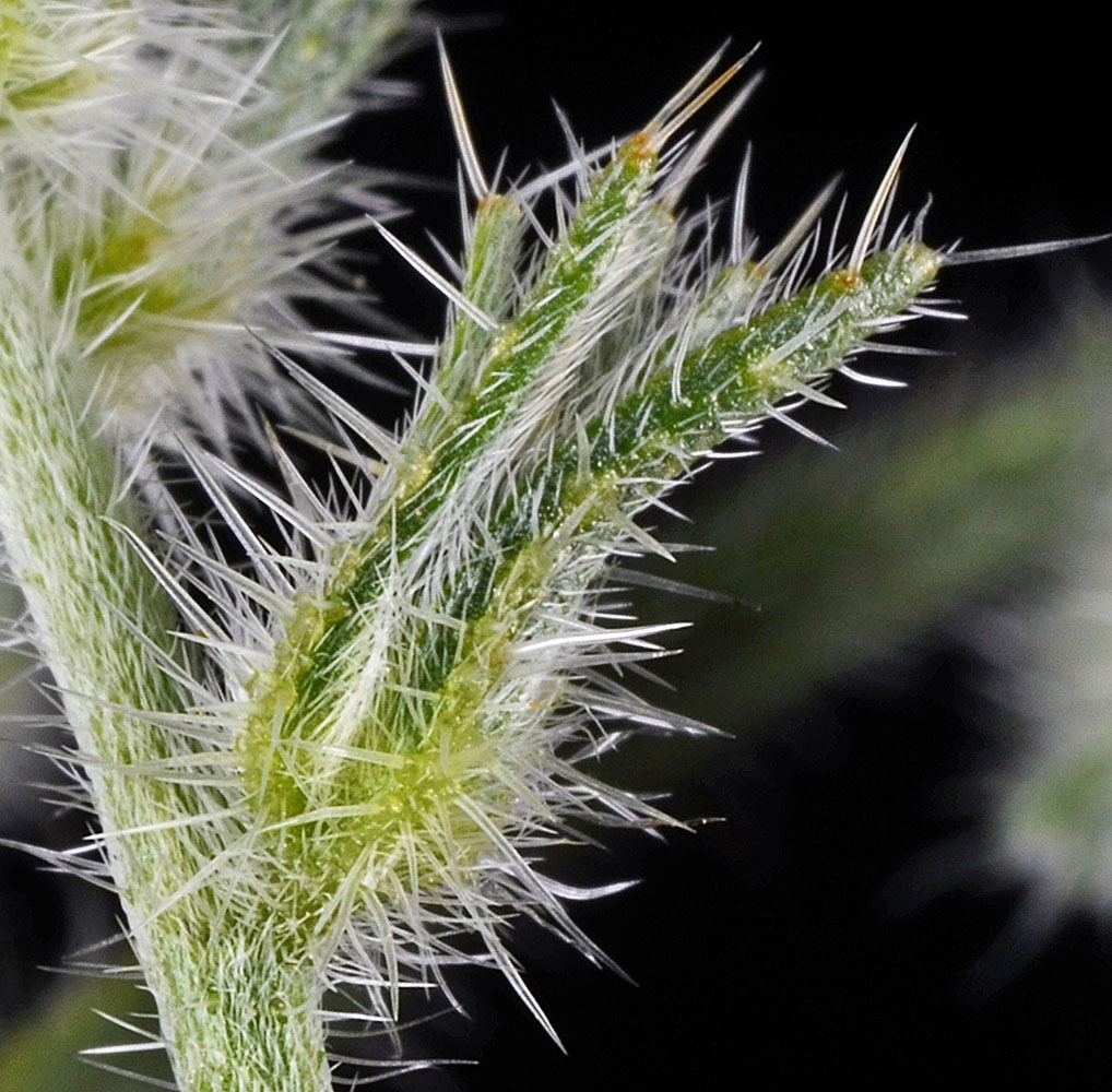
© Gerald D.. Carr N side of Squaw Butte Rd., 6.6 mi. SSE of Hwy 20, 4560 ft. elev., N43.46556, W119.68516, Harney Co., OR, 6/3/2013 
© Gerald D.. Carr Hwy 126, ca. 0.6 mi. W of Olmstead Rd., ca. 10 mi. W of Sisters, 3035 ft. elev., N44.29338, W121.34450, Deschutes Co., OR, 7/18/2011 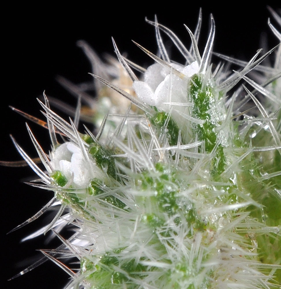
© Gerald D.. Carr Hwy 126, ca. 0.6 mi. W of Olmstead Rd., ca. 10 mi. W of Sisters, 3035 ft. elev., N44.29338, W121.34450, Deschutes Co., OR, 7/18/2011 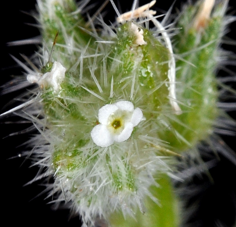
© Gerald D.. Carr Hwy 126, ca. 0.6 mi. W of Olmstead Rd., ca. 10 mi. W of Sisters, 3035 ft. elev., N44.29338, W121.34450, Deschutes Co., OR, 7/18/2011 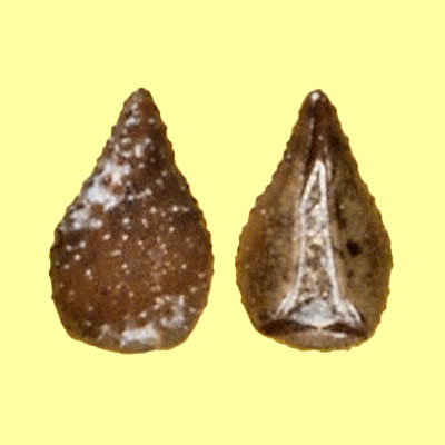
© Gerald D.. Carr Hwy 126, ca. 0.6 mi. W of Olmstead Rd., ca. 10 mi. W of Sisters, 3035 ft. elev., N44.29338, W121.34450, Deschutes Co., OR, 7/18/2011


