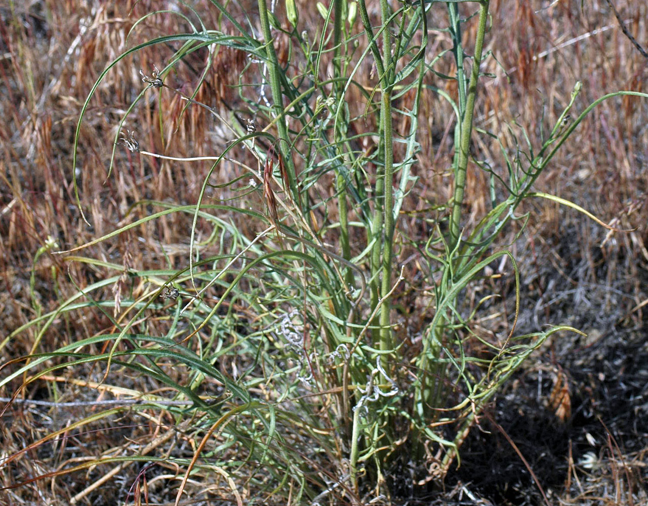
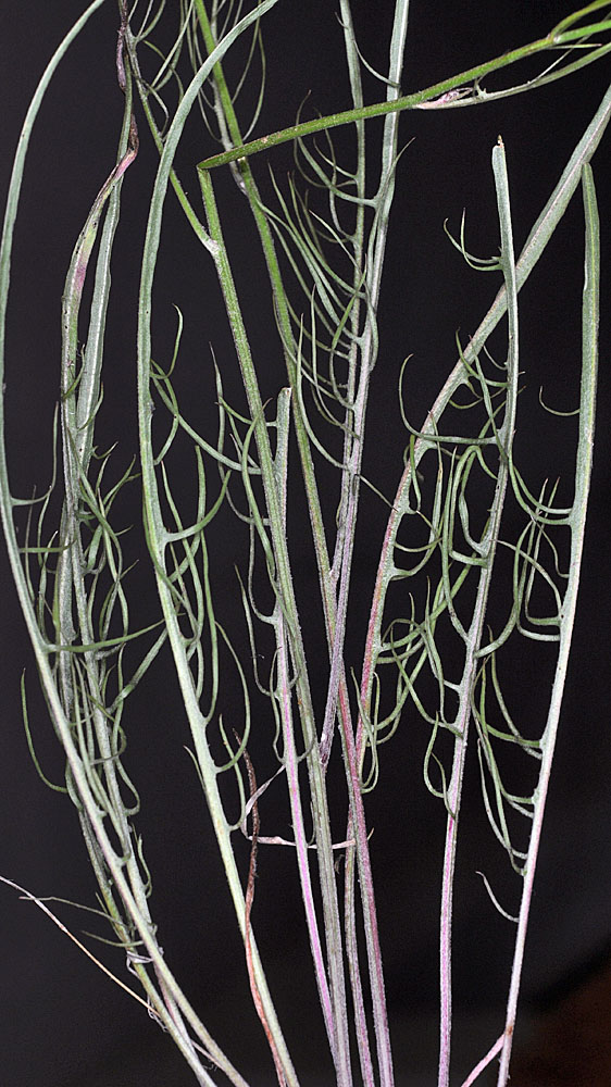
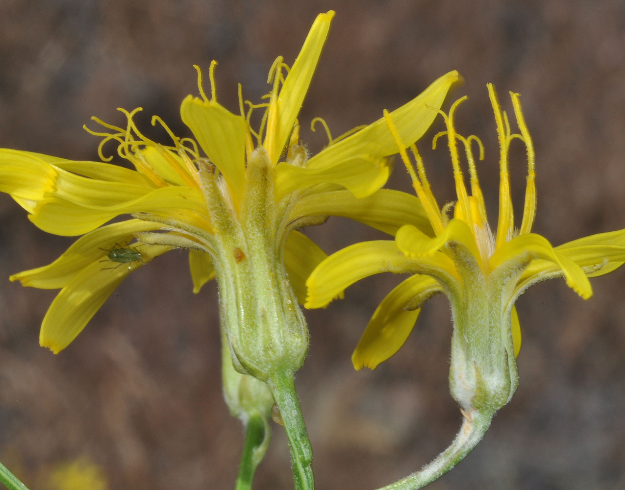
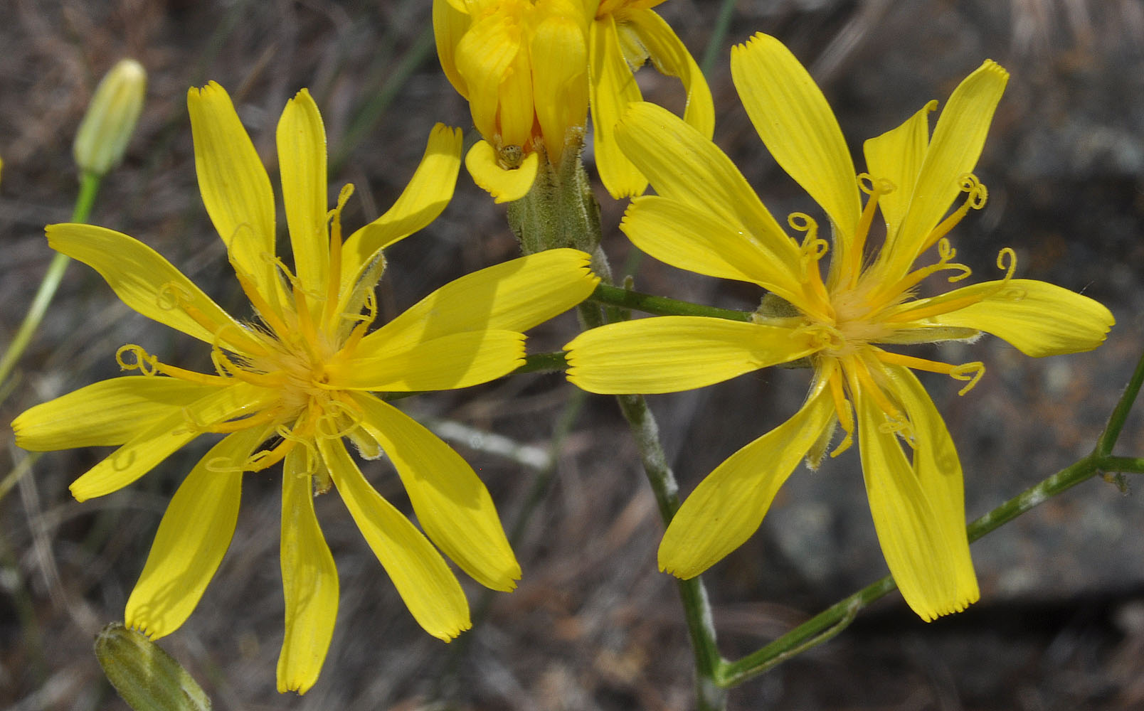
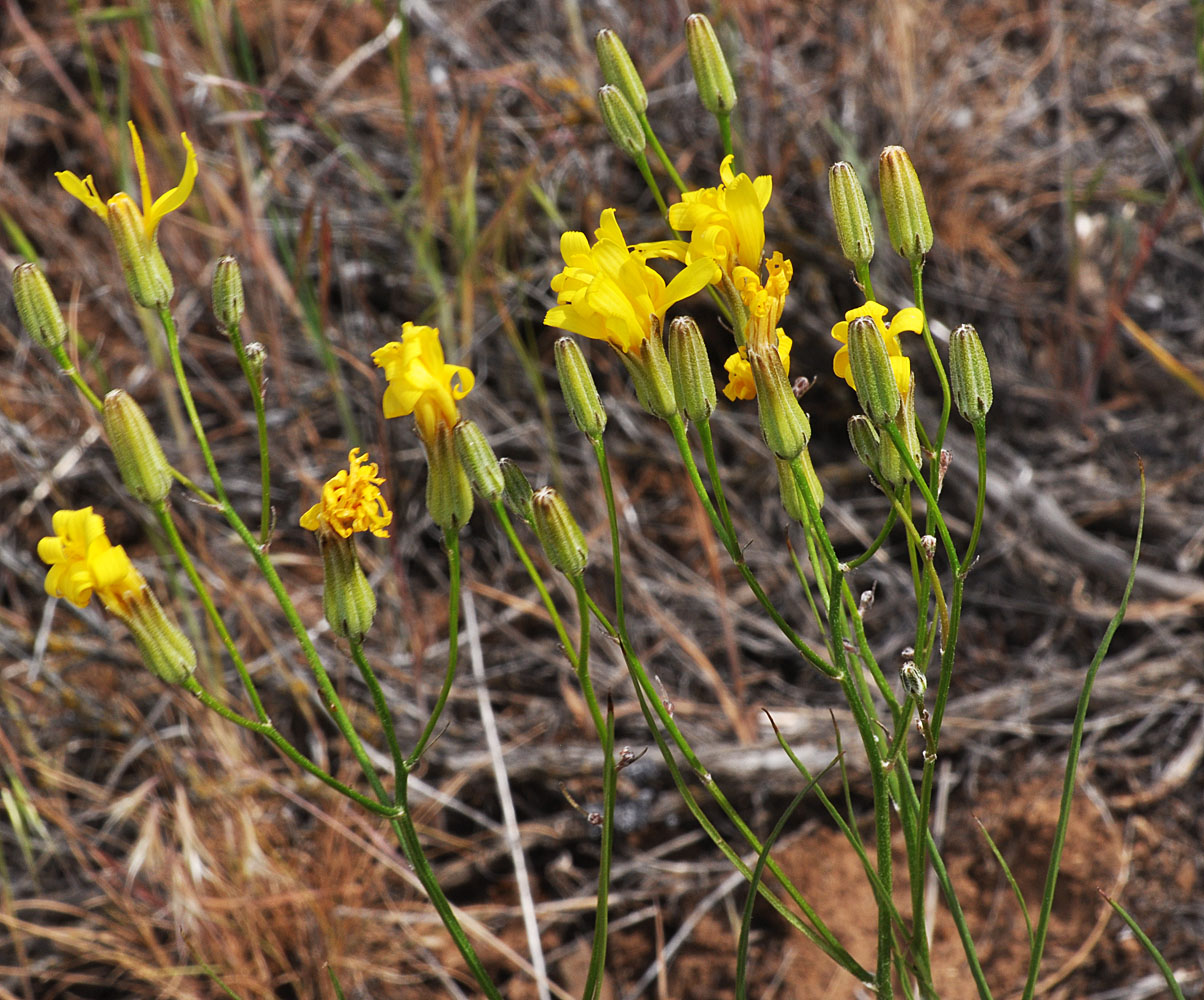
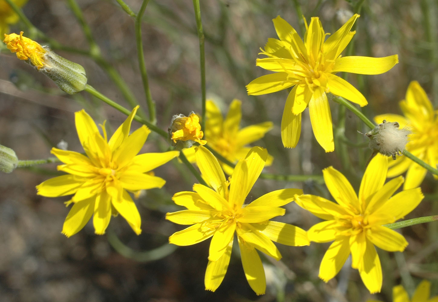
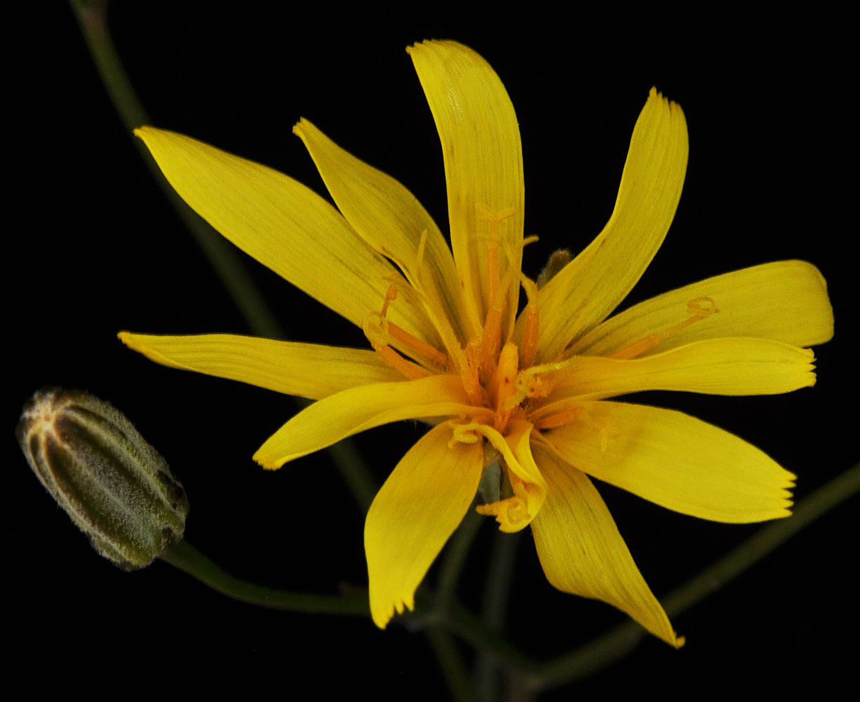
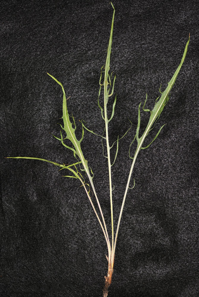
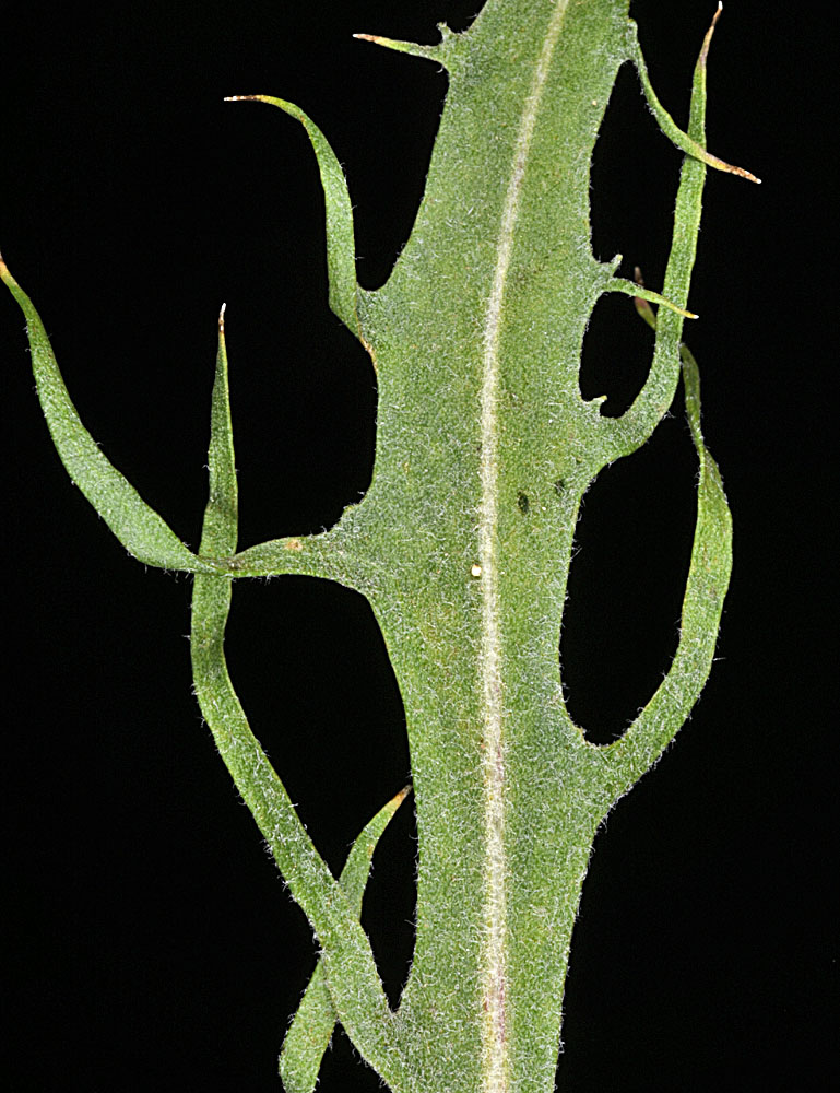
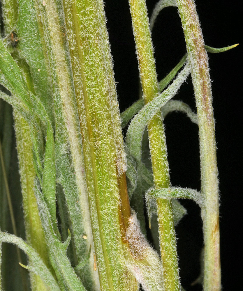
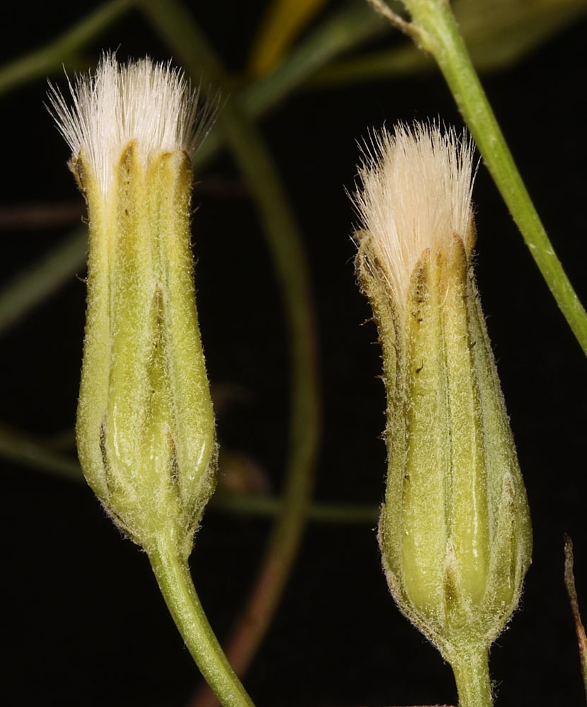
Rd to Midway S of the Verneta Bridge; 100 yds SW of 46 37 299N 119 47 726W – 5/28/2009Rd to Midway S of the Verneta Bridge; 100 yds SW of 46 37 299N 119 47 726W – 5/28/2009Ca. 0.37 air mi W of Campground on W end of Coffee Pot Lake, W of Harrington, WA; N 47.49931 W 118.56673; Lincoln Co.; 5/28/2014Rd to Midway S of the Verneta Bridge; 100 yds SW of 46 37 299N 119 47 726W – 5/28/2009Rd to Midway S of the Verneta Bridge; 100 yds SW of 46 37 299N 119 47 726W – 5/28/2009Ca. 0.37 air mi W of Campground on W end of Coffee Pot Lake, W of Harrington, WA; N 47.49931 W 118.56673; Lincoln Co.; 5/28/2014Rd to Midway S of the Verneta Bridge; 100 yds SW of 46 37 299N 119 47 726W – 5/28/2009Ca. 0.37 air mi W of Campground on W end of Coffee Pot Lake, W of Harrington, WA; N 47.49931 W 118.56673; Lincoln Co.; 5/28/2014Ca. 0.37 air mi W of Campground on W end of Coffee Pot Lake, W of Harrington, WA; N 47.49931 W 118.56673; Lincoln Co.; 5/28/2014NE of Silica Rd ca. 7.0 air mi N of Vantage, WA; N 47.04530 W 119.96997; Grant Co.; 5/20/2017NE of Silica Rd ca. 7.0 air mi N of Vantage, WA; N 47.04530 W 119.96997; Grant Co.; 5/20/2017NE of Silica Rd ca. 7.0 air mi N of Vantage, WA; N 47.04530 W 119.96997; Grant Co.; 5/20/2017Along Sand Ridge Rd 0.40 air mi SE of its jct with Peterson Rd, 7.5 air mi NW of Crow Butte Island in the Columbia R; N 45.90535 W 119.99242; Klickitat Co., WA; 5/14/2021