| Scientific Name | Carex diandra Schrank |
| Family | Cyperaceae |
| Common Names | lesser panicled sedge, lesser tussock sedge |
| Eastern Washington | Native |
| Synonyms | None |
| Conservation Status | |
| Notes |
Click on any image to enlarge it.
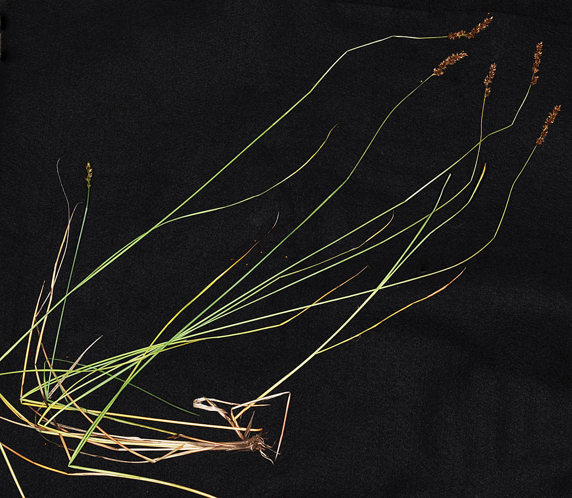
Ca. 0.25 mi W of the South end of Diamond Lk along a private drive; N 48.12100 W 117.22704; Pend Oreille Co.,WA; 6/22/2014 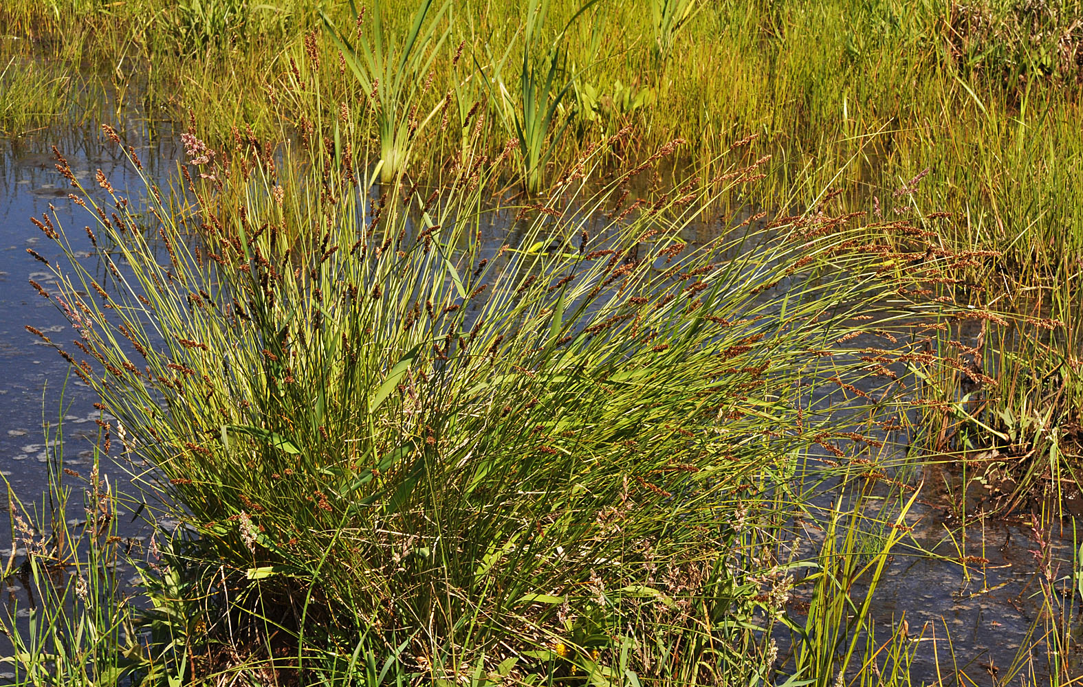
Ca. 0.25 mi W of the South end of Diamond Lk along a private drive; N 48.12100 W 117.22704; Pend Oreille Co.,WA; 6/22/2014 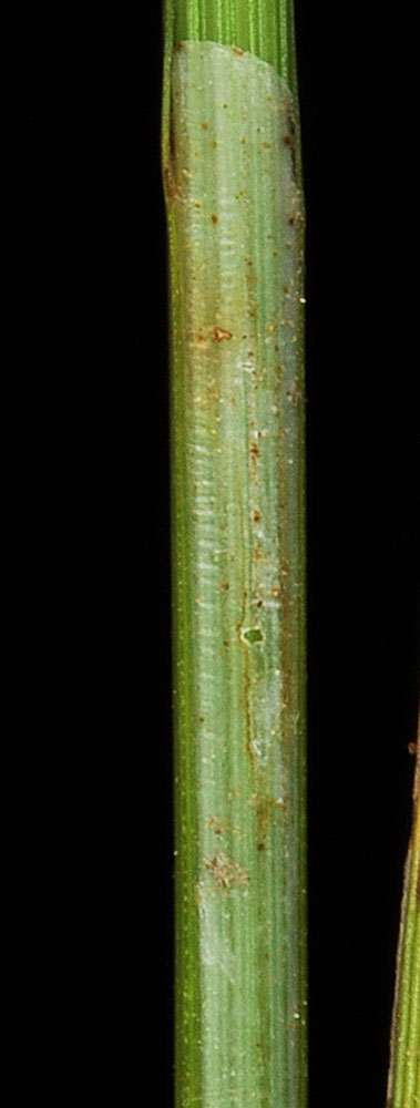
Ca. 0.25 mi W of the South end of Diamond Lk along a private drive; N 48.12100 W 117.22704; Pend Oreille Co.,WA; 6/22/2014 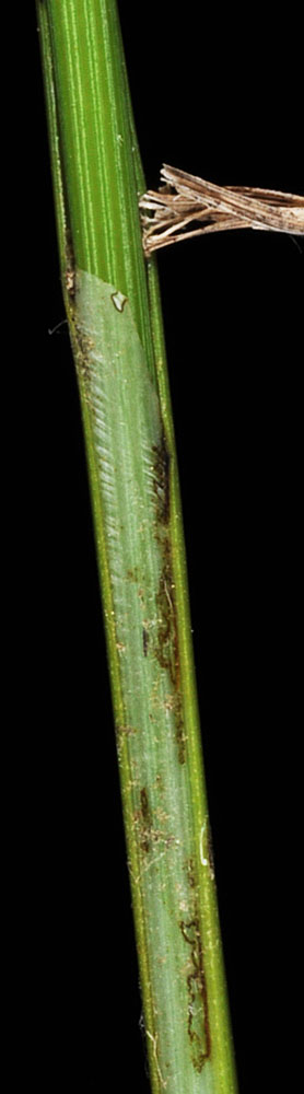
Ca. 0.25 mi W of the South end of Diamond Lk along a private drive; N 48.12100 W 117.22704; Pend Oreille Co.,WA; 6/22/2014 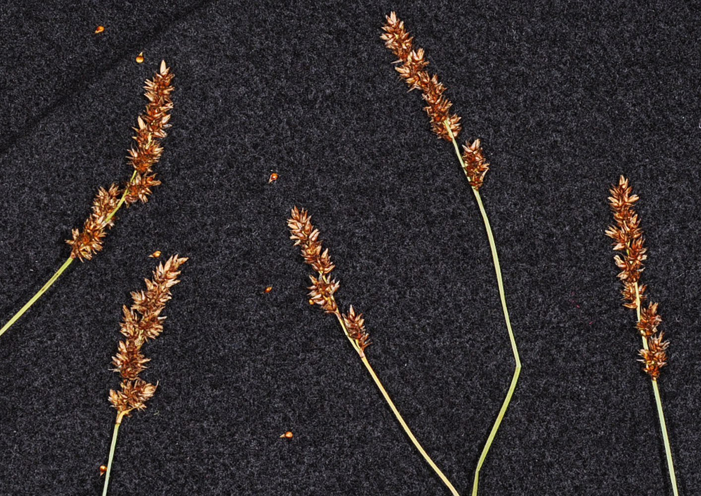
Ca. 0.25 mi W of the South end of Diamond Lk along a private drive; N 48.12100 W 117.22704; Pend Oreille Co.,WA; 6/22/2014 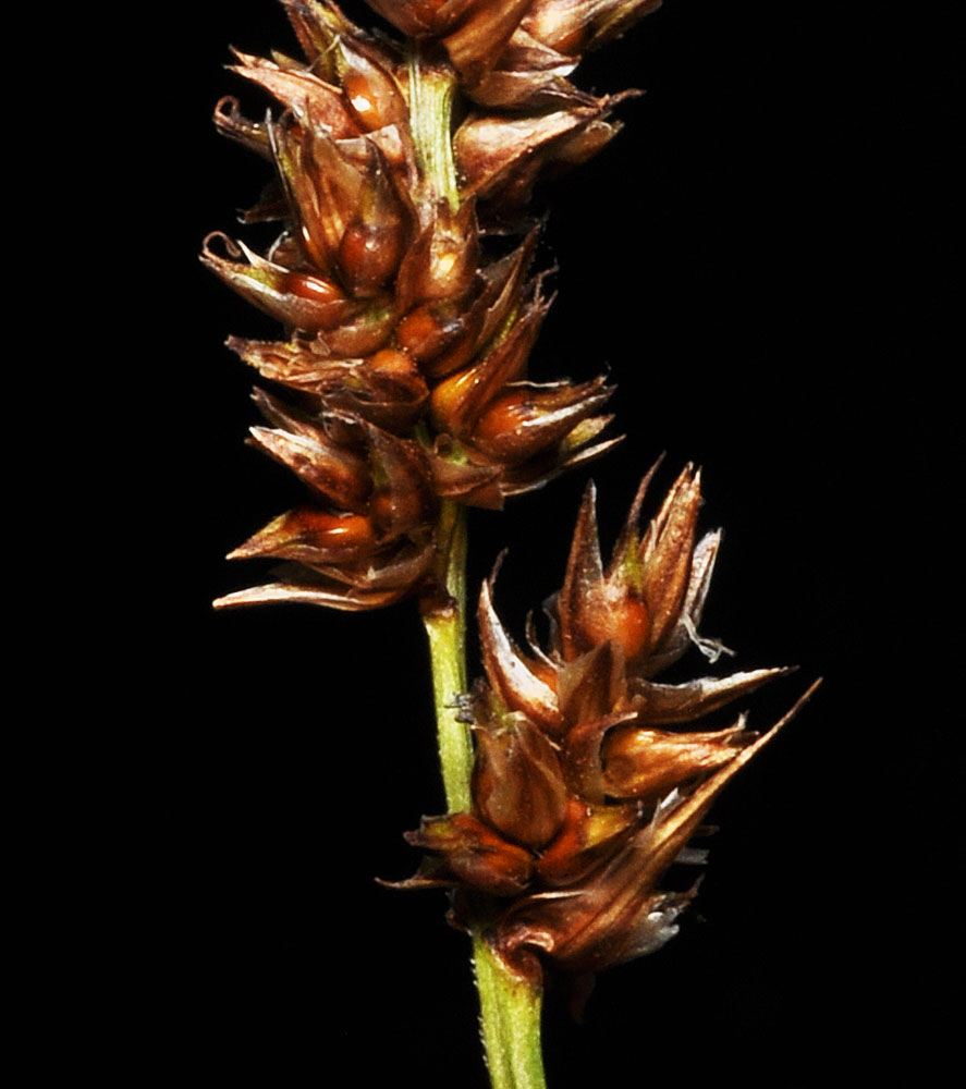
Ca. 0.25 mi W of the South end of Diamond Lk along a private drive; N 48.12100 W 117.22704; Pend Oreille Co.,WA; 6/22/2014 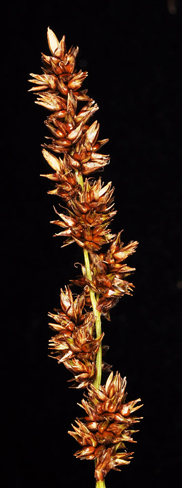
Ca. 0.25 mi W of the South end of Diamond Lk along a private drive; N 48.12100 W 117.22704; Pend Oreille Co.,WA; 6/22/2014 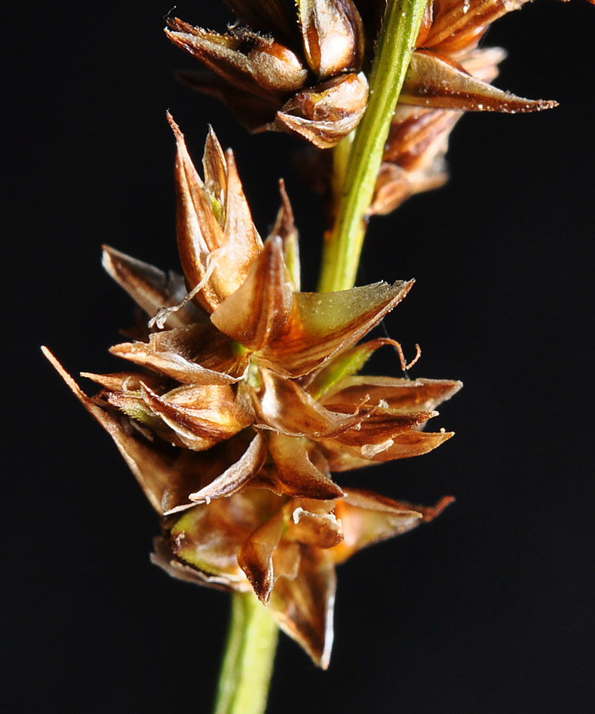
Ca. 0.25 mi W of the South end of Diamond Lk along a private drive; N 48.12100 W 117.22704; Pend Oreille Co.,WA; 6/22/2014 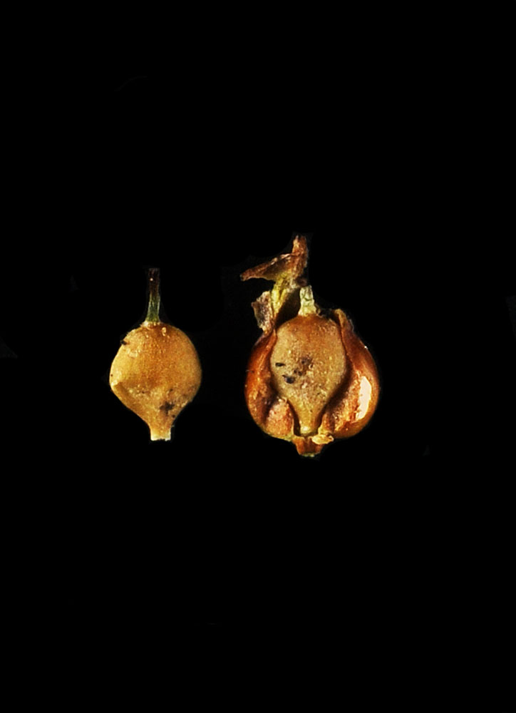
Ca. 0.25 mi W of the South end of Diamond Lk along a private drive; N 48.12100 W 117.22704; Pend Oreille Co.,WA; 6/22/2014 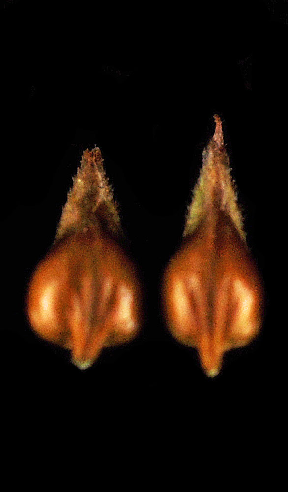
Ca. 0.25 mi W of the South end of Diamond Lk along a private drive; N 48.12100 W 117.22704; Pend Oreille Co.,WA; 6/22/2014 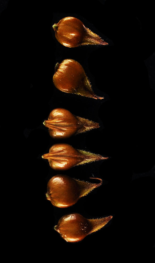
Ca. 0.25 mi W of the South end of Diamond Lk along a private drive; N 48.12100 W 117.22704; Pend Oreille Co.,WA; 6/22/2014 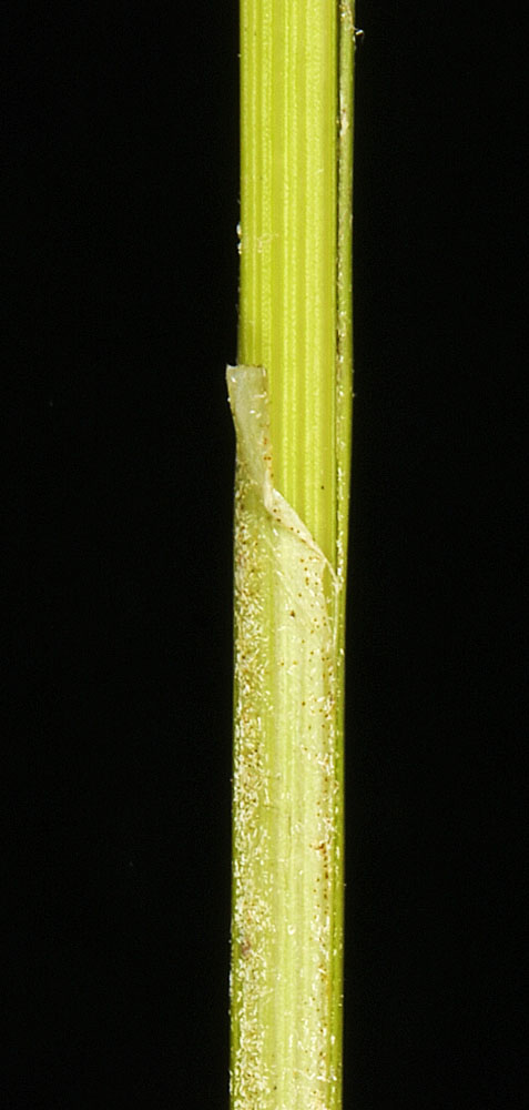
In standing water at the edge of path to fishing access at Troutlake; 8.5 air mi W of Kettle Falls, WA; N 48.62486 W 118.24047; Ferry Co.; 7/6/2018 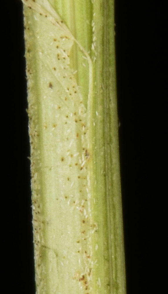
In standing water at the edge of path to fishing access at Troutlake; 8.5 air mi W of Kettle Falls, WA; N 48.62486 W 118.24047; Ferry Co.; 7/6/2018 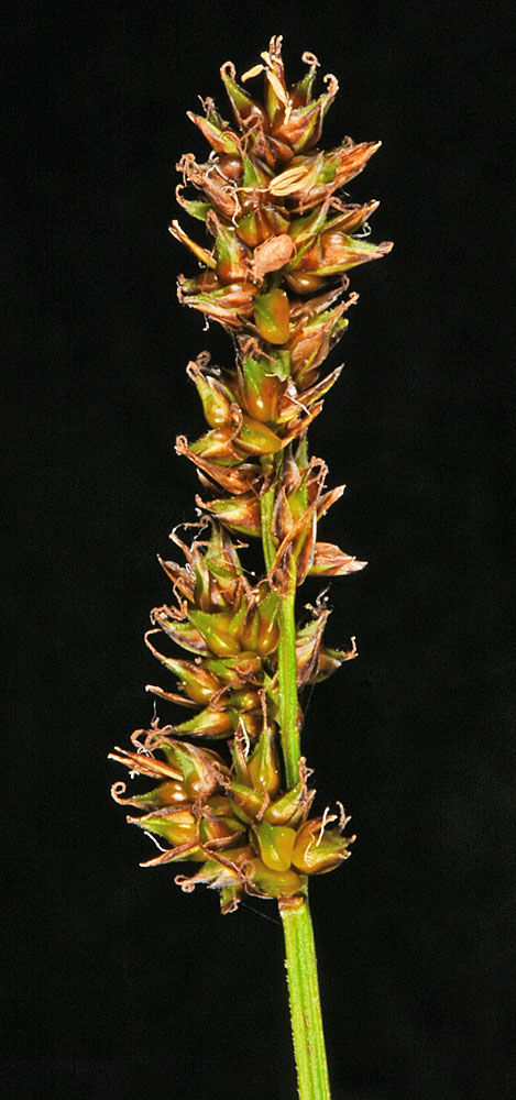
In standing water at the edge of path to fishing access at Troutlake; 8.5 air mi W of Kettle Falls, WA; N 48.62486 W 118.24047; Ferry Co.; 7/6/2018 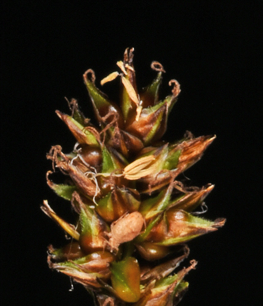
In standing water at the edge of path to fishing access at Troutlake; 8.5 air mi W of Kettle Falls, WA; N 48.62486 W 118.24047; Ferry Co.; 7/6/2018 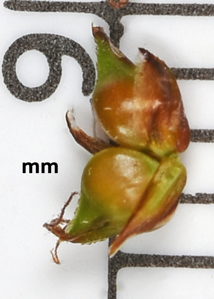
In standing water at the edge of path to fishing access at Troutlake; 8.5 air mi W of Kettle Falls, WA; N 48.62486 W 118.24047; Ferry Co.; 7/6/2018 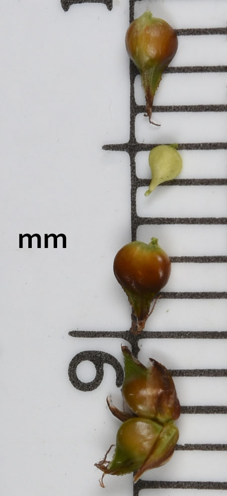
In standing water at the edge of path to fishing access at Troutlake; 8.5 air mi W of Kettle Falls, WA; N 48.62486 W 118.24047; Ferry Co.; 7/6/2018 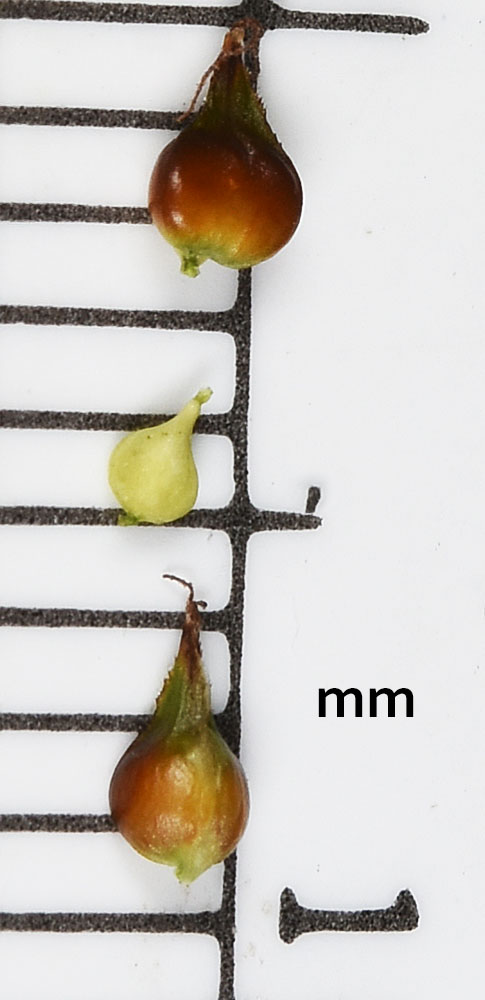
In standing water at the edge of path to fishing access at Troutlake; 8.5 air mi W of Kettle Falls, WA; N 48.62486 W 118.24047; Ferry Co.; 7/6/2018


