| Scientific Name | Astragalus caricinus (M.E. Jones) Barneby |
| Family | Fabaceae |
| Common Names | buckwheat milk-vetch |
| Eastern Washington | Native |
| Conservation Status | |
| Notes |
Click on any image to enlarge it.

Along powerlines 0.63 air mi N of Wanapum Dam substation; sandy areas between exposed basalt rock; N 46.88928 W 119.94066; Grant Co.; 6/3/2017 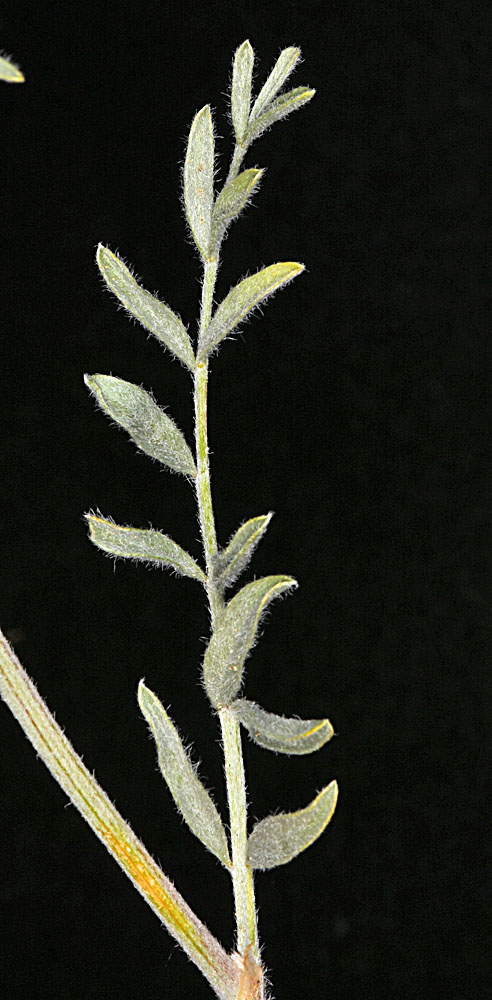
Along powerlines 0.63 air mi N of Wanapum Dam substation; sandy areas between exposed basalt rock; N 46.88928 W 119.94066; Grant Co.; 6/3/2017 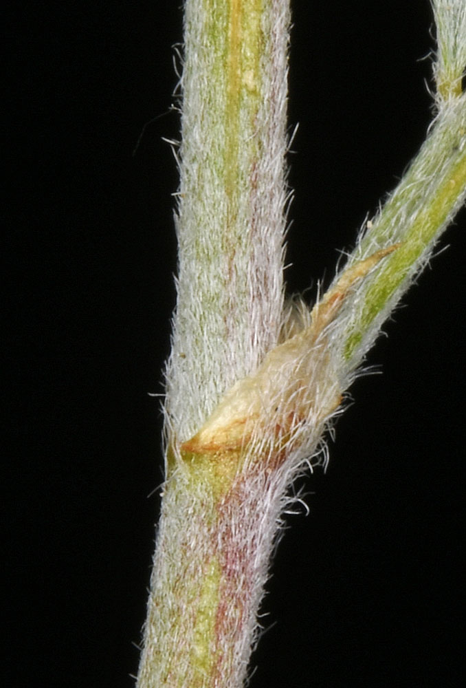
Along powerlines 0.63 air mi N of Wanapum Dam substation; sandy areas between exposed basalt rock; N 46.88928 W 119.94066; Grant Co.; 6/3/2017 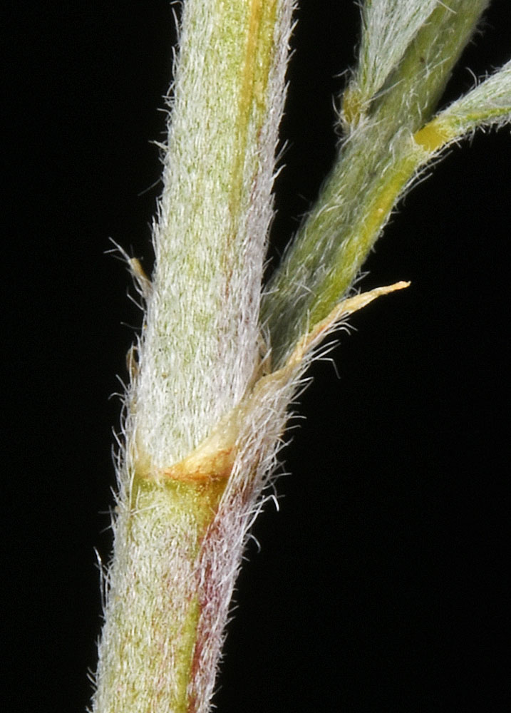
Along powerlines 0.63 air mi N of Wanapum Dam substation; sandy areas between exposed basalt rock; N 46.88928 W 119.94066; Grant Co.; 6/3/2017 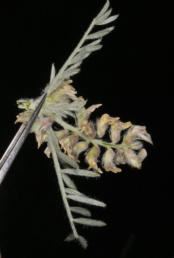
Along powerlines 0.63 air mi N of Wanapum Dam substation; sandy areas between exposed basalt rock; N 46.88928 W 119.94066; Grant Co.; 6/3/2017 
Along powerlines 0.63 air mi N of Wanapum Dam substation; sandy areas between exposed basalt rock; N 46.88928 W 119.94066; Grant Co.; 6/3/2017 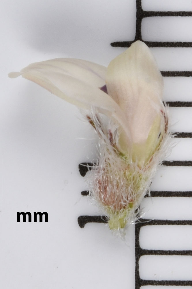
Along powerlines 0.63 air mi N of Wanapum Dam substation; sandy areas between exposed basalt rock; N 46.88928 W 119.94066; Grant Co.; 6/3/2017 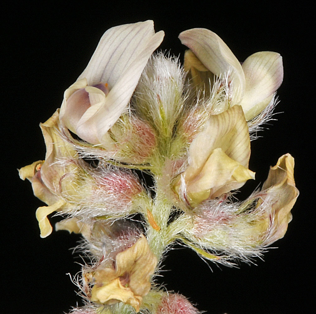
Along powerlines 0.63 air mi N of Wanapum Dam substation; sandy areas between exposed basalt rock; N 46.88928 W 119.94066; Grant Co.; 6/3/2017 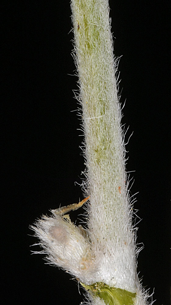
Along powerlines 0.63 air mi N of Wanapum Dam substation; sandy areas between exposed basalt rock; N 46.88928 W 119.94066; Grant Co.; 6/3/2017 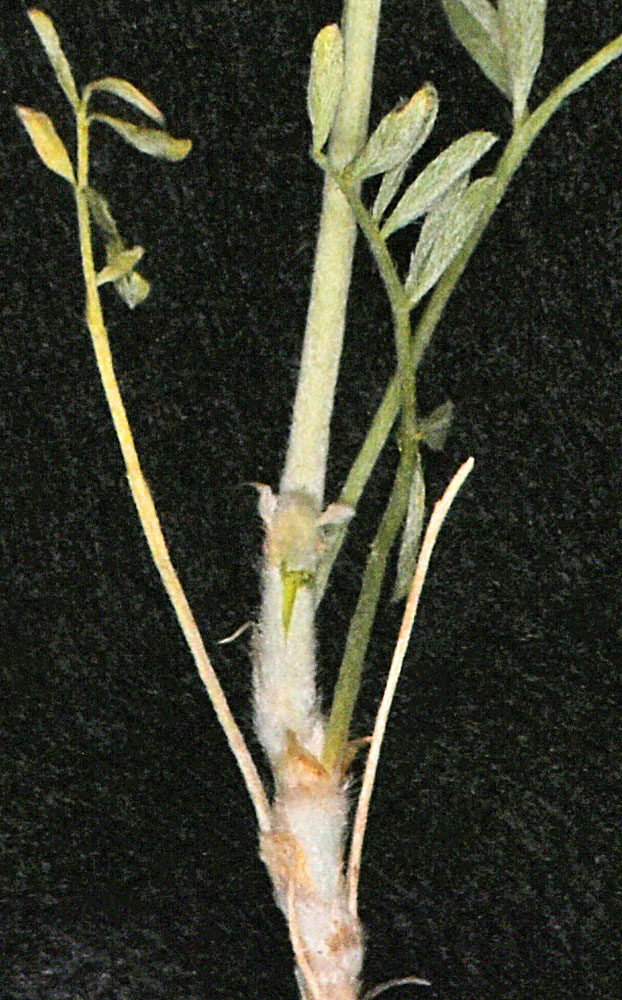
Along powerlines 0.63 air mi N of Wanapum Dam substation; sandy areas between exposed basalt rock; N 46.88928 W 119.94066; Grant Co.; 6/3/2017 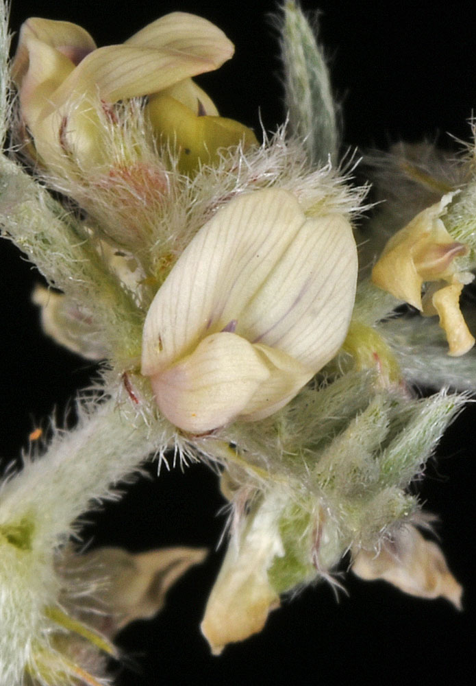
Along powerlines 0.63 air mi N of Wanapum Dam substation; sandy areas between exposed basalt rock; N 46.88928 W 119.94066; Grant Co.; 6/3/2017 
Along powerlines 0.63 air mi N of Wanapum Dam substation; sandy areas between exposed basalt rock; N 46.88928 W 119.94066; Grant Co.; 6/3/2017 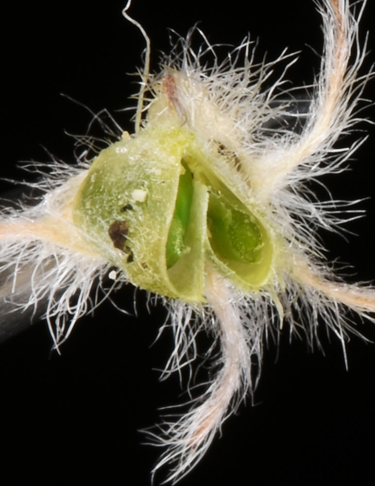
Along powerlines 0.63 air mi N of Wanapum Dam substation; sandy areas between exposed basalt rock; N 46.88928 W 119.94066; Grant Co.; 6/3/2017 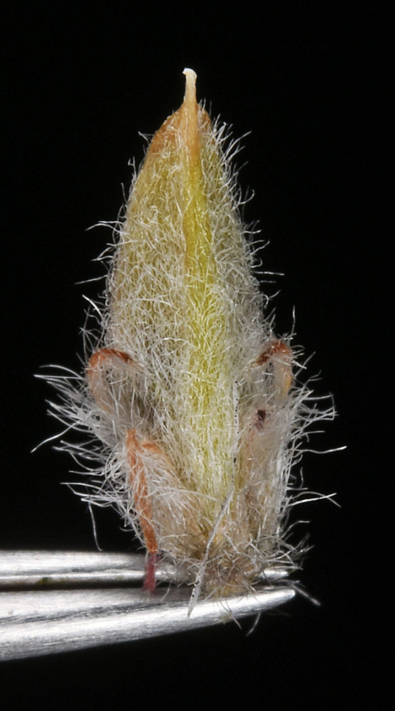
Along powerlines 0.63 air mi N of Wanapum Dam substation; sandy areas between exposed basalt rock; N 46.88928 W 119.94066; Grant Co.; 6/3/2017 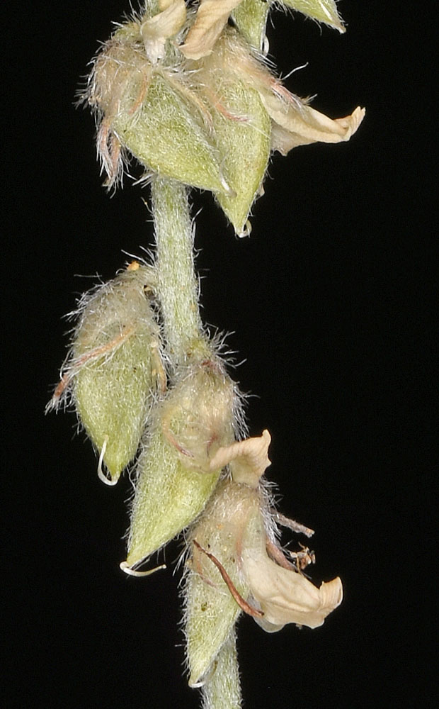
Along powerlines 0.63 air mi N of Wanapum Dam substation; sandy areas between exposed basalt rock; N 46.88928 W 119.94066; Grant Co.; 6/3/2017 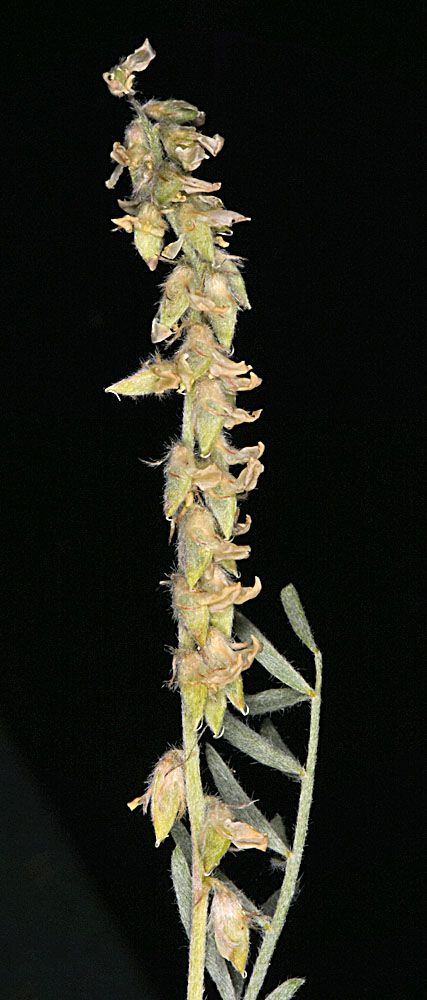
Along powerlines 0.63 air mi N of Wanapum Dam substation; sandy areas between exposed basalt rock; N 46.88928 W 119.94066; Grant Co.; 6/3/2017 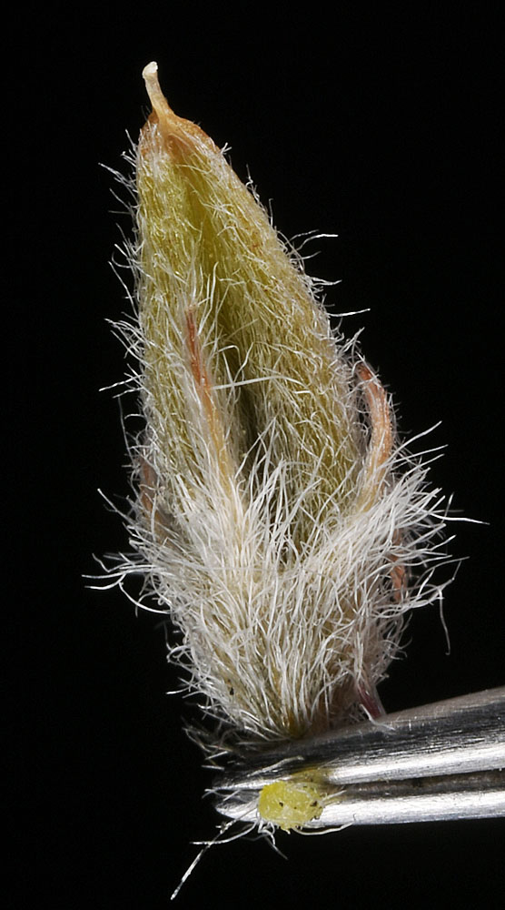
Along powerlines 0.63 air mi N of Wanapum Dam substation; sandy areas between exposed basalt rock; N 46.88928 W 119.94066; Grant Co.; 6/3/2017


