| Scientific Name | Arnica parryi A. Gray |
| Family | Asteraceae |
| Common Names | Parry’s arnica |
| Eastern Washington | Native |
| Conservation Status | |
| Notes |
Click on any image to enlarge it.
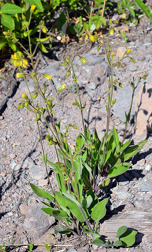
© Gerald D.. Carr Rd. 451, 2.3 mi. N of jct. with USFS Rd. 2309, SW flank of Groundhog Mt., ca. 12.1 air mi. SE of Oakridge, 5688 ft. elev., N43.58603, W122.34409, Lane Co., OR, 8/10/2012 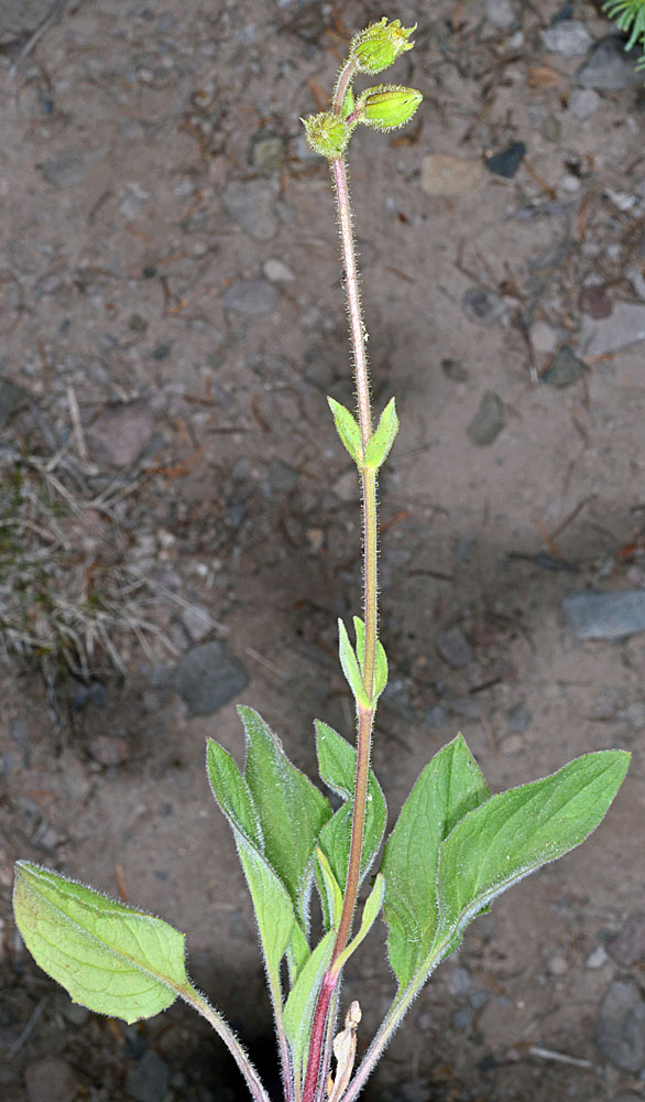
© Gerald D.. Carr Rd. 451, 2.3 mi. N of jct. with USFS Rd. 2309, SW flank of Groundhog Mt., ca. 12.1 air mi. SE of Oakridge, 5688 ft. elev., N43.58603, W122.34409, Lane Co., OR, 8/10/2012 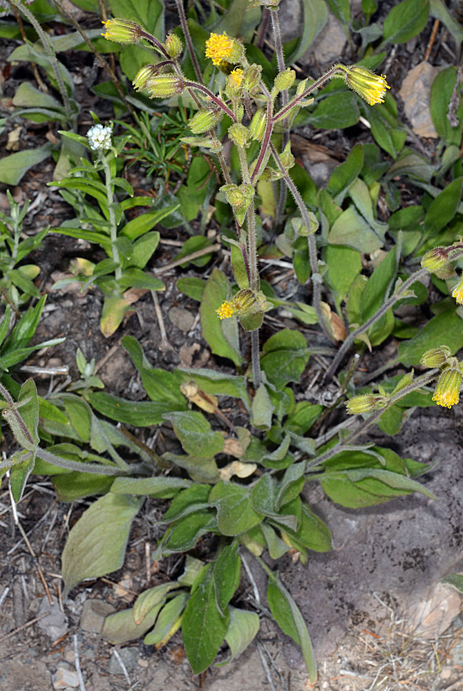
© Gerald D.. Carr Rd. 451, 2.3 mi. N of jct. with USFS Rd. 2309, SW flank of Groundhog Mt., ca. 12.1 air mi. SE of Oakridge, 5688 ft. elev., N43.58603, W122.34409, Lane Co., OR, 8/10/2012 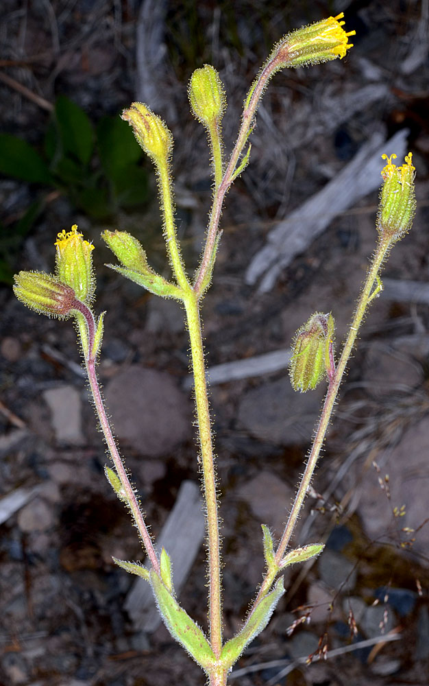
© Gerald D.. Carr Rd. 451, 2.3 mi. N of jct. with USFS Rd. 2309, SW flank of Groundhog Mt., ca. 12.1 air mi. SE of Oakridge, 5688 ft. elev., N43.58603, W122.34409, Lane Co., OR, 8/10/2012 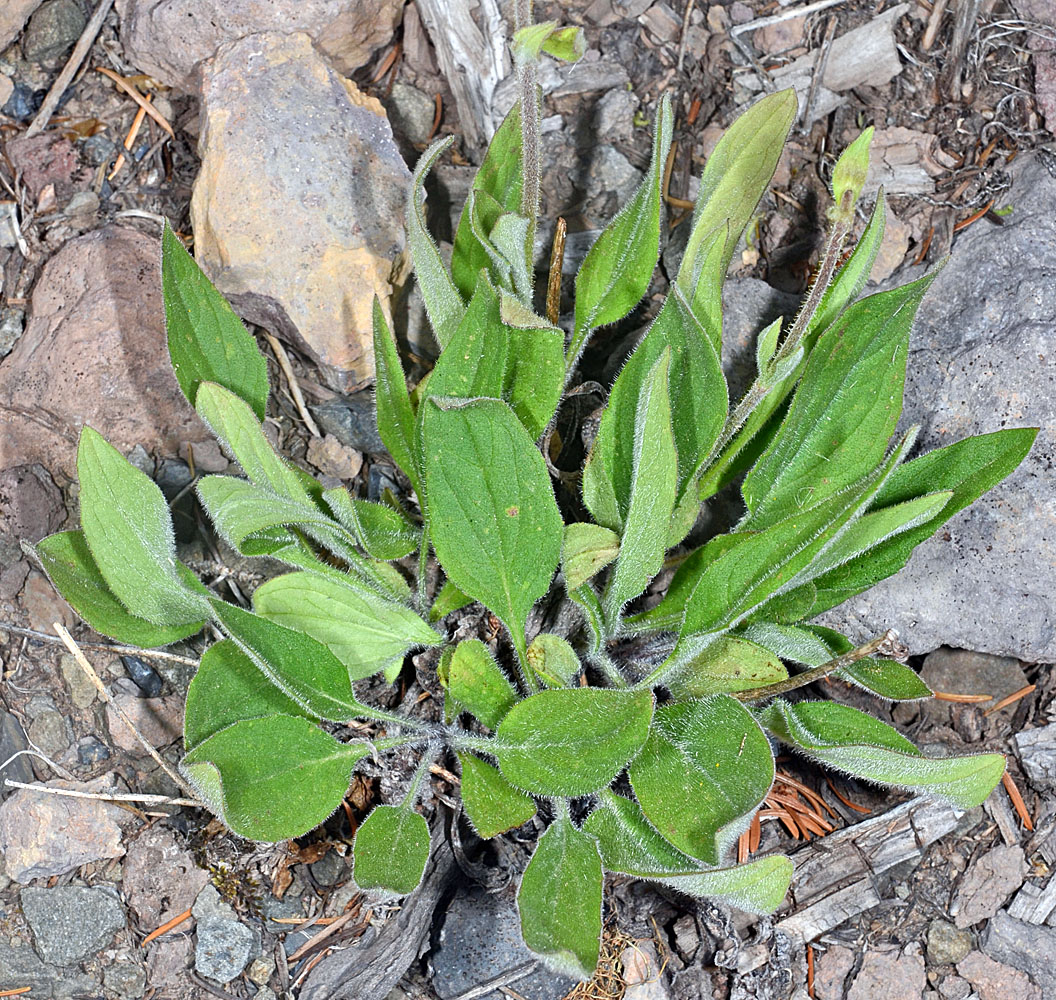
© Gerald D.. Carr Rd. 451, 2.3 mi. N of jct. with USFS Rd. 2309, SW flank of Groundhog Mt., ca. 12.1 air mi. SE of Oakridge, 5688 ft. elev., N43.58603, W122.34409, Lane Co., OR, 8/10/2012 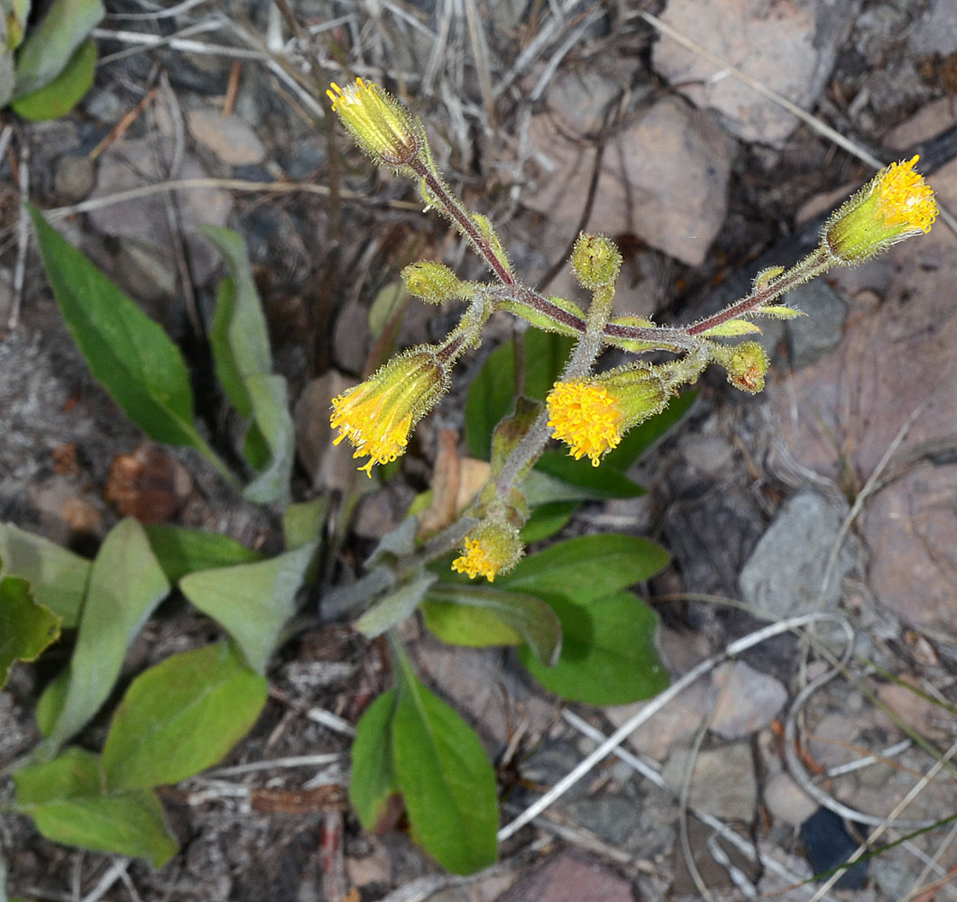
© Gerald D.. Carr Rd. 451, 2.3 mi. N of jct. with USFS Rd. 2309, SW flank of Groundhog Mt., ca. 12.1 air mi. SE of Oakridge, 5688 ft. elev., N43.58603, W122.34409, Lane Co., OR, 8/10/2012 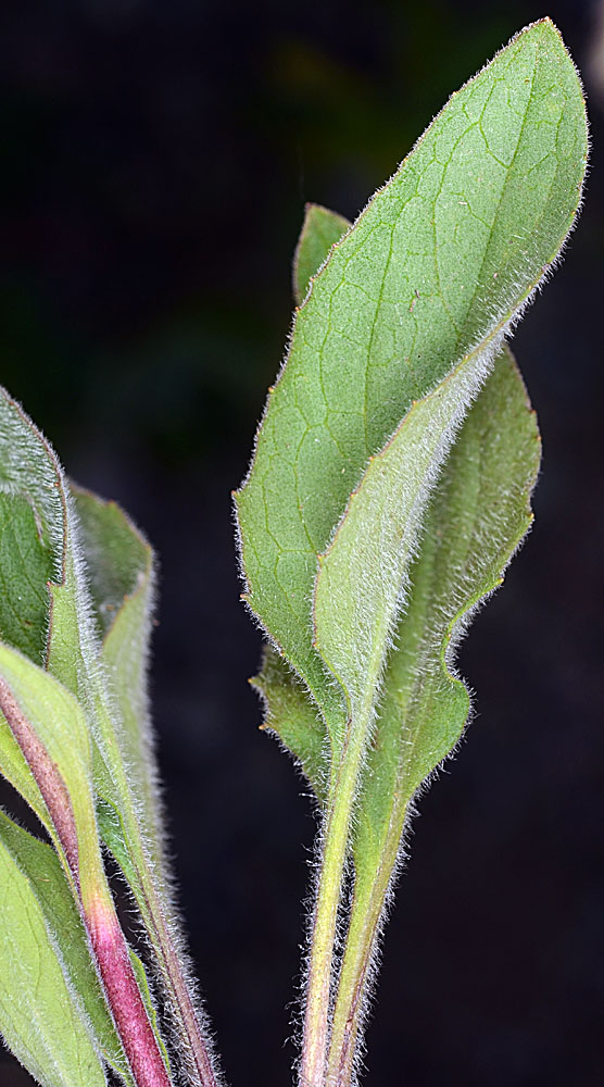
© Gerald D.. Carr Rd. 451, 2.3 mi. N of jct. with USFS Rd. 2309, SW flank of Groundhog Mt., ca. 12.1 air mi. SE of Oakridge, 5688 ft. elev., N43.58603, W122.34409, Lane Co., OR, 8/10/2012 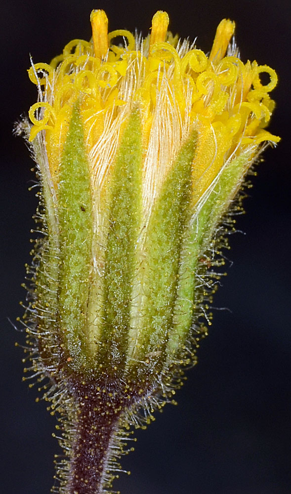
© Gerald D.. Carr Rd. 451, 2.3 mi. N of jct. with USFS Rd. 2309, SW flank of Groundhog Mt., ca. 12.1 air mi. SE of Oakridge, 5688 ft. elev., N43.58603, W122.34409, Lane Co., OR, 8/10/2012 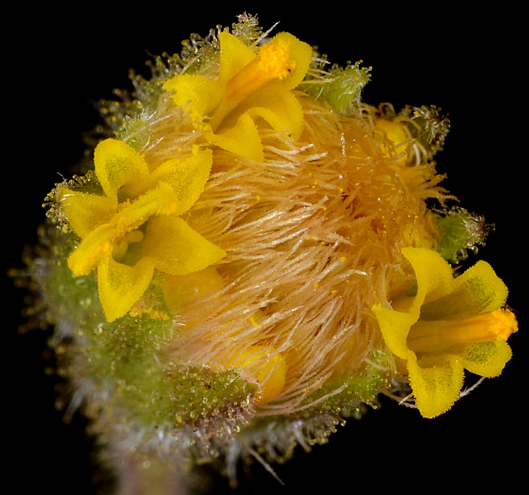
© Gerald D.. Carr Rd. 451, 2.3 mi. N of jct. with USFS Rd. 2309, SW flank of Groundhog Mt., ca. 12.1 air mi. SE of Oakridge, 5688 ft. elev., N43.58603, W122.34409, Lane Co., OR, 8/10/2012 
© Gerald D.. Carr Rd. 451, 2.3 mi. N of jct. with USFS Rd. 2309, SW flank of Groundhog Mt., ca. 12.1 air mi. SE of Oakridge, 5688 ft. elev., N43.58603, W122.34409, Lane Co., OR, 8/10/2012 
© Gerald D.. Carr Rd. 451, 2.3 mi. N of jct. with USFS Rd. 2309, SW flank of Groundhog Mt., ca. 12.1 air mi. SE of Oakridge, 5688 ft. elev., N43.58603, W122.34409, Lane Co., OR, 8/10/2012 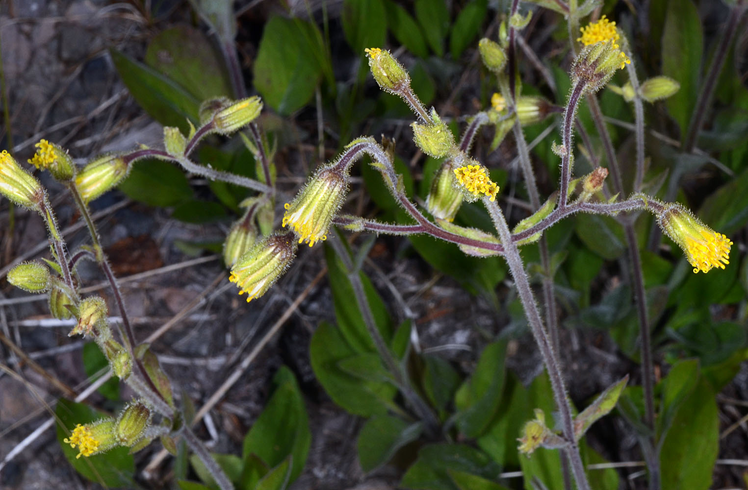
© Gerald D.. Carr Rd. 451, 2.3 mi. N of jct. with USFS Rd. 2309, SW flank of Groundhog Mt., ca. 12.1 air mi. SE of Oakridge, 5688 ft. elev., N43.58603, W122.34409, Lane Co., OR, 8/10/2012 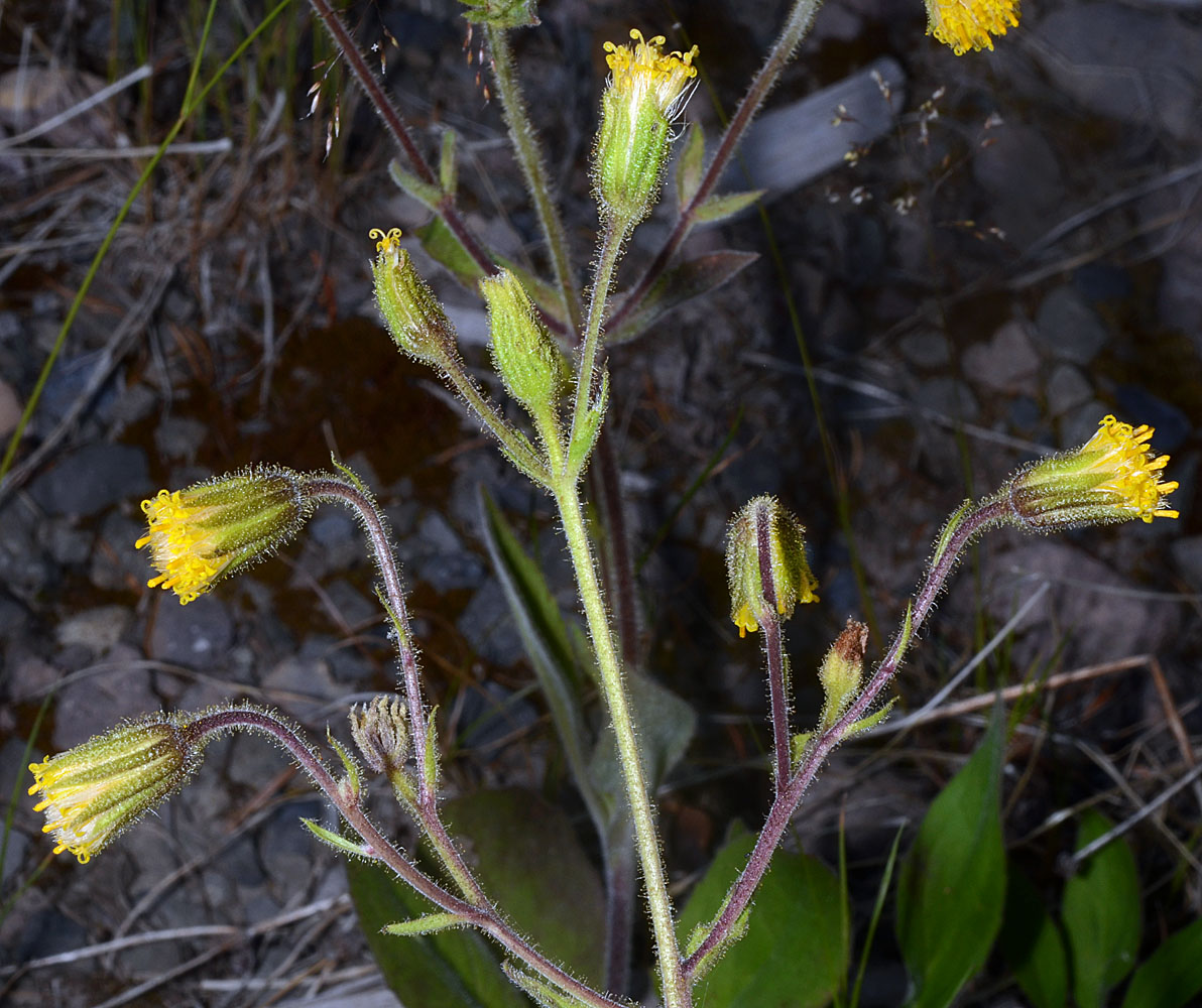
© Gerald D.. Carr Rd. 451, 2.3 mi. N of jct. with USFS Rd. 2309, SW flank of Groundhog Mt., ca. 12.1 air mi. SE of Oakridge, 5688 ft. elev., N43.58603, W122.34409, Lane Co., OR, 8/10/2012


