| Scientific Name | Anthriscus caucalis Bieb. |
| Family | Apiaceae |
| Common Names | burr chervil |
| Eastern Washington | European |
| Conservation Status | |
| Notes |
Click on any image to enlarge it.
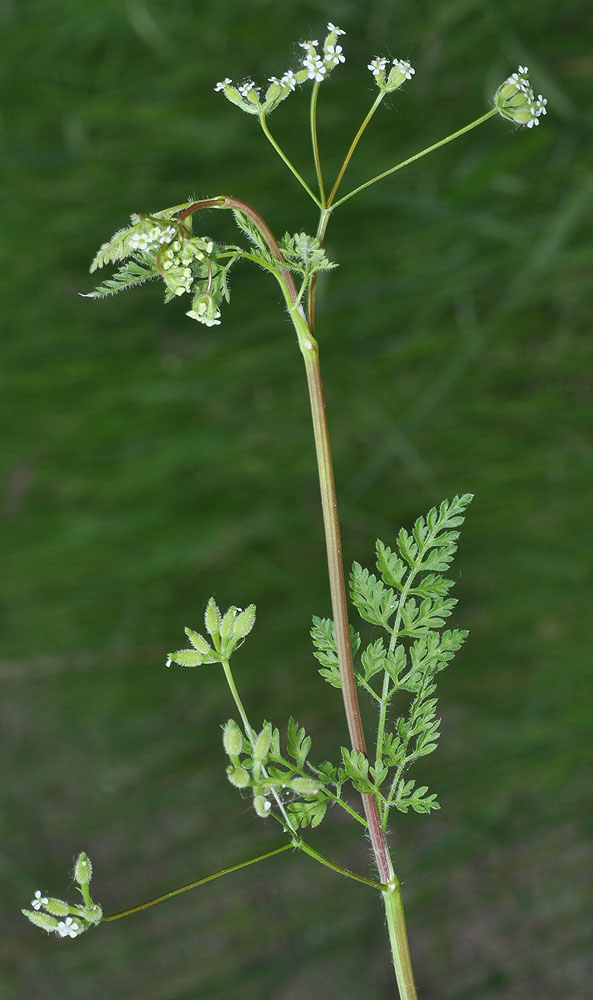
Steptoe Can; 46 32 064N 117 10 371W – Whitman Co., WA – 6/8/2009 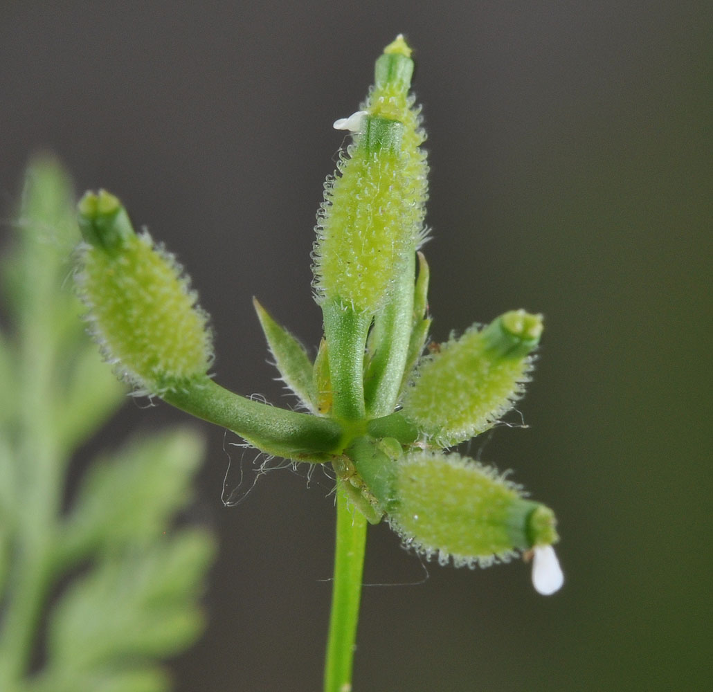
Steptoe Can; 46 32 064N 117 10 371W – Whitman Co., WA – 6/8/2009 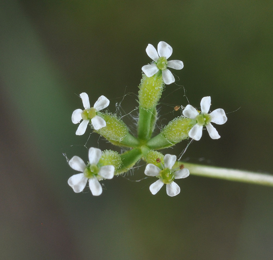
Steptoe Can; 46 32 064N 117 10 371W – Whitman Co., WA – 6/8/2009 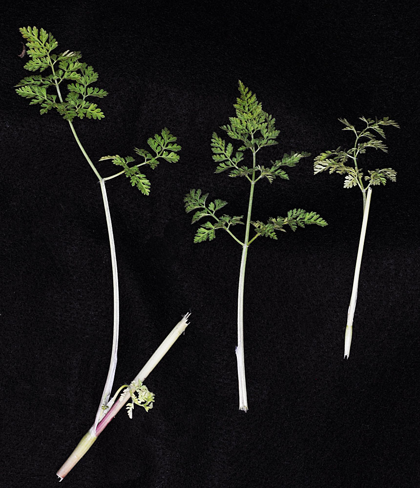
Ca. 3.5 mi E of Wishram, WA near Avery Rd; N 45.66421 W 121.04030 – Klickitat Co. – 5/20/2011 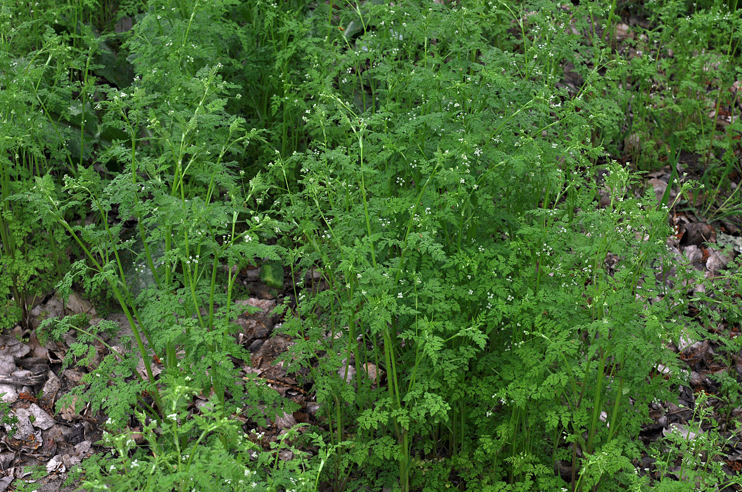
1.2 mi S of Cous Creek along the Snake River ca. 12 miles S of Asotin, WA; N 46.19329 W 116.95525 – Asotin Co. – 5/7/2011 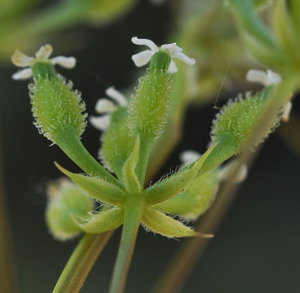
Ca. 3.5 mi E of Wishram, WA near Avery Rd; N 45.66421 W 121.04030 – Klickitat Co. – 5/20/2011 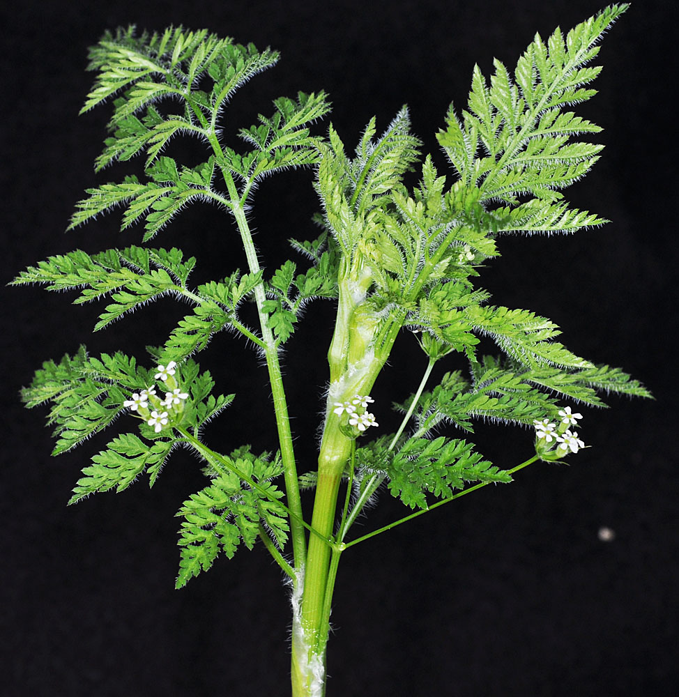
1.2 mi S of Cous Creek along the Snake River ca. 12 miles S of Asotin, WA; N 46.19329 W 116.95525 – Asotin Co. – 5/7/2011 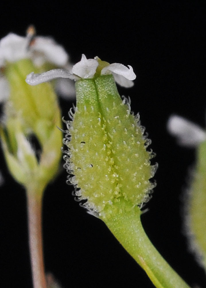
1.2 mi S of Cous Creek along the Snake River ca. 12 miles S of Asotin, WA; N 46.19329 W 116.95525 – Asotin Co. – 5/7/2011 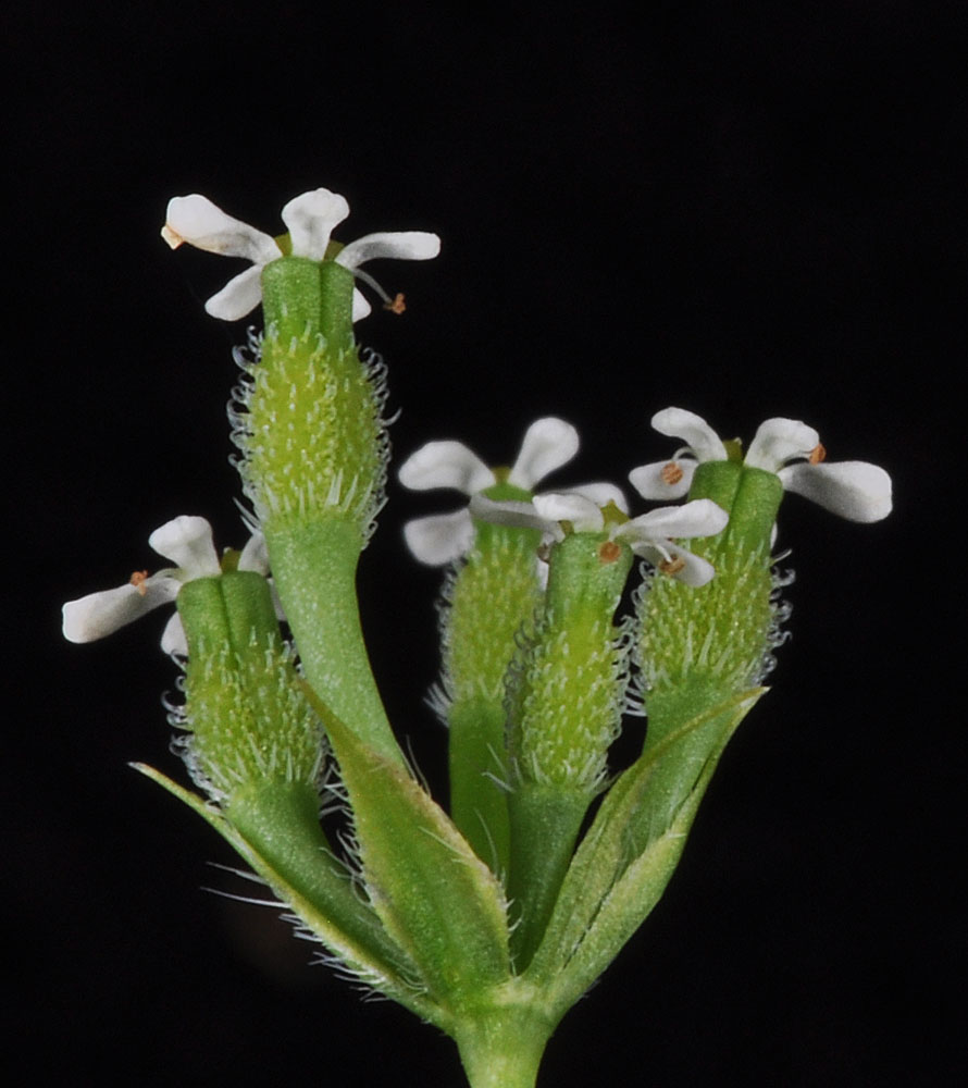
1.2 mi S of Cous Creek along the Snake River ca. 12 miles S of Asotin, WA; N 46.19329 W 116.95525 – Asotin Co. – 5/7/2011 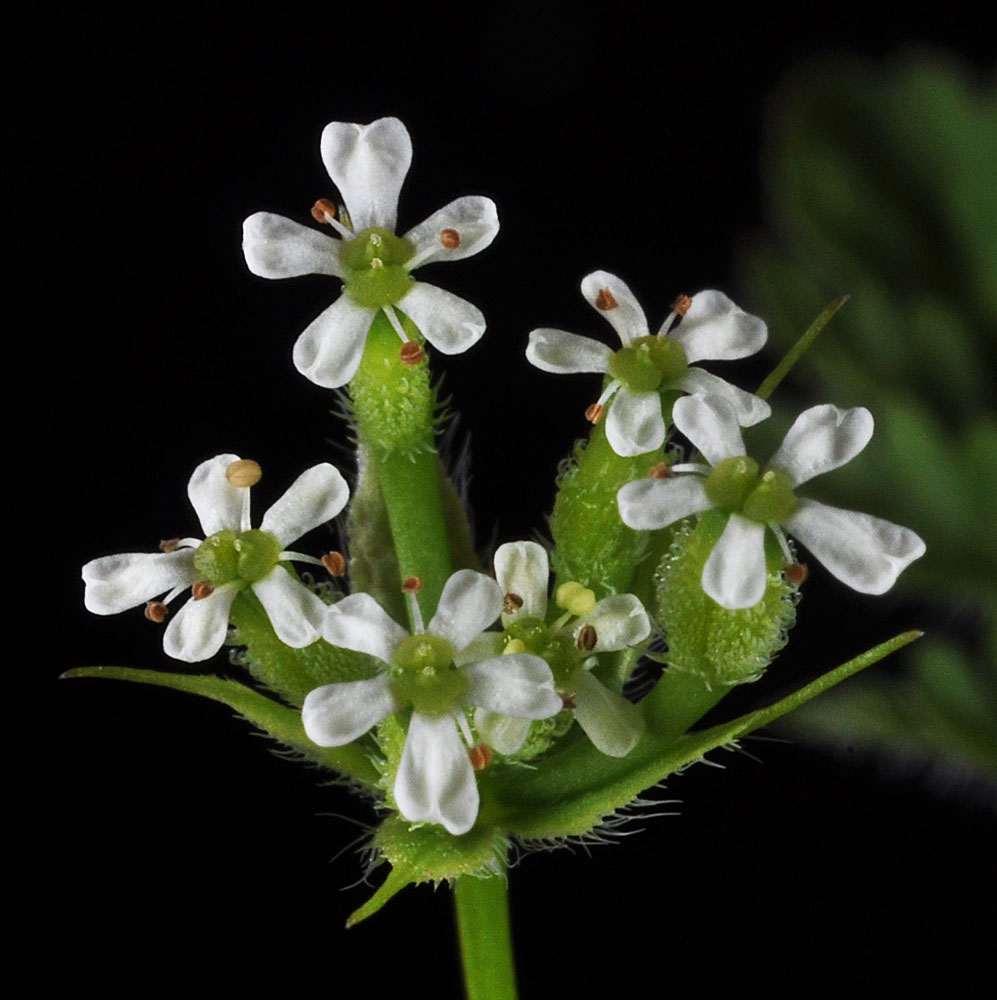
1.2 mi S of Cous Creek along the Snake River ca. 12 miles S of Asotin, WA; N 46.19329 W 116.95525 – Asotin Co. – 5/7/2011 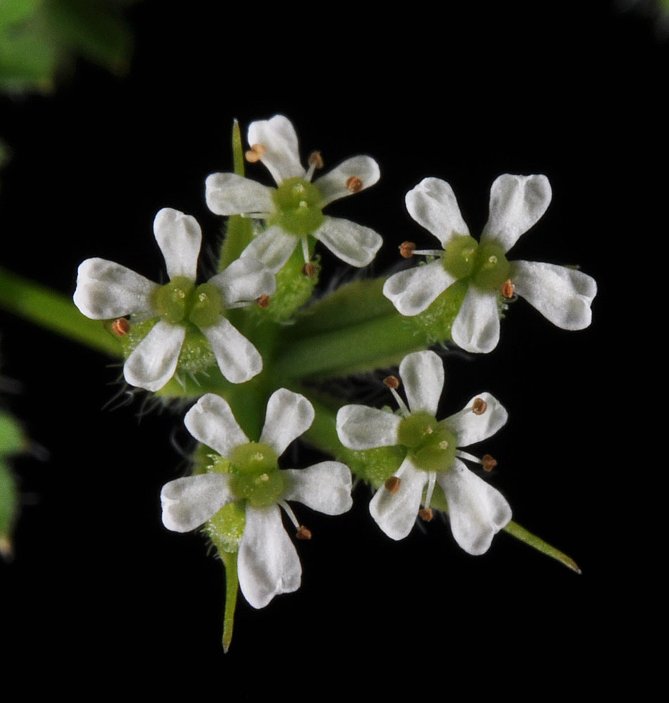
1.2 mi S of Cous Creek along the Snake River ca. 12 miles S of Asotin, WA; N 46.19329 W 116.95525 – Asotin Co. – 5/7/2011 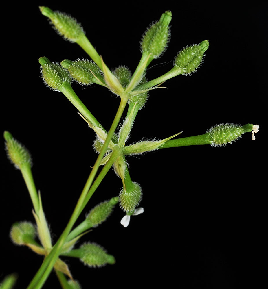
Along Old Hwy 14 just N of Rowland Lake; 4.84 air mi WNW of Lyle, WA; N 45.70952 W 121.38455; Klickitat Co.; 5/11/2015 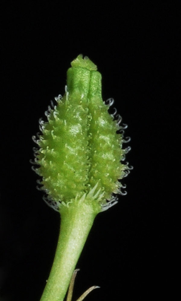
Along Old Hwy 14 just N of Rowland Lake; 4.84 air mi WNW of Lyle, WA; N 45.70952 W 121.38455; Klickitat Co.; 5/11/2015 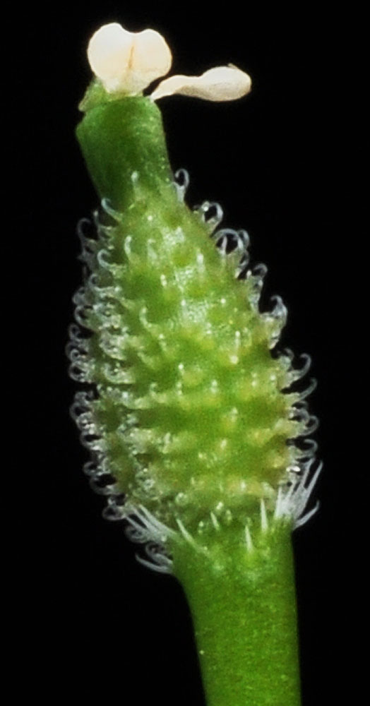
Along Old Hwy 14 just N of Rowland Lake; 4.84 air mi WNW of Lyle, WA; N 45.70952 W 121.38455; Klickitat Co.; 5/11/2015 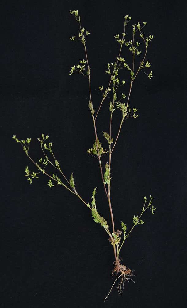
Near the jct of Hardy and Lamont Rds NE of Lamont, WA; Whitman Co.; 5/23/2018


