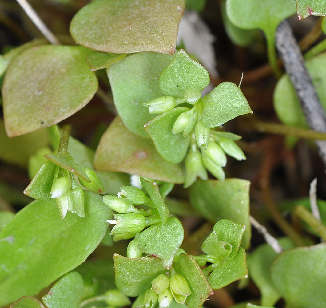
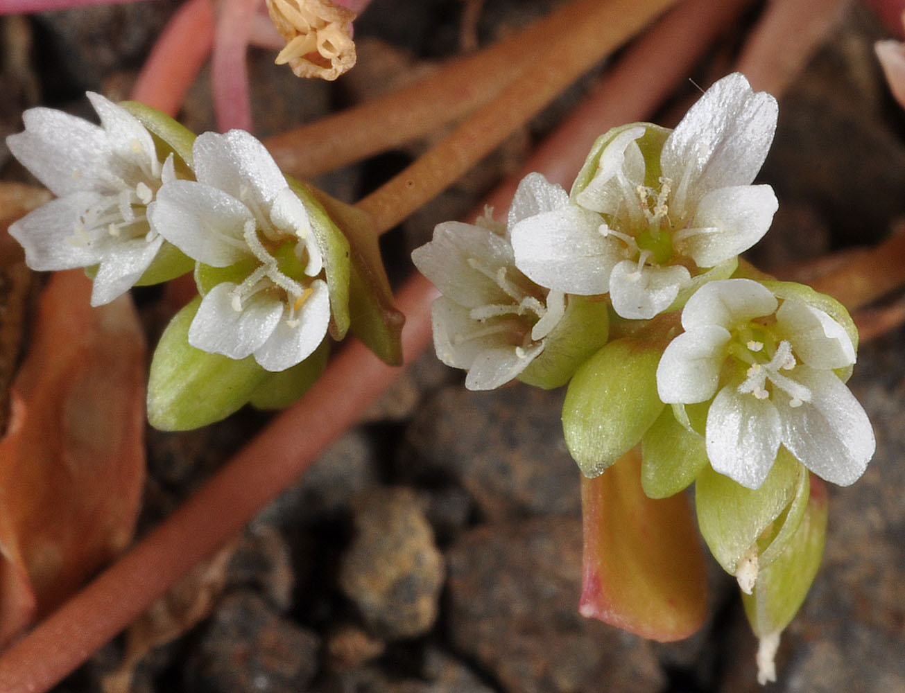
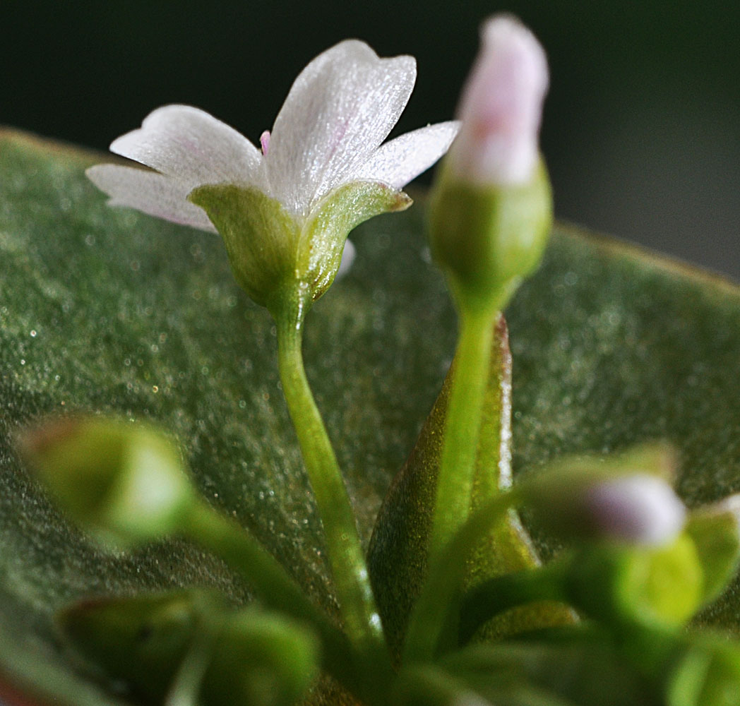
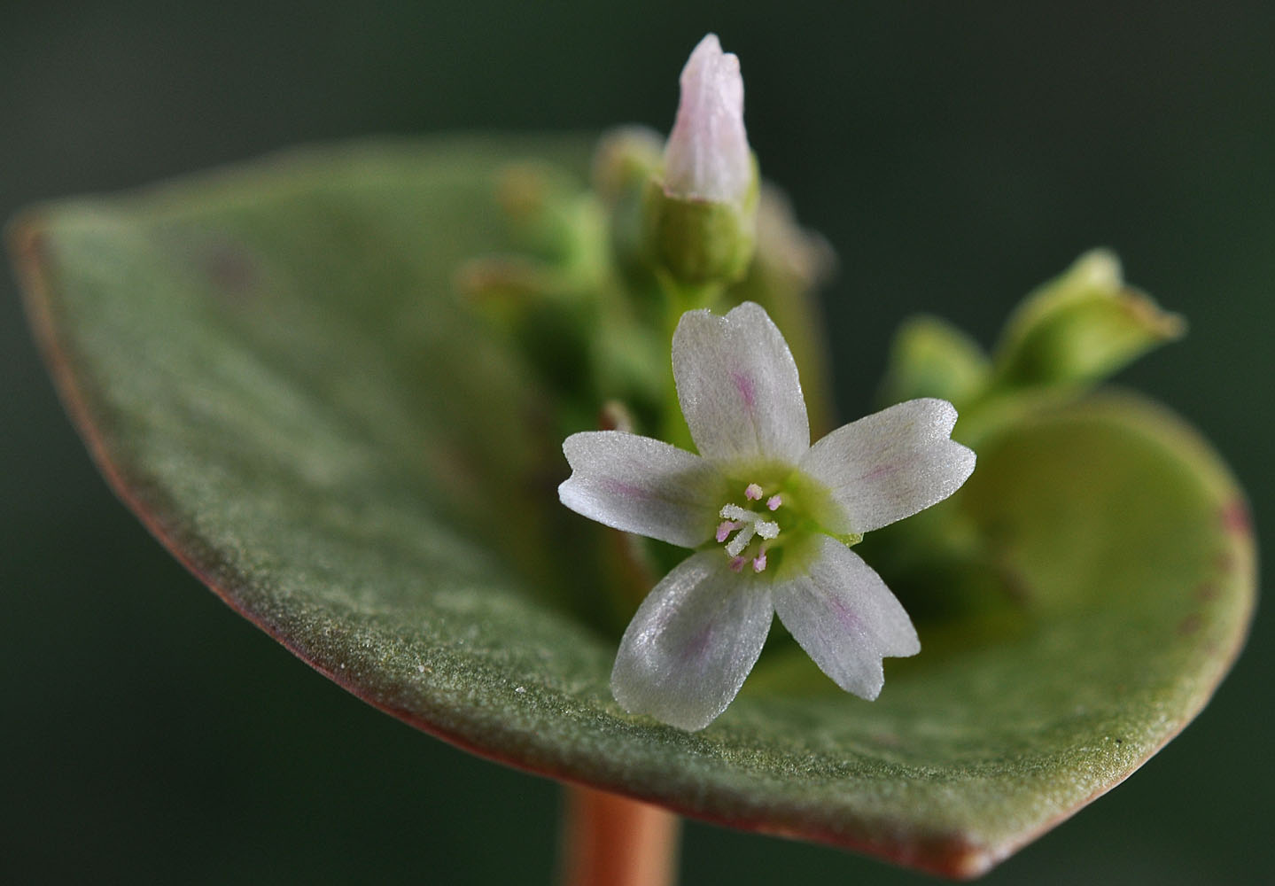
cushion miner’s lettuce, erubescent lettuce, red miners lettuce
Eastern Washington
Native
Conservation Status
Notes
Click on any image to enlarge it.
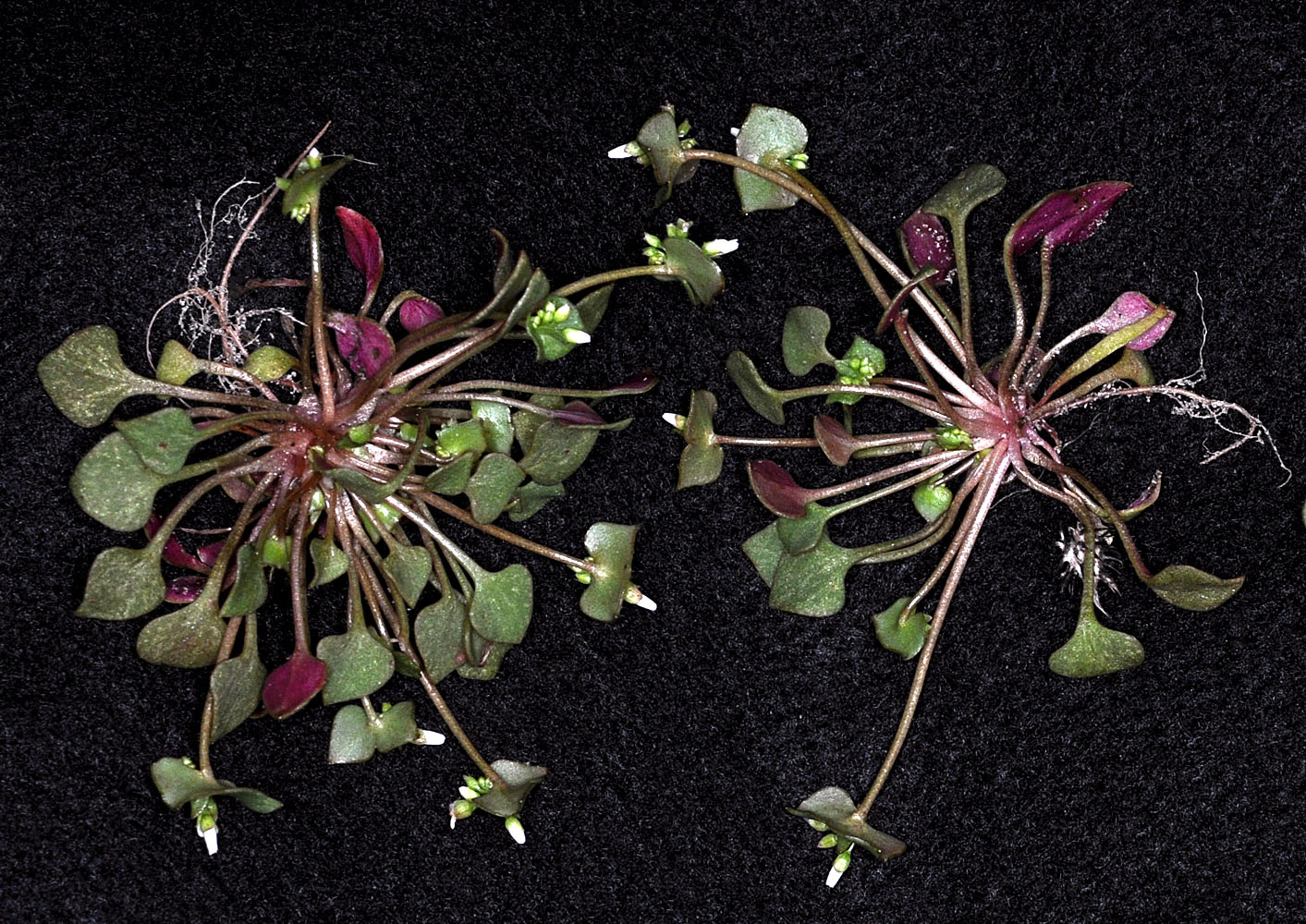
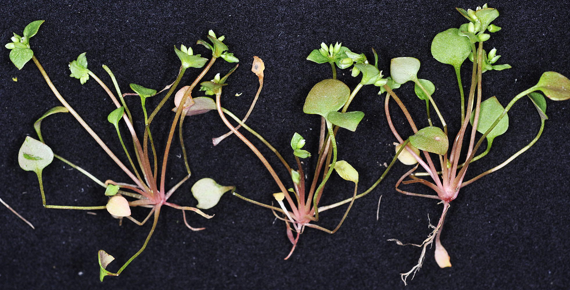
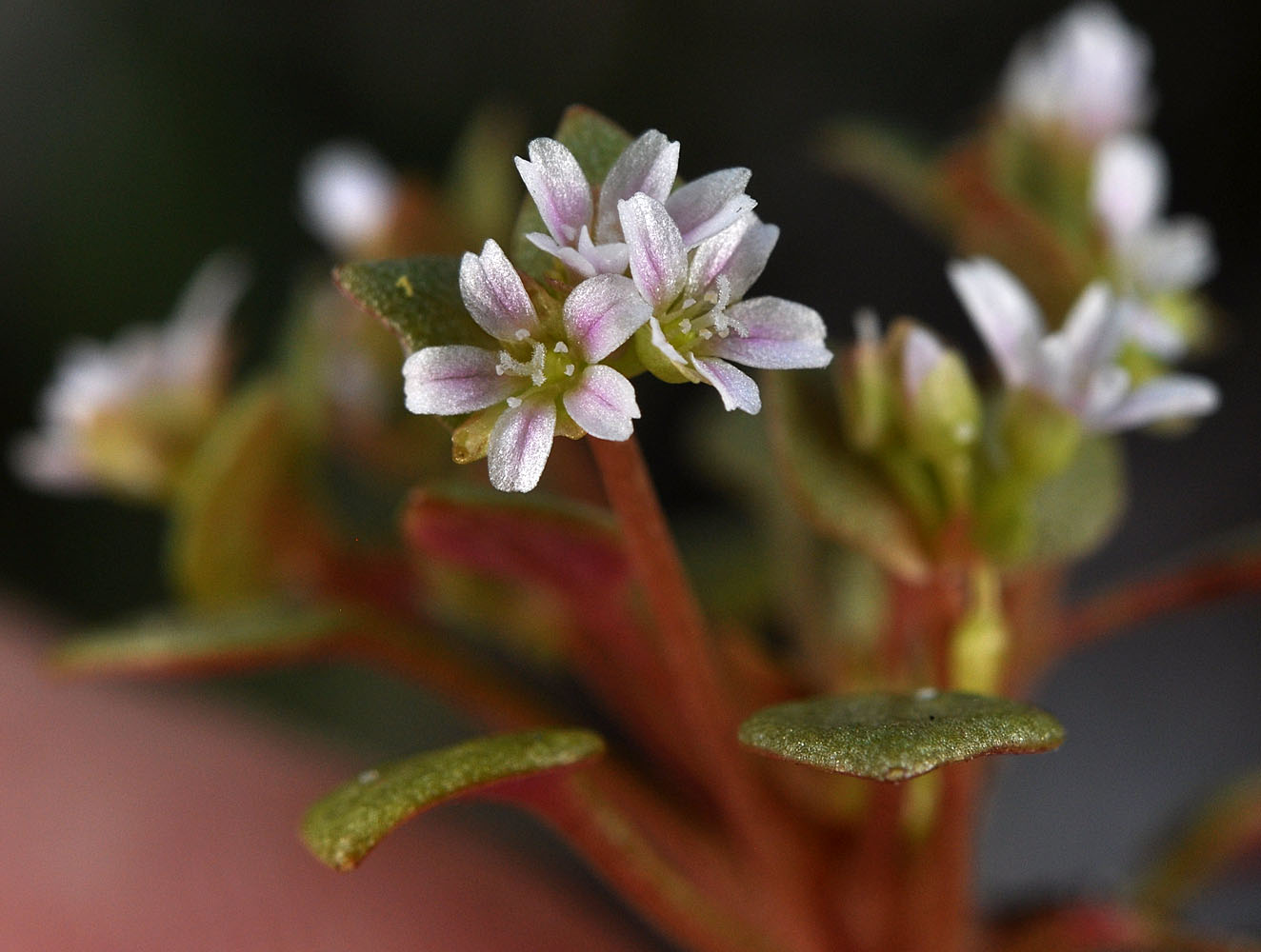
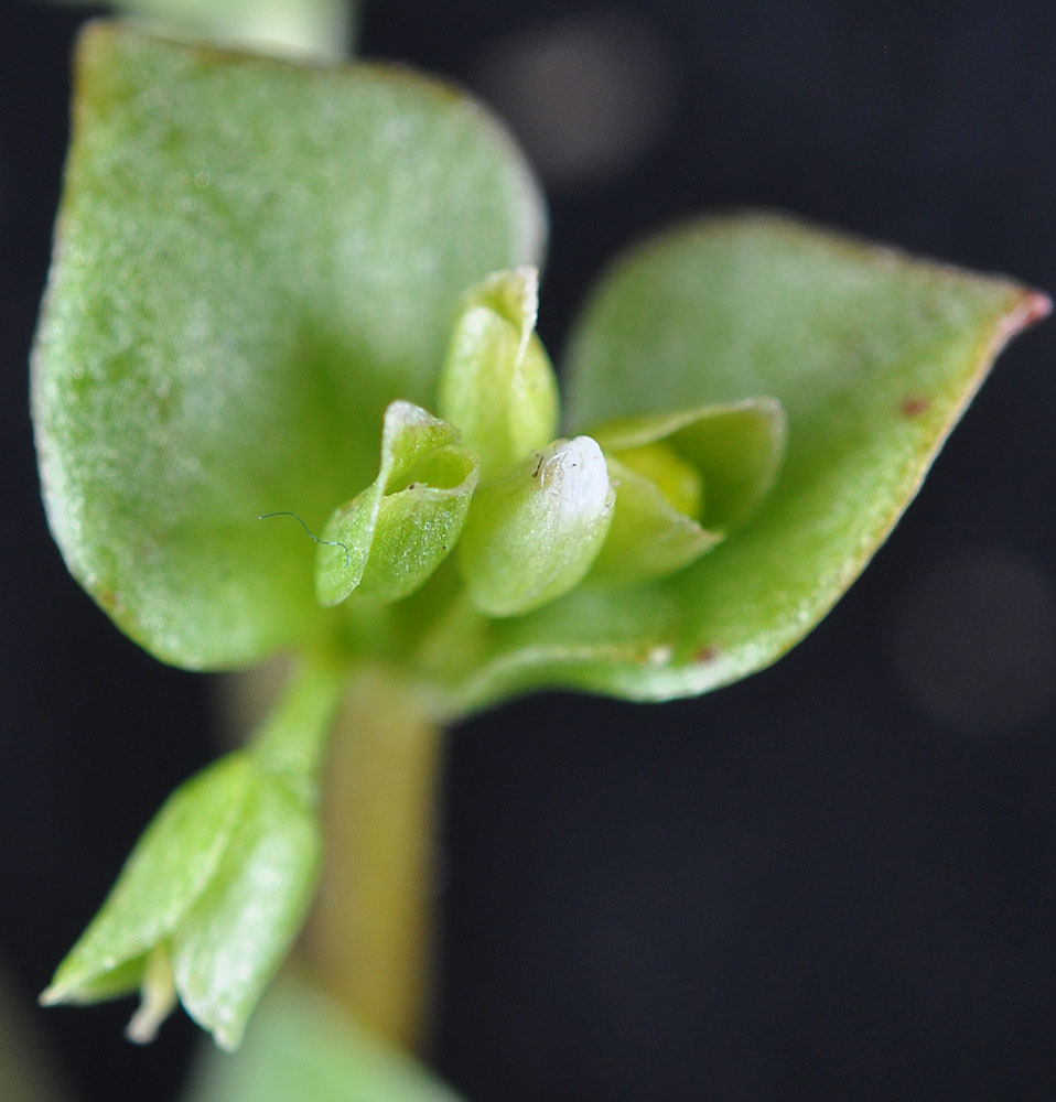
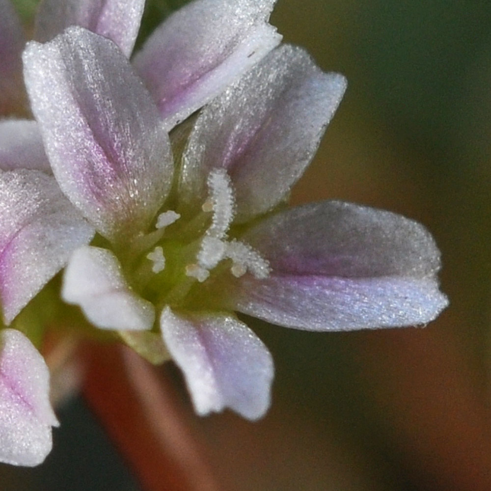
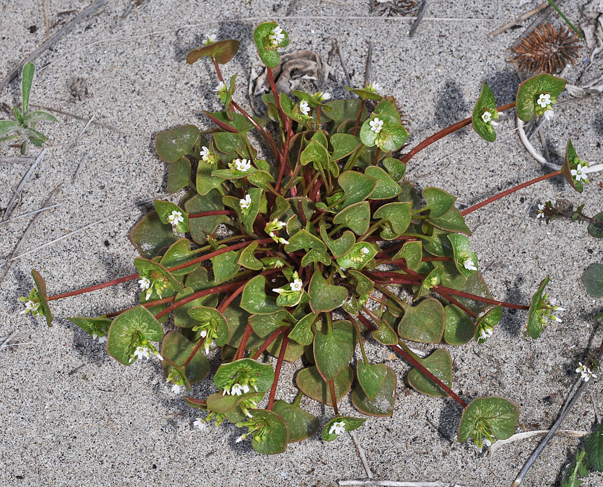
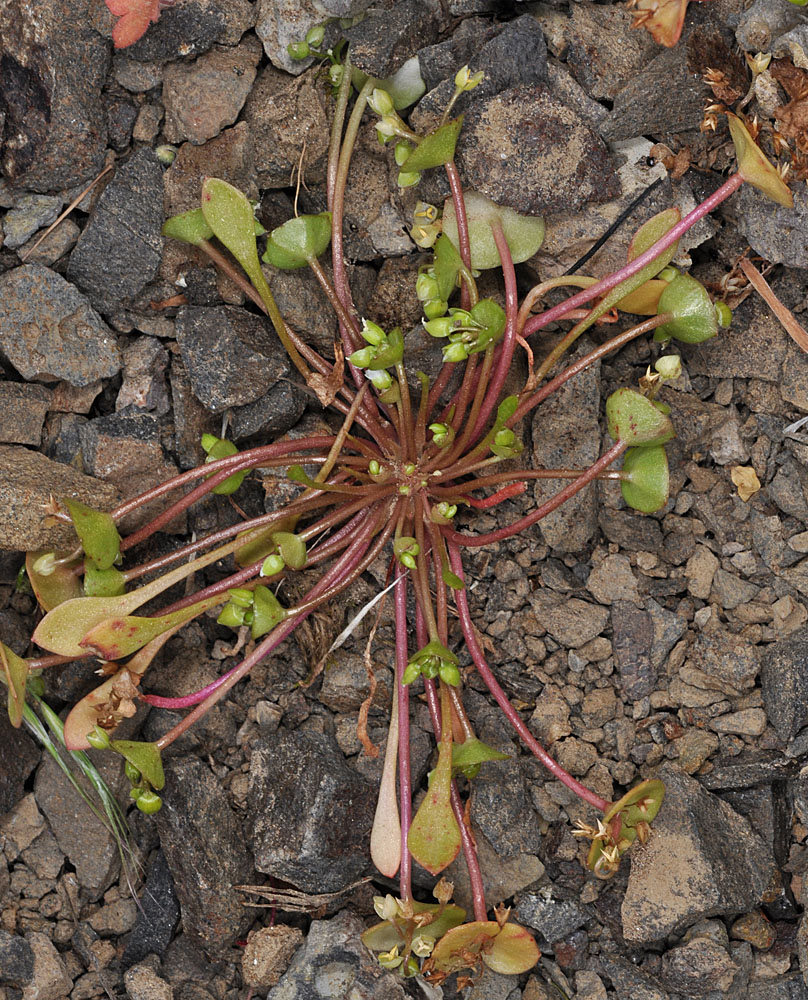
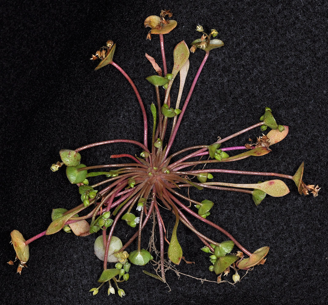
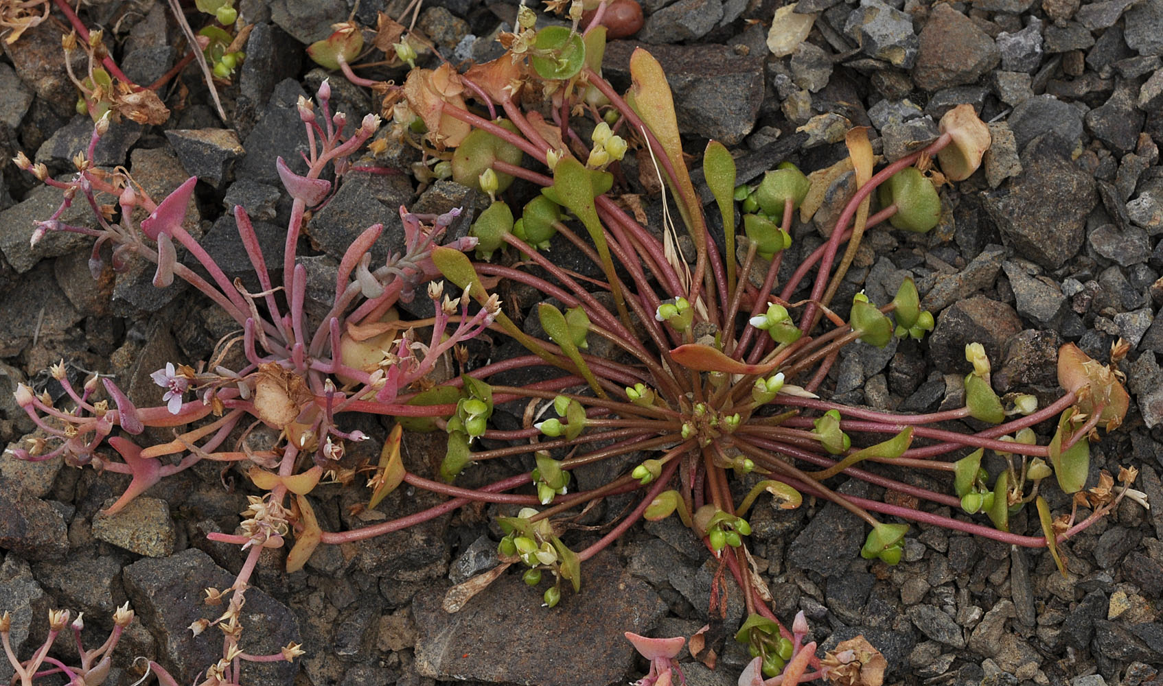
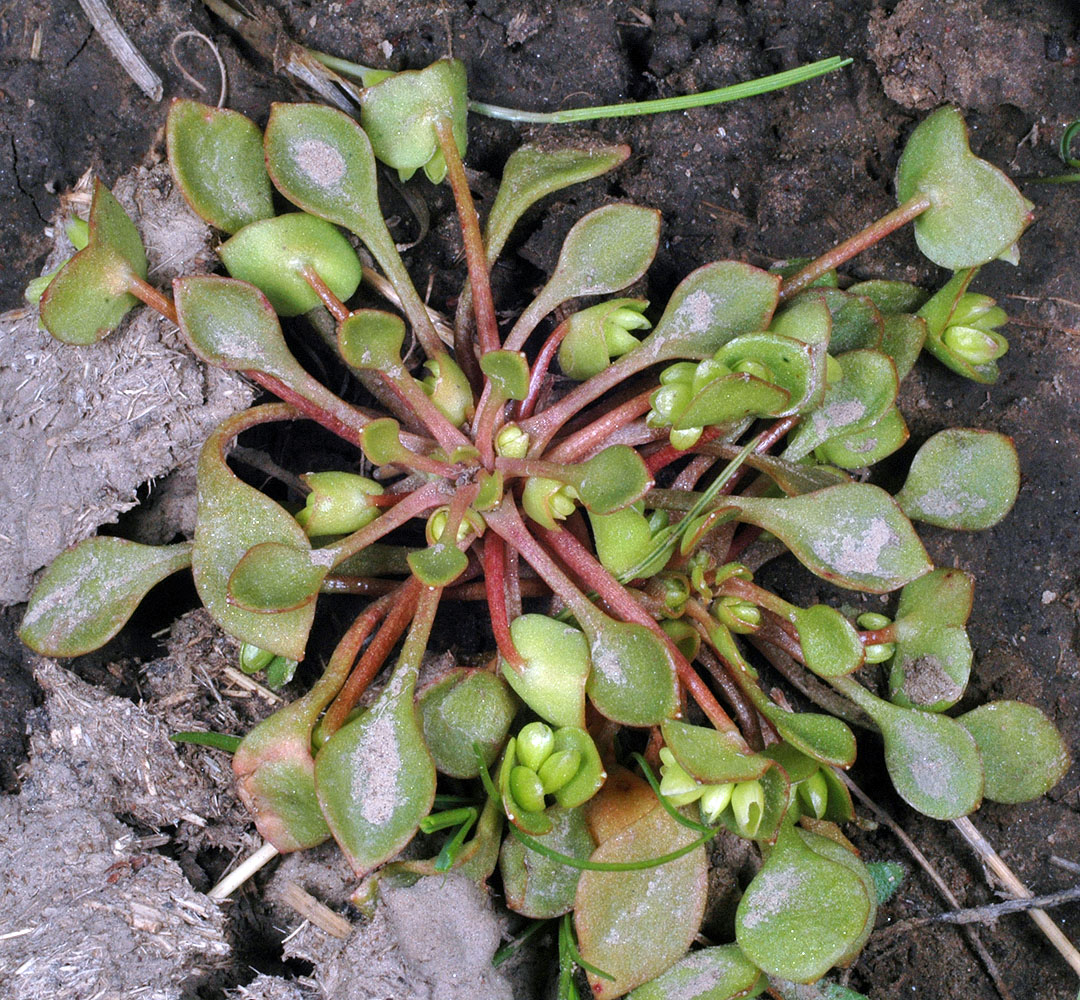
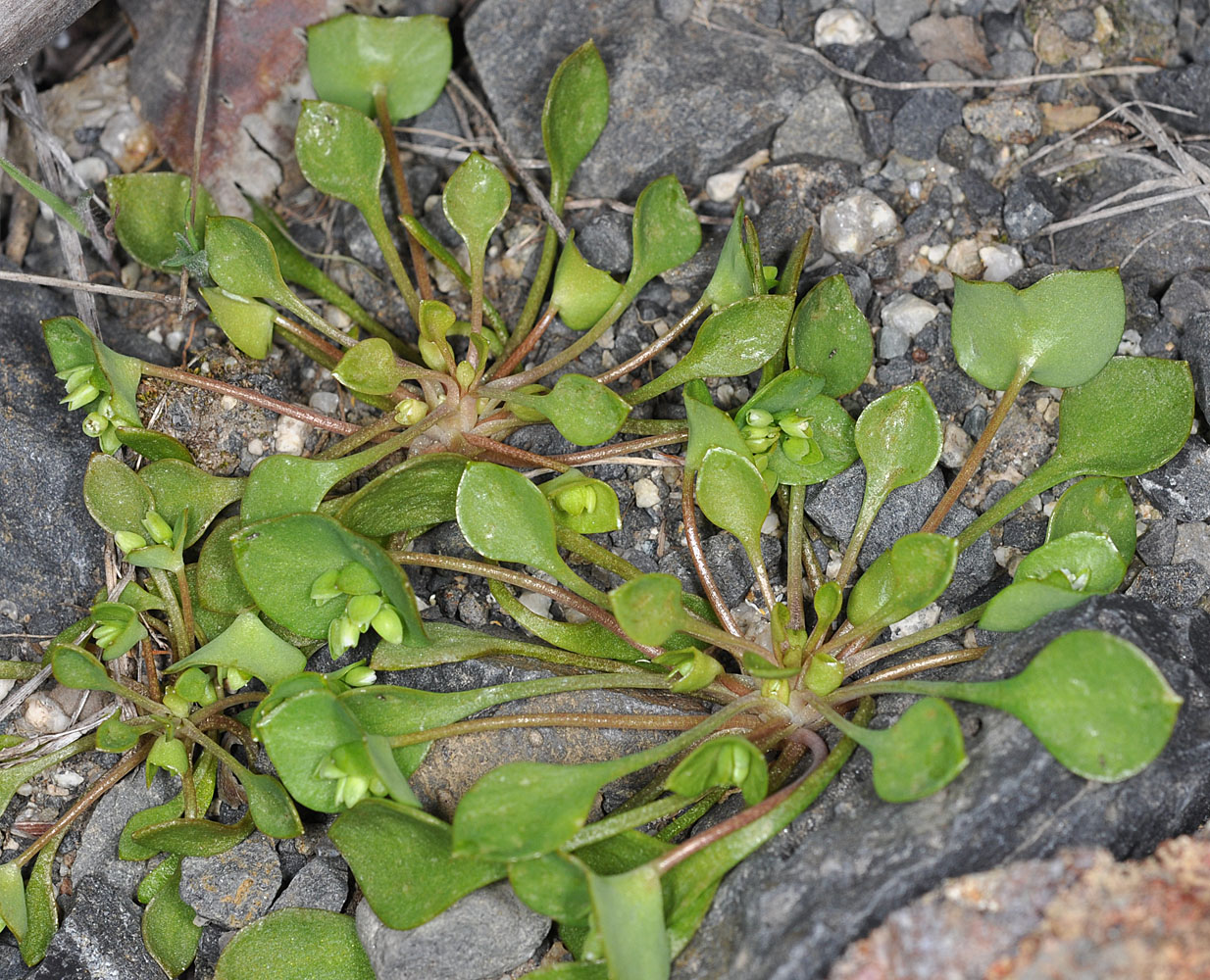
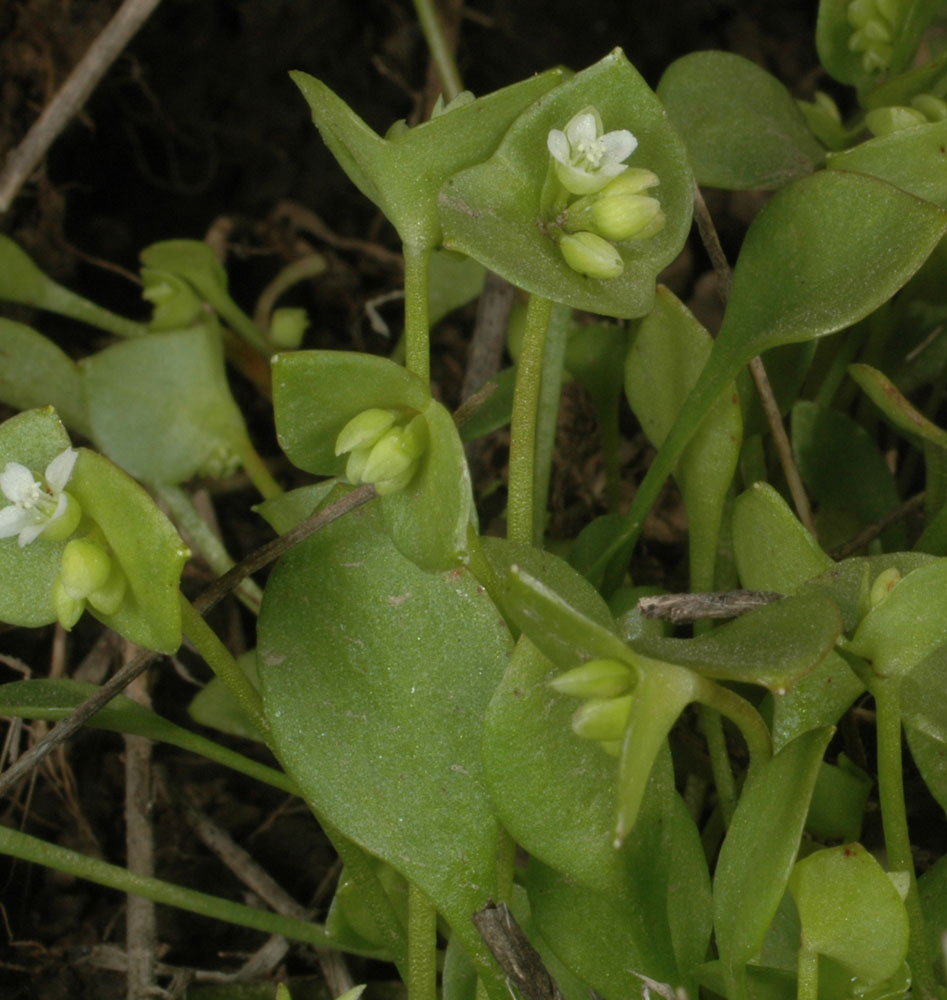
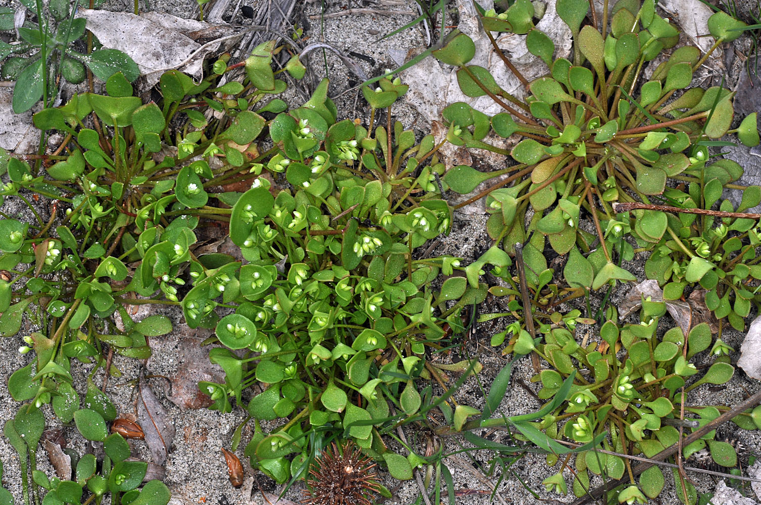
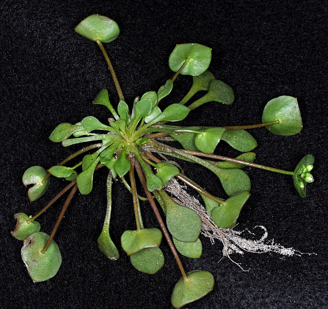
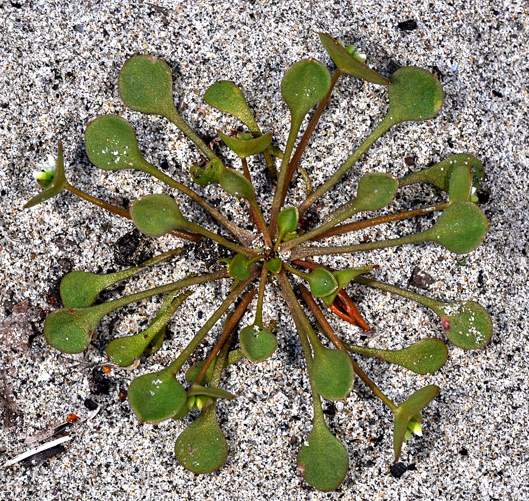
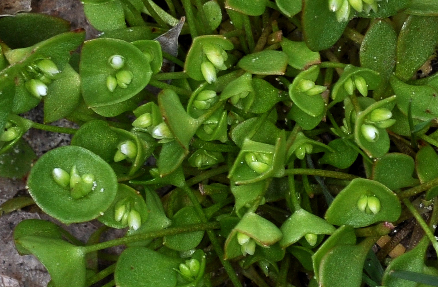
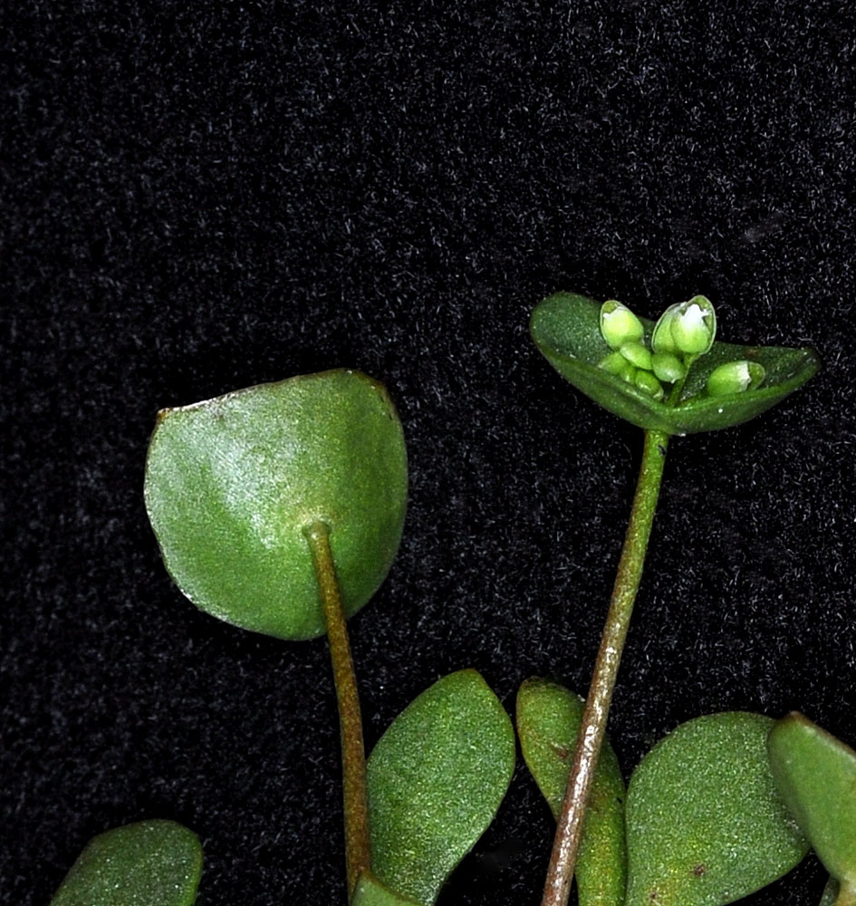
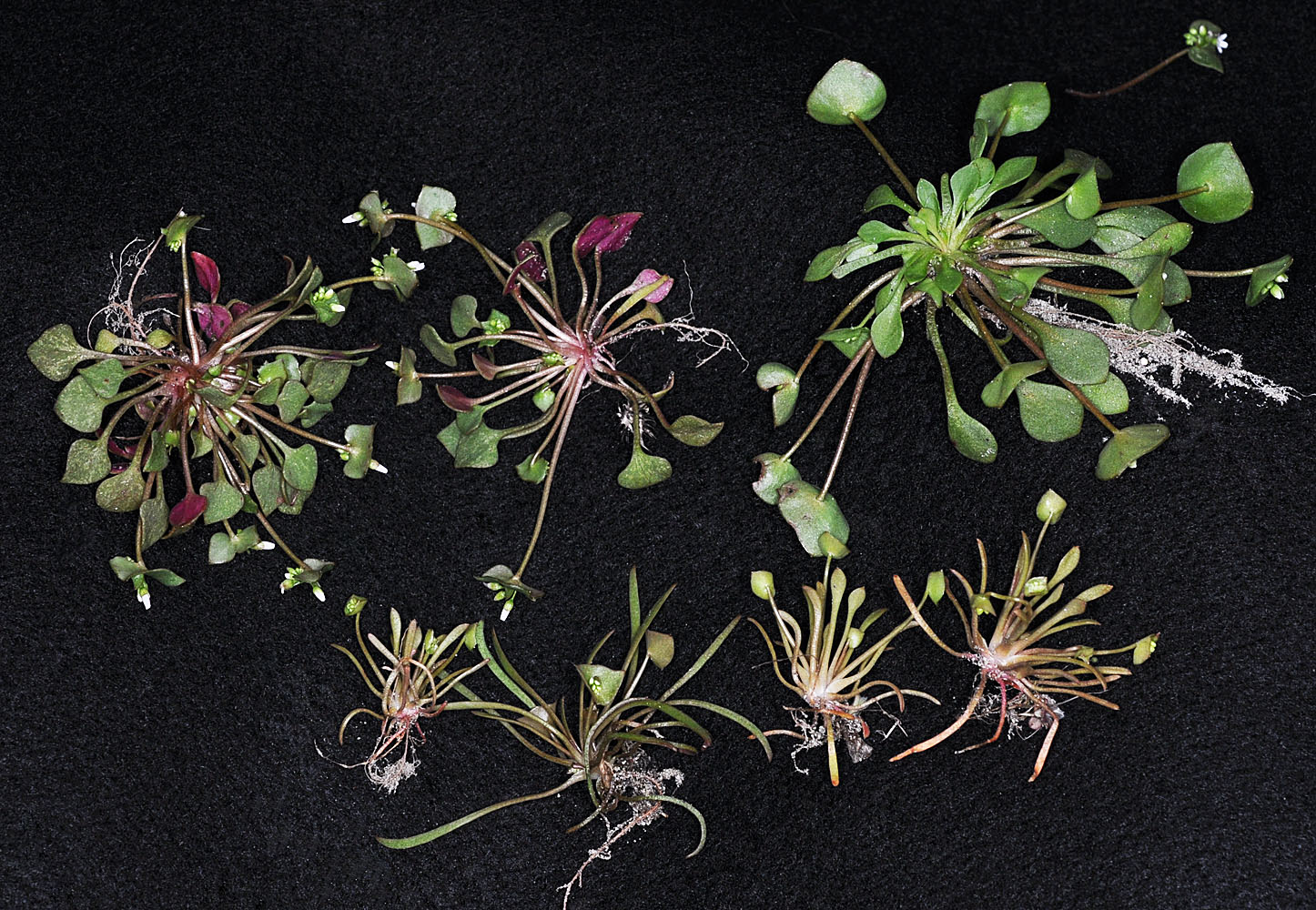
Along the Snake River S of Asotin, WA, 1.2 mi S of Couse Crk; N 46.19323 W 116.95413 – Asotin Co. – 4/1/2011Jct of Ritchey and Cameron Rds W of Cheney, WA – Spokane Co. – 4/16/2010Along the Snake River S of Asotin, WA, 1.2 mi S of Couse Crk; N 46.19323 W 116.95413 – Asotin Co. – 4/1/2011Jct of Ritchey and Cameron Rds W of Cheney, WA – Spokane Co. – 4/16/2010Jct of Ritchey and Cameron Rds W of Cheney, WA – Spokane Co. – 4/16/2010Along the Snake River S of Asotin, WA, 1.2 mi S of Couse Crk; N 46.19323 W 116.95413 – Asotin Co. – 4/1/2011Along the Snake River S of Asotin, WA, 1.2 mi S of Couse Crk; N 46.19323 W 116.95413 – Asotin Co. – 4/1/2011Ca. 14.4 miles S of Asotin, WA along Snake R.; N 46.15851 W 116.93011; Asotin Co.; 4/3/2012Ca. 14.4 miles S of Asotin, WA along Snake R.; N 46.15851 W 116.93011; Asotin Co.; 4/3/2012Ca. 14.4 miles S of Asotin, WA along Snake R.; N 46.15851 W 116.93011; Asotin Co.; 4/3/20127.3 mi E of THe Dalles Bridge (Hwy 197) along Freeway Cliffs (I-80) – Wasco Co., OR – 5/2/20107.3 mi E of THe Dalles Bridge (Hwy 197) along Freeway Cliffs (I-80) – Wasco Co., OR – 5/2/20107.3 mi E of THe Dalles Bridge (Hwy 197) along Freeway Cliffs (I-80) – Wasco Co., OR – 5/2/20107.3 mi E of THe Dalles Bridge (Hwy 197) along Freeway Cliffs (I-80) – Wasco Co., OR – 5/2/20107.3 mi E of THe Dalles Bridge (Hwy 197) along Freeway Cliffs (I-80) – Wasco Co., OR – 5/2/20107.3 mi E of THe Dalles Bridge (Hwy 197) along Freeway Cliffs (I-80) – Wasco Co., OR – 5/2/2010 (Claytonia exiqua on the left C. rubra on the right)Jct of Ritchey and Cameron Rds W of Cheney, WA – Spokane Co. – 4/16/2010Jct of Ritchey and Cameron Rds W of Cheney, WA – Spokane Co. – 4/16/2010Jct of Ritchey and Cameron Rds W of Cheney, WA – Spokane Co. – 4/16/2010Along the Snake River S of Asotin, WA, 1.2 mi S of Couse Crk; N 46.19323 W 116.95413 – Asotin Co. – 4/1/2011Along the Snake River S of Asotin, WA, 1.2 mi S of Couse Crk; N 46.19323 W 116.95413 – Asotin Co. – 4/1/2011Along the Snake River S of Asotin, WA, 1.2 mi S of Couse Crk; N 46.19323 W 116.95413 – Asotin Co. – 4/1/2011Along the Snake River S of Asotin, WA, 1.2 mi S of Couse Crk; N 46.19323 W 116.95413 – Asotin Co. – 4/1/2011Along the Snake River S of Asotin, WA, 1.2 mi S of Couse Crk; N 46.19323 W 116.95413 – Asotin Co. – 4/1/2011Along the Snake River S of Asotin, WA, 1.2 mi S of Couse Crk; N 46.19323 W 116.95413 – Asotin Co. – 4/1/2011 —- This image holds 3 different taxa: Claytonia parviflora ssp. parviflora (bottem 4 specimens), C. rubra ssp. rubra (upper left two specimens) and C. rubra ssp. depressa in the upper right. These individuals were all growing within a 10 ft diameter area.