| Scientific Name | Polygonum majus (Meisn.) Piper |
| Family | Polygonaceae |
| Common Names | Palouse knotweed, wiry knotweed |
| Eastern Washington | Native |
| Synonyms | None |
| Conservation Status | |
| Notes |
Click on any image to enlarge it.
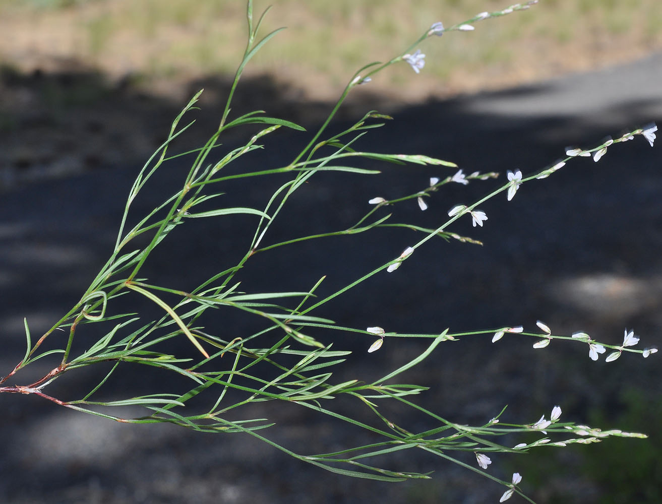
W. of Cheney off Baker rd 0.4 mi E of Ritchey rd. – Spokane Co., WA – 7/17/2009 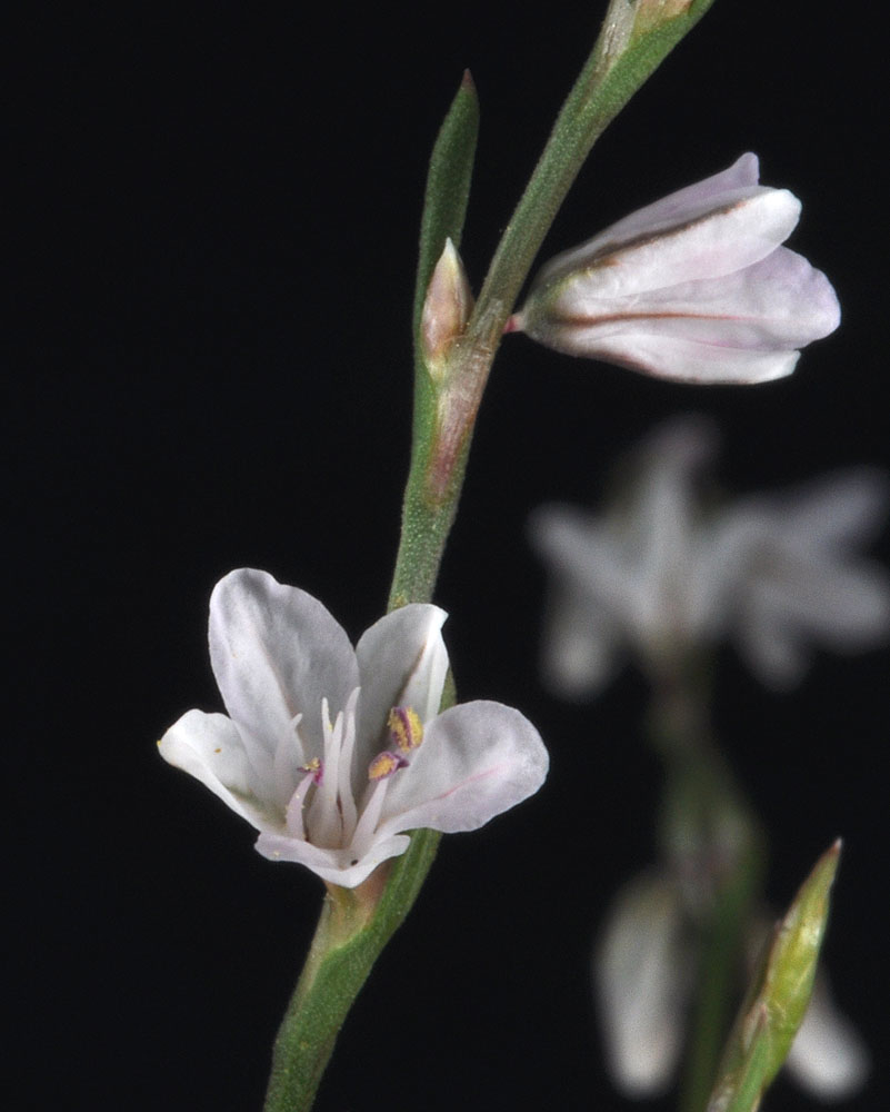
W. of Cheney off Baker rd 0.4 mi E of Ritchey rd. – Spokane Co., WA – 7/17/2009 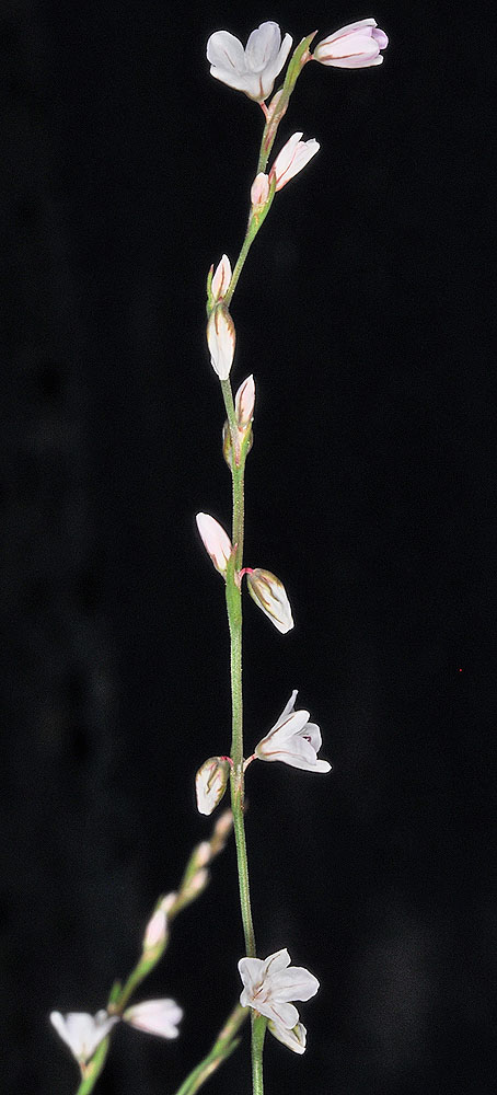
W. of Cheney off Baker rd 0.4 mi E of Ritchey rd. – Spokane Co., WA – 7/17/2009 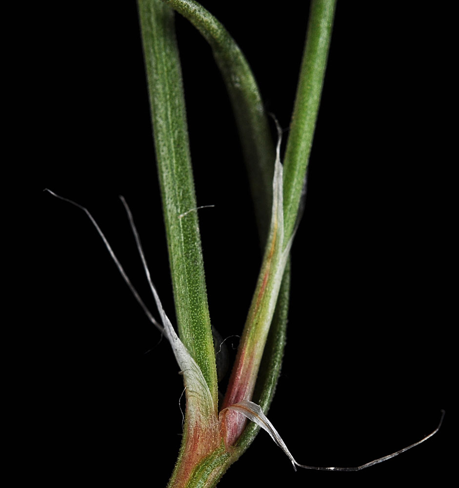
Sand dunes west of the mouth of Rock Creek, w of Roosevelt, WA; N 45.70340 W 120.46707; Klickitat Co.; 6/15/2012 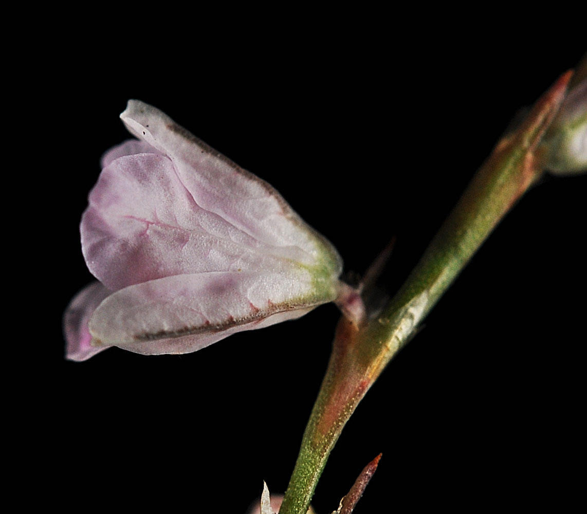
Sand dunes west of the mouth of Rock Creek, w of Roosevelt, WA; N 45.70340 W 120.46707; Klickitat Co.; 6/15/2012 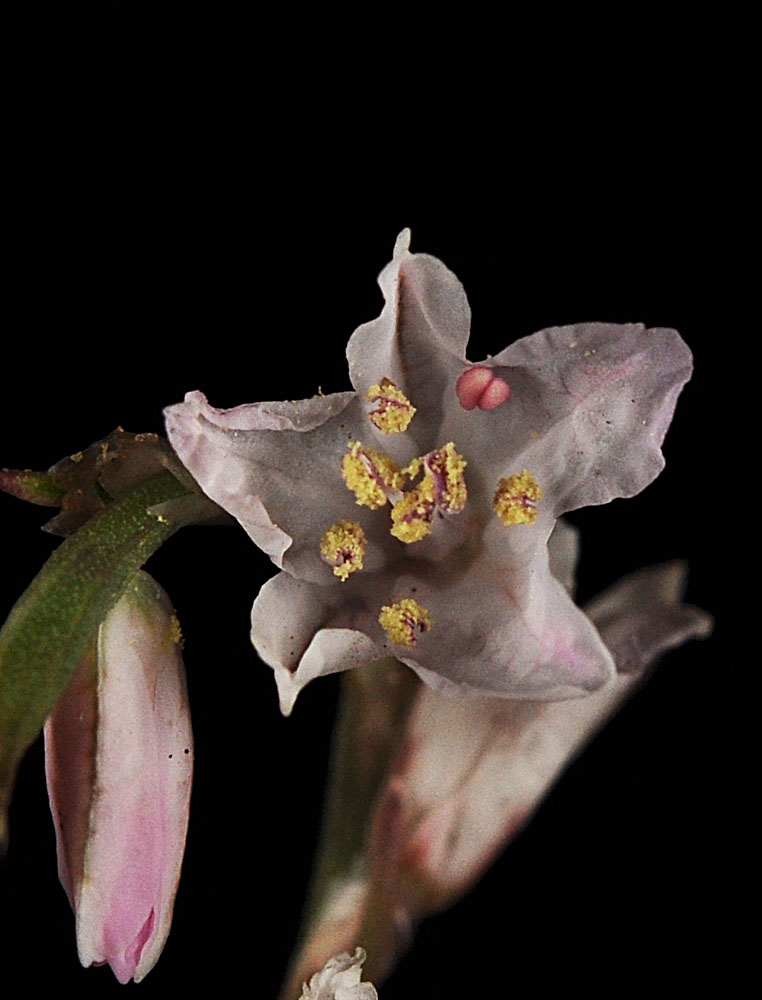
Sand dunes west of the mouth of Rock Creek, w of Roosevelt, WA; N 45.70340 W 120.46707; Klickitat Co.; 6/15/2012 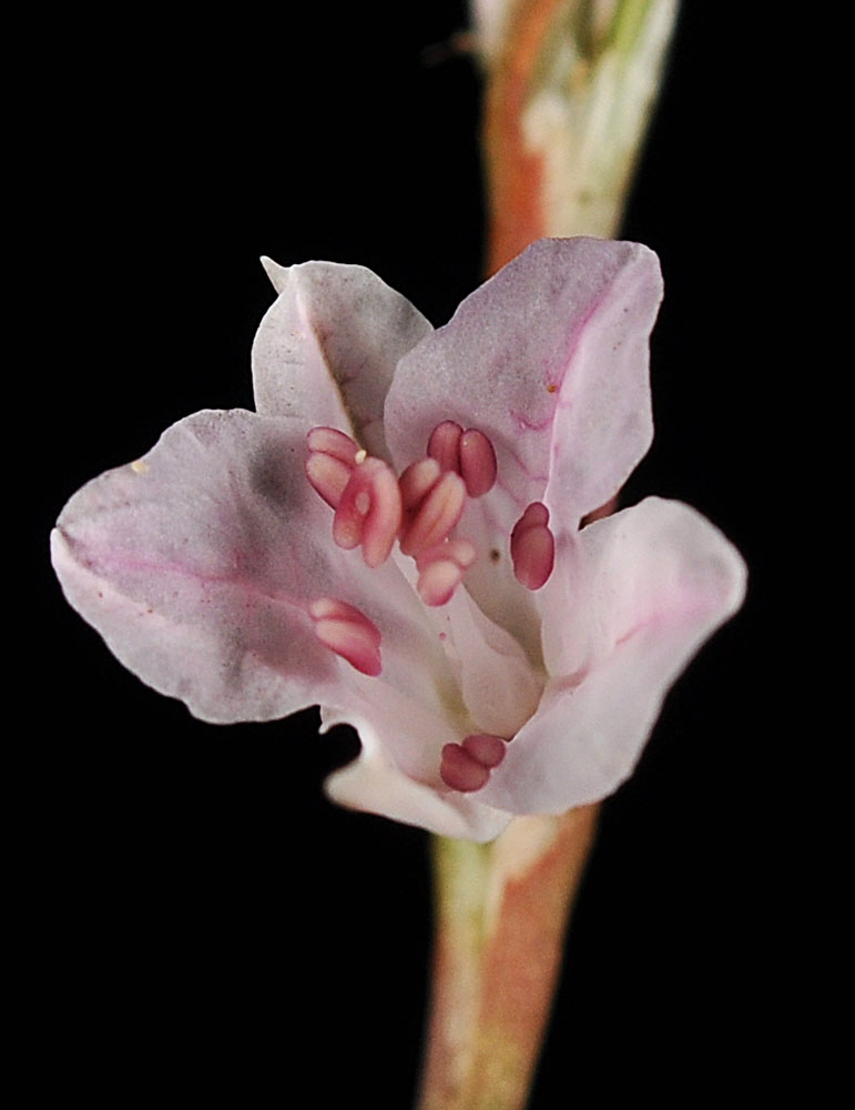
Sand dunes west of the mouth of Rock Creek, w of Roosevelt, WA; N 45.70340 W 120.46707; Klickitat Co.; 6/15/2012 
Sand dunes west of the mouth of Rock Creek, w of Roosevelt, WA; N 45.70340 W 120.46707; Klickitat Co.; 6/15/2012 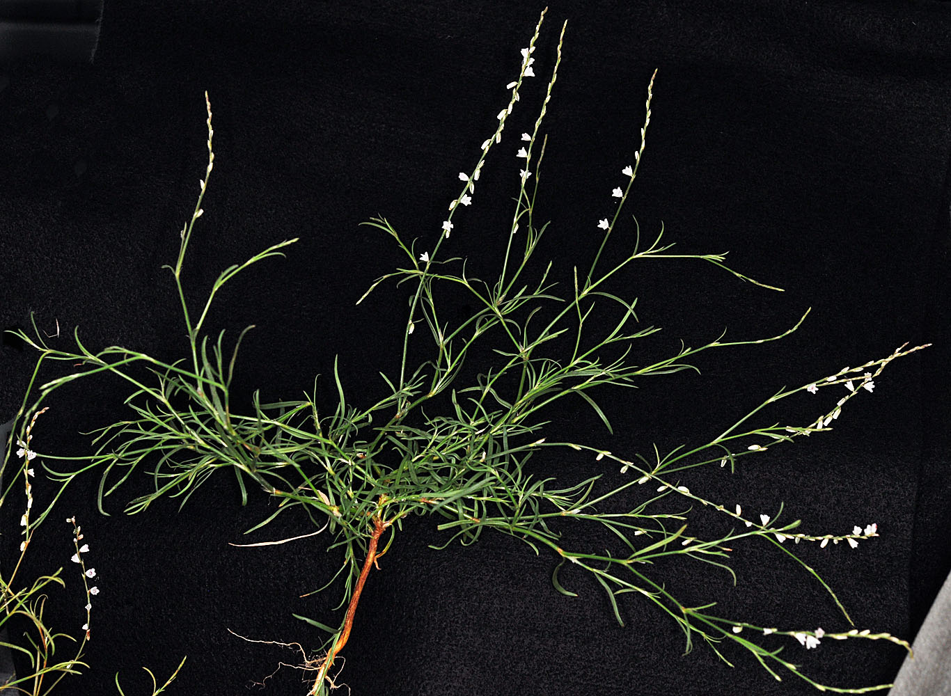
S of Vantage, WA; Ca. 0.6 mi S of Wanapum Dam; N 46.86242 W 119.97033; Kittitas Co.; 6/17/2013 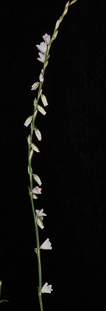
S of Vantage, WA; Ca. 0.6 mi S of Wanapum Dam; N 46.86242 W 119.97033; Kittitas Co.; 6/17/2013 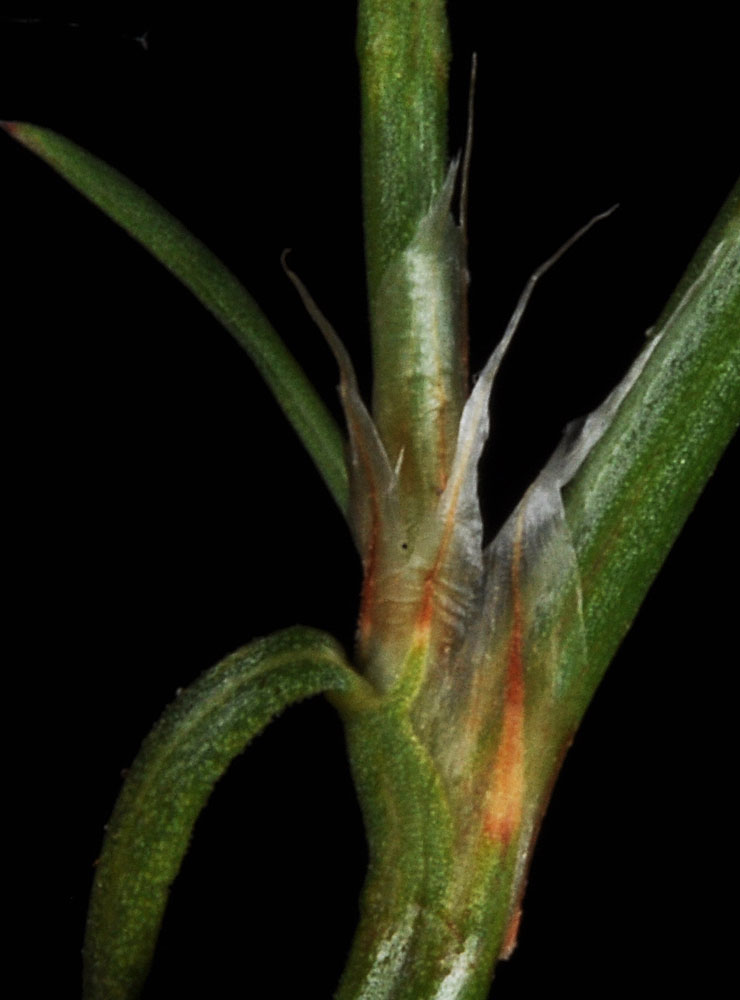
S of Vantage, WA; Ca. 0.6 mi S of Wanapum Dam; N 46.86242 W 119.97033; Kittitas Co.; 6/17/2013 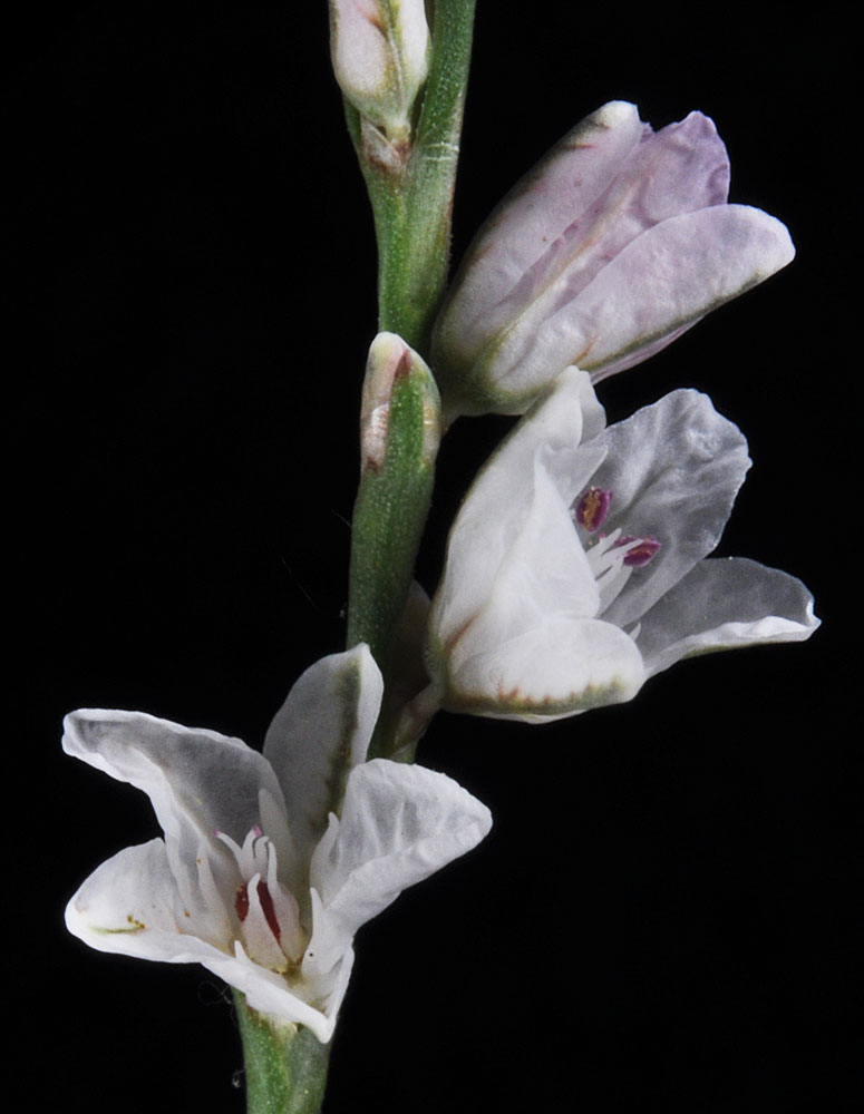
S of Vantage, WA; Ca. 0.6 mi S of Wanapum Dam; N 46.86242 W 119.97033; Kittitas Co.; 6/17/2013 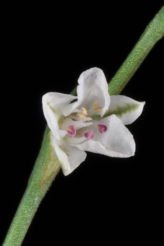
S of Vantage, WA; Ca. 0.6 mi S of Wanapum Dam; N 46.86242 W 119.97033; Kittitas Co.; 6/17/2013 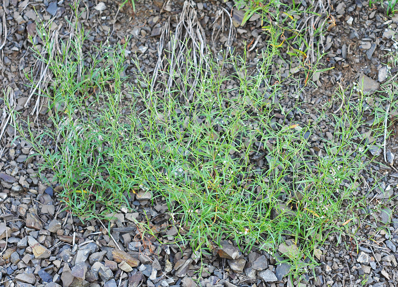
Cliff base N of W bridge at Kamiah, ID along Hwy 12 and Woodland Rd.; N 46.23109 W 116.01592; Idaho Co.; 6/7/2015 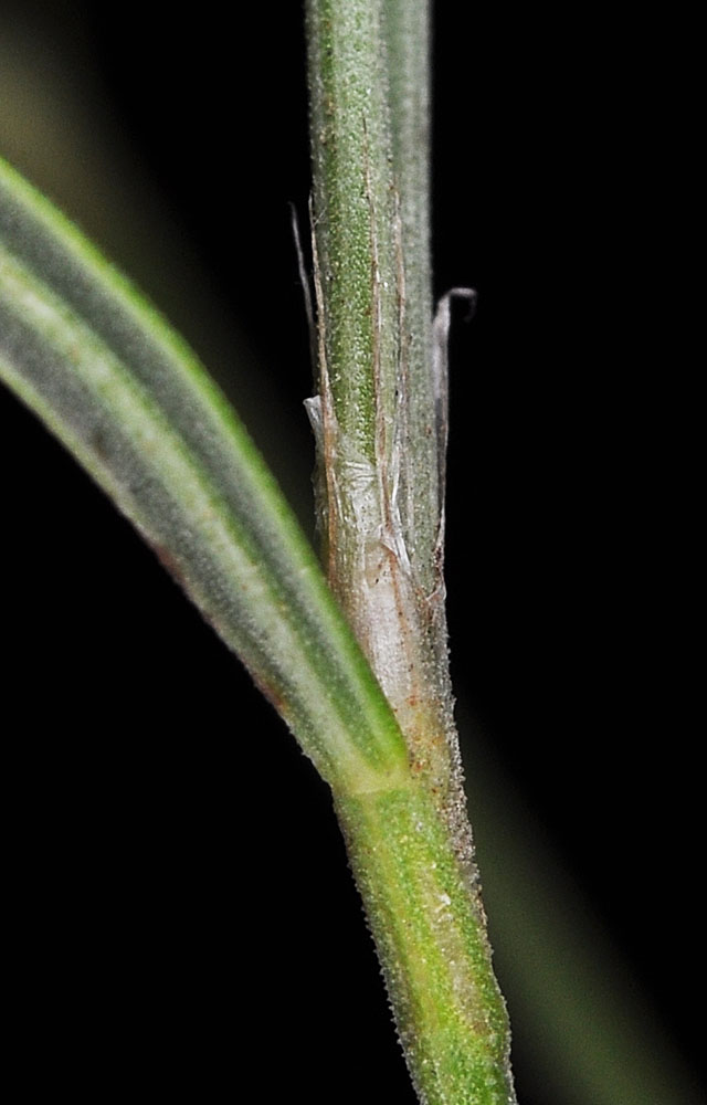
Cliff base N of W bridge at Kamiah, ID along Hwy 12 and Woodland Rd.; N 46.23109 W 116.01592; Idaho Co.; 6/7/2015 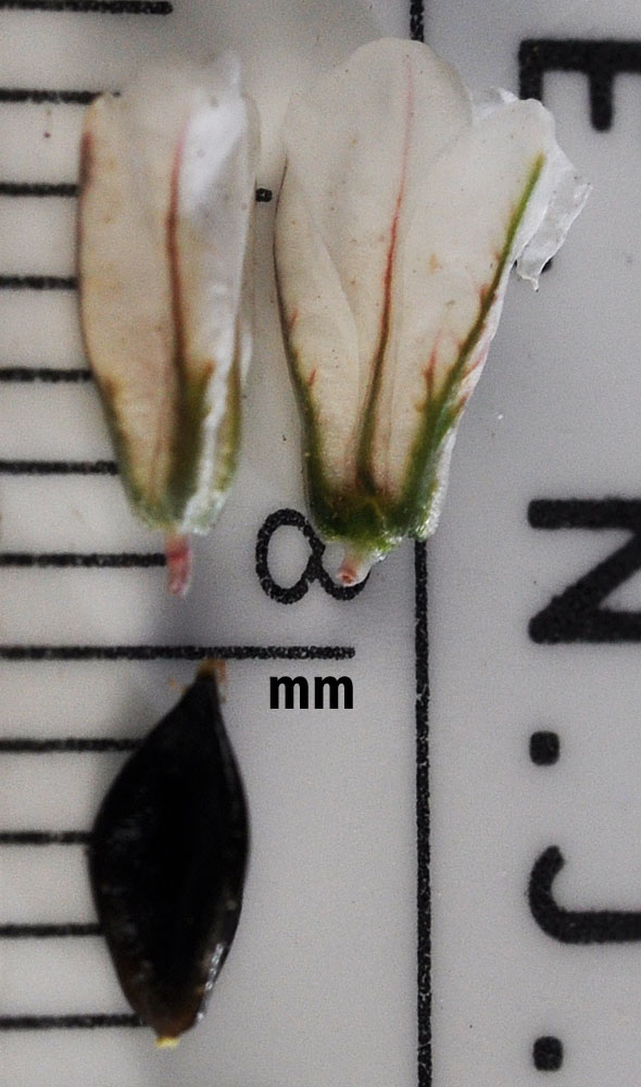
Cliff base N of W bridge at Kamiah, ID along Hwy 12 and Woodland Rd.; N 46.23109 W 116.01592; Idaho Co.; 6/7/2015 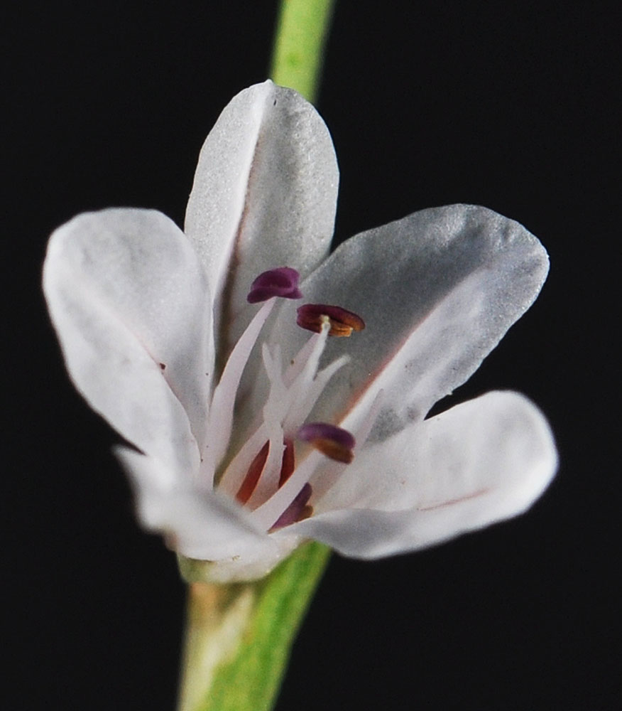
Cliff base N of W bridge at Kamiah, ID along Hwy 12 and Woodland Rd.; N 46.23109 W 116.01592; Idaho Co.; 6/7/2015


