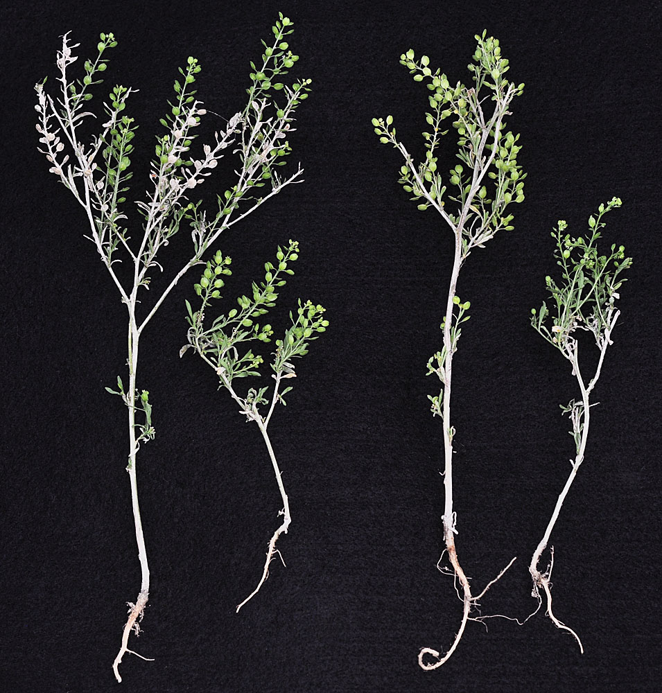
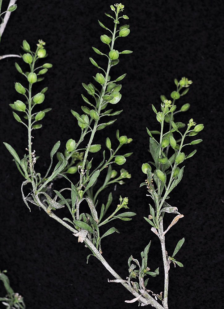
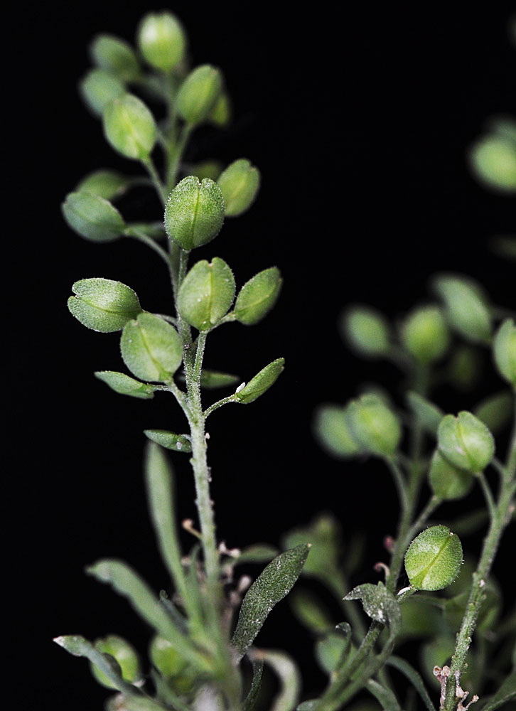
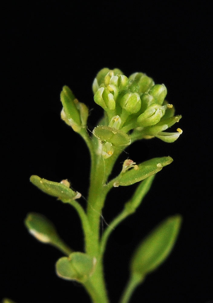
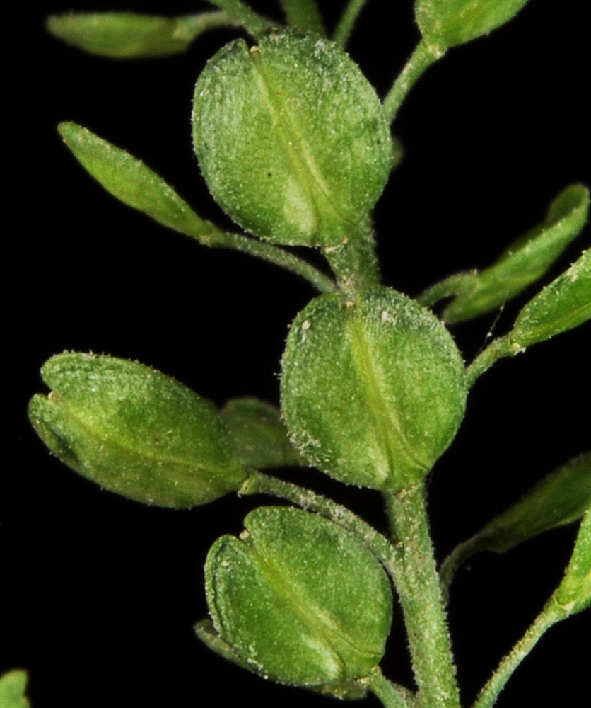
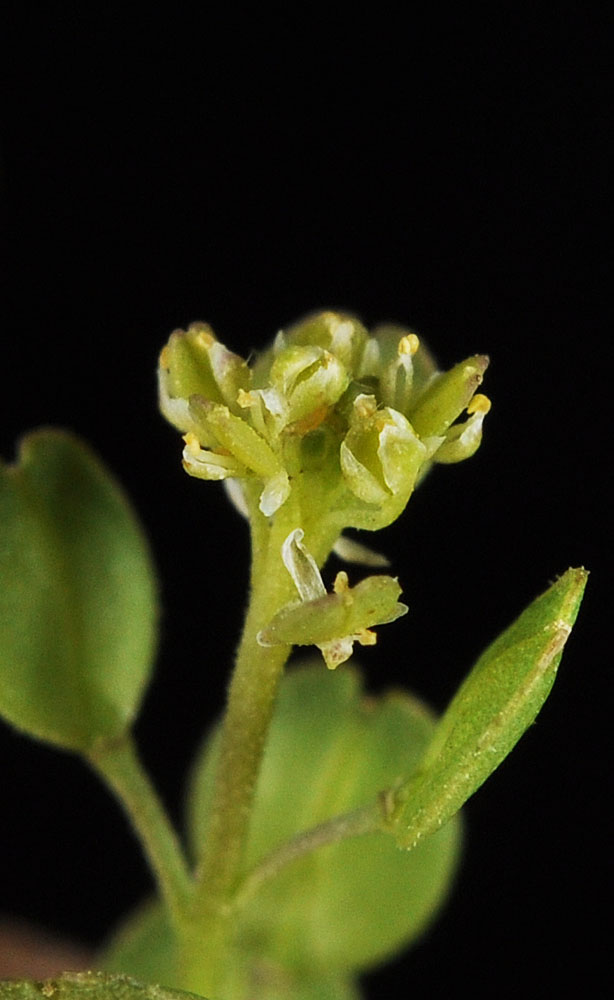
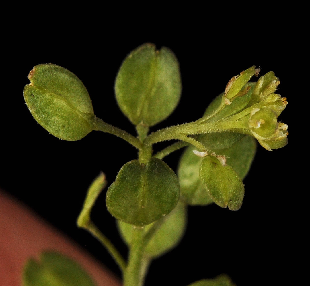
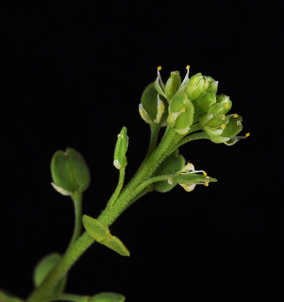
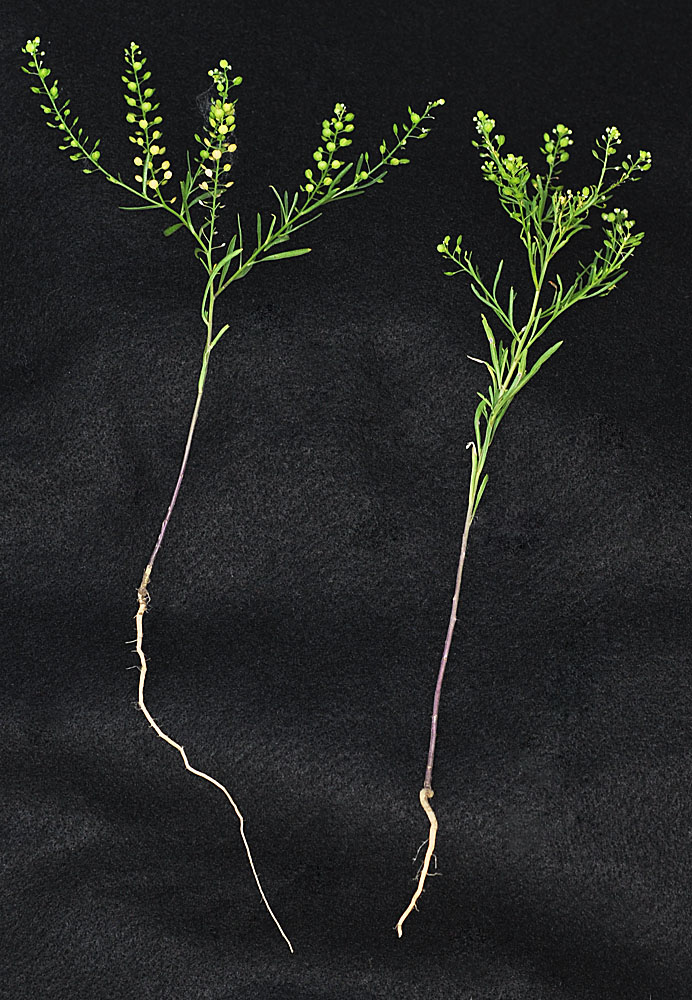
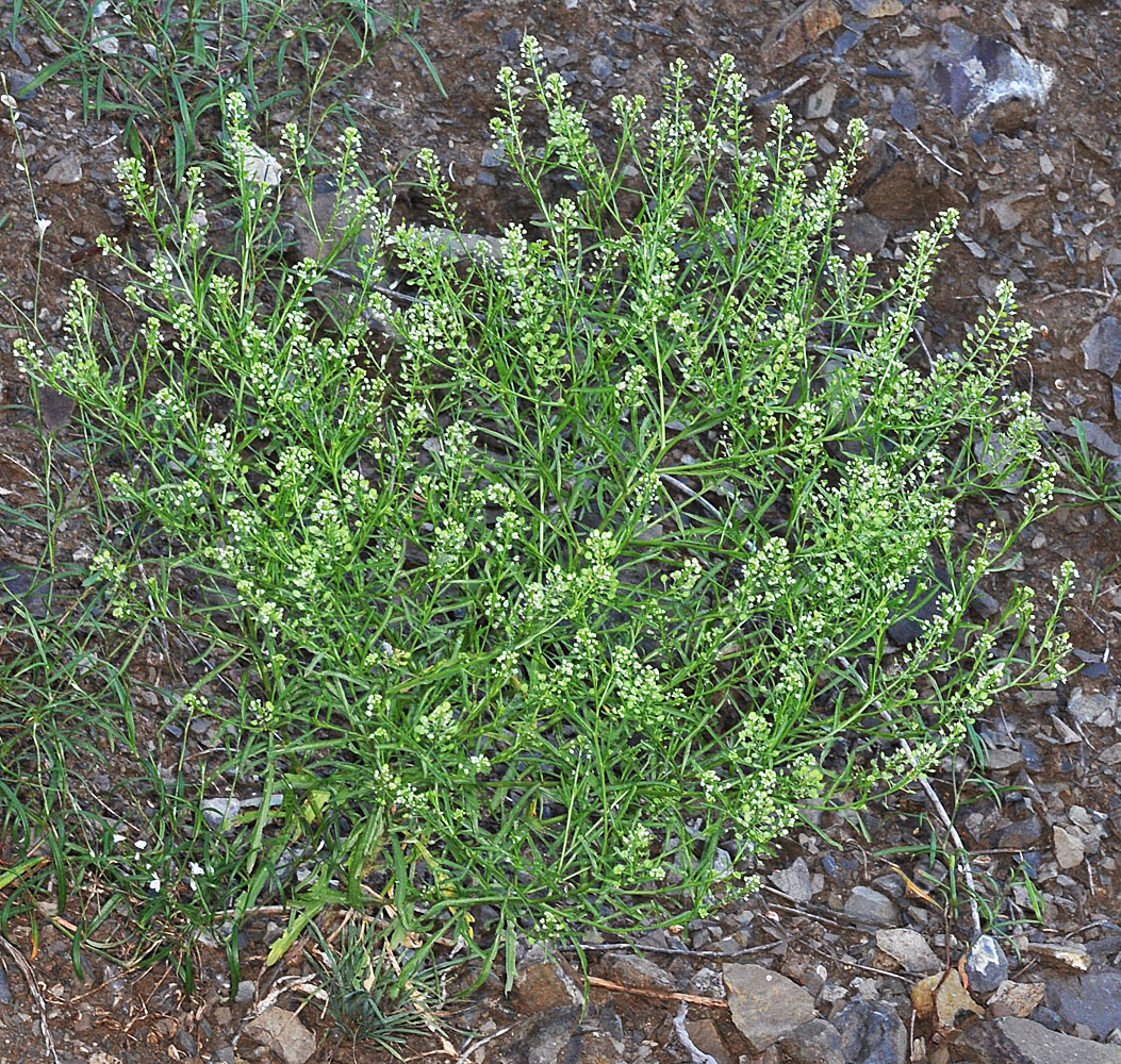
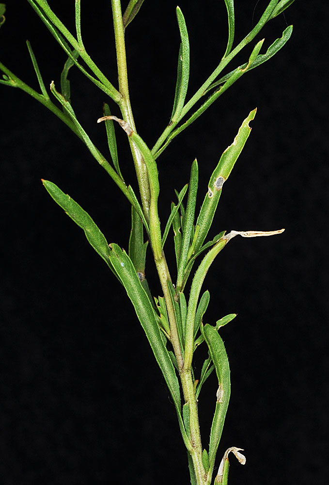
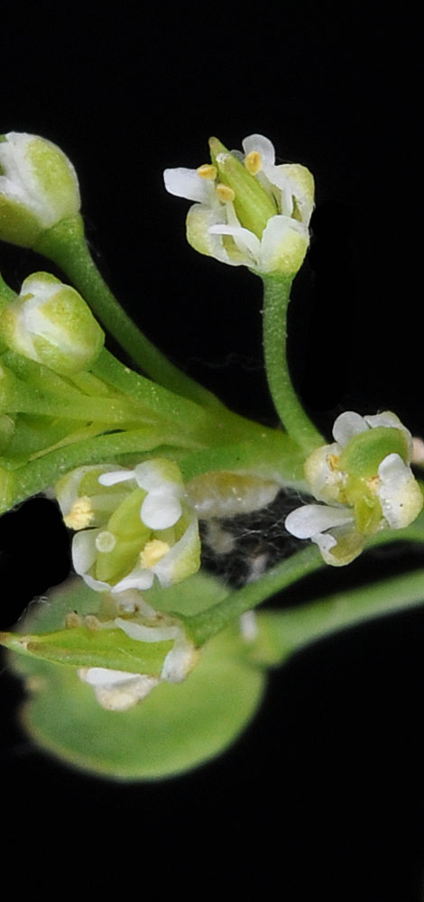
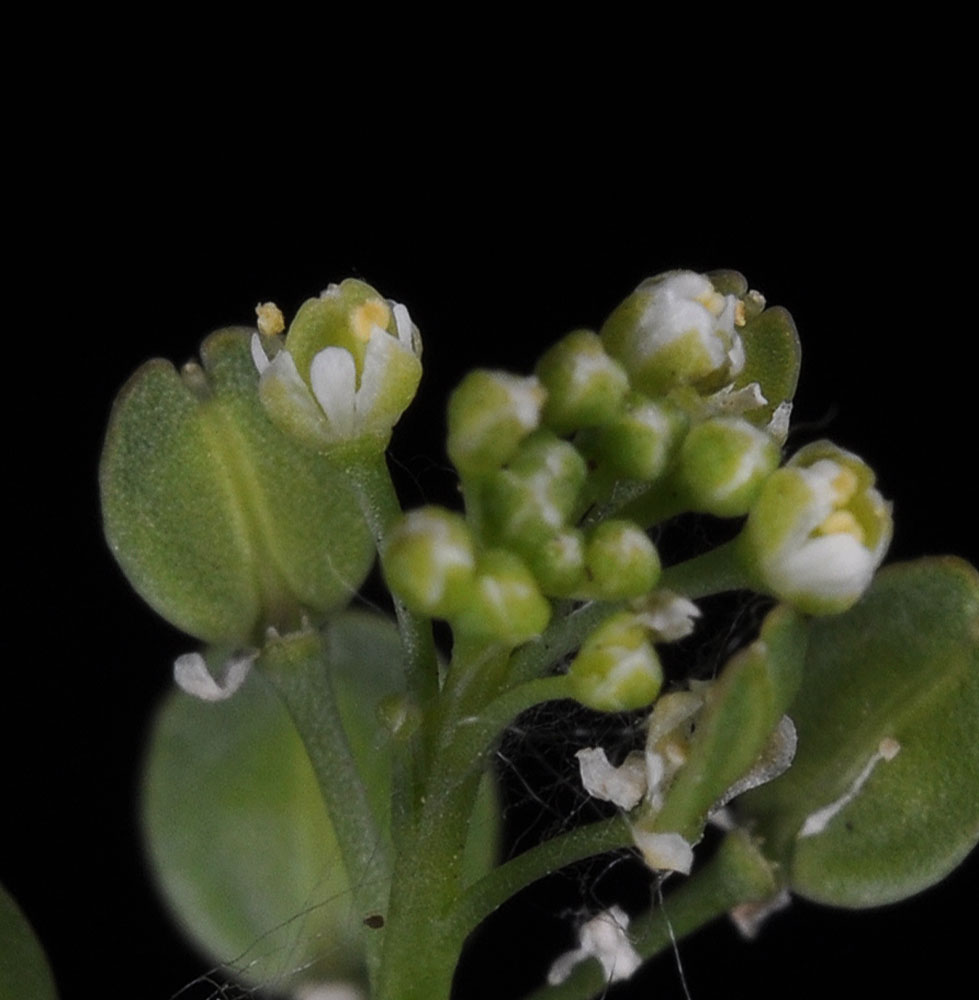
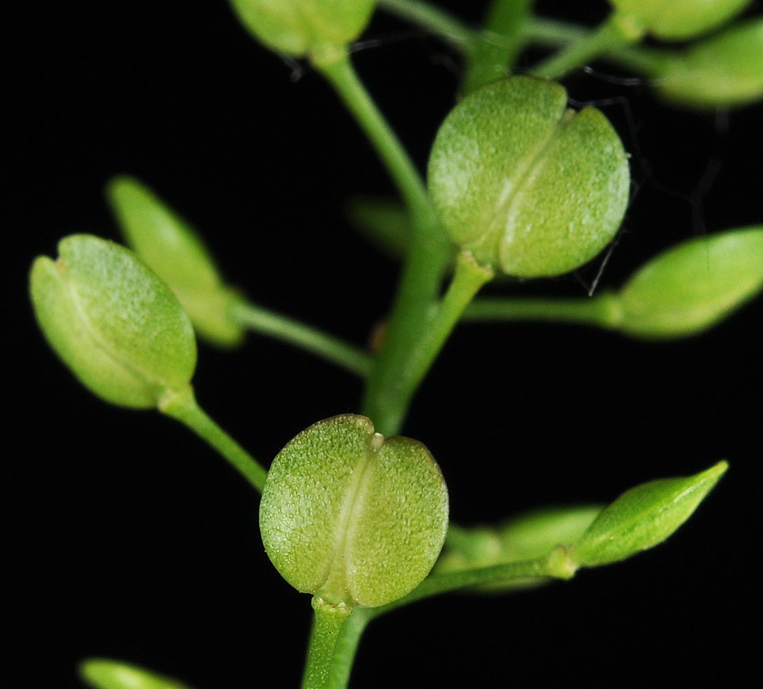
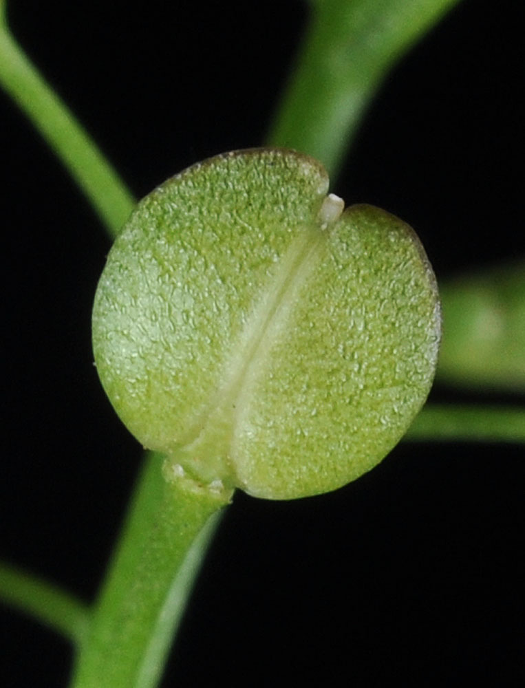
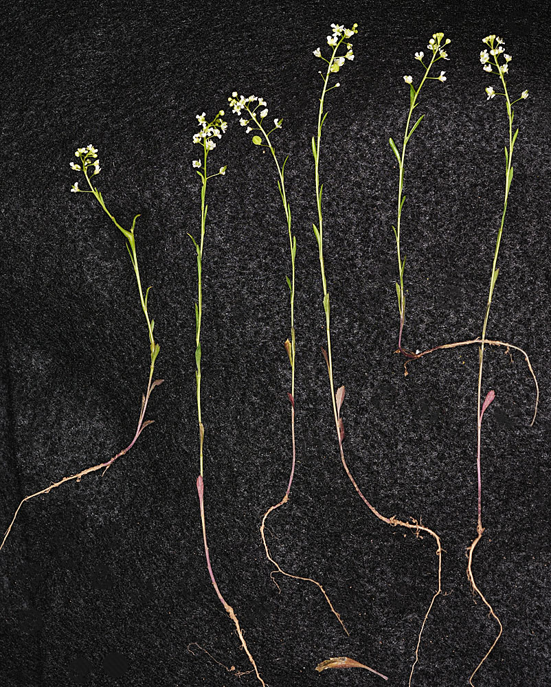
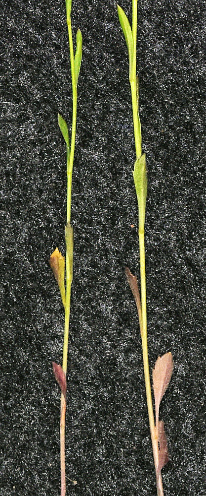
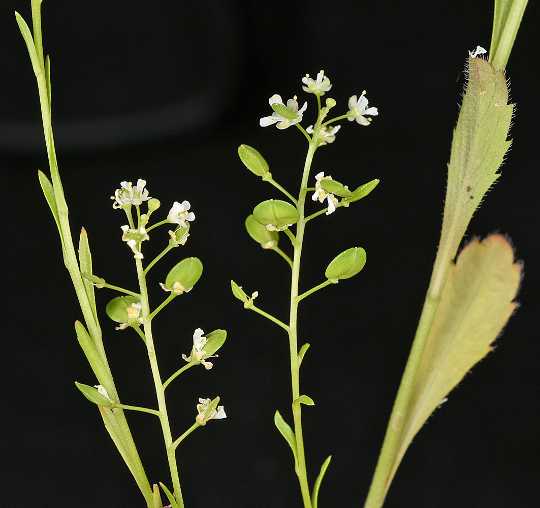
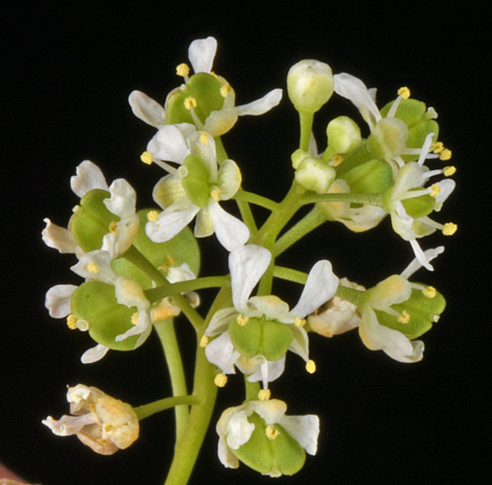
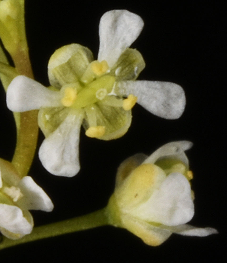
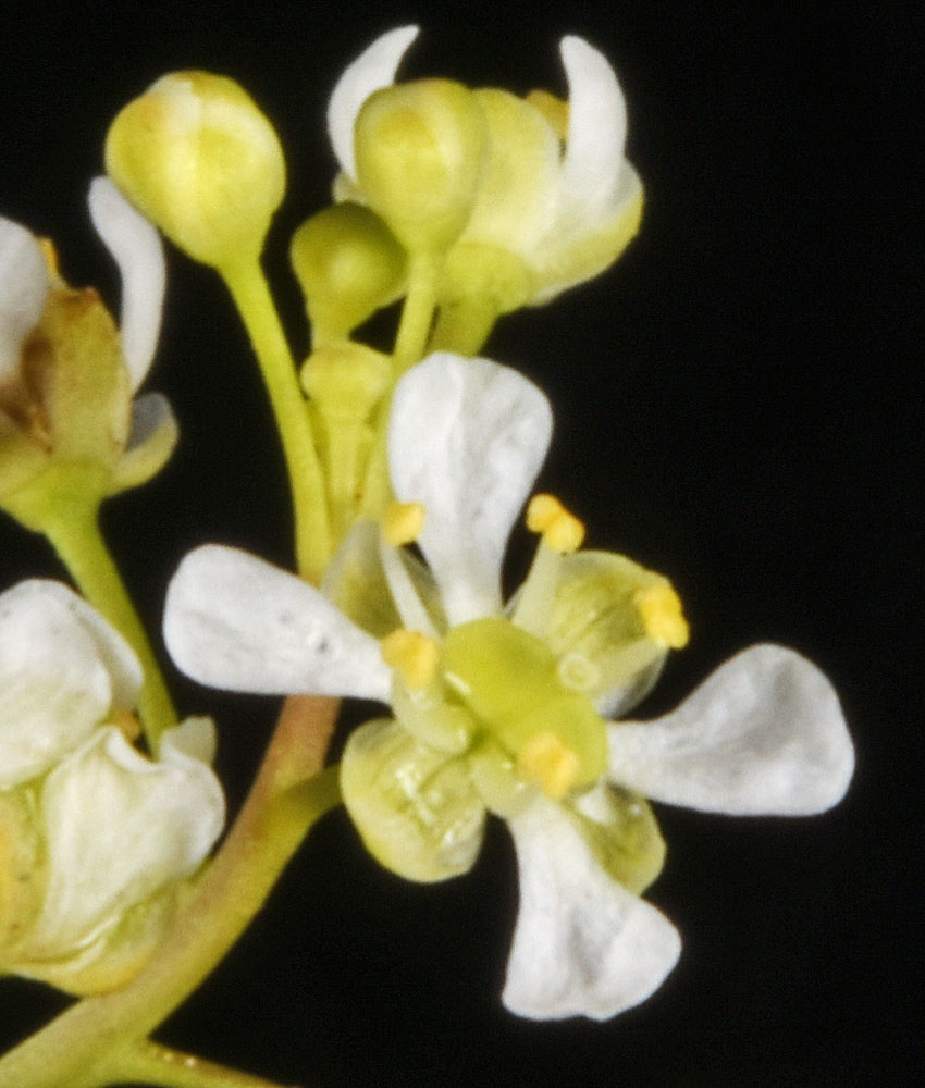
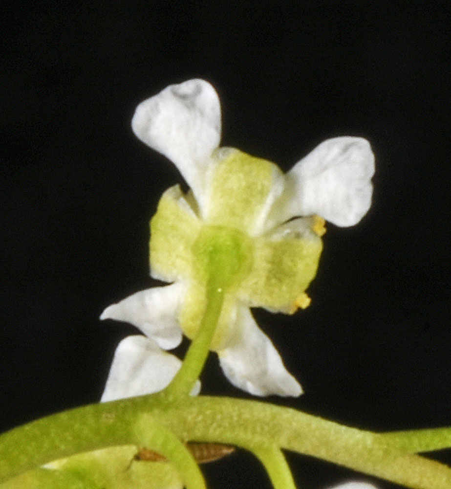
Scientific Name | Lepidium virginicum L. ssp. menziesii (DC.) Thell. |
Family | Brassicaceae |
Common Names | coastal, hairy, Idaho, Menzies’, tall, or tall western peppergrass |
Eastern Washington | Native |
Conservation Status | |
Notes |
Click on any image to enlarge it.
Ca. 0.5 mi W of the Vernita Bridge along the Columbia R; SW of Mattawa, WA; N 46.64149 W 119.73998; Grant Co.; 6/21/2013 Ca. 0.5 mi W of the Vernita Bridge along the Columbia R; SW of Mattawa, WA; N 46.64149 W 119.73998; Grant Co.; 6/21/2013 Ca. 0.5 mi W of the Vernita Bridge along the Columbia R; SW of Mattawa, WA; N 46.64149 W 119.73998; Grant Co.; 6/21/2013 Ca. 0.5 mi W of the Vernita Bridge along the Columbia R; SW of Mattawa, WA; N 46.64149 W 119.73998; Grant Co.; 6/21/2013 Ca. 0.5 mi W of the Vernita Bridge along the Columbia R; SW of Mattawa, WA; N 46.64149 W 119.73998; Grant Co.; 6/21/2013 Ca. 0.5 mi W of the Vernita Bridge along the Columbia R; SW of Mattawa, WA; N 46.64149 W 119.73998; Grant Co.; 6/21/2013 Ca. 0.5 mi W of the Vernita Bridge along the Columbia R; SW of Mattawa, WA; N 46.64149 W 119.73998; Grant Co.; 6/21/2013 Ca. 0.5 mi W of the Vernita Bridge along the Columbia R; SW of Mattawa, WA; N 46.64149 W 119.73998; Grant Co.; 6/21/2013 Cliff base N of W bridge at Kamiah, ID along Hwy 12 and Woodland Rd.; N 46.23109 W 116.01592; Idaho Co.; 5/7/2015 Cliff base N of W bridge at Kamiah, ID along Hwy 12 and Woodland Rd.; N 46.23109 W 116.01592; Idaho Co.; 5/7/2015 Cliff base N of W bridge at Kamiah, ID along Hwy 12 and Woodland Rd.; N 46.23109 W 116.01592; Idaho Co.; 5/7/2015 Cliff base N of W bridge at Kamiah, ID along Hwy 12 and Woodland Rd.; N 46.23109 W 116.01592; Idaho Co.; 5/7/2015 Cliff base N of W bridge at Kamiah, ID along Hwy 12 and Woodland Rd.; N 46.23109 W 116.01592; Idaho Co.; 5/7/2015 Cliff base N of W bridge at Kamiah, ID along Hwy 12 and Woodland Rd.; N 46.23109 W 116.01592; Idaho Co.; 5/7/2015 Cliff base N of W bridge at Kamiah, ID along Hwy 12 and Woodland Rd.; N 46.23109 W 116.01592; Idaho Co.; 5/7/2015 Ridge above the Grand Ronde R. just E oof Joseph Creek Rd. Ca. 1.55 air mi SW of Rogersburg, WA; N 46.06255 W 117.00175; Asotin Co.; 4/26/2017 Ridge above the Grand Ronde R. just E oof Joseph Creek Rd. Ca. 1.55 air mi SW of Rogersburg, WA; N 46.06255 W 117.00175; Asotin Co.; 4/26/2017 Ridge above the Grand Ronde R. just E oof Joseph Creek Rd. Ca. 1.55 air mi SW of Rogersburg, WA; N 46.06255 W 117.00175; Asotin Co.; 4/26/2017 Ridge above the Grand Ronde R. just E oof Joseph Creek Rd. Ca. 1.55 air mi SW of Rogersburg, WA; N 46.06255 W 117.00175; Asotin Co.; 4/26/2017 Ridge above the Grand Ronde R. just E oof Joseph Creek Rd. Ca. 1.55 air mi SW of Rogersburg, WA; N 46.06255 W 117.00175; Asotin Co.; 4/26/2017 Ridge above the Grand Ronde R. just E oof Joseph Creek Rd. Ca. 1.55 air mi SW of Rogersburg, WA; N 46.06255 W 117.00175; Asotin Co.; 4/26/2017 Ridge above the Grand Ronde R. just E oof Joseph Creek Rd. Ca. 1.55 air mi SW of Rogersburg, WA; N 46.06255 W 117.00175; Asotin Co.; 4/26/2017 Ridge above the Grand Ronde R. just E oof Joseph Creek Rd. Ca. 1.55 air mi SW of Rogersburg, WA; N 46.06255 W 117.00175; Asotin Co.; 4/26/2017